Metropolitan Avenue/Lorimer Street (New York City Subway)
Metropolitan Avenue/ Lorimer Street | |||||||
|---|---|---|---|---|---|---|---|
|
| |||||||
 Lorimer Street stair | |||||||
| Station statistics | |||||||
| Address |
Metropolitan Avenue between Lorimer Street & Union Avenue Brooklyn, NY 11211 | ||||||
| Borough | Brooklyn | ||||||
| Locale | Williamsburg | ||||||
| Coordinates | 40°42′46″N 73°57′05″W / 40.712752°N 73.951464°WCoordinates: 40°42′46″N 73°57′05″W / 40.712752°N 73.951464°W | ||||||
| Division | BMT/IND.[1] | ||||||
| Line |
BMT Canarsie Line IND Crosstown Line | ||||||
| Services |
G L | ||||||
| Transit connections |
| ||||||
| Levels | 2 | ||||||
| Other information | |||||||
| Opened | July 1, 1948 | ||||||
| Station code | 629[2] | ||||||
| Wireless service |
| ||||||
| Traffic | |||||||
| Passengers (2017) |
5,010,601 (station complex)[4] | ||||||
| Rank | 97 out of 425 | ||||||
| |||||||
| |||||||
| |||||||


Metropolitan Avenue/Lorimer Street is an underground New York City Subway station complex shared by the BMT Canarsie Line and the IND Crosstown Line. Located in the Williamsburg neighborhood of Brooklyn, the complex is served by the G and L trains at all times.
The BMT Canarsie Line platforms, which are named Lorimer Street, are located above the IND Crosstown Line platforms, which are named Metropolitan Avenue.
Station layout
| G | Street Level | Entrances/Exits |
| B1 | Side platform, doors will open on the right | |
| Northbound | ← | |
| Southbound | → | |
| Side platform, doors will open on the right | ||
| B2 | Mezzanine | to entrances/exits, station agent, MetroCard vending machines |
| B3 | Side platform, doors will open on the right | |
| Northbound | ← | |
| Southbound | → | |
| Side platform, doors will open on the right | ||
The L-shaped passageway, located above the Crosstown Line at its northern end and below the Canarsie Line at its western end, also serves as the mezzanine for the Crosstown Line lower level. When viewed from the Crosstown Line mezzanine, the passageway splits up as the right half leads to a ramp for Canarsie-bound trains while the left half leads to a crossunder to Eighth Avenue-bound trains.
Originally, passengers who wished to transfer between the Canarsie and Crosstown lines had to pay a separate fare, because the Brooklyn–Manhattan Transit Corporation (operator of the Canarsie Line) and the Independent Subway System (the Crosstown Line's operator) were competing companies. On July 1, 1948, eight years after the three operators of New York's subways were unified into a single entity, the transfer passageway was reconfigured to be inside fare control, thus permitting free transfers between lines.[1][5]
The 2000 artwork in the transfer passageway and the Crosstown Line mezzanine is called Signs of Life by Jackie Chang. A precinct of the New York City Transit Police is also located on the Crosstown Line mezzanine.
Exits
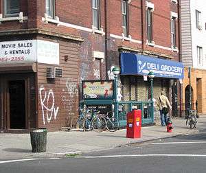
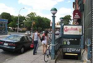
The main entrances at the corner of Metropolitan and Union Avenues lead to the transfer passageway between the lines. (A second set of entrances at Metropolitan Avenue and Lorimer Street to the east leads directly to the Canarsie Line platforms.)[6]
The station has a total of four closed entrances according to the MTA.[7][8] One leads to the northwest corner of Union Avenue and Hope Street and another leads to the northeast corner of Union Avenue and Powers Street. These exits are blocked by metal street grates and are used as emergency exits. A passageway beyond the Hope and Powers Streets exits leads to two more exits that lead to both northern corners of Grand Street and Union Avenue.[9] While the exit to the northeastern corner is also blocked by a metal sheet grate, the exit to the northwestern corner has been sealed and is inaccessible from street level.[10][7][11]
The exit to Hope Street is planned to be reopened before 2019 in order to accommodate the increased volume of passengers transferring between the two stations due to the closure of the Canarsie Tubes.[12] Originally, the exit to Powers Street was planned to be reopened.[13] The high entry-exit turnstiles in the transfer corridor would be replaced with waist-high "low turnstiles" to accommodate increased passenger flow.[12]
BMT Canarsie Line platforms
Lorimer Street | |||||||
|---|---|---|---|---|---|---|---|
|
| |||||||
 | |||||||
| Station statistics | |||||||
| Division | B (BMT) | ||||||
| Line | BMT Canarsie Line | ||||||
| Services |
L | ||||||
| Structure | Underground | ||||||
| Platforms | 2 side platforms | ||||||
| Tracks | 2 | ||||||
| Other information | |||||||
| Opened | June 30, 1924 | ||||||
| Station code | 121[2] | ||||||
| Wireless service |
| ||||||
| Station succession | |||||||
| Next west |
Bedford Avenue: L | ||||||
| Next east |
Graham Avenue: L | ||||||
| |||||||
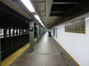
Lorimer Street on the BMT Canarsie Line has two tracks and two side platforms. It opened on June 30, 1924, as part of the initial segment of the underground Canarsie Line, a product of the Dual Contracts, stretching from Sixth Avenue in Manhattan to Montrose Avenue.[14][15]
The Lorimer Street entry point has a mezzanine above the station. There is also another entrance at Union Avenue that leads directly to the Manhattan-bound platform. The transfer to the Crosstown Line is toward the Union Avenue (western; railroad northern) end of the station, where passageways descend from each platform to the Union Avenue mezzanine.
Image gallery
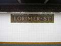 Lorimer Street full-name mosaic
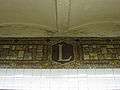 Lorimer Street "L" mosaic
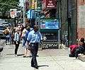 Metropolitan Avenue stair
IND Crosstown Line platforms
Metropolitan Avenue | |||||||
|---|---|---|---|---|---|---|---|
|
| |||||||
 Platform | |||||||
| Station statistics | |||||||
| Division | B (IND) | ||||||
| Line | IND Crosstown Line | ||||||
| Services |
G | ||||||
| Structure | Underground | ||||||
| Platforms | 2 side platforms | ||||||
| Tracks | 2 | ||||||
| Other information | |||||||
| Opened | July 1, 1937[16] | ||||||
| Station code | 285[2] | ||||||
| Wireless service |
| ||||||
| Former/other names | Metropolitan Avenue–Grand Street | ||||||
| Station succession | |||||||
| Next north |
Nassau Avenue: G | ||||||
| Next south |
Broadway: G | ||||||
| |||||||
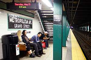
Metropolitan Avenue on the IND Crosstown Line opened on July 1, 1937 as part of the extension of the Crosstown Line from Nassau Avenue to Hoyt-Schermerhorn Streets.[16] The station also has two tracks and two side platforms.[17] Station tile signage retains the original name of the station: Metropolitan Avenue–Grand Street. IND icon tiles indicate "To Street and Transfer."[10] Two staircases from the north end of either platform lead to the mezzanine and transfer passageway to the BMT Canarsie Line.[17][18]
The mezzanine is full-length, but the central and south portions are closed to the public; the central portion is used as a police facility and as employee space and offices,[10] while the south portion is used as storage space. Because of the anticipated reopening of an exit in the south portion of the mezzanine in preparation for the 14th Street Tunnel shutdown in 2019, a staircase between both platforms and the south portion of the mezzanine will be reopened.[19]
Image gallery
 Street stair at southeast corner of Metropolitan & Union Avenues
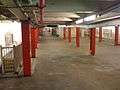 Closed southern mezzanine
 Artwork by Jackie Chang
References
- 1 2 "Transfer Points Under Higher Fare: Board of Transportation Lists Stations and Intersections for Combined Rides". New York Times. June 30, 1948. p. 19. Retrieved May 5, 2010.
- 1 2 3 "Station Developers' Information". Metropolitan Transportation Authority. Retrieved June 13, 2017.
- 1 2 3 "NYC Subway Wireless – Active Stations". Transit Wireless Wifi. Retrieved May 18, 2016.
- ↑ "Facts and Figures: Annual Subway Ridership 2012–2017". Metropolitan Transportation Authority. July 12, 2018. Retrieved July 12, 2018.
- ↑ Sparberg, Andrew J. (October 1, 2014). From a Nickel to a Token: The Journey from Board of Transportation to MTA. Fordham University Press. ISBN 9780823261901.
- ↑ "MTA Neighborhood Maps: Williamsburg & Bedford Stuyvesant" (PDF). mta.info. Metropolitan Transportation Authority. 2015. Retrieved July 20, 2016.
- 1 2 Hogan, Gwynne (February 29, 2016). "Open Shuttered Subway Entrances Before L Train Shutdown, Advocates Urge". DNAinfo.com. Williamsburg, Brooklyn. Archived from the original on August 21, 2016. Retrieved July 5, 2016.
- ↑ "Closed subway entrances". WNYC (AM). October 31, 2015. Retrieved July 4, 2016.
- ↑ https://www.flickr.com/photos/benyankee/8412266672
- 1 2 3 Kabak, Benjamin (January 24, 2013). "Inside Metropolitan Avenue's shuttered G passageway". Second Avenue Sagas. Retrieved July 5, 2016.
- ↑ Harshbarger, Rebecca (November 1, 2015). "NYC subway station entrances closed despite ridership spike: over one in four". AM New York. Retrieved July 5, 2016.
- 1 2 New York City Transit Authority (July 2018). "MTA New York City Transit Canarsie Tunnel Project Supplemental Environmental Assessment and Section 4(f) Review: Final Report" (PDF). mta.info. Metropolitan Transportation Authority. pp. 15–16. Retrieved 2018-07-27.
- ↑ Kabak, Benjamin (December 13, 2017). "First Look: DOT, MTA present initial plans for L train shutdown". Second Ave. Sagas. Retrieved December 16, 2017.
- ↑ "Subway Tunnel Through". The New York Times. August 8, 1919. Retrieved February 28, 2010.
- ↑ "Celebrate Opening of Subway Link". The New York Times. July 1, 1924. Retrieved February 13, 2010.
- 1 2 "New Crosstown Subway Line Is Opened". Brooklyn Daily Eagle. July 1, 1937. Retrieved December 24, 2015.
- 1 2 "Review of the G Line: Appendices" (PDF). Metropolitan Transportation Authority. July 10, 2013. Retrieved October 28, 2015.
- ↑ "Review of the G Line" (PDF). mta.info. Metropolitan Transportation Authority. July 10, 2013. Retrieved August 2, 2015.
- ↑ "Station Capacity Enhancements at Metropolitan Avenue". web.mta.info. Metropolitan Transportation Authority. December 31, 2017. Retrieved February 18, 2018.
External links
| Wikimedia Commons has media related to Lorimer Street / Metropolitan Avenue (New York City Subway). |
- nycsubway.org – BMT Canarsie Line: Lorimer Street
- nycsubway.org – IND Crosstown Line: Metropolitan Avenue
- Station Reporter — Metropolitan Avenue/Lorimer Street Complex
- The Subway Nut — Lorimer Street Pictures
- The Subway Nut — Metropolitan Avenue–Grand Street Pictures
- MTA's Arts For Transit — Metropolitan Avenue/Lorimer Street
Google Maps: Street View: