Vine Hill, California
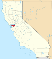
Vine Hill is a census-designated place (CDP) in Contra Costa County, California, United States. The population was 3,761 at the 2010 census. It is located 2.25 miles (3.6 km) east of downtown Martinez.[5]
Vine Hill | |
|---|---|
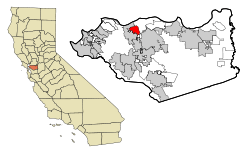 Location in Contra Costa County and the state of California | |
 Vine Hill Location in the United States | |
| Coordinates: 38°00′31″N 122°05′46″W | |
| Country | |
| State | |
| County | Contra Costa |
| Government | |
| • State Senate | Bill Dodd (D) and Steve Glazer (D)[1] |
| • State Assembly | Tim Grayson (D)[2] |
| • U. S. Congress | Mike Thompson (D)[3] |
| Area | |
| • Total | 1.504 sq mi (3.894 km2) |
| • Land | 1.504 sq mi (3.894 km2) |
| • Water | 0 sq mi (0 km2) |
| Elevation | 30 ft (9 m) |
| Population (2010) | |
| • Total | 3,761 |
| • Density | 2,500/sq mi (970/km2) |
| Time zone | UTC-8 (PST) |
| • Summer (DST) | UTC-7 (PDT) |
| ZIP code | 94553 |
| Area code(s) | 925 |
| FIPS code | 06-82842 |
| GNIS feature IDs | 1652648, 2409517 |
| [4] | |
Geography
According to the United States Census Bureau, the CDP has a total area of 1.5 square miles (3.9 km2), all of it land.
Demographics
| Historical population | |||
|---|---|---|---|
| Census | Pop. | %± | |
| 1990 | 3,214 | — | |
| 2000 | 3,260 | 1.4% | |
| 2010 | 3,761 | 15.4% | |
| sources:;[6][7] | |||
2010
At the 2010 census Vine Hill had a population of 3,761. The population density was 2,501.2 people per square mile (965.7/km²). The racial makeup of Vine Hill was 2,568 (68.3%) White, 111 (3.0%) African American, 33 (0.9%) Native American, 196 (5.2%) Asian, 35 (0.9%) Pacific Islander, 561 (14.9%) from other races, and 257 (6.8%) from two or more races. Hispanic or Latino of any race were 1,169 persons (31.1%).[8]
The census reported that 98.9% of the population lived in households and 1.1% lived in non-institutionalized group quarters.
There were 1,264 households, 509 (40.3%) had children under the age of 18 living in them, 630 (49.8%) were opposite-sex married couples living together, 192 (15.2%) had a female householder with no husband present, 96 (7.6%) had a male householder with no wife present. There were 115 (9.1%) unmarried opposite-sex partnerships, and 8 (0.6%) same-sex married couples or partnerships. 237 households (18.8%) were one person and 71 (5.6%) had someone living alone who was 65 or older. The average household size was 2.94. There were 918 families (72.6% of households); the average family size was 3.30.
The age distribution was 907 people (24.1%) under the age of 18, 345 people (9.2%) aged 18 to 24, 1,192 people (31.7%) aged 25 to 44, 984 people (26.2%) aged 45 to 64, and 333 people (8.9%) who were 65 or older. The median age was 35.1 years. For every 100 females, there were 103.2 males. For every 100 females age 18 and over, there were 104.7 males.
There were 1,348 housing units at an average density of 896.5 per square mile (346.1/km²),of which 1,264 were occupied, 833 (65.9%) by the owners and 431 (34.1%) by renters. The homeowner vacancy rate was 3.4%; the rental vacancy rate was 5.7%. 2,382 people (63.3% of the population) lived in owner-occupied housing units and 1,337 people (35.5%) lived in rental housing units.
2000
At the 2000 census there were 3,260 people, 1,144 households, and 814 families in the CDP. The population density was 697.5 people per square mile (269.5/km²). There were 1,171 housing units at an average density of 250.6 per square mile (96.8/km²). The racial makeup of the CDP was 75.09% White, 2.24% Black or African American, 1.72% Native American, 2.27% Asian, 0.18% Pacific Islander, 11.99% from other races, and 6.50% from two or more races. 24.14% of the population were Hispanic or Latino of any race.[9] Of the 1,144 households 36.3% had children under the age of 18 living with them, 49.0% were married couples living together, 15.6% had a female householder with no husband present, and 28.8% were non-families. 20.6% of households were one person and 4.8% were one person aged 65 or older. The average household size was 2.83 and the average family size was 3.25.
The age distribution was 26.9% under the age of 18, 9.2% from 18 to 24, 33.1% from 25 to 44, 22.9% from 45 to 64, and 7.9% 65 or older. The median age was 34 years. For every 100 females, there were 102.7 males. For every 100 females age 18 and over, there were 102.9 males.
The median household income was $48,125 and the median family income was $53,750. Males had a median income of $38,869 versus $31,875 for females. The per capita income for the CDP was $17,985. About 4.6% of families and 6.6% of the population were below the poverty line, including 5.6% of those under age 18 and 9.6% of those age 65 or over.
References
- "Senators". State of California. Retrieved April 1, 2013.
- "Members Assembly". State of California. Retrieved April 1, 2013.
- "California's 5th Congressional District - Representatives & District Map". Civic Impulse, LLC. Retrieved March 9, 2013.
- "Vine Hill". Geographic Names Information System. United States Geological Survey.
- Durham, David L. (1998). California's Geographic Names: A Gazetteer of Historic and Modern Names of the State. Clovis, Calif.: Word Dancer Press. p. 719. ISBN 1-884995-14-4.
- "CENSUS OF POPULATION AND HOUSING (1790-2000)". U.S. Census Bureau. Retrieved 2010-07-17.
- United States Census US Census Bureau
- "2010 Census Interactive Population Search: CA - Vine Hill CDP". U.S. Census Bureau. Archived from the original on July 15, 2014. Retrieved July 12, 2014.
- "U.S. Census website". United States Census Bureau. Retrieved 2008-01-31.
| Bodies of water |
|  |
|---|---|---|
| Counties | ||
| Major cities | ||
| Cities and towns 100k–250k | ||
| Cities and towns 50k–99k | ||
| Cities and towns 25k–50k | ||
| Cities and towns 10k–25k |
| |
| Sub-regions | ||