Ashland, California
Ashland (formerly San Leandro South) is a census-designated place (CDP) in Alameda County, California, United States. The population was 21,925 at the 2010 census.
Ashland | |
|---|---|
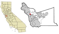 Location in Alameda County and the state of California | |
 Ashland Location in the United States | |
| Coordinates: 37°41′41″N 122°06′50″W | |
| Country | |
| State | |
| County | Alameda |
| Government | |
| • State Senate | Bob Wieckowski (D)[1] |
| • State Assembly | Bill Quirk (D)[2] |
| • U. S. Congress | Eric Swalwell (D)[3] |
| Area | |
| • Total | 1.84 sq mi (4.8 km2) |
| • Land | 1.84 sq mi (4.8 km2) |
| • Water | 0.00 sq mi (0.0 km2) 0% |
| Elevation | 43 ft (13 m) |
| Population (2010) | |
| • Total | 19,304 |
| • Estimate (2016)[6] | N/A |
| • Density | 10,000/sq mi (4,100/km2) |
| Time zone | UTC-8 (Pacific (PST)) |
| • Summer (DST) | UTC-7 (PDT) |
| ZIP code | 94541 |
| Area code(s) | 510, 341 |
| FIPS code | 06-02980 |
| GNIS feature IDs | 1657955, 2407773 |
Geography
According to the United States Census Bureau, the CDP has a total area of 1.8 square miles (4.7 km2), all of it land.

Demographics
| Historical population | |||
|---|---|---|---|
| Census | Pop. | %± | |
| U.S. Decennial Census[8] | |||
2010
At the 2010 census Ashland had a population of 21,925. The population density was 11,926.7 people per square mile (4,604.9/km²). The racial makeup of Ashland was 6,705 (30.6%) White, 4,269 (19.5%) African American, 232 (1.1%) Native American, 4,031 (18.4%) Asian, 260 (1.2%) Pacific Islander, 5,124 (23.4%) from other races, and 1,304 (5.9%) from two or more races. Hispanic or Latino of any race were 9,394 persons (42.8%).[9]
The census reported that 21,739 people (99.2% of the population) lived in households, 103 (0.5%) lived in non-institutionalized group quarters, and 83 (0.4%) were institutionalized.
There were 7,270 households, 3,209 (44.1%) had children under the age of 18 living in them, 2,786 (38.3%) were opposite-sex married couples living together, 1,589 (21.9%) had a female householder with no husband present, 635 (8.7%) had a male householder with no wife present. There were 639 (8.8%) unmarried opposite-sex partnerships, and 54 (0.7%) same-sex married couples or partnerships. 1,713 households (23.6%) were one person and 417 (5.7%) had someone living alone who was 65 or older. The average household size was 2.99. There were 5,010 families (68.9% of households); the average family size was 3.52.
The age distribution was 6,097 people (27.8%) under the age of 18, 2,317 people (10.6%) aged 18 to 24, 6,938 people (31.6%) aged 25 to 44, 4,905 people (22.4%) aged 45 to 64, and 1,668 people (7.6%) who were 65 or older. The median age was 31.4 years. For every 100 females, there were 95.2 males. For every 100 females age 18 and over, there were 91.3 males.
There were 7,758 housing units at an average density of 4,220.2 per square mile (1,629.4/km²),of which 7,270 were occupied, 2,510 (34.5%) by the owners and 4,760 (65.5%) by renters. The homeowner vacancy rate was 2.5%; the rental vacancy rate was 4.5%. 7,883 people (36.0% of the population) lived in owner-occupied housing units and 13,856 people (63.2%) lived in rental housing units.
2000
At the 2000 census there were 20,793 people, 7,223 households, and 4,868 families living in the CDP. The population density was 11,284.9 people per square mile (4,363.2/km²). There were 7,372 housing units at an average density of 4,001.0 per square mile (1,546.9/km²). The racial makeup of the CDP in 2010 was 15.6% non-Hispanic White, 18.6% non-Hispanic Black or African American, 0.4% Native American, 18.1% Asian, 1.1% Pacific Islander, 0.3% from other races, and 3.1% from two or more races. 42.8% of the population were Hispanic or Latino of any race.[10] Of the 7,223 households 40.0% had children under the age of 18 living with them, 39.7% were married couples living together, 20.5% had a female householder with no husband present, and 32.6% were non-families. 24.3% of households were one person and 6.8% were one person aged 65 or older. The average household size was 2.83 and the average family size was 3.39.
The age distribution was 28.5% under the age of 18, 10.0% from 18 to 24, 35.1% from 25 to 44, 17.3% from 45 to 64, and 9.1% 65 or older. The median age was 31 years. For every 100 females, there were 95.8 males. For every 100 females age 18 and over, there were 91.7 males.
The median household income was $40,811 and the median family income was $43,202. Males had a median income of $33,943 versus $31,092 for females. The per capita income for the CDP was $18,134. About 11.9% of families and 14.3% of the population were below the poverty line, including 19.9% of those under age 18 and 11.1% of those age 65 or over.
Government
Ashland is an unincorporated community and thus is governed directly by Alameda County. The area is policed by the Alameda County Sheriff's Office and the California Highway Patrol.
References
- "Senators". State of California. Retrieved March 18, 2013.
- "Members Assembly". State of California. Retrieved March 18, 2013.
- "California's 15th Congressional District - Representatives & District Map". Civic Impulse, LLC. Retrieved March 9, 2013.
- "2016 U.S. Gazetteer Files". United States Census Bureau. Retrieved Jul 19, 2017.
- "Ashland". Geographic Names Information System. United States Geological Survey.
- "Population and Housing Unit Estimates". Retrieved June 9, 2017.
- Durham, David L. (1998). California's Geographic Names: A Gazetteer of Historic and Modern Names of the State. Clovis, Calif.: Word Dancer Press. p. 597. ISBN 1-884995-14-4.
- "Census of Population and Housing". Census.gov. Retrieved June 4, 2016.
- "2010 Census Interactive Population Search: CA - Ashland CDP". U.S. Census Bureau. Archived from the original on July 15, 2014. Retrieved July 12, 2014.
- "U.S. Census website". United States Census Bureau. Retrieved 2008-01-31.
External links
| Bodies of water |
|  |
|---|---|---|
| Counties | ||
| Major cities | ||
| Cities and towns 100k–250k | ||
| Cities and towns 50k–99k | ||
| Cities and towns 25k–50k | ||
| Cities and towns 10k–25k |
| |
| Sub-regions | ||
Municipalities and communities of Alameda County, California, United States | ||
|---|---|---|
| Cities | 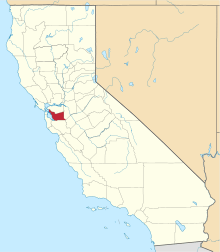 Alameda County map | |
| CDPs | ||
| Unincorporated communities | ||
| Annexed communities | ||
| Former townships |
| |
| Former communities | ||