West Wyalong
West Wyalong is the main town of the Bland Shire in the Riverina region of New South Wales, Australia.[2] Located 467 kilometres (290 mi) west of Sydney and 262 m (860 ft) above sea level, it is situated on the crossroads of the Newell Highway between Melbourne and Brisbane, and the Mid-Western Highway between Sydney and Adelaide.[3]
| West Wyalong New South Wales | |
|---|---|
 Main Street (Newell Highway) in West Wyalong | |
West Wyalong | |
| Coordinates | 33°55′0″S 147°13′0″E |
| Population | 2,643 (2011 census)[1] |
| Postcode(s) | 2671 |
| Elevation | 262 m (860 ft) |
| Location | |
| LGA(s) | Bland Shire |
| Region | Riverina (New South Wales) |
| State electorate(s) | Cootamundra |
| Federal Division(s) | Riverina |
The West Wyalong district is the largest cereal-growing centre in NSW. Eucalyptus oil production started in 1907 and the West Wyalong area became one of the major world exporters of the product.
History
The Wiradjuri people were the first to inhabitant this region. (Wiradjuri northern dialect pronunciation [wiraːjd̪uːraj]) or Wirraayjuurray people (Wiradjuri southern dialect pronunciation [wiraːjɟuːraj]) are a group of indigenous Australian Aboriginal people that were united by a common language, strong ties of kinship and survived as skilled hunter–fisher–gatherers in family groups or clans scattered throughout central New South Wales.
In the 21st century, major Wiradjuri groups live in Condobolin, Peak Hill, Narrandera and Griffith. There are significant populations at Wagga Wagga and Leeton and smaller groups at West Wyalong, Parkes, Dubbo, Forbes, Cootamundra, Cowra and Young.
Gold was discovered at Wyalong in September 1893 by Joseph Neeld. In 1895 West Wyalong was developed 5 kilometres (3 mi) from Wyalong around the bullock track, without the benefit of town planning, resulting in curious kinks in the road where it avoided trees. As well as the mines, the White Tank water supply was located here. This is now the location of McCann Park.[3] The goldfield was declared the most productive in the colony in 1899.[3]
As mining declined West Wyalong became the main service centre for agriculture in the surrounding district, although for many years there was rivalry between the towns. Both towns wanted the Temora railway line, but settled on a compromise of a station midway between the two towns, called Wyalong Central.
Development since the 1970s has expanded Wyalong in the direction of West Wyalong with several motels built at Central Wyalong. A shared bicycle and pedestrian track was constructed in 1994 to link Wyalong with West Wyalong.
The population has stabilised recently. This is due, in part, to the Cowal Gold Mine adjacent to Lake Cowal, 45 km northeast and Pace Farm's egg production facility.
West Wyalong Movies is a project by Ross Harmer aimed at documenting the history of West Wyalong and The Bland Shire.[4]
Places of interest
- The Poppet Head
- Lions Park Dakota DC3
- West Wyalong Museum
- West Wyalong Airport
Schools
- St Mary's War Memorial Catholic School (K-6) - The original St. Mary's Church School was built in 1901 of corrugated iron and staffed by the Sisters of Mercy. By 1903 there were 167 students. The present St. Mary's School was built in 1961.
- West Wyalong Primary School (K-6)
- West Wyalong High School (7-12)
- Wyalong Public School (K-6)
Pubs and clubs in West Wyalong
- The Tattersalls Hotel
- The Metropolitan Hotel
- Royal Hotel
- The White Tank Hotel
- West Wyalong Services & Citizens Club
- West Wyalong Lawn Bowling Club
- West Wyalong Golf Club
- Toppy Pub (Wyalong)
Sport
The town's rugby league team competed in the Maher Cup.
- West Wyalong Wildcats - (basketball)
- West Wyalong Mallee Men - rugby league
- West Wyalong-Girral Bulldogs - Australian rules football & netball
- West Wyalong Weevils - senior rugby union
- West Wyalong Pirates - junior rugby union
- Alleena Cricket Club - cricket
- Tallimba Cricket Club - cricket
- White Tank Cricket Club - cricket
Annual Shows and Events
January
- Australia Day Breakfast and Awards (26th), West Wyalong[5]
- David Earl Memorial Cricket Match, West Wyalong[5]
February
April
May
July
- Catholic Debutante Ball, West Wyalong[5]
September
October
- Mirrool Silo Kick Challenge (2nd Sat.)[5]
- 'in the West' Festival www.inthewest.com.au[5]
November
- Early Markets (1st Sat.), Wyalong[5]
Notable people from the area
- Dymphna Cusack, author[3]
- Reginald Roy Rattey, Victoria Cross recipient
- Terry Gathercole, champion swimmer
- Ron Crowe, rugby league footballer
- Mark O'Meley, rugby league footballer
- Scott Staniforth, rugby union footballer
- Mat McLachlan, author and historian
- Anthony Gelling, rugby union representatives
- Neale Daniher AM, former AFL footballer, former AFL coach and motor neurone disease campaigner
- Terry Daniher, former AFL footballer
- Anthony Daniher, former AFL footballer
- Chris Daniher, former AFL footballer
- Dal Stivens, author - grew up in the town
Gallery
 Aboriginal Artifacts Store
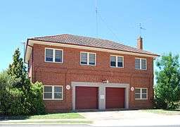 Ambulance Station
- West Wyalong Anglican Church

 Bland Shire Council Offices
 Colonial Mutual
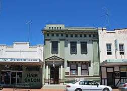 Commercial Bank of Australia
 Commercial Bank of Australia
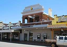
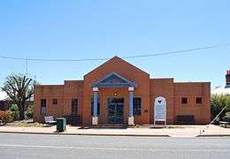 Court House
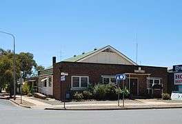 CWA Hall
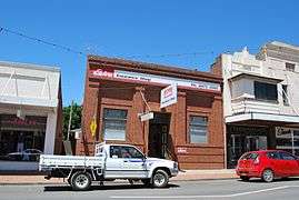 Elders Office
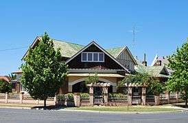 West Wyalong Federation House
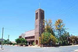
 Houses & Church
 Leadbetter Motor Garage
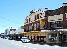
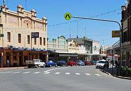 Main Street
 Medical Hall
 Mentor Chambers
 West Wyalong Police Station
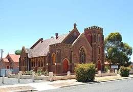 West Wyalong Presbyterian Church
 West Wyalong Presbyterian Manse
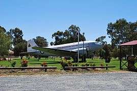 RAAF Plane
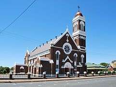 West Wyalong Roman Catholic Church
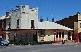 West Wyalong Post Office
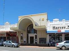 West Wyalong Rural Bank
 West Wyalong Rural Bank
 Main Street
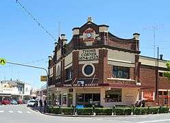 Thom's Corner
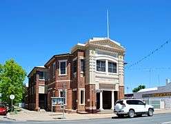 Memorial Literary Institute
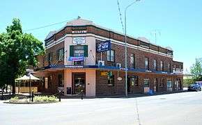 Tattersalls Hotel
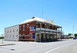 White Tank Hotel
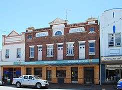 Royal Hotel
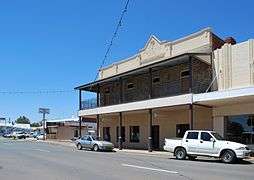 Post Office Hotel
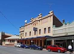 Metropolitan Hotel
 Globe Hotel
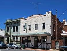 Empire Hotel
Surrounding towns
| • Barmedman | (32 km or 20 mi) |
| • Burcher | (52 km or 32 mi) |
| • Tallimba | (34 km or 21 mi) |
| • Ungarie | (42 km or 26 mi) |
| • Weethalle | (57 km or 35 mi) |
| • Wyalong | (3.5 km or 2.2 mi) |
References
- Australian Bureau of Statistics (31 October 2012). "West Wyalong (Urban Centre/Locality)". 2011 Census QuickStats. Retrieved 10 April 2014.

- Dow L, Guyon D, Irving R, McPhee M, Matthews A, Prineas P, Rubinich T, Simpson J (1995). Reader's Digest Illustrated Guide to Australian Places. Surry Hills, NSW: Reader's Digest. p. 227. ISBN 0-86438-399-1.
- "West Wyalong Movies bringing local history to life". Retrieved 28 December 2016.
- West Wyalong NSW find hearts of gold. West Wyalong: Bland Shire Council. 2012. p. 11.
External links
![]()