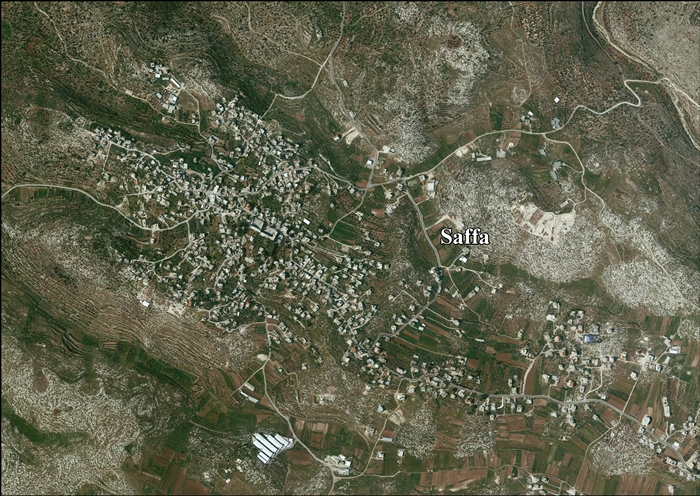
Saffa, Ramallah
Saffa (Arabic: صفّا) is a Palestinian town in the Ramallah and al-Bireh Governorate, located west of Ramallah in the northern West Bank. According to the Palestinian Central Bureau of Statistics (PCBS), the town had a population of approximately 3,802 inhabitants in 2007.[2]
Saffa | |
|---|---|
Municipality type C | |
| Arabic transcription(s) | |
| • Arabic | صفّا |
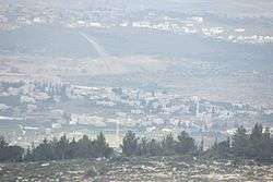 Saffa in the front, Deir Qaddis behind | |
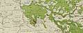
 Saffa Location of Saffa within Palestine | |
| Coordinates: 31°54′25″N 35°03′30″E | |
| Palestine grid | 155/145 |
| State | State of Palestine |
| Governorate | Ramallah and al-Bireh |
| Government | |
| • Type | Municipality |
| Population (2007) | |
| • Total | 3,802 |
| Name meaning | In rows[1] |
Location
Saffa is located 13.3 kilometers (8.3 mi) (in straight distance) west of Ramallah. It is bordered by Beit 'Ur at Tahta, Kafr Ni'ma and Deir Ibzi to the east, Bil'in, Ni'lin and Al Midya to the north, Israel to the west, and Beit 'Ur at Tahta and Beit Sira to the south.[3]
History
It has been proposed identifying Saffa with Casale Saphet of the Crusader era.[4]
Ottoman era
In the early Ottoman census of 1525-1526, it was not mentioned, but in 1538-1539, Saffa was located in the nahiya of Quds, and named as Mazra, or cultivated land.[5]
In 1838 it was noted as a Muslim village, located in the Beni Harith district, west of Jerusalem.[6][7]
In 1870, Victor Guérin noted that: "This village occupies a high plateau; it contains four hundred inhabitants. Some stones, scattered or embedded in Arab buildings, and numerous excavations in the rock, such as cisterns, tombs, quarries and subterranean vaults, proves that the present Saffa succeeded an ancient locality."[8] An Ottoman village list of about the same year showed that Saffa had 200 inhabitants with 67 houses, though the population count included only the men.[9][10]
In 1883 the PEF's Survey of Western Palestine described Suffa: "A small village standing high on a ridge, with a well to the east and a sacred place to the south."[11]
In 1896 the population of Safa was estimated to be about 564 persons.[12]
British Mandate era
In the 1922 census of Palestine, conducted by the British Mandate authorities, Saffa had a population of 495 Muslims,[13] increasing in the 1931 census to 644 Muslims, in 143 houses.[14]
In the 1945 statistics the population was 790 Muslims,[15] while the total land area was 9,602 dunams, according to an official land and population survey.[16] Of this, 2,536 were used for plantations and irrigable land, 2,975 for cereals,[17] while 99 dunams were classified as built-up areas.[18]
 Saffa 1944 1:20,000 from 1919 survey
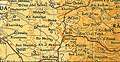 Saffa 1945 1:250,000
Jordanian era
In the wake of the 1948 Arab–Israeli War, and after the 1949 Armistice Agreements, Saffa came under Jordanian rule. It was annexed by Jordan in 1950.
In 1961, the population of Saffa was 1,364.[19]
1967-present
After the Six-Day War in 1967, Saffa has been under Israeli occupation.
After the 1995 accords, 12.9% of village land was classified as Area B, and the remaining 87.1% as Area C.[20]
Israel has confiscated land from Saffa in order to construct six Israeli settlements:
References
- Palmer, 1881, p. 329
- 2007 PCBS Census. Palestinian Central Bureau of Statistics. p.114.
- Saffa village profile, ARIJ, p. 4
- Röhricht, 1887, p. 213; cited in Finkelstein et al, 1998, p. 151
- Toledano, 1984, pp. 280, 298, has Saffa at location 31°54′25″N 35°03′05″E; cited in Finkelstein et al, 1997, p. 151
- Robinson and Smith, 1841, vol 3, Appendix 2, p. 124
- Robinson and Smith, 1841, vol 3, p. 58
- Guérin, 1875, p. 48
- Socin, 1879, p. 159 also notes that it is in the Beni Harith district
- Hartmann, 1883, p. 126, noted 47 houses
- Conder and Kitchener, 1883, SWP III, p. 7
- Schick, 1896, pp. 122, 124
- Barron, 1923, Table VII, Sub-district of Ramallah, p. 17
- Mills, 1932, p. 50.
- Government of Palestine, Department of Statistics, 1945, p. 26
- Government of Palestine, Department of Statistics. Village Statistics, April, 1945. Quoted in Hadawi, 1970, p. 65
- Government of Palestine, Department of Statistics. Village Statistics, April, 1945. Quoted in Hadawi, 1970, p. 112
- Government of Palestine, Department of Statistics. Village Statistics, April, 1945. Quoted in Hadawi, 1970, p. 163
- Government of Jordan, Department of Statistics, 1964, p. 24
- Saffa village profile, ARIJ, p. 16
- Saffa village profile, ARIJ, p. 17
Bibliography
- Barron, J.B., ed. (1923). Palestine: Report and General Abstracts of the Census of 1922. Government of Palestine.
- Conder, C.R.; Kitchener, H.H. (1883). The Survey of Western Palestine: Memoirs of the Topography, Orography, Hydrography, and Archaeology. 3. London: Committee of the Palestine Exploration Fund.
- Finkelstein, I.; Lederman, Zvi, eds. (1997). Highlands of many cultures. Tel Aviv: Institute of Archaeology of Tel Aviv University Publications Section. ISBN 965-440-007-3.
- Government of Jordan, Department of Statistics (1964). First Census of Population and Housing. Volume I: Final Tables; General Characteristics of the Population (PDF).
- Government of Palestine, Department of Statistics (1945). Village Statistics, April, 1945.
- Guérin, V. (1875). Description Géographique Historique et Archéologique de la Palestine (in French). 2: Samarie, pt. 2. Paris: L'Imprimerie Nationale. (p. 109? )
- Hadawi, S. (1970). Village Statistics of 1945: A Classification of Land and Area ownership in Palestine. Palestine Liberation Organization Research Center.
- Hartmann, M. (1883). "Die Ortschaftenliste des Liwa Jerusalem in dem türkischen Staatskalender für Syrien auf das Jahr 1288 der Flucht (1871)". Zeitschrift des Deutschen Palästina-Vereins. 6: 102–149.
- Mills, E., ed. (1932). Census of Palestine 1931. Population of Villages, Towns and Administrative Areas. Jerusalem: Government of Palestine.
- Palmer, E.H. (1881). The Survey of Western Palestine: Arabic and English Name Lists Collected During the Survey by Lieutenants Conder and Kitchener, R. E. Transliterated and Explained by E.H. Palmer. Committee of the Palestine Exploration Fund.
- Robinson, E.; Smith, E. (1841). Biblical Researches in Palestine, Mount Sinai and Arabia Petraea: A Journal of Travels in the year 1838. 3. Boston: Crocker & Brewster.
- Röhricht, R. (1887). "Studien zur mittelalterlichen Geographie und Topographie Syriens". Zeitschrift des Deutschen Palästina-Vereins. 10: 195–344.
- Schick, C. (1896). "Zur Einwohnerzahl des Bezirks Jerusalem". Zeitschrift des Deutschen Palästina-Vereins. 19: 120–127.
- Socin, A. (1879). "Alphabetisches Verzeichniss von Ortschaften des Paschalik Jerusalem". Zeitschrift des Deutschen Palästina-Vereins. 2: 135–163.
- Toledano, E. (1984). "The Sanjaq of Jerusalem in the Sixteenth Century: Aspects of Topography and Population". Archivum Ottomanicum. 9: 279–319.
External links
- Welcome To Saffa
- Saffa, Welcome to Palestine
- Survey of Western Palestine, Map 17: IAA, Wikimedia commons
- Saffa village (fact sheet), Applied Research Institute–Jerusalem (ARIJ)
- Saffa village profile, ARIJ
- Saffa aerial photo, ARIJ
- Locality Development Priorities and Needs in Saffa Village, ARIJ
| Cities |  | |
|---|---|---|
| Municipalities |
| |
| Village councils |
| |
| Refugee camps | ||