Beit Liqya
Beit Liqya (Arabic: بيت لقيا) is a Palestinian town located in the Ramallah and al-Bireh Governorate in the northern West Bank. According to the Palestinian Central Bureau of Statistics, it had a population of approximately 7,710 in 2007, of whom 3,799 were male and 3,911 were female.[2]
Beit Liqya | |
|---|---|
Municipality type C | |
| Arabic transcription(s) | |
| • Arabic | بيت لقيا |
| • Latin | Beit Liqya (official) Bayt Liqya (unofficial) |
 | |
 Beit Liqya Location of Beit Liqya within Palestine | |
| Coordinates: 31°52′09″N 35°04′01″E | |
| Palestine grid | 156/141 |
| State | State of Palestine |
| Governorate | Ramallah and al-Bireh |
| Government | |
| • Type | Municipality |
| • Head of Municipality | Areej Assi |
| Population (2011) | |
| • Total | 11,500 |
| Name meaning | "The house of Likia"[1] |
Location
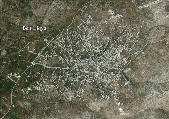
Beit Liqya is located 13.5 km southwest of Ramallah. It is bordered by Beit ‘Anan and Beit ‘Ur al Foqa to the east, Kharbatha al Misbah to the north, Beit Sira and Beit Nuba to the west, and Beit Nuba and Kharayib Umm al Lahim to the south.[3]
History
In the early 1200, the revenues from Beit Liqya were given as a waqf designated for the Al-Haram al-Sharif.[4]
Ottoman era
Beit Liqya, like the rest of Palestine, was incorporated into the Ottoman Empire in 1517, and in 1557 the revenues of the village were designated for the new waqf of Hasseki Sultan Imaret in Jerusalem, established by Hasseki Hurrem Sultan (Roxelana), the wife of Suleiman the Magnificent.[5][6]
In 1838 Beit Lukia was noted as a Muslim village, located in the Beni Malik area, west of Jerusalem.[7]
The French explorer Victor Guérin visited the village in the 1863, and estimated that it had around five hundred inhabitants. He also noted a wali for a Sheikh Abou Ismail.[8] An official Ottoman village list from about 1870, showed that "Bet Lukja" had a total of 109 houses and a population of 347, though the population count included only men.[9][10]
In 1883, the PEF's Survey of Western Palestine described Beit Likia as a "small village on a main road at the foot of the hills, supplied by cisterns. There are ancient foundations among the houses."[11]
British Mandate era
In the 1922 census of Palestine conducted by the British Mandate authorities, Beit Leqia had a population of 739, all Muslim,[12] increasing by the time of 1931 census, when Beit Liqya had 209 occupied houses and a population of 858, still all Muslim.[13]
In the 1945 statistics the population was 1,040, all Muslims,[14] while the total land area was 14,358 dunams, according to an official land and population survey.[15] Of this, 1,918 were allocated for plantations and irrigable land, 6,469 for cereals,[16] while 39 dunams were classified as built-up (urban) areas.[17]
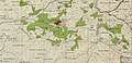 Beit Liqya 1944 1:20,000 from 1919 survey
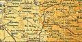 Beit Liqya 1945 1:250,000 (bottom right quadrant)
Jordanian era
In the wake of the 1948 Arab–Israeli War, and after the 1949 Armistice Agreements, Beit Liqya came under Jordanian rule.
In 1961, the population of Beit Liqya was 1,727.[18]
Post-1967
Since the Six-Day War in 1967, Beit Liqya has been under Israeli occupation.
After the 1995 accords, 10.4% of the land of Beit Liqya was classified as Area B, the remaining 89.6% as Area C.[19]
Jamal 'Asi (15 years old) and U'dai 'Asi (14 years old) were killed by the Israeli Army in 2005 near the Israeli West Bank barrier.[20] UN Secretary-General Kofi Annan welcomed Israel's announcement that an involved IDF officer was suspended, and that a full investigation of the incident would take place.[21]
Later the same year, their 15-year-old cousin Mahyoub al-Asi was killed by a civilian security guard, "whom he knew." He was tending the family vineyard. His brother was also killed by a mine explosion near the village several years ago.[20]
On October 16, 2014, Israeli forces shot and killed the 13-year-old Palestinian boy Bahaa Badr in the village near the dividing line with Israel. Bahaa Badr was shot in the chest and died 20 minutes after arriving at the hospital.[22][23][24]
References
- Palmer, 1881, p. 286
- 2007 PCBS Census. Palestinian Central Bureau of Statistics. p.115.
- Beit Liqya Town Profile, ARIJ, p. 4
- Shihab al-Umari, 1932, p. 49
- Singer, 2002, p. 50, citing TSAE-7816/8. (TSAE=Topkapi Saray Arsivi, Evrak) This document reiterate what was transferred on 14 Ramazan 963 AH.
- Toledano, 1984, p. 290, has Bayt Liqya and Bayt Luqua at location 31°52′15″N 35°03′55″E .
- Robinson and Smith, 1841, vol 3, Appendix 2, p. 124
- Guérin, 1868, p. 347
- Socin, 1879, p. 146 It was also noted to be in the Beni Malik area
- Hartmann, 1883, p. 118 also noted 109 houses
- Conder and Kitchener, 1883, SWP III, p. 16
- Barron, 1923, Table VII, Sub-district of Ramallah, p. 16
- Mills, 1932, p. 62.
- Government of Palestine, Department of Statistics, 1945, p. 26
- Government of Palestine, Department of Statistics. Village Statistics, April, 1945. Quoted in Hadawi, 1970, p. 64
- Government of Palestine, Department of Statistics. Village Statistics, April, 1945. Quoted in Hadawi, 1970, p. 111
- Government of Palestine, Department of Statistics. Village Statistics, April, 1945. Quoted in Hadawi, 1970, p. 161
- Government of Jordan, Department of Statistics, 1964, p. 24
- Beit Liqya Town Profile, ARIJ, pp. 16-17
- Security guard shoots Palestinian teen in family vineyard, Jul.10, 2005, Haaretz
- Secretary-General 'saddened' by killing of two teens near Ramallah
- Palestinian boy killed by Israeli forces in West Bank, Oct.16, 2014, Reuters
- Israeli Troops Are Suspected in Shooting of a Teenager, Jodi Rudoren, Oct. 16, 2014, The New York Times
- Palestinian family says it has proof boy shot by IDF troops posed no threat, By Jack Khoury, 26.10.14, Haaretz
Bibliography
- Barron, J.B., ed. (1923). Palestine: Report and General Abstracts of the Census of 1922. Government of Palestine.
- Canaan, T. (1927). Mohammedan Saints and Sanctuaries in Palestine. London: Luzac & Co. (pp. 4,8,16,58)
- Conder, C.R.; Kitchener, H.H. (1883). The Survey of Western Palestine: Memoirs of the Topography, Orography, Hydrography, and Archaeology. 3. London: Committee of the Palestine Exploration Fund.
- Government of Jordan, Department of Statistics (1964). First Census of Population and Housing. Volume I: Final Tables; General Characteristics of the Population (PDF).
- Government of Palestine, Department of Statistics (1945). Village Statistics, April, 1945.
- Guérin, V. (1868). Description Géographique Historique et Archéologique de la Palestine (in French). 1: Judee, pt. 1. Paris: L'Imprimerie Nationale.
- Hadawi, S. (1970), Village Statistics of 1945: A Classification of Land and Area ownership in Palestine, Palestine Liberation Organization Research Centre
- Hartmann, M. (1883). "Die Ortschaftenliste des Liwa Jerusalem in dem türkischen Staatskalender für Syrien auf das Jahr 1288 der Flucht (1871)". Zeitschrift des Deutschen Palästina-Vereins. 6: 102–149.
- Mills, E., ed. (1932). Census of Palestine 1931. Population of Villages, Towns and Administrative Areas. Jerusalem: Government of Palestine.
- Palmer, E.H. (1881). The Survey of Western Palestine: Arabic and English Name Lists Collected During the Survey by Lieutenants Conder and Kitchener, R. E. Transliterated and Explained by E.H. Palmer. Committee of the Palestine Exploration Fund.
- Robinson, E.; Smith, E. (1841). Biblical Researches in Palestine, Mount Sinai and Arabia Petraea: A Journal of Travels in the year 1838. 3. Boston: Crocker & Brewster.
- Shihab al-Umari (1932). "A medieval Arabic description of the Haram of Jerusalem". Quarterly Of The Department Of Antiquities In Palestine. 1: 44–51.
- Singer, A. (2002). Constructing Ottoman Beneficence: An Imperial Soup Kitchen in Jerusalem. Albany: State University of New York Press. ISBN 0-7914-5352-9.
- Socin, A. (1879). "Alphabetisches Verzeichniss von Ortschaften des Paschalik Jerusalem". Zeitschrift des Deutschen Palästina-Vereins. 2: 135–163.
- Toledano, E. (1984). "The Sanjaq of Jerusalem in the Sixteenth Century: Aspects of Topography and Population". Archivum Ottomanicum. 9: 279–319.
External links
- Welcome To Bayt Liqya
- Beit Liqya Town (Fact Sheet), Applied Research Institute–Jerusalem (ARIJ)
- Beit Liqya Town Profile, ARIJ
- Beit Liqya aerial photo, ARIJ
- Locality Development Priorities and Needs in Beit Liqya Town, ARIJ
- Survey of Western Palestine, Map 17: IAA, Wikimedia commons
- A New Israeli Military Order to confiscate ten dunums of Beit Liqya lands southwest of Ramallah city 24, April, 2010, AIRJ
| Cities |  | |
|---|---|---|
| Municipalities |
| |
| Village councils |
| |
| Refugee camps | ||