Deir Qaddis
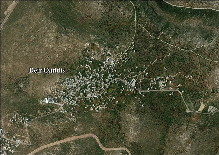
Deir Qaddis (Arabic: دير قديس) is a Palestinian town in the Ramallah and al-Bireh Governorate in the central West Bank, located sixteen kilometers west of Ramallah.[3] According to the Palestinian Central Bureau of Statistics, the town had a population of approximately 1,942 inhabitants in 2007.[4] The town consists of 8,207 dunams, of which 438 dunams are classified as built-up area. As a result of 1995 accords, 7.7% of Deir Qaddis' land was transferred to the Palestinian National Authority for civil affairs, so-called Area B, but Israel still retains full control of 92.3% of the town, being in Area C.[5]
Deir Qaddis | |
|---|---|
| Arabic transcription(s) | |
| • Arabic | دير قديس |
| • Latin | Deir Qiddis (official) Dayr Qaddis (unofficial) |
 View of Deir Qaddis | |
 Deir Qaddis Location of Deir Qaddis within Palestine | |
| Coordinates: 31°56′58″N 35°02′44″E | |
| Palestine grid | 154/150 |
| State | State of Palestine |
| Governorate | Ramallah and al-Bireh |
| Government | |
| • Type | Village council |
| • Head of Municipality | Fares Ibrahim |
| Area | |
| • Total | 8,207 dunams (8.2 km2 or 3.2 sq mi) |
| Elevation | 372 m (1,220 ft) |
| Population (2007) | |
| • Total | 1,942 |
| • Density | 240/km2 (610/sq mi) |
| Name meaning | "Monastery of the saint"[2] |
Location
Deir Qaddis is located 15.7 kilometers (9.8 mi) north-west of Ramallah. It is bordered by Kharbatha Bani Harith and Al-Itihad to the east, Shibtin to the north, Ni’lin to the west, and Bil’in to the south.[1]
History
Deir Qaddis means the "monastery of the saint".[2] French explorer Victor Guérin found in the Kharbet (=ruin) Deir Kaddis remains of houses built with large blocks and several cisterns dug into the rock,[6] while SWP (1882) notes a ruined monastery and cave near by the village, and that the name of the village indicates that a convent once existed here.[7]
Ottoman era
The village was incorporated into the Ottoman Empire in 1517 with all of Palestine, and in 1596 it appeared in the tax registers as Dayr Qiddis in the Nahiya of Ramlah of the Liwa of Gazza. It had a population of 11 households, all Muslim, and paid taxes on wheat, barley, summer crops, olive- and fruit trees, goats and beehives, and a press for olives or grapes; a total of 5,400 akçe.[8]
No sherds from the early Ottoman era have been found here.[9] In 1838 Deir el-Kaddis was noted as a village, located in the Beni Hasan area, west of Jerusalem.[10][11][12]
In 1863 Guérin estimated that Deir Kaddis had about 350 inhabitants,[6] while an Ottoman village list of about 1870 showed Der Kaddis had 36 houses and a population of 112, though the population count included only the men.[13][14]
In 1883, the PEF's Survey of Western Palestine described Deir el Kuddis as a "small hamlet on a high hill-top, with gardens to the north [..] There is a well on the east."[7]
British Mandate era
In the 1922 census of Palestine, conducted by the British Mandate authorities, Dair Qaddis had a population of 299 inhabitants, all Muslims,[15] increasing in the 1931 census to a population of 368, still all Muslim, in 82 houses.[16]
In the 1945 statistics, the population of Deir Qaddis was 440 Muslims,[17] with 8,224 dunams of land, according to an official land and population survey.[18] 1,815 dunams were used for plantations and irrigable land, 1,069 dunams for cereals,[19] while 8 dunams were built-up (urban) land.[20]
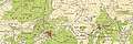 Deir Qaddis 1944 1:20,000
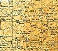 Deir Qaddis 1945 1:250,000
Jordanian era
In the wake of the 1948 Arab–Israeli War, Deir Qaddis came under Jordanian rule.
The Jordanian census of 1961 found 752 inhabitants in Deir Qaddis.[21]
Post-1967
Deir Qaddis came under Israeli occupation during the 1967 Six-Day War. The population in the 1967 census conducted by the Israeli authorities was 461, 25 of whom originated from the Israeli territory.[22]
After the 1995 accords, 7.7% of the village's total area has been classified as Area B land, while the remaining 93.3% is Area C.[5]
According to ARIJ, Israel has confiscated land from Deir Qaddis in order to construct three Israeli settlements:
Part of the village land was separated from Deir Qaddis after Israel finished the Separation Barrier in 2008. The first time the villagers were given permission to access their land behind the barrier was in 2012.[24]
The town today contains a mosque, three schools (two primary and one secondary), two medical clinics and a sports club.
The town's prominent families are Husain, Qattosa, Nasser, Abu Zeid, Hamada, Awadh, Abu Laban and Kreish.[25]
References
- Deir Qaddis Village Profile, ARIJ, p. 4
- Palmer, 1881, p. 228
- The Case of Deir Qiddis village Applied Research Institute - Jerusalem 10 November 2007.
- 2007 PCBS Census Archived December 10, 2010, at the Wayback Machine. Palestinian Central Bureau of Statistics. p.114.
- Deir Qaddis Village Profile, ARIJ, p. 16
- Guérin, 1875, p. 85
- Conder and Kitchener, 1882, p. 297
- Hütteroth and Abdulfattah, 1977, p. 154
- Finkelstein, et al, 1997, p. 192
- Robinson and Smith, 1841, vol 2, p. 133
- Robinson and Smith, 1841, vol 3, p. 66
- Robinson and Smith, 1841, vol 3, Appendix 2, p. 123
- Socin, 1879, p. 152
- Hartmann, 1883, p. 140, also noted 36 houses
- Barron, 1923, Table VII, Division Jaffa, Sub-district of Ramleh, p. 22
- Mills, 1932, p. 19
- Government of Palestine, Department of Statistics, 1945, p. 29
- Government of Palestine, Department of Statistics. Village Statistics, April, 1945. Quoted in Hadawi, 1970, p. 66
- Government of Palestine, Department of Statistics. Village Statistics, April, 1945. Quoted in Hadawi, 1970, p. 114
- Government of Palestine, Department of Statistics. Village Statistics, April, 1945. Quoted in Hadawi, 1970, p. 164
- Government of Jordan, Department of Statistics, 1964, p. 24
- Perlmann, Joel (November 2011 – February 2012). "The 1967 Census of the West Bank and Gaza Strip: A Digitized Version" (PDF). Levy Economics Institute. Retrieved 24 June 2016.
- Deir Qaddis Village Profile, ARIJ, p. 17
- Ocha Monthly report, 2012
- History of Dayr Qaddis Palestine Remembered. (in Arabic)
Bibliography
- Barron, J.B., ed. (1923). Palestine: Report and General Abstracts of the Census of 1922. Government of Palestine.
- Conder, C.R.; Kitchener, H.H. (1882). The Survey of Western Palestine: Memoirs of the Topography, Orography, Hydrography, and Archaeology. 2. London: Committee of the Palestine Exploration Fund.
- Finkelstein, I.; Lederman, Zvi, eds. (1997). Highlands of many cultures. Tel Aviv: Institute of Archaeology of Tel Aviv University Publications Section. ISBN 965-440-007-3.
- Government of Jordan, Department of Statistics (1964). First Census of Population and Housing. Volume I: Final Tables; General Characteristics of the Population (PDF).
- Government of Palestine, Department of Statistics (1945). Village Statistics, April, 1945.
- Guérin, V. (1875). Description Géographique Historique et Archéologique de la Palestine (in French). 2: Samarie, pt. 2. Paris: L'Imprimerie Nationale.
- Hadawi, S. (1970). Village Statistics of 1945: A Classification of Land and Area ownership in Palestine. Palestine Liberation Organization Research Center.
- Hartmann, M. (1883). "Die Ortschaftenliste des Liwa Jerusalem in dem türkischen Staatskalender für Syrien auf das Jahr 1288 der Flucht (1871)". Zeitschrift des Deutschen Palästina-Vereins. 6: 102–149.
- Hütteroth, Wolf-Dieter; Abdulfattah, Kamal (1977). Historical Geography of Palestine, Transjordan and Southern Syria in the Late 16th Century. Erlanger Geographische Arbeiten, Sonderband 5. Erlangen, Germany: Vorstand der Fränkischen Geographischen Gesellschaft. ISBN 3-920405-41-2.
- Mills, E., ed. (1932). Census of Palestine 1931. Population of Villages, Towns and Administrative Areas. Jerusalem: Government of Palestine.
- Palmer, E.H. (1881). The Survey of Western Palestine: Arabic and English Name Lists Collected During the Survey by Lieutenants Conder and Kitchener, R. E. Transliterated and Explained by E.H. Palmer. Committee of the Palestine Exploration Fund.
- Robinson, E.; Smith, E. (1841). Biblical Researches in Palestine, Mount Sinai and Arabia Petraea: A Journal of Travels in the year 1838. 2. Boston: Crocker & Brewster.
- Robinson, E.; Smith, E. (1841). Biblical Researches in Palestine, Mount Sinai and Arabia Petraea: A Journal of Travels in the year 1838. 3. Boston: Crocker & Brewster.
- Socin, A. (1879). "Alphabetisches Verzeichniss von Ortschaften des Paschalik Jerusalem". Zeitschrift des Deutschen Palästina-Vereins. 2: 135–163.
External links
- Welcome To Dayr Qaddis
- Survey of Western Palestine, Map 14: IAA, Wikimedia commons
- Deir Qaddis Fact sheet, Applied Research Institute–Jerusalem (ARIJ)
- Deir Qaddis profile, ARIJ
- Deir Qaddis aerial photo, ARIJ
- Locality Development Priorities and Needs in Deir Qaddis Village, ARIJ
- The Expansion of Kiryat Sefer Settlement on the Land of Dier 27, February, 1997, POICA
- The Israeli Occupation Milling of a Road Designated for "Military Purposes" Deir Qaddis – Ramallah Governorate 01, June, 2011, POICA
- “Israeli Piracy During the Daylight” The Israeli Bulldozers Started to Razing Lands in Deir Qiddis in order to loot more than 100 dunums of Deir Qiddis lands southwest of Ramallah 02, June, 2011, POICA
| Cities |  | |
|---|---|---|
| Municipalities |
| |
| Village councils |
| |
| Refugee camps | ||