Narail Sadar Upazila
Narail Sadar (Bengali: নড়াইল সদর) is an upazila of Narail District in the Division of Khulna, Bangladesh. Narail Thana was established in 1861 and was converted into an upazila in 1984.[3] The upazila takes its name from the district and the Bengali word sadar (headquarters). It is the subdistrict where the district headquarters, Narail town, is located.
Narail Sadar নড়াইল সদর | |
|---|---|
Upazila | |
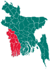
 Narail Sadar Location in Bangladesh | |
| Coordinates: 23°10′N 89°30′E | |
| Country | |
| Division | Khulna Division |
| District | Narail District |
| Area | |
| • Total | 381.75 km2 (147.39 sq mi) |
| Population (2011 census)[2] | |
| • Total | 272,872 |
| • Density | 710/km2 (1,900/sq mi) |
| Time zone | UTC+6 (BST) |
| Postal code | 7500, 7501 |
| Website | narailsadar |
Geography
Narail Sadar Upazila has a total area of 381.75 square kilometres (147.39 sq mi).[1] It borders Magura District to the north, Lohagara Upazila to the north and east, Kalia Upazila to the southeast, and Jessore District to the south and west. The Chitra River flows south through the upazila.[3][4]
Demographics
| Historical population | ||
|---|---|---|
| Year | Pop. (000) | ±% |
| 1981 | 220 | — |
| 1991 | 251 | +14.1% |
| 2001 | 269 | +7.2% |
| 2011 | 273 | +1.5% |
| Source: Bangladesh Bureau of Statistics[1] | ||
According to the 2011 Bangladesh census, Narail Sadar Upazila had 62,795 households and a population of 272,872, 18.8% of whom lived in urban areas. 9.4% of the population was under the age of 5. The literacy rate (age 7 and over) was 65.5%, compared to the national average of 51.8%.[2][5]
Arts and culture
A weeklong festival is held in Narail town in memory of artist SM Sultan every year in January or February. Past events have included an art competition, art exhibition, music, bull fight, horse race, lathi khela, and wrestling. Shorter commemorations are held in August and October, around the anniversaries of his birth and death.[6][7]
Museums
The SM Sultan Memorial Museum has 13 original Sultan artworks and digital prints of 28 others.[8]
Administration
Narail Sadar Upazila is divided into Narail Municipality and 13 union parishads: Auria, Banshgram, Bhadrabila, Bichhali, Chandibarpur, Habakhali, Kalora, Maij Para, Mulia, Sahabad, Shaikhati, Singasolpur, and Tularampur. The union parishads are subdivided into 180 mauzas and 231 villages.
Narail Municipality is subdivided into 9 wards and 24 mahallas.[1]
Transport
The town of Narail is the road transport hub of the district. To the west it is connected by regional highway R750 to Jessore, about 32 kilometres (20 mi) away. R720 runs north 50 kilometres (31 mi) to Magura. Within the district, zilla road Z7503 runs east to Lohagara and on to the Kalna ferry ghat on the Madhumati River. Z7502 runs south, across the Nabaganga River at Baroipara Ghat by ferry, and on to Kalia.[9]
Education
There are 16 colleges in the upazila. They include Abdul Hye City College, Maij Para College, and Mirzapur United College. Narail Government Victoria College, founded in 1886,[3] is the only honors level one.
According to Banglapedia, Narail Government High School, founded in 1903, is a notable secondary school.[3]
The madrasa education system includes one fazil and one kamil madrasa.[10]
Notable residents
- Saroj Dutta, communist activist and writer, was born in Narail in 1914 and attended Victoria Collegiate School there.[11]
- Mashrafe Mortaza, cricketer and current captain of the Bangladesh national cricket team was born in Narail in 1983.[12]
- Suvra Mukherjee, First Lady of India, was born in Bhadrabila village and attended primary school in Narail.[13]
- Bijoy Sarkar, poet, baul singer, lyricist, and composer, was born in Dumdi village in 1903.[14]
- SM Sultan, artist, was born in Machimdia village in 1923 and lived most of his life in Narail.[15]
See also
- Upazilas of Bangladesh
- Districts of Bangladesh
- Divisions of Bangladesh
References
- "District Statistics 2011: Narail" (PDF). Bangladesh Bureau of Statistics. Archived from the original (PDF) on November 13, 2014. Retrieved July 25, 2014.
- "Community Report: Shariatpur" (PDF). Population & Housing Census 2011. Bangladesh Bureau of Statistics. Retrieved 2018-08-15.
- Tuku, Enamul Kabir (2012). "Narail Sadar Upazila". In Islam, Sirajul; Jamal, Ahmed A. (eds.). Banglapedia: National Encyclopedia of Bangladesh (Second ed.). Asiatic Society of Bangladesh.
- "Upazila Map: Upazila Narail Sadar". Local Government Engineering Department. Archived from the original on March 4, 2016. Retrieved July 25, 2014.
- "Population and Housing Census 2011: Bangladesh at a Glance" (PDF). Bangladesh Bureau of Statistics. Archived from the original (PDF) on July 28, 2014. Retrieved July 21, 2014.
- Bose, Ponuel S (January 15, 2013). "Week-long Sultan Mela starts in Narail". The Daily Star. Dhaka. Retrieved August 6, 2014.
- "Sultan Mela in full swing in Narail". New Age. Dhaka. March 1, 2014. Archived from the original on August 12, 2014. Retrieved August 6, 2014.
- "Sultan Museum still locked". The Daily Star. Dhaka. August 10, 2008. Retrieved August 6, 2014.
- "RHD Road Network, Khulna Zone" (PDF). Roads and Highways Department. May 2005. Retrieved July 25, 2014.
- "List of Institutions". Ministry of Education. Retrieved July 15, 2014.
- "Long Live Comrade Saroj Dutta". Liberation. Communist Party of India. March 2014. Retrieved August 7, 2014.
- "Mashrafe Mortaza". ESPN Cricinfo. Retrieved August 6, 2014.
- "Mukherjee, wife make nostalgic trip to Narail". khulnanews.com. March 6, 2013. Archived from the original on August 8, 2014. Retrieved August 7, 2014.
- Haq, Md. Enamul (2012). "Sarkar, Kavial Bijay Krishna". In Islam, Sirajul; Jamal, Ahmed A. (eds.). Banglapedia: National Encyclopedia of Bangladesh (Second ed.). Asiatic Society of Bangladesh.
- Islam, Syed Manzoorul (2012). "Sultan, SM". In Islam, Sirajul; Jamal, Ahmed A. (eds.). Banglapedia: National Encyclopedia of Bangladesh (Second ed.). Asiatic Society of Bangladesh.
| Upazila/Thana: | ||
|---|---|---|