Mujibnagar Upazila
Mujibnagar is an Upazila (subdistrict) of Meherpur District in Bangladesh.
Mujibnagar Bhoborpara( Ex- Baidyanathtala) | |
|---|---|
Upazila | |
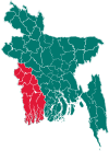
 Mujibnagar Location in Bangladesh | |
| Coordinates: 23°39′N 88°36′E | |
| Country | |
| Division | Khulna Division |
| District | Meherpur District |
| Population (2011) | |
| • Total | 99,143 |
| Time zone | UTC+6 (BST) |
| Postal code | 7102 |
| Website | mujibnagar |
History
Mujibnagar was formerly a part of the Meherpur Sadar Upazila, before it was made a separate Upazila on 22 February 2000. The name Mujibnagar commemorates an event in the history of Bangladesh: It is the place where, on 17 April 1971, the first government of the People's Republic of Bangladesh was sworn in, and the place was named Mujibnagar after the name of the Father of the nation Bangabandhu Sheikh Mujibur Rahman.[1]
Geography
Mujibnagar Upazila is bounded by Meherpur Sadar Upazila in Meherpur District, on the north, Meherpur Sadar Upazila and Damurhuda Upazila, the latter in Chuadanga District, on the east, and Tehatta I CD Block, in Nadia District, West Bengal, India, on the south and the west.[2][3]
Demographics
According to 2011 Bangladesh census, Mujibnagar had a population of 99,143. Males constituted 49.51% of the population and females 50.49%. Muslims formed 93.774% of the population, Hindus 0.953%, Christians 5.245%, and others 0.028%. Mujibnagar had a literacy rate of 50.5% for the population 7 years and above.[4]
References
- Hossain, Md. Murad (2012). "Mujibnagar Upazila". In Islam, Sirajul; Jamal, Ahmed A. (eds.). Banglapedia: National Encyclopedia of Bangladesh (Second ed.). Asiatic Society of Bangladesh.
- "Mujibnagar Upazila". Banglapedia. Retrieved 15 November 2018.
- "Tehsil Map of Nadia". CD Block/ Tehsil. Maps of India. Retrieved 15 November 2018.
- "Bangladesh Population and Housing Census 2011: Zila Report – Meherpur" (PDF). Table P01 : Household and Population by Sex and Residence, Table P05 : Population by Religion, Age group and Residence, Table P09 : Literacy of Population 7 Years & Above by Religion, Sex and Residence. Bangladesh Bureau of Statistics (BBS), Ministry of Planning, Government of the People’s Republic of Bangladesh. Retrieved 9 December 2018.
| Upazilas | ||
|---|---|---|
| Constituencies | ||
| Attractions and sites | ||
| Rivers | ||
| Inhabited areas |
| |
| Educational institutions | ||
| History |
| |