Sharsha Upazila
Sharsha (Bengali: শার্শা) is an Upazila of Jessore District in the Division of Khulna, Bangladesh.
Gorpara শার্শা | |
|---|---|
Upazila | |
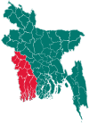
 Gorpara Location in Bangladesh | |
| Coordinates: 23°4.5′N 88°52′E | |
| Country | |
| Division | Khulna Division |
| District | Jessore District |
| Area | |
| • Total | 336.34 km2 (129.86 sq mi) |
| Population (2011) | |
| • Total | 341,328 |
| • Density | 1,000/km2 (2,600/sq mi) |
| Time zone | UTC+6 (BST) |
| Website | Official Map of Sharsha |
Geography
Sharsha is located at 23.0744°N 88.8667°E. It has 46,084 households and a total area of 336.34 km².
Sharsha Upazila is bounded by Bagdah CD Block in North 24 Parganas district in West Bengal, India and Chaugachha, upazila on the north, Jhikargachha upazila on the east, Kalaroa upazila on the south and Bangaon and Gaighata CD Blocks in North 24 Parganas district in West Bengal, India, on the west.[1]
Demographics
According to the 2011 Bangladesh census, Sharsha had a population of 341,565. Males constituted 49.82% of the population and females 50.18%. Muslims formed 97.42% of the population, Hindus 2.47%, Christians 0.08%, and others 0.03%. Sharsha had a literacy rate of 49.76% for the population 7 years and above.[2]
According to the 1991 Bangladesh census, Sharsha had a population of 258,789. Males comprised 51.4% of the population, and females 48.6%. The population aged 18 or over was 126,532. Sharsha had an average literacy rate of 25.5% (7+ years), compared to the national average of 32.4%.[3]
Administration
Sharsha has 11 Unions/Wards,[4] 135 Mauzas/Mahallas, and 172 villages.
The unions are following
- Putkhali
- Bahadurpur
- Bagachra
- Kaiba
- Ulashi
- Sharsa
- Goga
- Dihi
- Benapole
- Lakshampur
- Nijampur
See also
- Upazilas of Bangladesh
- Districts of Bangladesh
- Divisions of Bangladesh
References
- "Sharsha Upazila". Banglapedia. Retrieved 21 July 2016.
- "Bangladesh Population and Housing Census 2011: Zila Report – Jessore" (PDF). Table P01 : Household and Population by Sex and Residence, Table P05 : Population by Religion, Age group and Residence, Table P09 : Literacy of Population 7 Years & Above by Religion, Sex and Residence. Bangladesh Bureau of Statistics (BBS), Ministry of Planning, Government of the People’s Republic of Bangladesh. Retrieved 17 December 2018.
- "Population Census Wing, BBS". Archived from the original on 2005-03-27. Retrieved 10 November 2006.
- "ইউনিয়ন সমূহ - শার্শা উপজেলা-". sharsha.jessore.gov.bd. Retrieved 2018-12-01.
| Upazila/Thana: |
| |
|---|---|---|