Muir Beach, California
Muir Beach is a census designated place (CDP), unincorporated community, and beach that is located 16.5 miles (26.6 km) northwest of San Francisco in western Marin County, California, United States. Unlike many other entities in the area, it is not named in honor of conservationist John Muir; instead it was named after Muir Woods National Monument to capitalize on the latter's popularity.[5] The population was 310 at the 2010 census. The community itself flanks the northwest side of the beach.
Muir Beach | |
|---|---|
Census designated place | |
 Muir Beach as seen from the beach in December 2013 | |
 Location in Marin County and the state of California | |
 Muir Beach CDP, California | |
| Coordinates: 37°51′44″N 122°34′53″W | |
| Country | |
| State | |
| County | Marin |
| Government | |
| • Type | Community Services District |
| • Board members | See Directors |
| • Supervisor | District 4 Dennis Rodoni[1] |
| • State senator | Mark Leno (D) |
| • Assemblymember | Marc Levine (D) |
| • U. S. rep. | Jared Huffman (D)[2] |
| Area | |
| • Total | 0.493 sq mi (1.276 km2) |
| • Land | 0.493 sq mi (1.276 km2) |
| • Water | 0 sq mi (0 km2) 0% |
| Elevation | 312 ft (95 m) |
| Population | |
| • Total | 310 |
| • Density | 630/sq mi (240/km2) |
| Time zone | UTC-8 (Pacific) |
| • Summer (DST) | UTC-7 (PDT) |
| ZIP code | 94965 |
| Area codes | 415/628 |
| FIPS code | 06-49950 |
| GNIS feature IDs | 1853403, 2408888 |
| Website | www |
Located about 2 miles (3 km) from the entrance to Muir Woods, the beach is about 1000 feet (305 m) long and 200 feet (61 m) wide, with coarse sand and several large boulders. Redwood Creek empties into the beach. There is a parking lot at the beach, which is accessible via a footbridge.
The beach was formerly called Big Lagoon after a freshwater lagoon that was located where the parking lot is now. Damage from 20th century dairy farms interfered with the flow of the creek and the lagoon.[6]
Geography
According to the United States Census Bureau, the CDP has a total area of 0.5 square miles (1.3 km²), all of it land.
The beach is one of the cleanest in the state.[7]

Demographics
2010
At the 2010 census Muir Beach had a population of 310. The population density was 629.0 people per square mile (242.9/km²). The racial makeup of Muir Beach was 283 (91.3%) White, 5 (1.6%) African American, 1 (0.3%) Native American, 12 (3.9%) Asian, 1 (0.3%) from other races, and 8 (2.6%) from two or more races. Hispanic or Latino of any race were 7 people (2.3%).[8]
The census reported that 95.8% of the population lived in households and 4.2% lived in non-institutionalized group quarters.
There were 141 households, 27 (19.1%) had children under the age of 18 living in them, 79 (56.0%) were opposite-sex married couples living together, 4 (2.8%) had a female householder with no husband present, 3 (2.1%) had a male householder with no wife present. There were 11 (7.8%) unmarried opposite-sex partnerships, and 1 (0.7%) same-sex married couples or partnerships. 39 households (27.7%) were one person and 11 (7.8%) had someone living alone who was 65 or older. The average household size was 2.11. There were 86 families (61.0% of households); the average family size was 2.47.
The age distribution was 38 people (12.3%) under the age of 18, 10 people (3.2%) aged 18 to 24, 56 people (18.1%) aged 25 to 44, 138 people (44.5%) aged 45 to 64, and 68 people (21.9%) who were 65 or older. The median age was 52.6 years. For every 100 females, there were 102.6 males. For every 100 females aged 18 and over, there were 106.1 males.
There were 162 housing units at an average density of 328.7 per square mile (126.9/km²), of which 73.8% were owner-occupied and 26.2% were occupied by renters. The homeowner vacancy rate was 1.0%; the rental vacancy rate was 2.6%. 75.2% of the population lived in owner-occupied housing units and 20.6% lived in rental housing units.

2000
At the 2000 census there were 295 people, 131 households, and 69 families in the CDP. The population density was 596.8 people per square mile (232.4/km²). There were 144 housing units at an average density of 291.3 per square mile (113.5/km²). The racial makeup of the CDP in 2010 was 89.7% non-Hispanic White, 0.8% non-Hispanic African American, 3.9% Asian, and 2.6% from two or more races. Hispanic or Latino of any race were 2.3%.[9]
Of the 131 households 19.1% had children under the age of 18 living with them, 45.0% were married couples living together, 5.3% had a female householder with no husband present, and 46.6% were non-families. 30.5% of households were one person and 7.6% were one person aged 65 or older. The average household size was 2.22 and the average family size was 2.67.
The age distribution was 14.2% under the age of 18, 2.7% from 18 to 24, 26.1% from 25 to 44, 46.8% from 45 to 64, and 10.2% 65 or older. The median age was 48 years. For every 100 females, there were 90.3 males. For every 100 females aged 18 and over, there were 91.7 males.
The median household income was $125,402 and the median family income was $152,174. The per capita income for the CDP was $66,476. None of the families and 10.5% of the population were living below the poverty line.[10]
Education
Muir Beach is in the Mill Valley School District, Tamalpais Union High School District, and the Marin Community College District. Students attend public schools in or near Mill Valley at Tamalpais Valley Elementary School (kindergarten - grade 5), Mill Valley Middle School (grades 6 - 8), and Tamalpais High School (grades 9 - 12).[11]
Local government
Muir Beach is unincorporated, receiving general government services from Marin County, including law enforcement, land-use planning, library, public health, and code enforcement. A special district, the Muir Beach Community Services District, provides local services, including fire protection, water, road maintenance, and recreation. The District has a board of directors, with five members elected to four-year terms. The District includes all of the Muir Beach CDP, plus Green Gulch Farm. (See map of MBCSD.)[12]
See also
Notes
- "County of Marin District 4 webpage". County of Marin. Retrieved February 7, 2020.
- "California's 2nd Congressional District - Representatives & District Map". Civic Impulse, LLC. Retrieved March 8, 2013.
- "2010 Census U.S. Gazetteer Files – Places – California". United States Census Bureau.
- "Muir Beach". Geographic Names Information System. United States Geological Survey. Retrieved April 18, 2015.
- Jim, Wood (May 20, 2008). "Muir Beach". Marin Magazine.
- Nolte, Carl (May 25, 2013) "Muir Beach to Close for the Summer." San Francisco Chronicle. (Retrieved 6-11-13.)
- Bay Area beaches grade well for safe swimming, May 27, 2010 by Carolyn Jones, San Francisco Chronicle
- "2010 Census Interactive Population Search: CA - Muir Beach CDP". U.S. Census Bureau. Archived from the original on July 15, 2014. Retrieved July 12, 2014.
- "U.S. Census website". United States Census Bureau. Retrieved January 31, 2008.
- U.S. Census Bureau, Muir Beach CDP, California Fact Sheet Archived February 12, 2020, at Archive.today, accessed June 12, 2007
- Marin County Office of Education, "Marin County Public Schools, 2006 - 2007", pages 25 - 28 Archived November 29, 2006, at the Wayback Machine
- Marin Local Agency Formation Commission, Directory of Marin County Local Governments, November 17, 2005 Archived July 1, 2007, at the Wayback Machine
External links
| Wikimedia Commons has media related to Muir Beach, California. |
- http://www.muirbeach.com/about.html (private web page)
- Muir Beach Community Services District
Municipalities and communities of Marin County, California, United States | ||
|---|---|---|
| Cities and towns | 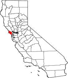 Marin County map | |
| CDPs | ||
| Unincorporated communities |
| |
| Ghost towns | ||
| Bodies of water |
|  |
|---|---|---|
| Counties | ||
| Major cities | ||
| Cities and towns 100k–250k | ||
| Cities and towns 50k–99k | ||
| Cities and towns 25k–50k | ||
| Cities and towns 10k–25k |
| |
| Sub-regions | ||