Bancharampur Upazila
Bancharampur (Bengali: বাঞ্ছারামপুর) is an Upazila (administrative region similar to a county) in the Brahmanbaria District[1] in the Division of Chittagong, Bangladesh.
Banxdcharampur বাঞ্ছারামপুর | |
|---|---|
Upazila | |
 Banxdcharampur Location in Bangladesh | |
| Coordinates: 23°46.7′N 90°48.5′E | |
| Country | |
| Division | Chittagong Division |
| District | Brahmanbaria District |
| Area | |
| • Upazila | 217.38 km2 (83.93 sq mi) |
| • Metro | Bancharampur Bangladesh km2 (Formatting error: invalid input when rounding sq mi) |
| Population (2010) | |
| • Upazila | 358,371 |
| • Density | 1,189/km2 (3,080/sq mi) |
| Time zone | UTC+6 (BST) |
Geography
Bancharampur is located at 23.777823°N 90.808388°E. It covers an area of 219.38 square kilometres (84.70 sq mi).
Demographics
According to the 2010 Bangladesh census, Bancharampur had a population of 358,371 in 43,987 households. 120,882 were 18 years of age and above. Bancharampur had an average literacy rate of 50.9% for citizens aged 7 and older at the time, compared to the national average of 32.4%[2]
Administration
Bancharampur has 1 Pourosova,13 Unions/Wards, 78 Mouzas/Mahallas, and 129 villages.
Villages
|
|
|
See also
- Upazilas of Bangladesh, jonercor
- Districts of Bangladesh
- Divisions of Bangladesh
References
- Md Abul Kasem Bhuiyan (2012), "Banchharampur Upazila", in Sirajul Islam and Ahmed A. Jamal (ed.), Banglapedia: National Encyclopedia of Bangladesh (Second ed.), Asiatic Society of Bangladesh
- "Population Census Wing, BBS". Archived from the original on 2005-03-27. Retrieved November 10, 2006.
External links
Capital: Brahmanbaria | ||
| Upazilas | ||
| Constituencies | ||
| Attractions and sites | ||
| History | ||
| Inhabited areas | ||
| Rivers | ||
| Educational institutions | ||
| Organisations | ||
| Transport | ||
Capital: Chattogram | ||
| Bandarban District | 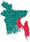 | |
| Brahmanbaria District | ||
| Chandpur District | ||
| Chattogram District | ||
| Cumilla District |
| |
| Cox's Bazar District | ||
| Feni District | ||
| Khagrachari District |
| |
| Lakshmipur District | ||
| Noakhali District | ||
| Rangamati District | ||
This article is issued from Wikipedia. The text is licensed under Creative Commons - Attribution - Sharealike. Additional terms may apply for the media files.