Chandina Upazila
Chandina (Bengali: চান্দিনা) is an Upazila of Comilla District in the Division of Chittagong, Bangladesh.[1]
Chandina চান্দিনা | |
|---|---|
Upazila | |
 Chandina Location in Bangladesh | |
| Coordinates: 23°29′N 91°0.5′E | |
| Country | |
| Division | Chittagong Division |
| District | Comilla District |
| Area | |
| • Total | 201.92 km2 (77.96 sq mi) |
| Population (2011) | |
| • Total | 350,273 |
| • Density | 1,700/km2 (4,500/sq mi) |
| Time zone | UTC+6 (BST) |
| Website | Official Map of Chandina |
Geography
Chandina is located at 23.4833°N 91.0083°E . It has 46,856 households and a total area of 201.92 km². Chandina township is a class B municipality, which is located at the extreme north of the upazila by the Dhaka Chittagong Highway. Cahndiara village area is within the municipality and value of property here, like the rest of the municipality, have increased significantly.
Demographics
Chandina, due to fertile land and less flood zones, is one of the most densely populated rural areas of the world. According to the 1991 Bangladesh census, Chandina had a population of 269,878, of whom 127,010 were aged 18 or over. Males constituted 50.18% of the population, and females 49.82%. Chandina had an average literacy rate of 27.7% (7+ years), against the national average of 32.4%.[2]
Administration
Chandina has 1 class B municipality 13 Unions, 126 Mauzas/Mahallas, and 232 villages.
See also
- Upazilas of Bangladesh
- Districts of Bangladesh
- Divisions of Bangladesh
References
- Bhuiyan, Muhammad Mosharaf Hossain (2012). "Chandina Upazila". In Islam, Sirajul; Jamal, Ahmed A. (eds.). Banglapedia: National Encyclopedia of Bangladesh (Second ed.). Asiatic Society of Bangladesh.
- "Population Census Wing, BBS". Archived from the original on 2005-03-27. Retrieved November 10, 2006.
Cumilla District | ||
|---|---|---|
| Upazila/Thana: |
| |
Capital: Chattogram | ||
| Bandarban District | 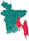 | |
| Brahmanbaria District | ||
| Chandpur District | ||
| Chattogram District | ||
| Cumilla District |
| |
| Cox's Bazar District | ||
| Feni District | ||
| Khagrachari District |
| |
| Lakshmipur District | ||
| Noakhali District | ||
| Rangamati District | ||