Dighinala Upazila
Dighinala (Bengali: দীঘিনালা) is an Upazila of Khagrachari District[1] in the Division of Chittagong, Bangladesh.
Dighinala দীঘিনালা | |
|---|---|
Upazila | |
 Dighinala Location in Bangladesh | |
| Coordinates: 23°15.5′N 92°3.5′E | |
| Country | |
| Division | Chittagong Division |
| District | Khagrachari District |
| Area | |
| • Total | 694.12 km2 (268.00 sq mi) |
| Population (2011) | |
| • Total | 103,392 |
| • Density | 150/km2 (390/sq mi) |
| Time zone | UTC+6 (BST) |
| Website | www |
History
Dighinala, the biggest upazila of Khagrachhari zila in respect of area, came into existence in 1916 as a thana and was upgraded to upazila in 1984. It is said that in the long past, Raja Manikkya Bahadur dug a big pond (meaning Dighi in Bangla) by the side of a canal (meaning Nala in Bangla) .It is generally believed that the upazila might have originated its name from above two words Dighi and Nala. [2]
Geography
Dighinala Upazila (khagrachhari district) area 694.12 sq km, located in between 23°04' and 23°44' north latitudes and in between 91°56' and 92°11' east longitudes. It is a hilly area. It is bounded by tripura state of India on the north, langadu upazila on the south, baghaichhari upazila on the east, panchhari and khagrachhari sadar upazilas and Tripura state on the west. Golamoon, Karmi Mura, Lutiban, Kuradia hills are notable.
Demographics
According to the 2011 Bangladesh census, Dighinala has a population of 103,392,with a growth rate of 1.08%;Males 53,054;Female 50,338. Dighinala had a literacy rate of 46.2%(7+ Year)[3]
Administration
The upazila consists of 5 unions, 22 populated mauzas and 245 villages. The average size of population of each union, mauza and village are 20678, 4700 and 422 respectively.
- Merung Union
- Boyalkhali Union
- Kobakhali Union
- Dighinala Union
- Babuchhara Union
Economy
Main sources of income Agriculture 65.53%, non-agricultural labourer 8.51%, commerce 9.70%, service 5.01%, construction 0.42%, religious service 0.20%, rent and remittance 0.10% and others 10.53%.
Ownership of agricultural land Landowner 46.96%, landless 53.04%; agricultural landowner: urban 25.85% and rural 50.57%.
Main crops Paddy, ginger, garlic, mustard, nut, sesame, potato, vegetables.
Main fruits Banana, jackfruit.
Fisheries, dairies and poultries Poultry 6. [4]
Education
Literacy rate and educational institutions Average literacy 47.5%; male 56.1%, female 38%. Educational institutions: Choto Merung High School, DIGHINALA BORADOM HIGH SCHOOL,[5] Dighinala Government College, Dighinala Government High School, Dighinala Model Girls' School, Hashinpur High School, Anath Ashram Abashik High School, Babuchhara High School, Udal Bagan High School, Rasik Nagar Dakhil Madrasa.
Transport
Communication facilities Pucca road 91 km, semi-pucca road 34 km, mud road 280 km.
Extinct or nearly extinct traditional transport Bullock cart. Connected to the zila headquarters by metalled roads. Bus, minibus, three wheelers ply over the upazila. Chander Gari (local four wheeled jeep) is a popular transport used to ply in the hill area of upazila. [6]
Point of Interest
•Sajek
•10 No. Jhorna
•Suspension Bridge
See also
- Upazilas of Bangladesh
- Districts of Bangladesh
- Divisions of Bangladesh
References
- Atikur Rahman (2012), "Dighinala Upazila", in Sirajul Islam; Ahmed A. Jamal (eds.), Banglapedia: National Encyclopedia of Bangladesh (Second ed.), Asiatic Society of Bangladesh
- http://www.bbs.gov.bd/site/page/47856ad0-7e1c-4aab-bd78-892733bc06eb/%E0%A6%AA%E0%A6%AA%E0%A7%81%E0%A6%B2%E0%A7%87%E0%A6%B6%E0%A6%A8-%E0%A6%8F%E0%A6%A8%E0%A7%8D%E0%A6%A1-%E0%A6%B9%E0%A6%BE%E0%A6%89%E0%A6%9C%E0%A6%BF%E0%A6%82-%E0%A6%B8%E0%A7%87%E0%A6%A8%E0%A7%8D%E0%A6%B8%E0%A6%BE%E0%A6%B8
- "Population Census Wing, BBS". Archived from the original on 2005-03-27. Retrieved November 10, 2006.
- http://en.banglapedia.org/index.php?title=Dighinala_Upazila
- http://en.banglapedia.org/index.php?title=Dighinala_Upazila
- http://en.banglapedia.org/index.php?title=Dighinala_Upazila
| Upazilas | ||
|---|---|---|
| Attractions and sites | ||
| Organisations | ||
| Inhabited areas | ||
| History | ||
| Rivers and transport | ||
Capital: Chattogram | ||
| Bandarban District | 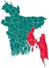 | |
| Brahmanbaria District | ||
| Chandpur District | ||
| Chattogram District | ||
| Cumilla District |
| |
| Cox's Bazar District | ||
| Feni District | ||
| Khagrachari District |
| |
| Lakshmipur District | ||
| Noakhali District | ||
| Rangamati District | ||