Haziganj Upazila
Haziganj (Bengali: হাজীগঞ্জ) or Hajiganj is an Upazila of Chandpur District[1] in the Division of Chittagong, Bangladesh.
Haziganj হাজীগঞ্জ উপজেলা. | |
|---|---|
Upazila | |
 Haziganj Location in Bangladesh | |
| Coordinates: 23°15′N 90°51′E | |
| Country | |
| Division | Chittagong Division |
| District | Chandpur District |
| Area | |
| • Total | 189.9 km2 (73.3 sq mi) |
| Population (1991) | |
| • Total | 254,057 |
| • Density | 1,300/km2 (3,500/sq mi) |
| Time zone | UTC+6 (BST) |
| Website | hajiganj |
Geography
Haziganj is located at 23.2500°N 90.8500°E.Hajiganj Upazila (chandpur district) area 189.90 km2, located in between 23°12' and 23°20' north latitudes and in between 90°45' and 90°55' east longitudes. It is bounded by kachua and matlab dakshin upazilas on the north, faridganj and ramganj upazilas on the south, shahrasti upazila on the east, chandpur sadar, Matlab Dakshin and Chandpur Sadar upazilas on the west.
Demographics
The Hajigonj Municipality is a 1st class municipality. It is 19 square kilometres (7.3 sq mi) in area. The population of the municipality is 58,000, with a population density of 3055 people per km2. According to the 2011 Bangladesh census, Haziganj had a population of 291,057. Males constituted 49.17% of the population, and females 50.83%. The population aged 18 or over was 127,498. Haziganj had an average literacy rate of 60.5% (7+ years), compared to the national average of 64.4%.[2]
Economy
- Hats, bazars and fairs Hats and bazars are 28, fairs :Hajiganj, Bakila Bazar, Rampur, Rajargaon, Ramchandrapur, Chengatali and Aliganj, Barkul, Belghar-Rajapur, Balakhal fairs are notable.
Main exports Jute, Jute made products.
- Cold stores: 2
- Rice mills: 19
- CNG filling stations: 3
- petrol pumps: 2
Administration
Haziganj has 13 unions/wards, 139 mauzas/mahallas, and 147 villages.
1. Aligonj
2.Uttar Kalocho
3.Dakshin Kalocho
4.randhuni mura
5.poschim borkul
6.dokkhin borkul
7.ali gonj
8.mokima bad
9.bola khal.
Notable Village name: 1.Shidla 2.Ajagora 3.Waruk 4.Rajargaon
Infrastructure
upozila health complex, hajigonj
- govt. Union Hosp.-8
- Private Hosp-9
- Eye Hosp.-1
- Diabetic Hosp-1
- Clinic-49
Education
- Primary School-205
- Non-govt. Primary-165
- High School-36
- College-18
- Madrasa-183
- University College-2
- Pvt. Polytechnic.-2
- MATS-1
See also
- Shakir Hossain of Bangladesh
- Upazilas of Bangladesh
- Districts of Bangladesh
- Divisions of Bangladesh
References
- Md. Tofael Ahmed Sheikh (2012), "Hajiganj Upazila", in Sirajul Islam and Ahmed A. Jamal (ed.), Banglapedia: National Encyclopedia of Bangladesh (Second ed.), Asiatic Society of Bangladesh
- "Population Census Wing, BBS". Archived from the original on 2005-03-27. Retrieved November 10, 2006.
| Upazila/Thana: |
| |
|---|---|---|
Capital: Chattogram | ||
| Bandarban District | 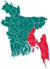 | |
| Brahmanbaria District | ||
| Chandpur District | ||
| Chattogram District | ||
| Cumilla District |
| |
| Cox's Bazar District | ||
| Feni District | ||
| Khagrachari District |
| |
| Lakshmipur District | ||
| Noakhali District | ||
| Rangamati District | ||