Michigan's 6th congressional district
Michigan's 6th congressional district is a United States congressional district in southwest Michigan. It consists of all of Berrien, Cass, Kalamazoo, St. Joseph, and Van Buren, counties, and includes most of Allegan county. Its largest city is Kalamazoo.
| Michigan's 6th congressional district | |||
|---|---|---|---|
.tif.png) Michigan's 6th congressional district since January 3, 2013 | |||
| Representative |
| ||
| Population (2010) | 705,974 | ||
| Median income | $53,414[1] | ||
| Ethnicity |
| ||
| Cook PVI | R+4[2] | ||
2011 redistricting removed the portion of Calhoun County that had been in the district, and added northwestern Allegan County, leaving only parts of the city of Holland in the 2nd district.
Major cities
Voting
| Election results from presidential races | ||
|---|---|---|
| Year | Office | Results |
| 2016 | President | Trump 51 - 43% |
| 2012 | President | Romney 50 - 49% |
| 2008 | President | Obama 54 - 45% |
| 2004 | President | Bush 53 - 46% |
| 2000 | President | Bush 52 - 45% |
| 1996 | President | Clinton 46 - 44% |
| 1992 | President | Clinton 39 - 38% |
History
Michigan's Sixth Congressional District was originally formed in 1862. At this time it had all the Upper Peninsula except Menominee, Delta and Mackinac counties.
The district was vaguely contiguous, in that it did not contain the Straits of Mackinac but did include Presque Isle County, which can be reached without going through another district's area. It included another 21 counties on the Lower Peninsula. The southern boundary of the district was formed by Clinton, Shiawassee, Genesee, Tuscola and Huron counties. The district had a population of 97,783.[3]
In 1872, the Sixth District was shifted southward. It retained Clinton, Shiawassee, and Genesee counties while adding Ingham, Livingston and Oakland counties. With 163,000 residents the district had 12,000 more inhabitants than the next most populous district, and 65,000 more residents than Michigan's least populous district.[4]
In 1882, Shiawassee County was removed from the district. The new district had about 165,000 people. In 1892, Clinton County was removed but the townships of Livonia, Nankin (now Westland, Michigan and surrounding cities), Redford (including the eastern portion since annexed by Detroit), Greenfield (almost all now in Detroit, except the portion that became Highland Park, Springwells (since annexed by Detroit and Dearborn), and Dearborn in Wayne County were added, as well as the part of Detroit west of Lawton. This new district had a population of 190,539 that was 0.8% African-American.[5]
No changes were made in the boundaries of the district in 1902. Its population had risen to 221,699.[6]
It was not until 1932 that the boundaries of the 6th district were altered. In this year it lost its parts of Oakland and Wayne counties and was shifted to Ingham, Livingston, and Genesee Counties. These boundaries were not changed until 1964, when the district was redrawn to cover Jackson, Ingham, and Shiawassee counties.
In 1972, the district was redrawn to include Jackson, Ingham, and Livingston counties, as well as the western portion of Washtenaw County.
In 1982 the district was redrawn to Ingham, Livingston, and northwestern Oakland counties with a finger stretching all the way to Pontiac. Waterford Township was in the district, as was Auburn Hills, but Orion Township, Rochester Hills and Bloomfield Hills were all in other districts. The boundaries also included Independence Township, White Lake Township, Rose Township, Springfield Township and Highland Township. Brighton and the areas directly east of it in Livingston County were also not in this district. Most of Lansing was put in the 3rd District. In Jackson County the district covered Henrietta Township, Rives Township, and Tompkins Township. In Clinton County it included Bath Township. In Shiawassee County the district included Antrim Township, Perry Township, Perry, and Woodhull Township.[7][8]
In 1992, most of the old 6th's territory became the 8th District, while the 6th was redrawn to cover most of the old 4th and a small portion of the old 3rd, ending the splitting of Kalamazoo County between two districts. There were minor changes in the districts boundaries in 2002 and 2012.
List of representatives
| Representative | Party | Term | Cong ress |
Electoral History |
|---|---|---|---|---|
| District created | March 4, 1863 | |||
 | Republican | March 4, 1863 – March 3, 1869 | 38th 39th 40th | |
 | Republican | March 4, 1869 – March 3, 1871 | 41st | |
 | Democratic | March 4, 1871 – March 3, 1873 | 42nd | |
 | Republican | March 4, 1873 – March 3, 1875 | 43rd | |
 | Democratic | March 4, 1875 – March 3, 1877 | 44th | |
 | Republican | March 4, 1877 – March 3, 1881 | 45th 46th | |
 | Republican | March 4, 1881 – March 3, 1883 | 47th | |
 | Democratic | March 4, 1883 – March 3, 1887 | 48th 49th | |
| Republican | March 3, 1887 – March 3, 1891 | 50th 51st | |
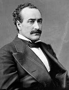
.jpg) | Democratic | March 3, 1891 – March 3, 1893 | 52nd | |
 | Republican | March 4, 1893 – March 3, 1897 | 53rd 54th | |
 | Republican | March 4, 1897 – March 3, 1915 | 55th 56th 57th 58th 59th 60th 61st 62nd 63rd | |
 | Republican | March 4, 1915 – March 3, 1923 | 64th 65th 66th 67th | Redistricted from the At-large district |
 | Republican | March 4, 1923 – March 3, 1931 | 67th 68th 69th 70th 71st | |
 | Republican | March 4, 1931 – March 3, 1933 | 72nd | |
| Democratic | March 4, 1933 – January 3, 1935 | 73rd | |
| Republican | January 3, 1935 – January 3, 1937 | 74th | |
| Democratic | January 3, 1937 – January 3, 1939 | 75th | |
| Republican | January 3, 1939 – January 3, 1953 | 76th 77th 78th 79th 80th 81st 82nd | |
 | Republican | January 3, 1953 – January 3, 1955 | 83rd | |
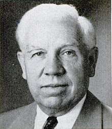
.jpg) | Democratic | January 3, 1955 – January 3, 1957 | 84th | |
 | Republican | January 3, 1957 – December 31, 1974 | 85th 86th 87th 88th 89th 90th 91st 92nd 93rd | Resigned |
| Vacant | December 31, 1974 – January 3, 1975 | |||
.jpeg) | Democratic | January 3, 1975 – January 3, 1981 | 94th 95th 96th | |
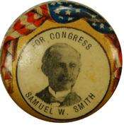
.png) | Republican | January 3, 1981 – January 3, 1983 | 97th | |
| Democratic | January 3, 1983 – January 3, 1993 | 98th 99th 100th 101st 102nd | Redistricted to the 8th district |
 | Republican | January 3, 1993 – present | 103rd 104th 105th 106th 107th 108th 109th 110th 111th 112th 113th 114th 115th 116th | Redistricted from the 4th district, Incumbent |
Historical district boundaries

.PNG)
Notes
- "My Congressional District".
- "PVI Map and District List". The Cook Political Report. Retrieved December 13, 2017.
- Parson, Beach and Dubin. Congressional Districts and Data p. 119
- Parson et al.Congressional Districts and Data p. 180-181
- Parsons, Dubin and Parsons. Congressional Districts. p. 222
- Parsons et al. Congressional Districts p. 359
- Barone, Michael and Grant Ujifusa. The Almanac of American Politics. (Washington: National Journal, 1983) p. 576
- http://www.censu.gov%5B%5D maps
- Edwin B. Winans was elected as a fusion candidate, but was seated in Congress with the Democratic Party.
- Byron G. Stout was elected on a Democratic and Union ticket in 1890 to the 52nd Congress.
References
- Govtrack.us for the 7th District – Lists current Senators and representative, and map showing district outline
- The Political graveyard: U.S. Representatives from Michigan, 1807–2003
- U.S. Representatives 1837–2003, Michigan Manual 2003–2004
- Martis, Kenneth C. (1989). The Historical Atlas of Political Parties in the United States Congress. New York: Macmillan Publishing Company.
- Martis, Kenneth C. (1982). The Historical Atlas of United States Congressional Districts. New York: Macmillan Publishing Company.
- Congressional Biographical Directory of the United States 1774–present