Paw Paw, Michigan
Paw Paw is a village in the U.S. state of Michigan. The population was 3,534 at the 2010 census. It is the county seat of Van Buren County.[6]
Paw Paw, Michigan | |
|---|---|
 Van Buren County Courthouse | |
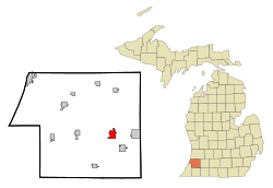 Location of Paw Paw, Michigan | |
 Paw Paw, Michigan Location of Paw Paw, Michigan  Paw Paw, Michigan Paw Paw, Michigan (the United States) | |
| Coordinates: 42°13′2″N 85°53′24″W | |
| Country | United States |
| State | Michigan |
| County | Van Buren |
| Area | |
| • Total | 2.86 sq mi (7.41 km2) |
| • Land | 2.64 sq mi (6.84 km2) |
| • Water | 0.22 sq mi (0.57 km2) |
| Elevation | 732 ft (223 m) |
| Population | |
| • Total | 3,534 |
| • Estimate (2018)[3] | 3,385 |
| • Density | 1,295.57/sq mi (500.17/km2) |
| Time zone | UTC-5 (Eastern (EST)) |
| • Summer (DST) | UTC-4 (EDT) |
| ZIP code | 49079 |
| Area code(s) | 269 |
| FIPS code | 26-62980[4] |
| GNIS feature ID | 634488[5] |
| Website | www |
Overview
The village is located at the confluence of the east and south branches of the Paw Paw River in the northeast portion of Paw Paw Township. Paw Paw was incorporated in 1837 and is located in the southwestern portion of Michigan, on Interstate 94 (I-94) approximately 20 miles (32 km) west of Kalamazoo.
Paw Paw is in a rural location whose primary agricultural product is grapes, which are used both in the local Michigan wine industry and for juice and jellies. The St. Julian Winery and Warner's Winery started in Paw Paw. Paw Paw has an annual Wine and Harvest Festival, which traditionally occurs the weekend following Labor Day. The Festival features a beer tent, bandstand, live music, a popular grape stomping competition among barefoot locals, carnival foods, and fireworks over scenic Maple Lake. Fine dining establishments in the Theater District cater to attendees of the Festival.
Paw Paw is named for the pawpaw trees which once grew along the Paw Paw River. However, the pawpaw trees are less common at present due to the clearing of the shade trees that pawpaws require. An experimental planting of pawpaw trees on the high school grounds failed to flourish due to its location in an open, sunny field.
The village is the main setting for the musical Dear Edwina by Marcy Heisler and Zina Goldrich.
Historic sites
Listed in the National Register for Historic places is the Van Buren County Courthouse at 212 E. Paw Paw Street, wherein the first election was held in 1837. Renovations were completed in 1999.[7]
Geography
According to the United States Census Bureau, the village has a total area of 2.89 square miles (7.49 km2), of which 2.67 square miles (6.92 km2) is land and 0.22 square miles (0.57 km2) is water.[8]
Demographics
| Historical population | |||
|---|---|---|---|
| Census | Pop. | %± | |
| 1870 | 1,428 | — | |
| 1880 | 1,482 | 3.8% | |
| 1890 | 1,391 | −6.1% | |
| 1900 | 1,465 | 5.3% | |
| 1910 | 1,643 | 12.2% | |
| 1920 | 1,556 | −5.3% | |
| 1930 | 1,684 | 8.2% | |
| 1940 | 1,910 | 13.4% | |
| 1950 | 2,382 | 24.7% | |
| 1960 | 2,970 | 24.7% | |
| 1970 | 3,160 | 6.4% | |
| 1980 | 3,211 | 1.6% | |
| 1990 | 3,169 | −1.3% | |
| 2000 | 3,363 | 6.1% | |
| 2010 | 3,534 | 5.1% | |
| Est. 2018 | 3,385 | [3] | −4.2% |
| U.S. Decennial Census[9] | |||
2010 census
As of the census[2] of 2010, there were 3,534 people, 1,499 households, and 862 families living in the village. The population density was 1,323.6 inhabitants per square mile (511.0/km2). There were 1,674 housing units at an average density of 627.0 per square mile (242.1/km2). The racial makeup of the village was 92.3% White, 2.3% African American, 0.2% Native American, 0.4% Asian, 2.2% from other races, and 2.7% from two or more races. Hispanic or Latino of any race were 5.9% of the population.
There were 1,499 households of which 31.2% had children under the age of 18 living with them, 34.6% were married couples living together, 17.5% had a female householder with no husband present, 5.5% had a male householder with no wife present, and 42.5% were non-families. 35.6% of all households were made up of individuals and 13.2% had someone living alone who was 65 years of age or older. The average household size was 2.27 and the average family size was 2.91.
The median age in the village was 36.4 years. 24.2% of residents were under the age of 18; 9.5% were between the ages of 18 and 24; 27.1% were from 25 to 44; 25.3% were from 45 to 64; and 13.8% were 65 years of age or older. The gender makeup of the village was 48.5% male and 51.5% female.
2000 census
As of the census[4] of 2000, there were 3,363 people, 1,417 households, and 855 families living in the village. The population density was 1,262.5 per square mile (488.1/km²). There were 1,511 housing units at an average density of 567.3 per square mile (219.3/km²). The racial makeup of the village was 92.83% White, 2.85% African American, 0.83% Native American, 0.27% Asian, 0.06% Pacific Islander, 1.19% from other races, and 1.96% from two or more races. Hispanic or Latino of any race were 2.97% of the population.
There were 1,417 households out of which 29.7% had children under the age of 18 living with them, 41.2% were married couples living together, 14.9% had a female householder with no husband present, and 39.6% were non-families. 32.7% of all households were made up of individuals and 12.3% had someone living alone who was 65 years of age or older. The average household size was 2.27 and the average family size was 2.86.
In the village, the population was spread out with 23.3% under the age of 18, 10.0% from 18 to 24, 30.2% from 25 to 44, 21.5% from 45 to 64, and 15.0% who were 65 years of age or older. The median age was 36 years. For every 100 females, there were 93.5 males. For every 100 females age 18 and over, there were 90.3 males.
The median income for a household in the village was $38,750, and the median income for a family was $50,889. Males had a median income of $36,548 versus $29,559 for females. The per capita income for the village was $21,859. About 1.9% of families and 5.7% of the population were below the poverty line, including 3.1% of those under age 18 and 3.4% of those age 65 or over.
Education
Paw Paw Public Schools is the school district serving the community.
Notable people
- Jason Babin, football player for Western Michigan, first-round NFL draft pick
- John Bonamego, football head coach at Central Michigan University; previously assistant coach with NFL's Miami Dolphins, Jacksonville Jaguars, Green Bay Packers and Detroit Lions
- Frank R. Gooding, Governor of Idaho 1905-09, U.S. Senator 1921-28; raised in Paw Paw
- Doane Harrison, Oscar-nominated film editor, best known for his long collaboration with director Billy Wilder
- Bill and Wade Killefer, early 20th-century baseball players
- Ricky Knotts, racecar driver killed attempting to qualify for 1981 Daytona 500
- Joseph Labadie, labor leader and political activist
- Ron Labadie, head of scouting for NFL's Miami Dolphins
- Loretta Long, actress and educator, best known as "Susan Robinson" on Sesame Street
- Charlie Maxwell ("Old Paw Paw"), a former Detroit Tigers, Boston Red Sox, Baltimore Orioles and Chicago White Sox baseball player
- Jerry Mitchell, Tony Award-winning choreographer
- Don Moorhead, football player for Michigan 1969-1970, Canadian Football League quarterback
- A. W. Underwood, a 19th-century Paw Paw native with the purported ability to set items ablaze
- Abraham Wechter, master luthier of Wechter Guitars
- Shayne Whittington, NBA basketball player for the Indiana Pacers
References
- "2017 U.S. Gazetteer Files". United States Census Bureau. Retrieved Jan 3, 2019.
- "U.S. Census website". United States Census Bureau. Retrieved 2012-11-25.
- "Population and Housing Unit Estimates". Retrieved November 12, 2019.
- "U.S. Census website". United States Census Bureau. Retrieved 2008-01-31.
- U.S. Geological Survey Geographic Names Information System: Paw Paw, Michigan
- "Find a County". National Association of Counties. Archived from the original on May 31, 2011. Retrieved 2011-06-07.
- "Van Buren County community center website, History". Archived from the original on 2010-11-29. Retrieved 2010-06-06.
- "US Gazetteer files 2010". United States Census Bureau. Archived from the original on January 12, 2012. Retrieved 2012-11-25.
- "Census of Population and Housing". Census.gov. Retrieved June 4, 2015.
External links
Municipalities and communities of Van Buren County, Michigan, United States | ||
|---|---|---|
| Cities | 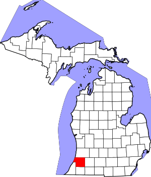 Map of Michigan highlighting Van Buren County.svg | |
| Villages | ||
| Charter township | ||
| Civil townships | ||
| Unincorporated community | ||
| Indian reservation | ||
| Footnotes | ‡This populated place also has portions in an adjacent county or counties | |
| Authority control |
|
|---|