Marilao
Marilao, officially the Municipality of Marilao, (Tagalog: Bayan ng Marilao), is a 1st class municipality in the province of Bulacan, Philippines. According to the 2015 census, it has a population of 221,965 people.[3]
Marilao | |
|---|---|
| Municipality of Marilao | |
 Façade of the Municipal Hall | |
 Seal | |
| Motto(s): Ramdam na Serbisyo | |
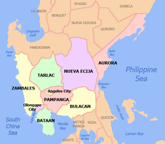
 Map of Bulacan with Marilao highlighted | |

| |
.svg.png) Marilao Location within the Philippines | |
| Coordinates: 14°45′29″N 120°56′53″E | |
| Country | |
| Region | Central Luzon (Region III) |
| Province | Bulacan |
| District | 4th District |
| Founded | April 21, 1796 |
| Barangays | 16 (see Barangays) |
| Government | |
| • Type | Sangguniang Bayan |
| • Mayor | Ricardo M. Silvestre |
| • Vice Mayor | Henry R. Lutao |
| • Congressman | Henry R. Villarica |
| • Electorate | 94,484 voters (2019) |
| Area | |
| • Total | 33.74 km2 (13.03 sq mi) |
| Elevation | 7.3 m (24.0 ft) |
| Population (2015 census)[3] | |
| • Total | 221,965 |
| • Rank | 9 out of 1,489 Municipalities |
| • Density | 6,600/km2 (17,000/sq mi) |
| • Households | 51,591 |
| Economy | |
| • Income class | 1st municipal income class |
| • Poverty incidence | 5.11% (2015)[4] |
| • Revenue | |
| • Assets | |
| • Expenditure | |
| Utilities | |
| • Electricity | MERALCO |
| Time zone | UTC+8 (PST) |
| ZIP code | 3019 |
| PSGC | |
| IDD : area code | +63 (0)44 |
| Climate type | tropical monsoon climate |
| Native languages | Tagalog |
| Website | www |
With the continuous expansion of Metro Manila, the municipality is part of Manila's built-up area which reaches San Ildefonso on its northernmost part. Marilao is 22 kilometres (14 mi) from Manila and 23 kilometres (14 mi) from Malolos City.
Marilao is one of the 21 Philippine municipalities that have met the requirements for cityhood set by the Constitution and Local Government Code of the Republic of the Philippines and as agreed upon by the League of Cities of the Philippines (LCP).
History
Long before the establishment as an independent town, Marilao traces its origin as little as a barrio. It was initially a barrio of its neighboring town Meycauayan and the Franciscan missionaries from Meycauayan built a visita (chapel) dedicated to Saint Michael the Archangel.
In April 21, 1796, the Barrio of Marilao was established as a pueblo as approved by the Alcalde Mayor of Bulacan and the Franciscan friars of Meycauayan, with the approval of Archbishop of Manila, the visita of San Miguel Arcangel became a town church where Padre Vicente de Talavera served as its parish priest. In 1913, Marilao completely became an independent town.
Geography
Climate
| Climate data for Marilao, Bulacan | |||||||||||||
|---|---|---|---|---|---|---|---|---|---|---|---|---|---|
| Month | Jan | Feb | Mar | Apr | May | Jun | Jul | Aug | Sep | Oct | Nov | Dec | Year |
| Average high °C (°F) | 29 (84) |
30 (86) |
32 (90) |
34 (93) |
33 (91) |
31 (88) |
30 (86) |
29 (84) |
29 (84) |
30 (86) |
30 (86) |
29 (84) |
31 (87) |
| Average low °C (°F) | 20 (68) |
20 (68) |
21 (70) |
23 (73) |
24 (75) |
25 (77) |
24 (75) |
24 (75) |
24 (75) |
23 (73) |
22 (72) |
21 (70) |
23 (73) |
| Average precipitation mm (inches) | 7 (0.3) |
7 (0.3) |
9 (0.4) |
21 (0.8) |
101 (4.0) |
152 (6.0) |
188 (7.4) |
170 (6.7) |
159 (6.3) |
115 (4.5) |
47 (1.9) |
29 (1.1) |
1,005 (39.7) |
| Average rainy days | 3.3 | 3.5 | 11.1 | 8.1 | 18.9 | 23.5 | 26.4 | 25.5 | 24.5 | 19.6 | 10.4 | 6.4 | 181.2 |
| Source: Meteoblue [5] | |||||||||||||
Barangays
Marilao is politically subdivided into 16 barangays, all classified as urban.[6]
| PSGC | Barangay | Population | ±% p.a. | |||
|---|---|---|---|---|---|---|
| 2015[3] | 2010[7] | |||||
| 031411001 | Abangan Norte | 4.2% | 9,424 | 8,665 | 1.61% | |
| 031411002 | Abangan Sur | 4.3% | 9,625 | 9,788 | −0.32% | |
| 031411003 | Ibayo | 4.6% | 10,103 | 6,584 | 8.49% | |
| 031411004 | Lambakin | 19.3% | 42,821 | 37,007 | 2.82% | |
| 031411005 | Lias | 5.8% | 12,900 | 12,038 | 1.33% | |
| 031411006 | Loma de Gato | 25.9% | 57,569 | 46,286 | 4.24% | |
| 031411007 | Nagbalon | 1.8% | 4,015 | 3,766 | 1.23% | |
| 031411008 | Patubig | 3.4% | 7,501 | 6,113 | 3.97% | |
| 031411009 | Poblacion I | 0.8% | 1,826 | 1,661 | 1.82% | |
| 031411010 | Poblacion II | 2.5% | 5,475 | 5,536 | −0.21% | |
| 031411011 | Prenza I | 3.2% | 7,065 | 5,827 | 3.74% | |
| 031411012 | Prenza II | 5.1% | 11,229 | 6,507 | 10.95% | |
| 031411013 | Santa Rosa I | 4.9% | 10,793 | 9,921 | 1.62% | |
| 031411014 | Santa Rosa II | 4.3% | 9,648 | 8,510 | 2.42% | |
| 031411015 | Saog | 6.7% | 14,950 | 11,445 | 5.22% | |
| 031411016 | Tabing Ilog | 3.2% | 7,021 | 5,970 | 3.14% | |
| Total | 221,965 | 185,624 | 3.46% | |||
Pollution and flooding
In 2007, Marilao, along with neighboring Meycauayan, share a slot in the list of the world’s 30 most polluted places in the developing world drawn up by a private New York-based institute. In its report, “The World’s Worst Polluted Places” for 2007, the Blacksmith Institute said: “Industrial waste is haphazardly dumped into the Meycauayan, Marilao and Obando River system, a source of drinking and agricultural water supplies for the 250,000 people living in and around”[8] the Meycauayan-Marilao area.
Marilao is also notorious for frequent flooding during the monsoon season. A section of MacArthur Highway near SM City Marilao is in particular, prone to floods. [9]
Demographics
| Population census of Marilao | ||
|---|---|---|
| Year | Pop. | ±% p.a. |
| 1903 | 3,506 | — |
| 1918 | 4,202 | +1.21% |
| 1939 | 5,682 | +1.45% |
| 1948 | 6,206 | +0.98% |
| 1960 | 9,206 | +3.34% |
| 1970 | 16,128 | +5.76% |
| 1975 | 21,017 | +5.45% |
| 1980 | 35,069 | +10.78% |
| 1990 | 56,361 | +4.86% |
| 1995 | 68,761 | +3.80% |
| 2000 | 101,017 | +8.60% |
| 2007 | 160,452 | +6.59% |
| 2010 | 185,624 | +5.45% |
| 2015 | 221,965 | +3.46% |
| Source: Philippine Statistics Authority[3][7][10][11] | ||
In the 2015 census, the population of Marilao, Bulacan, was 221,965 people,[3] with a density of 6,600 inhabitants per square kilometre or 17,000 inhabitants per square mile.
Local government
Current officials
| Position | Name | Party | |
|---|---|---|---|
| Mayor | Ricardo "Ricky" M. Silvestre | PDP–Laban | |
| Vice Mayor | Henry R. Lutao | PDP–Laban | |
| Councilors | |||
| Divina "Deby" Espiritu-Reyes | PDP–Laban | ||
| Arnold T. Papa | PDP–Laban | ||
| Allane T. Sayo | NUP | ||
| Irma G. Celones | PDP–Laban | ||
| Mark Joseph L. Guillermo | PDP–Laban | ||
| Ariel "Aye" P. Amador | PDP–Laban | ||
| William "Willy" R. Villarica | PDP–Laban | ||
| Marlon O. Villamar | PDP–Laban | ||
Past Mayors of Marilao
| Mayor | In office |
|---|---|
| Martin Villarica | 1913–1919 |
| Ceferino Santiago | 1912–1922 |
| Canuto Santo Tomas | 1922–1925 |
| Agripino San Miguel | 1925–1928 |
| Honorio Ramos | 1928–1931 |
| Miguel Villarica | 1931–1934 |
| Ricardo de Vera | 1934–1937 |
| Andres Roxas | 1937–1940 |
| Miguel Villarica | 1941–1944 |
| Benito Santa Rosa | 1945–1946 |
| Justino Cruz | 1946–1947 |
| Miguel Villarica | 1948–1951 |
| Mario Santiago | 1956–1971 |
| Nicanor Guillermo | 1972–1984 |
| Abelardo T. Dalmacio | 1984–1986 |
| Mario De Guzman Villarica | 1986–1987 |
| Israel Guevarra | 1987–1988 |
| Abelardo T. Dalmacio | 1988–1992 |
| Epifanio Guillermo | 1992–1995 |
| Leoncio Duran, Jr. | 1995–2004 |
| Epifanio Guillermo | 2004–2013 |
| Juanito H. Santiago | 2013-2019 |
| Ricardo Silvestre | 2019-present |
Education
The Pambayang Dalubhasaan ng Marilao Municipal College of Marilao is a public college in Marilao. The public primary and secondary schools in Marilao are governed by the Department of Education-Provincial Schools Division of Bulacan. Several private schools in Marilao also provide education services.
Public High Schools
- Assemblywoman Felicita G. Bernardino Memorial Trade School(AFGBMTS)
- Prenza National High School(PNHS)
Religion
National Shrine of the Divine Mercy

It was elevated to the status of National Shrine by Archbishop Orlando Quevedo of the Catholic Bishops Conference of the Philippines. The first mass was held at the site on February 2, 1992, the Feast of the Presentation. Located in Barangay Santa Rosa I.
On the occasion of the World Apostolic Congress on Mercy in 2017, a 38-meter Statue of Merciful Jesus was built here.[12]
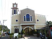
San Miguel Arcangel Parish Church

The Parish celebrates its patronal feasts on May 8 and September 29. Its 28th Parish Priest, Rev. Fr. Alberto D.J. Santiago succeeded Fr. Avelino G. Santos. Under Parochial Vicar, Fr. Francis Protacio S. Cortez III,OSA.[13] It is hundred years old spiritual edifice in Poblacion I considered as “place marker” and serve as “point of orientation” to the local residents and visitors.[14]
St Michael the Archangel Parish is under the jurisdiction of the Latin Rite Diocese of Malolos, a suffragan of the Archdiocese of Manila canonically erected in 1961. The mother church of the Diocese is the Malolos Cathedral located in Malolos City, Bulacan.
Our Lady of Fatima Parish Church

Located in Barangay Loma de Gato.
Our Lady of Mercy Quasi-parish Church
Located in Barangay Loma de Gato.
There are also a presence of other religions in Marilao like the Iglesia ni Cristo,Jehova's Witnesses, Born Again Christians, Members of Church of Gode International and etc.
Landmarks and attractions
 Marilao Welcome Arch along McArthur Highway
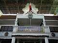 Old Marilao Municipal Hall, now Municipal Hall of Justice
 SM City Marilao façade
 Marilao Wet and Dry Public Market
 Façade of Barangay Hall of Lias
 Façade of Loma de Gato Barangay Hall
 Pantubig Barangay Hall Façade
References
- "Municipality". Quezon City, Philippines: Department of the Interior and Local Government. Retrieved 31 May 2013.
- "Province: Bulacan". PSGC Interactive. Quezon City, Philippines: Philippine Statistics Authority. Retrieved 12 November 2016.
- Census of Population (2015). "Region III (Central Luzon)". Total Population by Province, City, Municipality and Barangay. PSA. Retrieved 20 June 2016.
- "PSA releases the 2015 Municipal and City Level Poverty Estimates". Quezon City, Philippines. Retrieved 1 January 2020.
- "Marilao: Average Temperatures and Rainfall". Meteoblue. Retrieved 12 May 2020.
- "Bulacan, Philippines: Marilao, Bulacan: General Info". Bulacan.gov.ph. Retrieved 2016-12-07.
- Census of Population and Housing (2010). "Region III (Central Luzon)". Total Population by Province, City, Municipality and Barangay. NSO. Retrieved 29 June 2016.
- "Inquirer.net, Meycauayan, Marilao in world's 'Dirty 30'-- report". Archived from the original on 2009-06-07. Retrieved 2007-09-17.
- "Flood remains gutter-deep along McArthur Highway in Marilao, Bulacan". GMA News. July 1, 2019. Retrieved July 31, 2019.
- Censuses of Population (1903–2007). "Region III (Central Luzon)". Table 1. Population Enumerated in Various Censuses by Province/Highly Urbanized City: 1903 to 2007. NSO.
- "Province of Bulacan". Municipality Population Data. Local Water Utilities Administration Research Division. Retrieved 17 December 2016.
- UCA News
- Archived 2014-02-02 at the Wayback Machine
External links
| Wikimedia Commons has media related to Marilao, Bulacan. |
- Marilao Profile at PhilAtlas.com
- Coordinates
- Bulacan Official Website - Marilao
- Marilao Bulacan
- New Website of Marilao
- Philippine Standard Geographic Code
- Philippine Census Information
- The Blacksmith Institute - World's Worst Polluted Places
- Iglesia, "Ang Bayan ng Dios" - Multiply Website
Places adjacent to Marilao | |
|---|---|