Carranglan
Carranglan, officially the Municipality of Carranglan, is a 1st class municipality in the province of Nueva Ecija, Philippines. According to the 2015 census, it has a population of 41,131 people.[3]
Carranglan Kadanglaan | |
|---|---|
| Municipality of Carranglan | |
 Welcome arc | |
 Seal | |
 Map of Nueva Ecija with Carranglan highlighted | |
OpenStreetMap 
| |
.svg.png) Carranglan Location within the Philippines | |
| Coordinates: 15°58′N 121°04′E | |
| Country | |
| Region | Central Luzon (Region III) |
| Province | Nueva Ecija |
| District | 2nd District |
| Barangays | 17 (see Barangays) |
| Government | |
| • Type | Sangguniang Bayan |
| • Mayor | Mary B. Abad |
| • Vice Mayor | Efren P. Alfonso Jr. |
| • Congressman | Micaela S. Violago |
| • Electorate | 24,704 voters (2019) |
| Area | |
| • Total | 705.31 km2 (272.32 sq mi) |
| Elevation | 244.9 m (803.5 ft) |
| Population (2015 census)[3] | |
| • Total | 41,131 |
| • Density | 58/km2 (150/sq mi) |
| • Households | 9,588 |
| Economy | |
| • Income class | 1st municipal income class |
| • Poverty incidence | 17.46% (2015)[4] |
| • Revenue (₱) | 164,446,285.15 (2016) |
| Time zone | UTC+8 (PST) |
| ZIP code | 3123 |
| PSGC | |
| IDD : area code | +63 (0)44 |
| Climate type | tropical monsoon climate |
| Native languages | Ilocano Tagalog |
The municipality is home to the Pantabangan–Carranglan Watershed Forest Reserve.
Geography
It is the province's largest municipality in terms of land area.
Barangays
Carranglan is politically subdivided into 17 barangays.
- Baluarte (now R.A. Padilla)
- Bantug
- Bunga
- Burgos
- Capintalan
- Digdig (now called Joson)
- General Luna
- Minuli
- Piut
- Puncan
- Putlan
- Salazar
- San Agustin
- T. L. Padilla Pob. (Barangay I)
- F. C. Otic Pob. (Barangay II)
- D. L. Maglanoc Pob. (BarangayIII)
- G. S. Rosario Pob. (Barangay IV)
Climate
| Climate data for Carranglan, Nueva Ecija | |||||||||||||
|---|---|---|---|---|---|---|---|---|---|---|---|---|---|
| Month | Jan | Feb | Mar | Apr | May | Jun | Jul | Aug | Sep | Oct | Nov | Dec | Year |
| Average high °C (°F) | 28 (82) |
29 (84) |
30 (86) |
32 (90) |
31 (88) |
30 (86) |
29 (84) |
28 (82) |
29 (84) |
29 (84) |
29 (84) |
28 (82) |
29 (85) |
| Average low °C (°F) | 18 (64) |
19 (66) |
20 (68) |
22 (72) |
23 (73) |
23 (73) |
23 (73) |
23 (73) |
23 (73) |
22 (72) |
20 (68) |
19 (66) |
21 (70) |
| Average precipitation mm (inches) | 13 (0.5) |
15 (0.6) |
21 (0.8) |
33 (1.3) |
92 (3.6) |
121 (4.8) |
142 (5.6) |
124 (4.9) |
121 (4.8) |
143 (5.6) |
50 (2.0) |
22 (0.9) |
897 (35.4) |
| Average rainy days | 6.0 | 6.4 | 9.2 | 12.2 | 20.3 | 23.1 | 25.1 | 22.5 | 22.4 | 20.0 | 11.6 | 7.1 | 185.9 |
| Source: Meteoblue (Use with caution: this is modeled/calculated data, not measured locally.) [5] | |||||||||||||
Demographics
| Population census of Carranglan | |||||||||||||||||||||||||||||||||||||||||||||||||
|---|---|---|---|---|---|---|---|---|---|---|---|---|---|---|---|---|---|---|---|---|---|---|---|---|---|---|---|---|---|---|---|---|---|---|---|---|---|---|---|---|---|---|---|---|---|---|---|---|---|
|
| ||||||||||||||||||||||||||||||||||||||||||||||||
| Source: Philippine Statistics Authority[3][6][7][8] | |||||||||||||||||||||||||||||||||||||||||||||||||
Landmarks
Gallery
.jpg) Spanish-built bridge in Carranglan
Spanish-built bridge in Carranglan Saint Nicolas of Tolentine Parish Church
 Carranglan Municipal Hall
 The mountains of Sierra Madre, located east of the municipality
 Carranglan's Gymnasium
 Legislative building
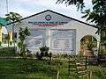 Nueva Ecija University of Science and Technology
 Carranglan Central School

References
- "Municipality". Quezon City, Philippines: Department of the Interior and Local Government. Retrieved 31 May 2013.
- "Province: Nueva Ecija". PSGC Interactive. Quezon City, Philippines: Philippine Statistics Authority. Retrieved 12 November 2016.
- Census of Population (2015). "Region III (Central Luzon)". Total Population by Province, City, Municipality and Barangay. PSA. Retrieved 20 June 2016.
- "PSA releases the 2015 Municipal and City Level Poverty Estimates". Quezon City, Philippines. Retrieved 1 January 2020.
- "Carranglan: Average Temperatures and Rainfall". Meteoblue. Retrieved 4 May 2020.
- Census of Population and Housing (2010). "Region III (Central Luzon)". Total Population by Province, City, Municipality and Barangay. NSO. Retrieved 29 June 2016.
- Censuses of Population (1903–2007). "Region III (Central Luzon)". Table 1. Population Enumerated in Various Censuses by Province/Highly Urbanized City: 1903 to 2007. NSO.
- "Province of Nueva Ecija". Municipality Population Data. Local Water Utilities Administration Research Division. Retrieved 17 December 2016.
External links
| Wikimedia Commons has media related to Carranglan, Nueva Ecija. |
- Carranglan Profile at PhilAtlas.com
- Philippine Standard Geographic Code
- Philippine Census Information
- Local Governance Performance Management System
Places adjacent to Carranglan | ||||||||||
|---|---|---|---|---|---|---|---|---|---|---|
| ||||||||||
Palayan (capital) | |
| Municipalities | |
| Component cities | |
This article is issued from Wikipedia. The text is licensed under Creative Commons - Attribution - Sharealike. Additional terms may apply for the media files.