Limay, Bataan
Limay, officially the Municipality of Limay (Tagalog: Bayan ng Limay; Kapampangan: Balen ning Limay), is a 1st class municipality in the province of Bataan, Philippines. According to the 2015 census, it has a population of 68,071 people.[4]
Limay | |
|---|---|
| Municipality of Limay | |
 Downtown Limay | |
 Seal | |
 Map of Bataan with Limay highlighted | |
OpenStreetMap 
| |
.svg.png) Limay Location within the Philippines | |
| Coordinates: 14°33′43″N 120°35′54″E | |
| Country | |
| Region | Central Luzon (Region III) |
| Province | Bataan |
| District | 2nd District |
| Founded | October 4, 1917 |
| Barangays | 12 (see Barangays) |
| Government | |
| • Type | Sangguniang Bayan |
| • Mayor | Nelson C. David |
| • Vice Mayor | Richie Jason D. David |
| • Congressman | Jose Enrique S. Garcia III |
| • Electorate | 54,468 voters (2019) |
| Area | |
| • Total | 103.60 km2 (40.00 sq mi) |
| Elevation | 8.7 m (28.5 ft) |
| Population (2015 census)[4] | |
| • Total | 68,071 |
| • Density | 660/km2 (1,700/sq mi) |
| • Households | 15,036 |
| Economy | |
| • Income class | 1st municipal income class |
| • Poverty incidence | 10.78% (2015)[5] |
| • Revenue (₱) | 363,156,834.99 (2016) |
| Time zone | UTC+8 (PST) |
| ZIP code | 2104 |
| PSGC | |
| IDD : area code | +63 (0)47 |
| Climate type | tropical monsoon climate |
| Native languages | Mariveleño Tagalog |
Limay is accessible via the Bataan Provincial Expressway (Route 301), off Exit 45, San Fernando Exit. Located at the south-eastern section of Bataan Peninsula, it is 136 kilometres (85 mi) from Manila and 15 kilometres (9.3 mi) south from the provincial capital Balanga.
History
The Dominican and Franciscan friars settled in Limay by the late 1600s, using its rich limestone deposits to build churches in Orion and Balanga. The town was a barangay of Orion.
In the Philippine revolution of 1898, Limay inhabitants fought for their independence. American Governor-General Francis Burton Harrison's Executive Order of January 1, 1917 created Limay as the last Bataan municipality.
In 1913, the Cadwallader-Gibson Lumber Company employed Limayans and Visayan immigrants.
During the World War II, Limay became the host to the first medical hospital of American and Filipino forces, run by the "Angels of Bataan". In Lamao, Limay, Major General Edward P. King capitulated to the Japanese forces, after the last stand of the American and Filipino forces faltered along the banks of the Alangan River.[6]
Geography
Limay is located at 14°33′43″N 120°35′54″E.
According to the Philippine Statistics Authority, the municipality has a land area of 103.60 square kilometres (40.00 sq mi) [2] constituting 7.55% of the 1,372.98-square-kilometre- (530.11 sq mi) total area of Bataan.
Climate
| Climate data for Limay, Bataan | |||||||||||||
|---|---|---|---|---|---|---|---|---|---|---|---|---|---|
| Month | Jan | Feb | Mar | Apr | May | Jun | Jul | Aug | Sep | Oct | Nov | Dec | Year |
| Average high °C (°F) | 31 (88) |
32 (90) |
34 (93) |
35 (95) |
33 (91) |
31 (88) |
29 (84) |
29 (84) |
29 (84) |
29 (84) |
30 (86) |
31 (88) |
31 (88) |
| Average low °C (°F) | 19 (66) |
19 (66) |
20 (68) |
23 (73) |
25 (77) |
25 (77) |
24 (75) |
25 (77) |
25 (77) |
24 (75) |
23 (73) |
20 (68) |
23 (73) |
| Average precipitation mm (inches) | 7 (0.3) |
8 (0.3) |
14 (0.6) |
26 (1.0) |
127 (5.0) |
210 (8.3) |
263 (10.4) |
272 (10.7) |
218 (8.6) |
114 (4.5) |
46 (1.8) |
21 (0.8) |
1,326 (52.3) |
| Average rainy days | 4.0 | 4.0 | 6.9 | 11.2 | 21.0 | 24.5 | 27.4 | 26.9 | 25.9 | 21.9 | 13.4 | 6.3 | 193.4 |
| Source: Meteoblue [7] | |||||||||||||
Barangays
Limay is politically subdivided into 12 barangays.[8]
| PSGC | Barangay | Population | ±% p.a. | |||
|---|---|---|---|---|---|---|
| 2015[4] | 2010[9] | |||||
| 030806001 | Alangan | 8.5% | 5,803 | 4,716 | 4.03% | |
| 030806013 | Duale | 10.8% | 7,358 | 5,069 | 7.35% | |
| 030806002 | Kitang I | 2.8% | 1,930 | 1,764 | 1.73% | |
| 030806003 | Kitang 2 & Luz | 7.0% | 4,777 | 4,563 | 0.88% | |
| 030806004 | Lamao | 28.4% | 19,329 | 16,256 | 3.35% | |
| 030806006 | Landing | 4.7% | 3,209 | 3,393 | −1.06% | |
| 030806007 | Poblacion | 1.0% | 701 | 770 | −1.77% | |
| 030806008 | Reformista | 10.1% | 6,900 | 4,149 | 10.17% | |
| 030806014 | San Francisco de Asis | 8.7% | 5,900 | 5,398 | 1.71% | |
| 030806015 | Saint Francis II | 12.7% | 8,615 | 5,899 | 7.48% | |
| 030806009 | Townsite | 7.6% | 5,178 | 4,646 | 2.09% | |
| 030806012 | Wawa | 0.8% | 560 | 584 | −0.80% | |
| Total | 68,071 | 57,207 | 3.37% | |||
Demographics
| Population census of Limay | ||||||||||||||||||||||||||||||||||||||||||||||
|---|---|---|---|---|---|---|---|---|---|---|---|---|---|---|---|---|---|---|---|---|---|---|---|---|---|---|---|---|---|---|---|---|---|---|---|---|---|---|---|---|---|---|---|---|---|---|
|
| |||||||||||||||||||||||||||||||||||||||||||||
| Source: Philippine Statistics Authority[4][9][10][11] | ||||||||||||||||||||||||||||||||||||||||||||||
In the 2015 census, Limay had a population of 68,071.[4] The population density was 660 inhabitants per square kilometre (1,700/sq mi).
Local government
Pursuant to the local government,[12][13] the political seat of the municipal government is located at the Municipal Hall. In the Spanish colonial period, the Gobernadorcillo was the Chief Executive who held office in the Presidencia. During the American rule (1898–1946), the elected Mayor and local officials, including the appointed ones held office at the Municipal Hall. The legislative and executive departments perform their functions in the Sangguniang Bayan (Session Hall) and Municipal Trial Court, respectively, and are located in the Town Hall.
Limay, Bataan's incumbent elected officials are headed by – Mayor Nelson C. David (PDP-LBN) and Vice Mayor Richie Jason David.
The Sangguniang Bayan Members are:
- Sarah David
- Cecil Gerard Roxas
- Mel Fernando
- Dennis Gochuico
- Manuel Ambrocio
- Meng-Newr Tayag
- Bart Reyes
- Edong Villaviray
They hold office at the newly constructed Batasang Bayan in Barangay Wawa, inside the Judy's Park facility along the Limay coastline.
Attractions
Limay's attractions, events and historical landmarks include:
- 263 hectares military reservation (the DND Arsenal – Government Arsenal) — Headquarters at Camp General Antonio Luna
- Mariveles Mountain Complex — mountain range stretching from Mariveles to Mount Limay (or Mount Cayapo) – 393 metres (1,289 ft) higher than Mount Samat in Pilar — and with Mount Tarak
- Judy’s Park (Limay Municipal Park) — esplanade along Manila Bay with retaining walls and kiosks
- Tikip and Biga Waterfalls — 30-foot (9.1 m)t falls nestled deep in the Limay mountain range
- Saint Joseph's annual running of the bulls
- Peninsula Golf and Country Club — 18-hole golf course inside the Petron Bataan Refinery.
- The Limay public market and slaughterhouse
- Limay Sports Complex and Tennis Court
- Apo Iko Fiesta Parade — October 4
- Pagbubunyi Festival — May 4
- Limay Tanod Appreciation Day — June
- Lamao National High School
- Multi-purpose Building of Bo. Luz
- Limay Polytechnic College
- Bataan Limay Refinery Project, 140-megawatt power plant — P78B Petron Expansion Project.[14]
- Limay power plant[15]
- Port of Limay[16]
- 2009 Giant mushroom[17]
1935 Saint Francis of Assisi Parish Church
The 1935 Saint Francis of Assisi Parish Church (Barangay Poblacion) (Cath.: 26,440, Titular: St. Francis of Assisi, Feast day – October 4. with former Parish Priest, Father Rosauro Guila and Guest Priest: Father Guillermo Ramo)[18]) is under the Vicariate of Saint Michael Archangel.[19][19] It belongs to the Roman Catholic Diocese of Balanga[20] – The Vicariate of St. Peter).[21]
Its Parish Priest is Fr. Felizardo D. Sevilla.[18]
Gallery
 Municipal hall
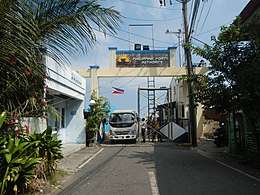 Philippine Ports Authority in Lamao
 Public market
 Saint Francis of Assisi Parish Church
 River view
References
- "Municipality". Quezon City, Philippines: Department of the Interior and Local Government. Retrieved 31 May 2013.
- "Province: Bataan". PSGC Interactive. Quezon City, Philippines: Philippine Statistics Authority. Retrieved 12 November 2016.
- "Limay, Bataan Profile". PhilAtlas.com. Retrieved 15 June 2020.
- Census of Population (2015). "Region III (Central Luzon)". Total Population by Province, City, Municipality and Barangay. PSA. Retrieved 20 June 2016.
- "PSA releases the 2015 Municipal and City Level Poverty Estimates". Quezon City, Philippines. Retrieved 12 October 2019.
- About Limay
- "Limay: Average Temperatures and Rainfall". Meteoblue. Retrieved 26 April 2020.
- "Municipal: Limay, Bataan". PSGC Interactive. Quezon City, Philippines: Philippine Statistics Authority. Retrieved 8 January 2016.
- Census of Population and Housing (2010). "Region III (Central Luzon)". Total Population by Province, City, Municipality and Barangay. NSO. Retrieved 29 June 2016.
- Censuses of Population (1903–2007). "Region III (Central Luzon)". Table 1. Population Enumerated in Various Censuses by Province/Highly Urbanized City: 1903 to 2007. NSO.
- "Province of Bataan". Municipality Population Data. Local Water Utilities Administration Research Division. Retrieved 17 December 2016.
- "Philippines : Gov.Ph : About the Philippines". Gov.ph. Archived from the original on 2009-01-22. Retrieved 2009-03-28.
- "The Local Government Code Of The Philippines – Chan Robles Virtual Law Library". Chanrobles.com. Retrieved 2016-11-21.
- "Petron power plant seen ready by Oct. | INQUIRER.net". Philippine Daily Inquirer. 2012-08-08. Retrieved 2016-11-21.
- "Limay, Bataan power plant to be up and running on Tuesday". GMA News. 2010-02-15. Retrieved 2016-11-21.
- "Archived copy". BusinessMirror. Archived from the original on 2012-11-15. Retrieved 2013-01-31.CS1 maint: archived copy as title (link)
- "giant mushroom nakita sa limay bataan". YouTube. 2009-08-30. Retrieved 2016-11-21.
- "Archived copy". Archived from the original on 2012-09-06. Retrieved 2013-01-27.CS1 maint: archived copy as title (link)
- "List of Parishes of the Roman Catholic Diocese of Balanga | Philippine Churches". Church.nfo.ph. 2012-06-27. Archived from the original on 2016-03-03. Retrieved 2016-11-21.
- "Parishes". Cbcponline.net. Archived from the original on 2013-10-20. Retrieved 2016-11-21.
- "Archived copy". Archived from the original on 2015-06-10. Retrieved 2013-01-31.CS1 maint: archived copy as title (link)
External links

- Limay Profile at PhilAtlas.com
- Philippine Standard Geographic Code
Places adjacent to Limay, Bataan | ||||||||||
|---|---|---|---|---|---|---|---|---|---|---|
| ||||||||||