Talugtug, Nueva Ecija
Talugtug, officially the Municipality of Talugtug, is a 4th class municipality in the province of Nueva Ecija, Philippines. According to the 2015 census, it has a population of 23,817 people.[3]
Talugtug | |
|---|---|
| Municipality of Talugtug | |
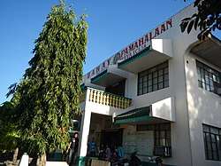 Talugtug Municipal Hall | |
 Seal | |
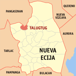 Map of Nueva Ecija with Talugtug highlighted | |

| |
.svg.png) Talugtug Location within the Philippines | |
| Coordinates: 15°46′44″N 120°48′40″E | |
| Country | |
| Region | Central Luzon (Region III) |
| Province | Nueva Ecija |
| District | 2nd District |
| Barangays | 28 (see Barangays) |
| Government | |
| • Type | Sangguniang Bayan |
| • Mayor | Pacifico B. Monta |
| • Vice Mayor | Floro C. Pagaduan Jr. |
| • Congressman | Micaela S. Violago |
| • Electorate | 15,621 voters (2019) |
| Area | |
| • Total | 93.95 km2 (36.27 sq mi) |
| Elevation | 92.7 m (304.1 ft) |
| Population (2015 census)[3] | |
| • Total | 23,817 |
| • Density | 250/km2 (660/sq mi) |
| • Households | 5,776 |
| Economy | |
| • Income class | 4th municipal income class |
| • Poverty incidence | 23.86% (2015)[4] |
| • Revenue (₱) | 70,371,701.30 (2016) |
| Time zone | UTC+8 (PST) |
| ZIP code | 3118 |
| PSGC | |
| IDD : area code | +63 (0)44 |
| Climate type | tropical monsoon climate |
| Native languages | Ilocano Tagalog |
| Website | Official website |
Geography
The municipality is situated in the northern part of Nueva Ecija, about 71 kilometres (44 mi) from the seat of the provincial government in Palayan City; 169 kilometres (105 mi) from Manila; and 29 kilometres (18 mi) from the nearby City of San Jose. It is bounded on the South by the Municipality of Guimba; on the southeast by the municipality of Muñoz; on the west by Cuyapo, on the east by Lupao, all of which are in the province of Nueva Ecija. On the northern most side of Talugtug is the boundary of Pangasinan with the municipality of Umingan. Talugtug has a total land area of 10,122.2324 hectares (25,012.581 acres).
Talugtug is characterized by hilly and rolling land in the north-eastern and north-western section of the municipality covering almost 7 barangays. The foot of two mountain ranges, namely Mt. Baloy (with peak in Cuyapo) and Mt. Amorong (with peak in Umingan, Pangasinan) occupies its hilly and rolling areas.
About 70% of the land is flat and constitutes the agricultural area of the municipality, where almost 75% of its total rice production comes from.
Climate
| Climate data for Talavera, Nueva Ecija | |||||||||||||
|---|---|---|---|---|---|---|---|---|---|---|---|---|---|
| Month | Jan | Feb | Mar | Apr | May | Jun | Jul | Aug | Sep | Oct | Nov | Dec | Year |
| Average high °C (°F) | 29 (84) |
30 (86) |
31 (88) |
33 (91) |
33 (91) |
31 (88) |
30 (86) |
29 (84) |
29 (84) |
30 (86) |
30 (86) |
29 (84) |
30 (87) |
| Average low °C (°F) | 19 (66) |
19 (66) |
20 (68) |
22 (72) |
23 (73) |
24 (75) |
24 (75) |
24 (75) |
23 (73) |
22 (72) |
21 (70) |
20 (68) |
22 (71) |
| Average precipitation mm (inches) | 4 (0.2) |
6 (0.2) |
7 (0.3) |
12 (0.5) |
61 (2.4) |
89 (3.5) |
96 (3.8) |
99 (3.9) |
81 (3.2) |
88 (3.5) |
37 (1.5) |
13 (0.5) |
593 (23.5) |
| Average rainy days | 2.5 | 3.0 | 4.1 | 6.3 | 15.8 | 19.4 | 22.5 | 21.6 | 20.1 | 17.5 | 9.6 | 4.0 | 146.4 |
| Source: Meteoblue [5] | |||||||||||||
Barangays
Talugtug is politically subdivided into 28 barangays.
- Alula
- Baybayabas
- Buted
- Cabiangan
- Calisitan
- Cinense
- Culiat
- Maasin
- Magsaysay (Poblacion)
- Mayamot I
- Mayamot II
- Nangabulan
- Osmeña (Poblacion)
- Villa Fronda
- Patola
- Quezon (Poblacion)
- Quirino (Poblacion)
- Roxas (Poblacion)
- Saguing
- Sampaloc
- Santa Catalina
- Santo Domingo
- Saverona
- Tandoc
- Tibag
- Villa Rosario
- Villa Rosenda (formerly Saringaya)
- Villa Boado
Demographics
| Population census of Talugtug | ||
|---|---|---|
| Year | Pop. | ±% p.a. |
| 1948 | 5,127 | — |
| 1960 | 8,808 | +4.61% |
| 1970 | 10,702 | +1.96% |
| 1975 | 12,225 | +2.70% |
| 1980 | 11,734 | −0.82% |
| 1990 | 14,036 | +1.81% |
| 1995 | 18,119 | +4.90% |
| 2000 | 18,895 | +0.90% |
| 2007 | 20,671 | +1.25% |
| 2010 | 21,291 | +1.08% |
| 2015 | 23,817 | +2.16% |
| Source: Philippine Statistics Authority[3][6][7][8] | ||
Economy
The municipality's status is currently fourth class. Majority of the inhabitants rely mainly on farming from their small farm holdings while the rest depend on pasturing animals.
References
- "Municipality". Quezon City, Philippines: Department of the Interior and Local Government. Retrieved 31 May 2013.
- "Province: Nueva Ecija". PSGC Interactive. Quezon City, Philippines: Philippine Statistics Authority. Retrieved 12 November 2016.
- Census of Population (2015). "Region III (Central Luzon)". Total Population by Province, City, Municipality and Barangay. PSA. Retrieved 20 June 2016.
- "PSA releases the 2015 Municipal and City Level Poverty Estimates". Quezon City, Philippines. Retrieved 1 January 2020.
- "Talugtug: Average Temperatures and Rainfall". Meteoblue. Retrieved 4 May 2020.
- Census of Population and Housing (2010). "Region III (Central Luzon)". Total Population by Province, City, Municipality and Barangay. NSO. Retrieved 29 June 2016.
- Censuses of Population (1903–2007). "Region III (Central Luzon)". Table 1. Population Enumerated in Various Censuses by Province/Highly Urbanized City: 1903 to 2007. NSO.
- "Province of Nueva Ecija". Municipality Population Data. Local Water Utilities Administration Research Division. Retrieved 17 December 2016.
External links
| Wikimedia Commons has media related to Talugtug, Nueva Ecija. |
- Talugtug Profile at PhilAtlas.com
- Philippine Standard Geographic Code
- Philippine Census Information
- Local Governance Performance Management System
Places adjacent to Talugtug, Nueva Ecija | ||||||||||
|---|---|---|---|---|---|---|---|---|---|---|
| ||||||||||
Palayan (capital) | |
| Municipalities | |
| Component cities | |