Bagac
Bagac, officially the Municipality of Bagac, (Tagalog: Bayan ng Bagac; Kapampangan: Balen ning Bagac), is a 3rd class municipality in the province of Bataan, Philippines. According to the 2015 census, it has a population of 26,936 people.[4]
Bagac | |
|---|---|
| Municipality of Bagac | |
 Municipal Plaza | |
 Seal | |
 Map of Bataan with Bagac highlighted | |
OpenStreetMap 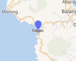
| |
.svg.png) Bagac Location in the Philippines | |
| Coordinates: 14°35′42″N 120°23′31″E | |
| Country | |
| Region | Central Luzon (Region III) |
| Province | Bataan |
| District | 2nd District |
| Founded | 1866 |
| Barangays | 14 (see Barangays) |
| Government | |
| • Type | Sangguniang Bayan |
| • Mayor | Rommel V. del Rosario |
| • Vice Mayor | Ron Michael Alexis R. del Rosario |
| • Congressman | Jose Enrique S. Garcia III |
| • Electorate | 24,385 voters (2019) |
| Area | |
| • Total | 231.20 km2 (89.27 sq mi) |
| Elevation | 18.7 m (61.4 ft) |
| Population (2015 census)[4] | |
| • Total | 26,936 |
| • Density | 120/km2 (300/sq mi) |
| • Households | 6,008 |
| Economy | |
| • Income class | 3rd municipal income class |
| • Poverty incidence | 11.17% (2015)[5] |
| • Revenue (₱) | 103,569,013.80 (2016) |
| Time zone | UTC+8 (PST) |
| ZIP code | 2107 |
| PSGC | |
| IDD : area code | +63 (0)47 |
| Climate type | tropical monsoon climate |
| Native languages | Mariveleño Tagalog |
With an area of 231.20 square kilometres (89.27 sq mi),[6] Bagac is the largest municipality in Bataan.
Geography
According to the Philippine Statistics Authority,[7] the municipality has a land area of 231.20 square kilometres (89.27 sq mi) [2] constituting 16.84% of the 1,372.98-square-kilometre- (530.11 sq mi) total area of Bataan.
Bagac borders Balanga (the provincial capital) to the north, Orion and Limay to the east, Mariveles to the south, and Morong and the South China Sea to the west.
Climate
| Climate data for Bagac, Bataan | |||||||||||||
|---|---|---|---|---|---|---|---|---|---|---|---|---|---|
| Month | Jan | Feb | Mar | Apr | May | Jun | Jul | Aug | Sep | Oct | Nov | Dec | Year |
| Average high °C (°F) | 31 (88) |
32 (90) |
34 (93) |
35 (95) |
33 (91) |
31 (88) |
29 (84) |
29 (84) |
29 (84) |
29 (84) |
30 (86) |
31 (88) |
31 (88) |
| Average low °C (°F) | 19 (66) |
19 (66) |
20 (68) |
23 (73) |
25 (77) |
25 (77) |
24 (75) |
25 (77) |
25 (77) |
24 (75) |
23 (73) |
21 (70) |
23 (73) |
| Average precipitation mm (inches) | 7 (0.3) |
8 (0.3) |
14 (0.6) |
26 (1.0) |
127 (5.0) |
210 (8.3) |
263 (10.4) |
272 (10.7) |
218 (8.6) |
114 (4.5) |
46 (1.8) |
21 (0.8) |
1,326 (52.3) |
| Average rainy days | 4.0 | 4.0 | 6.9 | 11.2 | 21.0 | 24.5 | 27.4 | 26.9 | 25.9 | 21.9 | 13.4 | 6.3 | 193.4 |
| Source: Meteoblue [8] | |||||||||||||
Barangays
Bagac is politically subdivided into 14 barangays.[6]
| PSGC | Barangay | Population | ±% p.a. | |||
|---|---|---|---|---|---|---|
| 2015[4] | 2010[9] | |||||
| 030802016 | Atilano L. Ricardo | 9.1% | 2,447 | 2,224 | 1.84% | |
| 030802001 | Bagumbayan (Poblacion) | 7.3% | 1,978 | 1,766 | 2.18% | |
| 030802002 | Banawang | 10.3% | 2,784 | 2,690 | 0.66% | |
| 030802003 | Binuangan | 2.3% | 613 | 609 | 0.12% | |
| 030802004 | Binukawan | 8.7% | 2,356 | 2,293 | 0.52% | |
| 030802006 | Ibaba | 6.3% | 1,689 | 1,760 | −0.78% | |
| 030802007 | Ibis | 6.2% | 1,660 | 1,407 | 3.20% | |
| 030802008 | Pag‑asa (Wawa‑Sibacan) | 12.1% | 3,271 | 3,456 | −1.04% | |
| 030802009 | Parang | 12.1% | 3,248 | 3,073 | 1.06% | |
| 030802010 | Paysawan | 2.7% | 731 | 680 | 1.39% | |
| 030802012 | Quinawan | 2.1% | 574 | 553 | 0.71% | |
| 030802013 | San Antonio | 5.4% | 1,445 | 1,295 | 2.11% | |
| 030802014 | Saysain | 10.6% | 2,859 | 2,539 | 2.29% | |
| 030802015 | Tabing‑Ilog (Poblacion) | 4.8% | 1,281 | 1,223 | 0.89% | |
| Total | 26,936 | 25,568 | 1.00% | |||
Demographics
| Population census of Bagac | ||
|---|---|---|
| Year | Pop. | ±% p.a. |
| 1903 | 1,310 | — |
| 1918 | 2,118 | +3.25% |
| 1939 | 2,958 | +1.60% |
| 1948 | 2,745 | −0.83% |
| 1960 | 6,889 | +7.97% |
| 1970 | 9,268 | +3.01% |
| 1975 | 10,676 | +2.88% |
| 1980 | 13,109 | +4.19% |
| 1990 | 18,241 | +3.36% |
| 1995 | 20,906 | +2.59% |
| 2000 | 22,353 | +1.45% |
| 2007 | 24,202 | +1.10% |
| 2010 | 25,568 | +2.02% |
| 2015 | 26,936 | +1.00% |
| Source: Philippine Statistics Authority[4][9][10][11] | ||
In the 2015 census, Bagac had a population of 26,936.[4] The population density was 120 inhabitants per square kilometre (310/sq mi).
Attractions
- Bagac Friendship Tower. — The monument, symbolizing the renewed friendship between Japan and the Philippines after the events of World War II, was erected by Risshō Kōsei Kai, a Japanese Buddhist organization. The tower was inaugurated on April 8, 1975 and is located about 200 m (660 ft) from where the Bataan Death March started. The 27-metre-high (89 ft) tower is composed of three pillars interconnected by several multi-layer rings. It located at the junction of the Gov. Linao National Road and the road to the Bagac town proper.[12]
- Las Casas Filipinas de Acuzar. — a heritage park built by José "Gerry" Acuzar, owner of the New San Jose Builders and history art collector. Inside this heritage park is a collection of Spanish Colonial buildings and stone houses (bahay na bato in Tagalog), planned to resemble a settlement reminiscent of the period. These houses were carefully transplanted from different parts of the Philippines and rehabilitated to their former splendor.
Popular culture
- The Ciudad Real de Acuzar Heritage Park was the location of the TV Show Zorro of GMA Network.
Gallery
 Municipal hall
 Heritage Houses, Las Casas Filipinas de Acuzar
 Bagac Friendship Tower
 Saint Catherine of Alexandria Parish Church
 Street view
References
- "Municipality". Quezon City, Philippines: Department of the Interior and Local Government. Retrieved 31 May 2013.
- "Province: Bataan". PSGC Interactive. Quezon City, Philippines: Philippine Statistics Authority. Retrieved 12 November 2016.
- "Bagac, Bataan Profile". PhilAtlas.com. Retrieved 15 June 2020.
- Census of Population (2015). "Region III (Central Luzon)". Total Population by Province, City, Municipality and Barangay. PSA. Retrieved 20 June 2016.
- "PSA releases the 2015 Municipal and City Level Poverty Estimates". Quezon City, Philippines. Retrieved 12 October 2019.
- "Municipal: Bagac". PSGC Interactive. Quezon City, Philippines: Philippine Statistics Authority. Retrieved 8 January 2016.
- "Archived copy". Archived from the original on 2016-10-23. Retrieved 2016-11-21.CS1 maint: archived copy as title (link)
- "Bagac: Average Temperatures and Rainfall". Meteoblue. Retrieved 26 April 2020.
- Census of Population and Housing (2010). "Region III (Central Luzon)". Total Population by Province, City, Municipality and Barangay. NSO. Retrieved 29 June 2016.
- Censuses of Population (1903–2007). "Region III (Central Luzon)". Table 1. Population Enumerated in Various Censuses by Province/Highly Urbanized City: 1903 to 2007. NSO.
- "Province of Bataan". Municipality Population Data. Local Water Utilities Administration Research Division. Retrieved 17 December 2016.
- "Friendship Tower in the Philippines". Rissho Kosei-kai. Archived from the original on July 30, 2007. Retrieved September 9, 2007.
External links
| Wikimedia Commons has media related to Bagac, Bataan. |