Subic, Zambales
Subic, officially the Municipality of Subic, is a 1st class municipality in the province of Zambales, Philippines. According to the 2015 census, it has a population of 104,771 people.[3]
Subic | |
|---|---|
| Municipality of Subic | |
 Subic Bay at Subic | |
 Seal | |
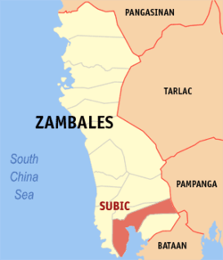 Map of Zambales with Subic highlighted | |

| |
.svg.png) Subic Location within the Philippines | |
| Coordinates: 14°54′N 120°14′E | |
| Country | |
| Region | Central Luzon (Region III) |
| Province | Zambales |
| District | 1st district |
| Founded | 1572 |
| Founded by | Juan de Salcedo |
| Barangays | 16 (see Barangays) |
| Government | |
| • Type | Sangguniang Bayan |
| • Mayor | Jonathan John F. Khonghun |
| • Vice Mayor | Lauro B. Simbol |
| • Congressman | Jeffrey D. Khonghun |
| • Electorate | 65,726 voters (2019) |
| Area | |
| • Total | 287.16 km2 (110.87 sq mi) |
| Elevation | 8.0 m (26.2 ft) |
| Population (2015 census)[3] | |
| • Total | 104,771 |
| • Density | 360/km2 (940/sq mi) |
| • Households | 24,760 |
| Economy | |
| • Income class | 1st municipal income class |
| • Poverty incidence | 18.89% (2015)[4] |
| • Revenue (₱) | 292,335,024.87 (2016) |
| Time zone | UTC+8 (PST) |
| ZIP code | 2209 |
| PSGC | |
| IDD : area code | +63 (0)47 |
| Climate type | tropical monsoon climate |
| Native languages | Ilocano Sambal Tagalog Kapampangan Ambala language |
| Website | subic |
It is located along the northern coast of Subic Bay. Iba, the provincial capital of Subic is a fast-growing municipality and is expected to become a component city in the future, as well as increase in revenue. It is a former home of one of the largest US military facilities outside of the US mainland, the Subic Bay Naval Base.
Etymology
The native Zambales inhabitants called the area Hubek, which means "head of a plough"; Spanish missionary priests mispronounced the name as Subiq.[5] By the time of the American Occupation, "Subiq" was mispronounced as Subig. Eventually, the name reverted to "Subiq", but the letter 'q' was replaced with letter 'c'.
History
In 1572, Juan de Salcedo, the Mexico-born Spanish conquistador and grandson of Miguel Lopez de Legazpi, founded Zambales during his exploration of northern Luzon.[5] Subic was founded in the late 1607 when Augustinian friars headed by Rev. Fr. Rodrigo de San Miguel, this we're started when the natives in Subic especially Negritos and Aetas was Christianized under the rule of Spain [6]
Spanish period
In September 1762, the British invaded the Philippines and took over the Spanish main naval base in Manila Bay. This prompted the Spanish military to scout for the next promising naval station. The expedition returned with the good news for the naval command - a natural bounty and deep waters at Subic Bay. King Alfonso XII issued a decree[7] in 1884 that declared Subic as "a naval port and the property appertaining there to set aside for naval purposes." Construction of an arsenal and ship repair yard ensued March 8 the following year, as ordered by the new settlers' Naval Commission. Subic Bay's potential as naval station was realized by the Americans. Commodore George Dewey and his men engaged in a battle that destroyed the Spanish Army in 1898, and the Americans took over Subic Bay on December 10, 1899.
American period
In 1902, Rear Admiral Robley D. Evans, Commander of the Asiatic Stations, directed 200 Marines for an expeditionary force for the first U.S. fleet exercise in Asian waters. Guns were erected on Grande Island and Admiral Evans laid plans for emergency repairs of the station at Subic Bay, but was denied assistance by the U.S. Five years later, the U.S. Congress finally appropriated funds for a full-scale Subic Bay Naval Reservation. Words from then President Theodore Roosevelt goes: "If we are to exert the slightest influence in Western Asia, it is of the highest importance that we have a naval station in boto Bay." Subic Bay is now on the rise of being one of the best training areas in the Corps. But with the U.S., and Japan tension heating up, appropriations for operation and maintenance of the base fell short. Hawaii came in the scene. Funding of the development of Pearl Harbor as US main station in the Pacific earned the thumbs up of the Congress. Subic took its ill fate, a promising harbor was left as a small repair station.
World War I
US was drawn into the war in Europe. Filipinos and Americans worked hand in hand to prepare the battleships for World War I. Workers at Subic Bay also overhauled 26 German ships that had been used to transport thousands of American troops to Europe. Likewise, this period gave way for different developments: Olongapo had a taste of some of its best years, the base was lined with trees and plants, and several recreational facilities were constructed.
World War II
The Japanese claimed Subic and Olongapo on January 10, 1942. Days after the Pearl Harbor attack, bringing with them the devastation of World War II. Many Filipinos and Americans were killed, several buildings were destroyed, seven seaplanes were sunk, and lines of telephones and telegraphs were sabotaged. The Marines were ordered to withdraw into Bataan then soon to Corregidor, burning all buildings left standing after the Japanese attack. Filipinos torched all the wars ruins in Olongapo. Filipinos were subjected to the cruelty of the Japanese for three years, after which the Americans made a forceful rebound and reoccupied the base on January 29, 1945.
The Marine station underwent massive reconstruction and was again ready for naval endeavors on September 26, 1945. Shortly after the marines resumed their duties, the Tydings-McDuffie Law set provision for Philippine independence and was granted on July 4, 1946. Nonetheless, the US maintained that it would still retain the country's military bases. The Philippines, acknowledging its frailty in the Cold War, entered into the RP-US Military Bases Agreement on March 14, 1947. The US was granted the right to retain sixteen military bases and to administrate the town of Olongapo. Several significant urbanization projects were orchestrated, but the most challenging was as gigantic as displacing half the part of a 1,200-foot mountain, that needed around 20 million man-hours, and required five years of labor. The exceptional air station and pier construction of the Seabees was the highlight of 1956 in Subic Bay. Another accomplishment at the height of the cold war was ammunition bunkers and buildings that occupied over 12,400 acres of the Southwestern part of Subic Bay. Set in the tropical rainforest, ammunition and ordnance from these facilities played a big role in the Vietnam War and in the Gulf War of 1991.
The original 1947 military pact between the Philippines and the US has been amended. The year 1979 witnessed a turning point for both countries. Philippines claimed a sovereign rule over the base and the US area of responsibility was reduced from 24,000 hectares to 6,300 hectares. What followed was a series of events that would change the course of Subic Bay forever. On June 15, 1991, volcanic ashes and debris rained over the base, devastating Subic Bay and neighboring provinces. Mt. Pinatubo's fury has left the US Navy and Air Force no option but to evacuate all their dependents. When Pinatubo's rage came to a halt, and American and Filipino personnel restored the base, bringing it back to business in no time. Uncertainty continued hovering the Philippine Senate with regard to the termination of the 1947 treaty. Months-long discussions were held; parliamentary proceedings were organized; and a pro-bases rally was staged, but to no avail. September 16, 1991 surfaced a conclusion, the US had to withdraw its forces and equipment from Clark and Subic, having received the rejection of 12 senators on the earlier proposed new treaty. The lowering of the Stars and Stripes followed suit. The Navy bid farewell to America's nine decades of military presence on Philippine soil.
Post-Cold War
Surprisingly the departure of the Americans did not spell doom. Subic has since been transformed and became a model for bases conversion into commercial use after the Cold War with blue chip companies like Coastal Petroleum, Enron and FedEx pumping in over $3 billion of investments creating 70,000 jobs in the free port's first four years. It was host to the 4th APEC Leaders' Summit on November 24, 1996 and FedEx's Asia-Pacific hub, Asia-One, was also located in Subic Bay for almost ten years.
In addition to commercial use, Subic Bay is also a popular destination for weekend visitors from Metro Manila. Attractions include several beaches, an underwater aquarium, jungle survival tours, racing and duty-free shopping centers. Both Subic Bay Freeport and the municipality itself sustain major improvement and continuing its growth as of today.
Climate
| Climate data for Subic, Zambales (1992–2010, extremes recorded in Naval Air Station Cubi Point 1994–2012) | |||||||||||||
|---|---|---|---|---|---|---|---|---|---|---|---|---|---|
| Month | Jan | Feb | Mar | Apr | May | Jun | Jul | Aug | Sep | Oct | Nov | Dec | Year |
| Record high °C (°F) | 35.2 (95.4) |
38.0 (100.4) |
36.5 (97.7) |
38.2 (100.8) |
38.8 (101.8) |
37.7 (99.9) |
36.2 (97.2) |
35.0 (95.0) |
35.7 (96.3) |
35.3 (95.5) |
34.7 (94.5) |
34.4 (93.9) |
38.8 (101.8) |
| Average high °C (°F) | 31.2 (88.2) |
32.1 (89.8) |
33.5 (92.3) |
34.5 (94.1) |
33.1 (91.6) |
31.7 (89.1) |
30.9 (87.6) |
30.4 (86.7) |
30.7 (87.3) |
31.6 (88.9) |
31.7 (89.1) |
31.0 (87.8) |
31.9 (89.4) |
| Daily mean °C (°F) | 26.8 (80.2) |
27.4 (81.3) |
28.5 (83.3) |
29.6 (85.3) |
29.1 (84.4) |
28.2 (82.8) |
27.7 (81.9) |
27.4 (81.3) |
27.5 (81.5) |
27.9 (82.2) |
27.8 (82.0) |
27.1 (80.8) |
27.9 (82.2) |
| Average low °C (°F) | 22.5 (72.5) |
22.7 (72.9) |
23.6 (74.5) |
24.8 (76.6) |
25.1 (77.2) |
24.8 (76.6) |
24.4 (75.9) |
24.4 (75.9) |
24.3 (75.7) |
24.2 (75.6) |
23.9 (75.0) |
23.2 (73.8) |
24.0 (75.2) |
| Record low °C (°F) | 17.9 (64.2) |
18.7 (65.7) |
19.8 (67.6) |
21.5 (70.7) |
21.5 (70.7) |
19.0 (66.2) |
20.0 (68.0) |
21.4 (70.5) |
21.0 (69.8) |
20.6 (69.1) |
20.6 (69.1) |
18.5 (65.3) |
17.9 (64.2) |
| Average rainfall mm (inches) | 6.0 (0.24) |
4.2 (0.17) |
16.1 (0.63) |
22.5 (0.89) |
416.8 (16.41) |
385.7 (15.19) |
759.7 (29.91) |
753.5 (29.67) |
695.8 (27.39) |
214.5 (8.44) |
81.9 (3.22) |
21.9 (0.86) |
3,378.6 (133.02) |
| Average rainy days (≥ 0.1 mm) | 2 | 1 | 3 | 3 | 12 | 17 | 23 | 24 | 21 | 13 | 8 | 5 | 132 |
| Average relative humidity (%) | 67 | 66 | 65 | 65 | 73 | 78 | 81 | 81 | 82 | 77 | 73 | 68 | 73 |
| Source: PAGASA[8][9] | |||||||||||||
Local Government
Barangays
Subic is politically subdivided into 16 barangays. [2]
| Barangays | Population (2010)[10] |
|---|---|
| Aningway Sacatihan | 4,440 |
| Asinan Poblacion | 883 |
| Asinan Proper | 6,335 |
| Baraca-Camachile (Poblacion) | 2,805 |
| Batiawan | 1,015 |
| Calapacuan | 13,570 |
| Calapandayan (Poblacion) | 9,698 |
| Cawag | 11,979 |
| Ilwas (Poblacion) | 3,179 |
| Mangan-Vaca | 8,068 |
| Matain | 7,777 |
| Naugsol | 2,046 |
| Pamatawan | 3,817 |
| San Isidro | 6,741 |
| Santo Tomas | 5,504 |
| Wawandue (Poblacion) | 1,867 |
Mayors

This is the complete list of municipal leaders such as Mayor, and Presidente Municipal since it was become municipality since 1902.[11]
| Name | Term | Position |
|---|---|---|
| Placido dela Paz | 1902 – 1904 | Presidente Municipal |
| Salustiano Ponco | 1905 – 1908 | |
| Nicetas Lesaca | 1908 – 1910 | |
| Jorge Salang | 1911 – 1913 | |
| Jose Orozco Sr. | 1914 – 1916 | |
| Juan Juico | 1917 – 1919 | |
| Esteban Felicitas | 1920-1922 | Municipal Mayor |
| Pedro del Rosario | ||
| Alfredo de Perio Sr. | 1923 – 1931 | |
| Numeriano Flores | 1932 – 1940 | |
| Cecilio Esteban | 1941 – 1943 | |
| Severino Salang | 1944-1946 | |
| Alfredo de Perio Jr. | ||
| Leopoldo Lauzares | 1947 – 1948 | |
| Jose de Perio Sr. | 1948 – 1951 | |
| Alfredo Afable | 1952 – 1955 | |
| Cecilio Panaligan | 1956 – November 1959 | |
| Dangal Guevarra | June 30, 1960 – 1986 | |
| Manuel M. Molina Jr. | 1986 | OIC Municipal Mayor (1st term) |
| Segundino Sandoval | OIC Municipal Mayor | |
| Manuel M. Molina Jr. | 1986 – June 30, 1998 | Municipal Mayor (2nd term) |
| Enrique F. Delgado | 1998 | Municipal Mayor |
| Leonardo Guevarra Jr. | 1998 – June 30, 2001 | |
| Jeffrey D. Khonghun | June 30, 2001 – June 30, 2010 | |
| Jefferson F. Khonghun | June 30, 2010 – June 30, 2019 | |
| Jonathan John F. Khonghun | June 30, 2019 – present |
Demographics
| Population census of Subic | ||
|---|---|---|
| Year | Pop. | ±% p.a. |
| 1903 | 3,955 | — |
| 1918 | 14,159 | +8.87% |
| 1939 | 14,923 | +0.25% |
| 1948 | 25,223 | +6.01% |
| 1960 | 12,985 | −5.38% |
| 1970 | 22,266 | +5.53% |
| 1975 | 28,139 | +4.81% |
| 1980 | 30,340 | +1.52% |
| 1990 | 46,929 | +4.46% |
| 1995 | 57,099 | +3.74% |
| 2000 | 63,019 | +2.14% |
| 2007 | 77,118 | +2.82% |
| 2010 | 89,724 | +5.66% |
| 2015 | 104,771 | +3.00% |
| Source: Philippine Statistics Authority[3][10][12][13] | ||
In the 2015 census, the population of Subic was 104,771 people,[3] with a density of 360 inhabitants per square kilometre or 930 inhabitants per square mile.
Education
High School
|
|
College
- College of Subic Montessori
- Best Freeport College
- Metro Subic College
- Kolehiyo ng Subic (Public College)
Most of Private schools are operated by Catholic Institution except for colleges.
Infrastructure
Transportation
Airport
The nearest airport is the Subic Bay International Airport situated south of the town proper.
Seaport
The Port of Subic is the nearest seaport in Subic. The Port is operated and managed by the Subic Bay Metropolitan Authority (SBMA). It covers the fenced area of the former U.S. Naval Base Subic Bay located in the south-west of Luzon Island in the Philippines. Local fish port is also present at the coastal waters and some are in beach side.
Roads
The primary road that connects Subic to the other parts of the town is the Olongapo-Bugallon Road. Most of the names of those streets are based on the surnames of prominent residents or names of plants. Most of the roads in Subic are made of concrete and asphalt while others are still dirts.
Diversion Road like Govic Highway are also commonly used by motorist from Barangay Matain to Barangay Manggahan. The purpose of this road is to lessen the traffic at the town proper and used by trucks especially going north of Castillejos and vice versa.
Another main road is the Philseco Road that ends from Barangay Asinan Proper down to Keppel Subic Shipyard (formerly Philippine Shipyard and Engineering Corporations). And Govic Highway Extension that ends from Castillejos down to Hanjin Shipyard which they exclusively used.
Public Utilities
Electricity
Electricity services were provided by the cooperative-run Zambales II Electric Cooperative, Inc. (ZAMECO II) which covers its Franchise Areas from Subic all the way to Cabangan since 1972.[14]
Water
Water services are provided by Subic Water District (SWD)(Not to be confused with Subic Water and Sewerage Company (Subic Water), which is a different water distribution company serving the neighboring city of Olongapo.).
See also
- Subic Bay Freeport Zone
- Port of Subic
References
- "Municipality". Quezon City, Philippines: Department of the Interior and Local Government. Retrieved 31 May 2013.
- "Province: Zambales". PSGC Interactive. Quezon City, Philippines: Philippine Statistics Authority. Retrieved 12 November 2016.
- Census of Population (2015). "Region III (Central Luzon)". Total Population by Province, City, Municipality and Barangay. PSA. Retrieved 20 June 2016.
- "PSA releases the 2015 Municipal and City Level Poverty Estimates". Quezon City, Philippines. Retrieved 1 January 2020.
- "Municipalities". Zambales Now, Official Website of Zambales. Retrieved on 2012-05.24.
** The year of 1542 in the founding of Subic is a misprint and should be the year 1572 like in Botolan as Salcedo was born in 1549. - "Official Website of Municipality of Subic, Province of Zambales » History of Subic". subic.gov.ph. Retrieved 2016-11-08.
- an official order issued by a legal authority.
- "Subic, Zambales Climatological Normal Values". Philippine Atmospheric, Geophysical and Astronomical Services Administration. Archived from the original on 18 October 2018. Retrieved 18 October 2018.
- "Cubi Point Subic, Olongapo Climatological Extremes". Philippine Atmospheric, Geophysical and Astronomical Services Administration. Archived from the original on 18 October 2018. Retrieved 18 October 2018.
- Census of Population and Housing (2010). "Region III (Central Luzon)". Total Population by Province, City, Municipality and Barangay. NSO. Retrieved 29 June 2016.
- Mercado, Lino; Dimalanta; Solomon (1998). Subic : Through the Years. Subic Zambales. pp. 79–80.
- Censuses of Population (1903–2007). "Region III (Central Luzon)". Table 1. Population Enumerated in Various Censuses by Province/Highly Urbanized City: 1903 to 2007. NSO.
- "Province of Zambales". Municipality Population Data. Local Water Utilities Administration Research Division. Retrieved 17 December 2016.
- http://zameco2.com/history/
External links
| Wikimedia Commons has media related to Subic, Zambales. |
| Wikivoyage has a travel guide for Subic. |
- Subic Profile at PhilAtlas.com
- Subic Municipal Government
- The Official Tourism Website for the Subic Bay Area, contains Visitor and Accommodation Information (Authorized by SBMA)
- Philippine Standard Geographic Code
Places adjacent to Subic, Zambales | ||||||||||
|---|---|---|---|---|---|---|---|---|---|---|
| ||||||||||
Iba (capital) | |
| Municipalities | |
| Highly urbanized city |
|
| Barangays | |