Peddapalli district
Peddapalli district is a district located in the northern region of the Indian state of Telangana. Its Administrative Headquarters is at Peddapalli and it is one of the fastest developing District in Telangana. Largest and Biggest city in Peddapalli District is Ramagundam. The District Shares Boundaries with Mancherial, Karimnagar, Jagtial and Jayashankar Bhupalpally Districts.
Peddapalli district | |
|---|---|
District of Telangana | |
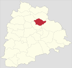 Location of Peddapalli district in Telangana | |
| Country | India |
| State | Telangana |
| Tehsils | 14 |
| Government | |
| • District collector | Ms. Sikta Patnaik |
| • commissioner of police | V. Satyanarayana (Ramagundam Police Commissionerate) |
| • Lok Sabha constituencies | Peddapalli |
| • Vidhan Sabha constituencies | Peddapalli, Ramagundam, Manthani |
| Area | |
| • Total | 4,614.74 km2 (1,781.76 sq mi) |
| Population (2011) | |
| • Total | 795,332 |
| • Density | 170/km2 (450/sq mi) |
| Time zone | UTC+05:30 (IST) |
| Vehicle registration | TS–22[1] |
| Literacy Rate | 65.52% |
| Website | peddapalle |

Geography
The district is spread over an area of 4,614.74 square kilometres (1,781.76 sq mi).[2]
Mandals in Peddapalli District
There are 14 Mandals/Tahsils are there in Peddapalli District they are:
| Sl No. | Mandal Name |
|---|---|
| 1 | Peddapalli |
| 2 | Sulthanabad |
| 3 | Ramagundam |
| 4 | Manthani |
| 5 | Darmaram |
| 6 | Ramagiri |
| 7 | Kamanpur |
| 8 | Kalva Srirampur |
| 9 | Julapalli |
| 10 | Eligaid |
| 11 | Odela |
| 12 | Mutharam(Manthani) |
| 13 | Palakurthy |
| 14 | Anthergoan |
Villages in Peddapalli District
There are 215 Revenue Villages in Peddapalli district.
- Abbapur
- Abbapuram
- Adavisomanpalle
- Adavisrirampur
- Adial
- Adivarampeta
- Adivarampeta
- Adrial
- Akena palli
- Akkepalle
- Allur
- Ammagaripalle
- Andugulapalli
- Angulur
- Anthergoam
- Appannapet
- Arenda
- Bandampalli
- Banjerupally
- Begumpet
- Bestapally
- Bhatpalle
- Bhatpally
- Bhitpalli
- Bhojannapet
- Bhoopathipuram
- Bitpalle (k)
- Bittupally
- Bommareddypalli
- Bompalli
- Botlavanaparthy
- Brahmanapalli
- Budhavarampeta
- Burahanmayapet
- Chamanpalle
- Chandapalli
- Cheekurai
- Chillapally
- Chinnabonkur
- Chinnakalvala
- Chinnaodela
- Dariyapur
- Dharmaram
- Dongathurthy
- Donthulapally
- Doolikatta
- Dubbapally
- Dubbapet
- Edulapuram
- Eklaspur
- Eklaspur
- Eligaid
- Elkalpalle
- Esalatakkalapally
- Gaddalapalle
- Gajulapally
- Gangaram
- Garrepalle
- Gattepalle
- Gattusingaram
- Goilwada
- Gollapalle
- Gollapally
- Gopalpur
- Gopalraopet
- Gowreddipet
- Gudem
- Gudipalle
- Gumnoor
- Gumpula
- Gundaram
- Gundlapalli
- Gunjapadu
- Gurrampalli
- Haripur
- Haripuram
- Indurthi
- Ippalapalle
- Isala Tekkalla Palle
- Ithrajpalle
- Jafarkhanpet
- Jallaram
- Jallipalle
- Jangoam
- Jayyarm
- Jeelakunta
- Jillelapalli
- Julapalle
- Kachapur
- Kadambapur
- Kakarlapally
- Kalwacherla
- Kamanpur
- Kammarikhanpeta
- Kanagarthy
- Kannala
- Kanukula
- Kasipet
- Kasulapally
- Katnepalle
- Khanampalle
- Khanapur
- Khansabpet
- Khilavanaparthy
- Kistampet
- Kodurupaka
- Kolanur / Kolanoor
 Kolanoor is a Village in Odela Mandal in Karimnagar District of Telangana State, India. It is located 37 KM towards East from District head quarters Karimnagar. 12 KM
 from Odela. Kolanoor Pin code is 505162 and postal head office is Kolanur.Telugu is the Local Language here. Total population of Kolanoor is 7390 .Males are 3675 and
 Females are 3,715 living in 1798 Houses. Total area of Kolanoor is 3075 hectares.
 It has a Government School and Hospital. There is a huge lake and is surrounded by paddy crops.
- Komera
- Kothapalle
- Kothapally
- Kothur
- Kuchirajpalle
- Kukkalagudur
- Kummarikunta
- Kunaram
- Kundanpalle
- Ladnapoor
- Lakkapur
- Lakkaram
- Lalapalli
- Lankakesaram
- Laxmipur
- Lingala
- Lingapur
- Lokapet
- Machupeta
- Madaka
- Maddiriyala
- Maidipalle
- Malkapur
- Mallapur
- Mallaram
- Mallepalle
- Mallial
- Mallialpalli
- Mancharami
- Mangapet
- Manthani
- Maredpaka
- Maredugonda
- Maredupalle
- Medipalle
- Mirzampet
- Miyapur
- Mogalpahad (n.e)
- Motlapalle
- Mulasala
- Mulkalapalle
- Munjampalle
- Muppirithota
- Murmoor
- Mustial
- Mutharam
- Myadaram
- Mydambanda
- Nadimipally
- Nagaram
- Nagepally
- Nagulapalli
- Namsanipalle
- Narsapoor
- Narsimhulapalli
- Narsingapur
- Neerukulla
- Nellipalli
- Nimmanapalle
- Nittur
- Odedu
- Odela
- Paidichinthala palle
- Palakurthy
- Palilthem
- Palthem
- Pandilla
- Pandulapalle
- Pandulapally
- Pannur
- Paratpalle
- Parthipaka
- Parupalle
- Pathipaka
- Pathkapalle
- Pedda Odala
- Peddabonkur
- Peddakalvala
- Peddampet
- Peddapalle (urban)
- Peddapur
- Pegadapalle
- Penchikalpet
- Perapalle
- Poosala
- Potharam
- Potiyala
- Putnoor
- Puttapaka
- Rachepalle
- Raghavapur
- Ragineedu
- Ragnapoor
- Raidandi
- Rajapur
- Ramagundam (U)
- Ramaiah palli
- Ramaraopally
- Rampalle
- Ranapur
- Rangaiahpalli
- Rangampalle
- Rangapur
- Rathupalle
- Ratnapur
- Rebbaldevipalle
- Regadimaddikunta
- Rompikunta
- Roopnarayanpet
- Ryakaldevpalli
- Sabitham
- Sanagonda
- Sarnepalle
- Sarvaram
- Sayampeta
- Seethampeta
- Shastrulapally
- Shatharajpalle
- Shivapalli
- Shukravarampalli
- Siripuram
- Somanapalle
- Srirampur
- Suddala
- Sukravarampeta
- Sultanabad
- Sulthanpoor
- Sundilla
- Suraiahpally
- Swarnapalle
- Swarnapally
- Telukunta
- Tharupalle
- Thoagarrai
- Thotagopaiahpally
- Turkalamaddi Kunta
- Undeda
- Upparapalli
- Upparla Kesaram
- Uppatla
- Velgalapahad
- Vemnoor
- Vempad
- Venkatapur
- Venkatraopalli
- Vennampalle
- Vilochavaram
- Wadkapur
- Yellamapalle
- Yerraguntapalli
Demographics
As of 2011 Census of India, the district has a population of 795,332.[2]
Administrative divisions
- Revenue Divisions - 2 (Peddapalli and Manthani)
- Municipalities - 4 (Ramagundam, Peddapally, Manthani and Sulthanabad)
- Revenue Villages - 215
- Gram Panchayats - 208
Transport
ROAD
Peddapalli District is Well Connected with the Road Transportation. This District has a District Ring Road which Connects all the Mandal Headquarters. There are two State highways they are SH-1 and SH-7. This District has No National Highways. This District has two Telangana State Road Transport Corporation Bus Depot's named Godavarikhani (GDK) and Manthani (MNTY).
RAIL
Peddapalli District is Well Connected with Rail Transportation which is Operated by Secunderabad Railway Division in South Central Railway Zone. This District has a Main Railway Line Which Connects New Delhi(NDLS) - Chennai Central(MAS) and Peddapalli(PDPL) - Nizamabad (NZB).
List of Railway Stations in Peddapalli District with Railway Station Codes:
| Railway Station Code | Railway Station Name |
|---|---|
| PPZ | Peddampet Railway Station |
| RDM | Ramagundam Railway Station |
| RGPM | Raghavapuram Railway Station |
| PDPL | Peddapalli Junction Railway Station |
| KYOP | Kottapalli railway station |
| KOLR | Kolanoor Railway Station |
| OEA | Odela Railway Station |
| PTKP | Potkapalli Railway Station |
AIR
Airport Code IATA: RMD, ICAO: VORG
Peddapalli District has an Airport with 1,300 m runway. Which is located at Kesoram Cement Factory, BasanthNagar, Ramagundam. It is Owned by the Birla Family and it is operated by the Airports Authority of India. But After the closure of Vayudoot it has not been regular use. Now it is an unusual Airport. The Government of Telangana is planning to develop this airport as a part of third airport in the state of Telangana by 2022 and it serves for four districts i.e. Peddapalli, Mancherial, Karimnagar and Jagtial.
Tourist Spot's
- Bugga Ramaswamy Temple
- Ramagiri Fort, Begumpet.
- Gouri Gundala WaterFalls, Sabbitham.
- Sripada Yellampalli Project, Yellampalli.
- Nandi Medaram Pump House, Nandi Medaram.
Awards
Peddapalli district has won so many awards in the National Level
- Swachh Darpan - 2020
- Swachh Sundar Shauchalaya - 2019
- Telangana Best Brand Award by CMO ASIA
- Swachh Survekshan Grameen - 2019 (3rd in National Level and 1st in Southern India)
- Best Swachh District In India
Out of the survey conducted in 690 districts and 17,400 villages in the country, Peddapalli district emerged overall best district. On the occasion of Swachh Bharath to mark Mahatma Gandhi 150th birth anniversary celebrations, Prime Minister Narendra Modi presented this award to Collector A. Sri Devasena in Ahmedabad in Gujarat
Etc......
See also
- Peddapalle (Lok Sabha constituency)
- Peddapalle (Assembly constituency)
- List of districts in Telangana
- Ramagiri Fort
- NTPC Ramagundam
- Sripada Yellampalli project
References
- "Telangana New Districts Names 2016 Pdf TS 31 Districts List". Timesalert.com. 11 October 2016. Retrieved 11 October 2016.
- "New Districts". Andhra Jyothy.com. 8 October 2016. Retrieved 8 October 2016.
External links
Places adjacent to Peddapalli district | ||||||||||
|---|---|---|---|---|---|---|---|---|---|---|
| ||||||||||
| portal | |
|---|---|
| Dynasties |
|
| Districts |
|
| Commissionerates |
|
| Major cities | |
| Tourism |
|
| Municipal corporations | |
| Related lists |
|