Bhandara district
Bhandara District is an administrative district in the state of Maharashtra in India. The district headquarters are located at Bhandara. The district occupies an area of 4087 km2 and has a population of 1,200,334 (605,520 males and 594,814 females), of which 19.48% are urban as of 2011.[1] It is known as the "District of Lakes". Bhandara has a mixed economy with agriculture, industries and forest resources. Bhandara is known for its large production of rice. Tumsar, a tahsil town, is a noted rice market. Bhandara town is also known as "Brass City" owing to the presence of a large brass products industry. Bhandara has several tourist destinations, like Ambagad Fort, Brahmi, Chinchgad, and Dighori.
Bhandara district | |
|---|---|
District of Maharashtra | |
 Location of Bhandara district in Maharashtra | |
| Country | India |
| State | Maharashtra |
| Division | Nagpur Division |
| Headquarters | Bhandara |
| Tehsils | 1. Bhandara, 2. Tumsar, 3. Pauni and 4. Mohadi, 5. Sakoli, 6. Lakhni, 7. Lakhandur |
| Government | |
| • Lok Sabha constituencies | Bhandara-Gondiya (shared with Gondia district) |
| • Vidhan Sabha constituencies | 3 |
| Area | |
| • Total | 4,087 km2 (1,578 sq mi) |
| Population (2011) | |
| • Total | 1,200,334 |
| • Density | 290/km2 (760/sq mi) |
| • Urban | 19.48% |
| Time zone | UTC+05:30 (IST) |
| Major highways | NH53, NH247, NH353C. |
| Average annual precipitation | 1327 mm |
| Website | bhandara |
The district is also known for the Ordnance Factory Bhandara of the Ordnance Factories Board, which manufactures products for the Indian Armed Forces. It is located on an estate which is commonly known as Jawaharnagar colony. This is the only Kendriya Vidyalaya in the Bhandara district. There is one Navodaya Vidyalaya (brain child of Late Prime Minister Rajiv Gandhi) in Navegoan Bandh. Ashok Leyland, a Hinduja Group Company, has a production facility at Gadegaon near Bhandara. Sunflag Iron Steel company and Shivmangal Ispat Pvt. Ltd. are other major industrial undertakings in the district.
History
The Ramayana said that the region to the south of the Godavari was inhabited by natives called Rakshasas. In the seventh century, the district was included in the territories of the Haihaya Rajput kings of Chhattisgarh, whose kingdom was known as Maha Kosala. The name of the district is derived from 'Bhannara', the name by which it is mentioned in a stone inscription at Ratanpur, which confirms that the name dates back to at least the 11th century. Formerly a part of the territories of the Haihaya Rajput kings of Chhattisgarh, Bhandara was taken over by the Panwar rajput in the 12th century, followed by the Gond chiefs.
By the 17th century, the district was made a part of Berar by Peshwas, who had invaded the region during the period. In 1699, the region came under the control of Parasoji Bhonsle along with the territories of Vidarbha and Berar. Raghoji Bhonsle of Vidarbha became the leader in 1743, and was succeeded by his son Janoji after his death in 1755. The feudal dynasty of Lanji governed the region from 1818 to 1830, and formed the Bhandara district in 1821.
Peshwas were ousted by Nizams during the 1850s, who ceded Berar to the British East India Company in 1903. With the re-organisation of states in 1956, Bhandara was transferred to Bombay Province from the state of Madhya Pradesh. After the formation of Maharashtra in 1960, Bhandara evolved as a district of the state. The erstwhile Bhandara district was bifurcated on 1 May 1999, and a new district, Gondia, was formed. Thus, Gondia and Bhandara came into existence.
Nicknames
The current name of Bhandara is derived from the term "bhana", meaning "brass", as the namesake town is dominated by the brass-working industry. With more than 3500 small lakes in and around the district, it is also referred to as the "District of Lakes". Bhandara district is mainly popular for its large production of rice, and is thus termed as the "Rice Bowl of Maharashtra".
Ambagad Fort
This medieval period fort is situated in Tumsar Taluka, about 13 km away from Tumsar. It was constructed by Raja Khan Pathan, the subhedar of Bakhtbuland shah, the ruler of Devgadh around 1700 AD. Later it came under the possession of Raja Raghuji Bhosla of Nagpur, who used it as a prison for captives. Later it was taken over by the British.
Geography
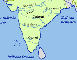
Bhandara is one of the major administrative districts in Maharashtra, and is located in the Nagpur division at 21°10'N 79°39'E. The district is enveloped by Balaghat district (Madhya Pradesh) in the north and Chandrapur in the south, while Gondia and Nagpur mark its eastern and western borders, respectively. Covering an area of 3716 km2, the district of Bhandara is segregated into three sub-divisions, Bhandara, Tumsar and Sakoli, that are further divided into seven talukas. Bhandara sub-division is divided into two talukas: Bhandara and Pauni.Tumsar division have Tumsar and Mohadi. Sakoli sub-division is divided into three talukas: Sakoli, Lakhani, and Lakhandur.
Demographics
| Historical population | ||
|---|---|---|
| Year | Pop. | ±% p.a. |
| 1901 | 276,306 | — |
| 1911 | 322,277 | +1.55% |
| 1921 | 337,193 | +0.45% |
| 1931 | 387,388 | +1.40% |
| 1941 | 452,512 | +1.57% |
| 1951 | 503,536 | +1.07% |
| 1961 | 593,898 | +1.66% |
| 1971 | 731,053 | +2.10% |
| 1981 | 850,488 | +1.52% |
| 1991 | 1,021,408 | +1.85% |
| 2001 | 1,136,146 | +1.07% |
| 2011 | 1,200,334 | +0.55% |
| source:[2] | ||
According to the 2011 census Bhandara district has a population of 1,200,334,[3] roughly equal to the nation of Timor-Leste[4] or the US state of Rhode Island.[5] This gives it a ranking of 397th in India (out of a total of 640).[3]
The district has a population density of 294 inhabitants per square kilometre (760/sq mi).[3] Its population growth rate over the decade 2001–2011 was 5.65%.[3] Bhandara has a sex ratio of 982 females for every 1000 males,[3] and a literacy rate of 83.76%.[3]
Language and culture
At the time of the 2011 Census of India, 93.19% of the population in the district spoke Marathi, 4.91% Hindi and 0.48% Gondi as their first language.[6]
Marathi is the official as well as the most spoken language in the district. Bhandara city has many people from other Indian states as well as people belonging to the world's major faiths.
There are three Vidhan Sabha constituencies in this district: Tumsar, Bhandara (SC) and Sakoli. All of these are part of the Bhandara-Gondiya Lok Sabha constituency.[7]
Economy
Bhandara has a mixed economy including agriculture, manufacturing and forest resources. With several ancient temples and historical monuments, along with lakes, parks and sanctuaries, Bhandara attracts many tourists.
In 2006 the Ministry of Panchayati Raj named Bhandara one of the country's 250 most backward districts (out of a total of 640).[8] It is one of the twelve districts in Maharashtra currently receiving funds from the Backward Regions Grant Fund Programme (BRGF).[8]
See also
- Bhandara Tehsil
References
- "Archived copy". Archived from the original on 11 January 2010. Retrieved 27 August 2009.CS1 maint: archived copy as title (link)
- Decadal Variation In Population Since 1901
- "District Census 2011". Census2011.co.in. 2011. Retrieved 30 September 2011.
- US Directorate of Intelligence. "Country Comparison:Population". Retrieved 1 October 2011.
Timor-Leste 1,177,834 July 2011 est.
- "2010 Resident Population Data". U. S. Census Bureau. Archived from the original on 19 October 2013. Retrieved 30 September 2011.
Rhode Island 1,052,567
- 2011 Census of India, Population By Mother Tongue
- "Districtwise List of Assembly and Parliamentary Constituencies". Chief Electoral Officer, Maharashtra website. Archived from the original on 25 February 2009. Retrieved 31 March 2009.
- Ministry of Panchayati Raj (8 September 2009). "A Note on the Backward Regions Grant Fund Programme" (PDF). National Institute of Rural Development. Archived from the original (PDF) on 5 April 2012. Retrieved 27 September 2011.
External links
| Wikimedia Commons has media related to Bhandara district. |
| Wikisource has the text of the 1911 Encyclopædia Britannica article Bhandara. |
Places adjacent to Bhandara district | ||||||||||
|---|---|---|---|---|---|---|---|---|---|---|
| ||||||||||
| Districts of Vidarbha | |
|---|---|
| Cities with municipal corporations | |
Portal:India | |
| Topics | |||||||||||||
|---|---|---|---|---|---|---|---|---|---|---|---|---|---|
| Regions | |||||||||||||
| Divisions and Districts |
| ||||||||||||
| Million-plus cities in Maharashtra | |||||||||||||
| Other cities with municipal corporations | |||||||||||||
Portal:India | |||||||||||||