Loyola, California
Loyola is a census-designated place in Santa Clara County, California, United States. The population was 3,261 at the 2010 census. The woodsy area is located between the cities of Los Altos and Los Altos Hills. It is the home of Facebook's first headquarters. Homes in the area range from cottages to mansions.
Loyola | |
|---|---|
 Location in Santa Clara County and the state of California | |
 Loyola Location in the United States | |
| Coordinates: 37°21′5″N 122°6′2″W | |
| Country | |
| State | |
| County | Santa Clara |
| Area | |
| • Total | 1.468 sq mi (3.803 km2) |
| • Land | 1.468 sq mi (3.803 km2) |
| • Water | 0 sq mi (0 km2) 0% |
| Elevation | 243 ft (75 m) |
| Population (2010) | |
| • Total | 3,261 |
| • Density | 2,200/sq mi (860/km2) |
| Time zone | UTC-8 (Pacific) |
| • Summer (DST) | UTC-7 (PDT) |
| ZIP code | 94024 |
| Area code | 650 |
| FIPS code | 06-44378 |
| GNIS feature IDs | 1867038, 2408147 |
The name comes from a 1904 plan by the Jesuits of Santa Clara University to build a new university named for their founder, St. Ignatius of Loyola, in the area. If the plan had come to fruition, the university would have been located in the area of the present-day golf course on Country Club Drive. The Loyola project succumbed to delays and financing problems stemming from the 1906 San Francisco earthquake.[3][4]
Geography
Loyola is located at 37°21′5″N 122°6′2″W (37.351391, -122.100526).[5]
According to the United States Census Bureau, the CDP has a total area of 1.5 square miles (3.9 km2), all of it land.
Demographics
2010
At the 2010 census Loyola had a population of 3,261. The population density was 2,220.8 people per square mile (857.4/km²). The racial makeup of Loyola was 2,291 (70.3%) White, 19 (0.6%) African American, 1 (0.0%) Native American, 760 (23.3%) Asian, 2 (0.1%) Pacific Islander, 37 (1.1%) from other races, and 151 (4.6%) from two or more races. Hispanic or Latino of any race were 114 people (3.5%).[6]
The census reported that 100% of the population lived in households.
There were 1,163 households, 446 (38.3%) had children under the age of 18 living in them, 877 (75.4%) were opposite-sex married couples living together, 52 (4.5%) had a female householder with no husband present, 27 (2.3%) had a male householder with no wife present. There were 30 (2.6%) unmarried opposite-sex partnerships, and 15 (1.3%) same-sex married couples or partnerships. 160 households (13.8%) were one person and 95 (8.2%) had someone living alone who was 65 or older. The average household size was 2.80. There were 956 families (82.2% of households); the average family size was 3.06.
The age distribution was 811 people (24.9%) under the age of 18, 133 people (4.1%) aged 18 to 24, 560 people (17.2%) aged 25 to 44, 1,107 people (33.9%) aged 45 to 64, and 650 people (19.9%) who were 65 or older. The median age was 47.5 years. For every 100 females, there were 97.4 males. For every 100 females age 18 and over, there were 94.3 males.
There were 1,208 housing units at an average density of 822.7 per square mile, of the occupied units 1,055 (90.7%) were owner-occupied and 108 (9.3%) were rented.The homeowner vacancy rate was 1.0%; the rental vacancy rate was 4.4%. 2,954 people (90.6% of the population) lived in owner-occupied housing units and 307 people (9.4%) lived in rental housing units.
2000
At the 2000 census there were 3,478 people, 1,275 households, and 1,039 families in the CDP. The population density was 2,003.9 people per square mile (771.8/km²). There were 1,298 housing units at an average density of 747.9 per square mile (288.0/km²). The racial makeup of the CDP was 79.13% White, 0.35% African American, 0.14% Native American, 15.93% Asian, 0.06% Pacific Islander, 1.09% from other races, and 3.31% from two or more races. Hispanic or Latino of any race were 3.91%.[7]
Of the 1,275 households 33.8% had children under the age of 18 living with them, 74.4% were married couples living together, 4.9% had a female householder with no husband present, and 18.5% were non-families. 14.0% of households were one person and 7.8% were one person aged 65 or older. The average household size was 2.73 and the average family size was 2.97.
The age distribution was 23.1% under the age of 18, 3.8% from 18 to 24, 22.5% from 25 to 44, 34.3% from 45 to 64, and 16.3% 65 or older. The median age was 45 years. For every 100 females, there were 94.8 males. For every 100 females age 18 and over, there were 93.6 males.
The median household income was $140,617 and the median family income was $149,379. Males had a median income of $100,001 versus $69,306 for females. The per capita income for the CDP was $68,730. None of the families and 0.8% of the population were living below the poverty line, including no under eighteens and none of those over 64.[8]
Government
In the California State Legislature, Loyola is in the 13th Senate District, represented by Democrat Jerry Hill, and in the 24th Assembly District, represented by Democrat Marc Berman.[9]
In the United States House of Representatives, Loyola is in California's 18th congressional district, represented by Democrat Anna Eshoo.[10]
Education
The Loyola CDP is served by the Los Altos School District (K-8) and Mountain View-Los Altos Union High School District (9-12).
References
- "2010 Census U.S. Gazetteer Files – Places – California". United States Census Bureau.
- "Loyola". Geographic Names Information System. United States Geological Survey. Retrieved January 26, 2015.
- Blitzer, Carol. "Neighborhoods: Loyola Corners, Los Altos". Palo Alto Online. Archived from the original on January 15, 2009. Retrieved October 25, 2008.
- McDonald, Don (October 31, 2007). "Los Altos History: Loyola Corners". Los Altos Town Crier. Archived from the original on January 15, 2009. Retrieved October 25, 2008.
- "US Gazetteer files: 2010, 2000, and 1990". United States Census Bureau. February 12, 2011. Retrieved April 23, 2011.
- "2010 Census Interactive Population Search: CA - Loyola CDP". U.S. Census Bureau. Archived from the original on July 15, 2014. Retrieved July 12, 2014.
- "U.S. Census website". United States Census Bureau. Retrieved January 31, 2008.
- "Profile of Selected Economic Characteristics: 2000 more information Census 2000 Summary File 3 (SF 3) - Sample Data". United States Census Bureau. Archived from the original on February 12, 2020. Retrieved February 13, 2015.
- "Statewide Database". UC Regents. Archived from the original on February 1, 2015. Retrieved January 7, 2015.
- "California's 18th Congressional District - Representatives & District Map". Civic Impulse, LLC.
Municipalities and communities of Santa Clara County, California, United States | ||
|---|---|---|
| Cities | 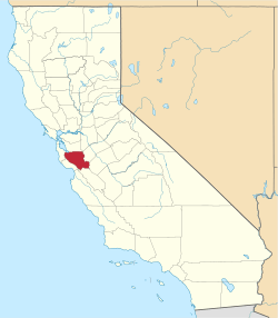 Santa Clara County map | |
| Towns | ||
| CDPs | ||
| Unincorporated communities | ||
| CCDs | ||
| Ghost towns | ||
| Bodies of water |
|  |
|---|---|---|
| Counties | ||
| Major cities | ||
| Cities and towns 100k–250k | ||
| Cities and towns 50k–99k | ||
| Cities and towns 25k–50k | ||
| Cities and towns 10k–25k |
| |
| Sub-regions | ||