List of Recorded Texas Historic Landmarks (Trinity-Zavala)
The following is a partial list of Recorded Texas Historic Landmarks (RTHLs) arranged by county as designated by the Texas Historical Commission and local county historical commissions in Texas. This page includes RTHLs in the following counties: Trinity, Tyler, Upshur, Upton, Uvalde, Val Verde, Van Zandt, Victoria, Walker, Waller, Ward, Washington, Webb, Wharton, Wheeler, Wichita, Wilbarger, Willacy, Williamson, Wilson, Winkler, Wise, Wood, Yoakum, Young, Zapata, and Zavala.
| Anderson-Callahan • Cameron-Duval • Eastland-Gray • Grayson-Hudspeth • Hunt-Martin • Mason-Rusk • Sabine-Travis • Trinity-Zavala |
KEY
Landmarks with multiple historic designations are colored according to their highest designation within the following hierarchy.
| ⁕ Listed individually on the National Register of Historic Places (NRHP) as a National Historic Landmark |
| # Listed individually as or as part of a State Antiquities Landmark |
Trinity County
| Registered Texas Historic Landmark | Image | Marker Number | Physical Address | Nearest city | Year designated | Description |
|---|---|---|---|---|---|---|
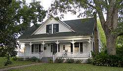
| I. N. Parker House | 7963 | 304 N. Maple St. | Trinity | 1996 | 304 North Maple | |
| John Henley Hill House | 18373 | 2005 Pinecrest Rd. | Trinity | 2016 | From the town of Trinity, go south on State Highway 19 to East Tatum Street, Turn left (east) go 2/10 mile to Pinecrest Road, turn right (south) and go 9/10 mile to driveway entrance on left. | |
| Old Red Schoolhouse |
 |
15316 | 100 W. San Jacinto St. | Trinity | 2004 | |
| Ranald McDonald House | 7962 | 401 S. Maple St. | Trinity | 1976 | Maple and San Jacinto | |
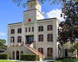
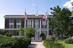
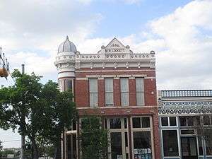
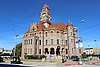
| Trinity County Courthouse |
 |
13075 | 162 W. First St. | Groveton | 2004 | 162 W First St |
Tyler County
| Registered Texas Historic Landmark | Image | Marker Number | Physical Address | Nearest city | Year designated | Description |
|---|---|---|---|---|---|---|
| Burch-Cauble House | 11359 | 1936 FM 2097 | Chester | 1964 | N of Chester via US 287 E to FM 2097 N 5 mi to Peach Tree Village | |
| Colmesneil, W.T., House | 15459 | 106 S. Pitzer St. | Colmesneil | 2008 | 106 S. Pitzer | |
| Cooper-Reid Home | 11362 | 702 W. Bluff St. | Woodville | 1968 | ||
| David Curlee Enloe House | 11365 | FM 1745 E of CR 2836 | Colmesneil | 1967 | FM 1745 4.5 mi W of Colmesneil (east of CR 2836) | |
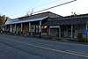
| Early Law Office | 11364 | 201 S. Beaver St. | Woodville | 1968 | Structure has been torn down | |
| James Barclay Place, 1842 | 11356 | 10 mi. SW of Woodville | Woodville | 1962 | ||
| Pine Grove Missionary Baptist Church and School | 16586 | 235 CR 2778 | Dies | 2010 | 0.14 mile N on CR 2778 from the intersection of CR 2778 and FM 1632 | |
| Tolar Kitchen | 11456 | 157 Private Rd. 6000 at US 190 W | Woodville | 1964 | Located 1.5 mi. W of Woodville at Heritage Museum | |
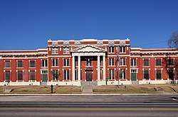
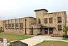
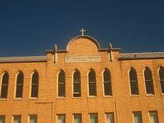
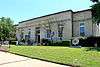
| Tyler County Courthouse |
 |
12432 | 104 W. Bluff St. | Woodville | 2000 |
Upshur County
| Registered Texas Historic Landmark | Image | Marker Number | Physical Address | Nearest city | Year designated | Description |
|---|---|---|---|---|---|---|
| 1925 Gilmer Post Office | .jpg) |
12254 | 119 Simpson St. | Gilmer | 1998 | |
| Ben Phillips Place | 11336 | West Mountain Cemetery, 8100 US 271 | Union Grove | 1964 | ? | |
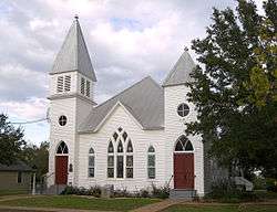
| Enon Baptist Church | 11309 | 3063 FM 556 | Gilmer | 1966 | From Gilmer, take FM 852 5.2 mi NW to intersection w/FM 556, church is at intersection | |
| John O'Byrne Home |
 |
11333 | 6488 FM 1844 | Union Grove | 1964 | |
| Lewis T. Mackey | 11327 | Union Grove Cemetery, 212 Union Grove Cemetery Rd. | Union Grove | 1964 | ||
| McDonald House | 11328 | 1 mi. E on SH 154 | Gilmer | 1964 | ||
| Old Alexander Cook Home | 11304 | 12 mi. NW in Souls Chapel community | Gilmer | 1966 | 12 mi. NW of Gilmer | |
| Old Hart Home | 11317 | 1 mi. from Gilmer | Gilmer | 1966 | ||
| Pritchett Normal Institute | 11338 | SH 155 at FM 1404 | Gilmer | 1967 | On SH 155, at intersection W/FM 1404, about 6 mi. SW of Gilmer | |
| The Ashley Phelps Home | 11335 | 107 N. Tyler St. | Big Sandy | 1982 | ||
| Warren-Futrell House | .jpg) |
12574 | 303 Warren St. | Gilmer | 2001 |
Upton County
| Registered Texas Historic Landmark | Image | Marker Number | Physical Address | Nearest city | Year designated | Description |
|---|---|---|---|---|---|---|
| Adrian Building | 90 | S of E. 3rd. St. at Santa Fe St. in Santa Fe Park | McCamey | 1965 | On US 67, Eastern edge of McCamey in Santa Fe Park | |
| Bobcat Hills | 444 | FM 305 S. of Medical Dr. | McCamey | 1967 | On FM 305, 7/10 mile S. of intersection w/ FM 1901 in McCamey. | |
| Castle Mountain | 755 | US 385 7 mi. NW of McCamey | McCamey | 1966 | US 385, 7 mi. NW of McCamey | |
| Elliott Ranch | 1460 | 100 W. 5th Ave. | Rankin | 1965 | At the Yates Hotel (5th and Main Sts.) Rankin | |
| Mendoza Trail |  |
3330 | S of Santa Fe St. near E. 3rd St. in Santa Fe Park | McCamey | 1967 | On US 67, Eastern edge of McCamey in Santa Fe Park |
| Rattlesnake Butte | 4205 | US 67 10 mi. E. of McCamey | McCamey | 1967 | On US 67, about 10 miles E. of McCamey | |
| The Little House on the Corner | 5371 | 111 E. 11th St. | McCamey | 1967 | 111 E. 11th St. (corner of 11th and Burleson Sts.), McCamey | |
| Yates Hotel | 5924 | 100 W. 5th Ave. | Rankin | 1964 | Corner of 5th and Main St., Rankin |
Uvalde County
| Registered Texas Historic Landmark | Image | Marker Number | Physical Address | Nearest city | Year designated | Description |
|---|---|---|---|---|---|---|
| Church of the Ascension |  |
858 | 27318 SH 55 | Montell | 1965 | From Uvalde: Take SH 55 about 20 miles northwest to Montell; church on west side of 55. |
| Grand Opera House |
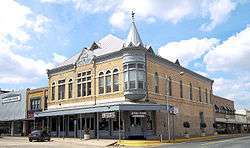 |
2249 | 104 W. North St. | Uvalde | 1967 | 104 North West Street - marker fronts Getty, Uvalde. |
| Habermacher Home | 15528 | US 90 3 mi. E of Sabinal | Sabinal | 1963 | 3 mi E of Sabinal (Ross Kennedy home) | |
| Home of Bertha Dalton | 2526 | 543 N. Getty St. | Uvalde | 1968 | Uvalde, 543 North Getty Street. | |
| Joe A. Kelley Home | 2759 | W of RM 187 approx. 7 mi. S of Utopia | Utopia | 1966 | From Utopia, take FM 187 S about 7 mile. | |
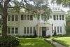
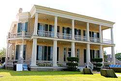
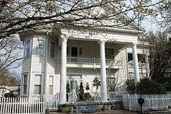
| John Nance Garner Home⁕ |
 |
2795 | 332 N. Park St. | Uvalde | 1962 | 332 North Park Street, Uvalde. |
| Nicolas Street School |
 |
17070 | 332 Nicolas St. | Uvalde | 2011 | 322 Nicolas St., Uvalde, TX 78801 |
| Old Binion Home | 3690 | 2354 N. RM 187 | Sabinal | 1963 | from Sabinal, take FM 187 North about 1/2 mile to intersection of FM 187 & FM 127 | |
| Old Davenport Home | 3719 | FM 1051 NW of Uvalde | Uvalde | 1967 | From Uvalde, take Hwy. 83 North about 19.5 miles then go NW on FM 1051 about 8 miles to Box 103 (west side of road) - Dry Frio Ranch | |
| Old Patterson Home | 15209 | RM 187 3 mi. S of Sabinal | Sabinal | 1965 | 6 mi from Sabinal (W. L. E. Shane Family home) | |
| Old Post Office | 3782 | CR 363 | Old Waresville | 1963 | From Utopia, take FM 187, Old Waresville (westward). | |
| Old Rock Store | 2015.jpg) |
3800 | 232 Main St. | Utopia | 1967 | East Main Street across from Post Office (Highway 187), Utopia |
| Old Waresville | 3831 | RM 187 1.5 mi. S of Utopia | Utopia | 1966 | (Marker on Highway 187, 1–2 miles south of Utopia). From Utopia, take Highway 187 South about 1.5 mile to marker. | |
| Schwartz House | 12257 | 524 N. Getty St. | Uvalde | 1997 | ||
| Utopia Methodist Church | 5618 | 119 Cypress St. | Utopia | 1967 | At end of Cypress Street off (eastward) Highway 187, Utopia | |
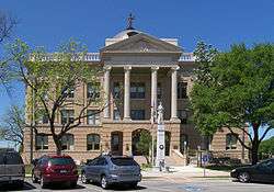
| Uvalde County Courthouse | 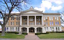 |
5620 | 100 N. Getty St. | Uvalde | 1983 | Corner of Main (U.S. 90) and Getty: Uvalde town plaza, Uvalde |
Val Verde County
| Registered Texas Historic Landmark | Image | Marker Number | Physical Address | Nearest city | Year designated | Description |
|---|---|---|---|---|---|---|
| Brinkley Mansion | 13015 | 512 Qualia Dr. | Del Rio | 2003 | 512 Qualia | |
| Elks Lodge Hall | 13163 | 330 Pecan St. | Del Rio | 2003 | Del Rio, 330 Pecan | |
| Glenn-Dowe House | 2191 | 301 E. Garfield St. | Del Rio | 1985 | Garfield on SE corner of intersection with Washington St., Del Rio | |
| Jersey Lily Saloon |  |
2749 | Behind Judge Roy Bean Visitor Center on Loop 25 N. at Torres Ave. | Langtry | 1965 | Inside Law West Museum walls in Langtry. |
| Old Perry Building | 3777 | 1308 S. Main St. | Del Rio | 1966 | Same location as Roy Bean and Semilole - Negro Scouts at Whitehead Memorial Museum, Main St., Del Rio. | |
| Sacred Heart Catholic Church | 4434 | 320 Mill St. | Del Rio | 1978 | 320 Mill St. where it crosses East Greenwood, Del Rio | |
| San Felipe Springs | 4534 | San Felipe Springs Rd. | Del Rio | 1966 | On San Felipe Springs Rd. - (off of US 90 W at 1 mile East of Del Rio), Del Rio | |
| The Cassinelli Gin House |
5300 | NE corner Academy St. at Pecan St. | Del Rio | 1981 | Front corner of Pecan and Academy Sts., Del Rio. |
Van Zandt County
| Registered Texas Historic Landmark | Image | Marker Number | Physical Address | Nearest city | Year designated | Description |
|---|---|---|---|---|---|---|
| Bennett Joseph Carter Home | 16506 | 203 E. Pecan St. | Edgewood | 2010 | 203 E. Pecan, attached to home | |
| Coltharp-Beall House | 11388 | FM 279 between CR 4819 and CR 2010 | Edom | 1964 | FM 279, Hamburg | |
| Four Mile Lutheran Church | 11412 | 460 CR 2607 | Mabank | 1964 | From Canton about 9 mi. W on FM 243 then S on SH 47 about 2.5 mi. then W on SH 90 about 3.5 mi. to CR 2607 about 3/10 mi. | |
| McKain Family Home | 11427 | 307 E. High St. | Wills Point | 1968 | ||
| Morton Salt Company Building | 11431 | 801 SH 110 | Grand Saline | 1962 | 1 mi. S of Grand Saline on SH 110 | |
| Rose Fountain | 16756 | N. Main St. at North Commerce St. | Wills Point | 2011 | Intersection of State Highway 47 and North Commerce Street | |
| Roseland Plantation Home | 11437 | 2591 SH 64 | Edom | 1966 | From Tyler about 11 mi. W on US 64 (on south side of road) - Burwell Hambrick / W. C. Windsor home, just west of Smith County line | |
| T. Z. Woodhouse Residence | 11449 | 904 Canton Ave. | Wills Point | 1965 | ||
| Van Zandt County Courthouse |
 |
12270 | 121 E. Dallas St. | Canton | 1999 | |
| William H. Humphries Home |
 |
11421 | 201 S. Main St. | Edgewood | 1976 |
Victoria County
| Registered Texas Historic Landmark | Image | Marker Number | Physical Address | Nearest city | Year designated | Description |
|---|---|---|---|---|---|---|
| 1892 Victoria County Courthouse |
 |
6576 | 101 N. Bridge St. | Victoria | 1961 | Replaced 1961 medallion and plate. |
| A. Goldman Home | 15266 | 107 S. Liberty St. | Victoria | 1966 | ||
| Abraham Levi House |
 |
6100 | 403 N. Main St. | Victoria | 1965 | 403 N. Main Street, Victoria. |
| Alexander Lowe House | 6103 | 701 N. Washington St. | Victoria | 1965 | 701 N. Washington Street, Victoria. | |
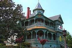
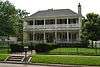
| B. F. Williams House |
 |
6581 | 401 E. Murray St. | Victoria | 1987 | 401 E. Murray St., Victoria |
| Band Stand |
 |
289 | N. Main St. at W. Constitution St. in DeLeon Plaza | Victoria | 1965 | Constitution Square, Main & Constitution Sts., Victoria |
| Beck Ranch Headquarters | 6535 | 412 Magruder Dr. | Victoria | 1980 | ||
| Billy Kyle Ranch House | 6099 | 0.25 mi. NW on US 87; 0.25 mi. W on private ranch road | Nursery | 1965 | From Nursery, take US 87 NW about 1/4 mile, go west at first cattleguard. Follow private road west about 1/4 mile (Private). | |
| Callender Home |
635 | 404 W. Guadalupe St. | Victoria | 1962 | 404 W. Guadalupe St., Victoria | |
| Early Victoria Home |
 |
14659 | 604 N. Craig St. | Victoria | 1971 | Proctor-Vandenberg Home? Welder Home? Ledbetter-Phillips-Proctor-Austin-Welder Home? |
| Fleming-Welder House |
 |
6258 | 607 N. Craig St. | Victoria | 1996 | |
| Fossati's Delicatessen |
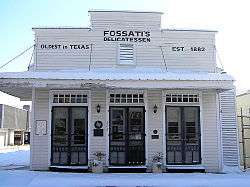 |
6547 | 302 S. Main St. | Victoria | 1987 | 302 Main St., Victoria |
| Friedrech and Margaretha Hiller House |
 |
15994 | 3003 N. Vine St. | Victoria | 2009 | 3003 N. Vine |
| George H. Hauschild Building |
 |
14524 | 206 N. Liberty St. | Victoria | 1990 | |
| Hill-O'Connor-Howard House |
 |
6551 | 802 W. Power Ave. | Victoria | 1981 | 802 W. Power St.,Victoria |
| Infant Jesus of Prague Catholic Church | 6552 | FM 445 | McFaddin | 1990 | FM 445, McFaddin | |
| J. Meredith Tatton House | 16919 | 601 W. North St. | Victoria | 2011 | Corner of North Street at Victoria | |
| Jacob Fox House |
 |
6548 | 708 W. Power Ave. | Victoria | 1985 | 708 W. Power, Victoria |
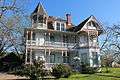
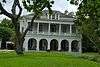
| James A. McFaddin Home |
 |
6554 | 207 W. Commercial St. | Victoria | 1967 | |
| Joe F. and Amelia Jecker House |
 |
13496 | 104 N. Liberty St. | Victoria | 2005 | 104 N. Liberty Street |
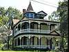
| Judge Alexander Phillips Home |
 |
14102 | 705 N. Craig St. | Victoria | 1967 | |
| McFaddin Mercantile | 3290 | FM 445 | McFaddin | 1990 | FM 445, McFaddin | |
| McFaddin Post Office | 3291 | FM 445 | McFaddin | 1990 | FM 445, (20 mi S. of Victoria on US 77) | |
| McNamara House |
 |
3306 | 502 N. Liberty St. | Victoria | 1965 | 502 N. Liberty, Victoria |
| Mundt Place | 3534 | 103 S. Glass St. | Victoria | 1966 | Continental Hotel / VFW 4146 | |
| Murphy Home | 3539 | US 87 | Nursery | 1966 | US 87, Nursery | |
| O'Connor-Proctor Building |
 |
3629 | 202 N. Main St. | Victoria | 1980 | |
| Old Federal Building |
 |
6546 | 210 E. Constitution St. | Victoria | 1981 | 210 E.Constitution St., Victoria |
| Old Grist Mill |
 |
14443 | N. De Leon St. at E. Commercial St. in Memorial Park | Victoria | 1962 | |
| Old L.D. Heaton Home | 6550 | 307 S. Bridge St. | Victoria | 1966 | 307 S. Bridge St., Victoria | |
| Pela House |
 |
12277 | 309 E. Santa Rosa St. | Victoria | 1998 | |
| Phillips-Sale House |  |
6558 | 701 N. Craig St. | Victoria | 1967 | |
| Power Home | 13867 | 307 S. William St. | Victoria | 1966 | ||
| Proctor House |
 |
4129 | 507 N. Glass St. | Victoria | 1985 | |
| Regan House |
 |
4234 | 507 S. De Leon St. | Victoria | 1996 | 507 S. De Leon, Victoria |
| Robert H. and Pauline Clark House |
 |
13050 | 317 N. Main St. | Victoria | 2004 | 317 N. Main |
| Robert L. Dabney House | 17973 | 801 N. Craig St. | Victoria | 2014 | ||
| Sengele Home | 14422 | 210 E. Forest St. | Victoria | 1962 | ||
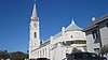
| St. Mary's Catholic Church |
 |
6566 | 101 W. Church St. | Victoria | 1964 | 100 W. Church St., Victoria |
| The Woodhouse Home |
 |
5898 | 609 N. Wheeler St. | Victoria | 1983 | 609 N. Wheeler St., Victoria |
| Thurmond Building | 6571 | 901 S. Bridge St. | Victoria | 1980 | 901 S. Bridge St., Victoria | |
| Victoria Pumping Station |
 |
16922 | 1201 W. Stayton Ave. | Victoria | 2011 |
Walker County
| Registered Texas Historic Landmark | Image | Marker Number | Physical Address | Nearest city | Year designated | Description |
|---|---|---|---|---|---|---|
| Angier Farm | 18490 | 1556 Southwood Dr. | Huntsville | 2016 | ||
| Austin College Building |
 |
8426 | 1700 Sam Houston Ave. | Huntsville | 1964 | Near the intersection of 17th St. and University on the Sam Houston State University campus, Huntsville. |
| Boettcher House | .jpg) |
8431 | 2020 Ave. N1⁄2 | Huntsville | 1991 | 2020 Ave. N 1/2; Huntsville. |
| Eastham-Thomason House | 8443 | 906 Ave. M | Huntsville | 1989 | 906 Ave. M; Huntsville. | |
| Farris Chapel Methodist Church | 8448 | 1651 FM 1791 | Huntsville | 1965 | From the intersection of SH 30 and IH-45 (Huntsville), take SH 30 W approximately 3 miles to FM 1791; then SW on FM 1791 approximately 10.5 miles. Old Richards Road southwest of Huntsville. | |
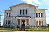
| Gibbs-Powell House# |  |
8454 | 1228 11th St. | Huntsville | 1989 | 1228 11th Street; Huntsville. |
| Jardine-Brown House | 8460 | 4621 FM 1374 | Huntsville | 1968 | From the intersection of FM 1374 and IH-45 take FM 1374 SW approximately 5.3 miles. | |
| Josey Boy Scouts Lodge | 16519 | 2201 Ave. M | Huntsville | 2010 | Southwest corner of intersection of Sam Houston Avenue (Highway 75) and 22nd Street | |
| Old Gibbs Store | 8455 | 1116 11th St. | Huntsville | 1964 | 1116 Cedar Street; Huntsville; 1114-18 11th St. | |
| Peabody Library Building# | 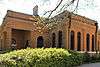 |
8469 | 1700 Sam Houston Ave. | Huntsville | 1990 | Near the corner of 12th and Avenue J, on the Sam Houston State University campus; Huntsville. |
| Powell Sanctuary | 18181 | 700 blk. Ninth St. in Oakwood Cemetery | Huntsville | 2015 | ||
| Pritchett House | 12490 | 1322 Ave. O | Huntsville | 2001 | ||
| St. Joseph's Catholic Church | 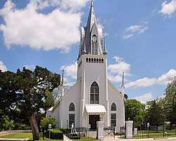 |
8472 | 101 Elmore St. | New Waverly | 1975 | corner of Elmore and Walker streets |
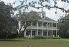
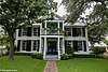
| Steamboat House⁕ |
 |
8474 | 1402 19th St. | Huntsville | 1964 | Sam Houston Memorial Museum |
| Woodland, Home of Sam Houston⁕ |
_in_Huntsville%2C_Texas.JPG) |
8482 | 1402 19th St. | Huntsville | 1962 | On the Sam Houston Memorial Museum and Education Center grounds (in front of Sam Houston home); Huntsville. |
| Wynne House | 14377 | 1428 11th St. | Huntsville | 2007 |
Waller County
| Registered Texas Historic Landmark | Image | Marker Number | Physical Address | Nearest city | Year designated | Description |
|---|---|---|---|---|---|---|
| Ahrenbeck-Urban Home | 9373 | 1203 13th St. | Hempstead | 1980 | corner of 13th St. & Lafayette, Hempstead | |
| Donigan House | 9379 | 906 Cooper St. | Brookshire | 1985 | Northeast corner of 5th and Cooper, Brookshire. Waller County Historical Museum. | |
| Frey-Benignus House | 9384 | W of Blinka Rd. 1 mi. N of Richard Frey Rd. | Brookshire vicinity | 1990 | From Brookshire take FM 362 north to Richard Frey, then west to Blinka Rd, then north 1 mile, Brookshire vicinity | |
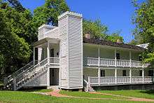
| Liendo Plantation |
9395 | Wycliff Chapel Rd. E of FM 1488 | Hempstead | 1964 | 5 mi. N of Hempstead on FM 1488 to Wycliff Chapel Rd. | |
| Pine Island Baptist Church | 8106 | 36573 Brumlow Rd. | Hempstead | 1965 | 4 miles east of Hempsted on 290, then south on Pine Island to junction with Brumlow | |
| Reid's Prairie Baptist Church | 8107 | 30414 FM 362 | Waller | 1965 | FM 362 15 miles north of Waller | |
| St. Francis Episcopal Church | 8108 | 204 Dooley St. | Prairie View | 1962 |
Ward County
| Registered Texas Historic Landmark | Image | Marker Number | Physical Address | Nearest city | Year designated | Description |
|---|---|---|---|---|---|---|
| Christ The King Catholic Church/Sands Art Center | 844 | 1000 N. Main Ave. | Monahans | 1992 | 1000 N. Main (also N SH 18 ) (at corner of Main and J Sts.) Monahans | |
| Grandfalls Union Church | 2252 | 103 Ave. D | Grandfalls | 1966 | At the intersection of SH 18 and SH 329 in Grandfalls | |
| Holman House | 2510 | Million Barrel Museum at 1500 E. Sealy Ave. | Monahans | 1966 | Million Barrel Museum, 400 Museum Blvd off E. Sealy Avenue (US 80) | |
| Old Railroad Section House | 3788 | PR 41 1.5 mi. N. of entrance to Monahans Sandhills State Park, 2500 I-20 E. Exit 86 |
Monahans | 1965 | About 6 miles E. of Monahans on US 80/I-20 in Sandhills State Park. aka Sand Hills Section House. | |
| Old Ward County Bank | 3830 | NE corner Mackey Ave. at San Marcos St. | Barstow | 1962 | Mackey Ave., Barstow | |
| Water Improvement District No. 2 Office | 5724 | SW corner Ave. D at 2nd St. | Grandfalls | 1966 | On SH 18, near intersection of SH 18 and 2nd St. at the Chamber of commerce Grandfalls |
Washington County
| Registered Texas Historic Landmark | Image | Marker Number | Physical Address | Nearest city | Year designated | Description |
|---|---|---|---|---|---|---|
| Allcorn-Kokemoor Farmstead |
16820 | 4625 Old Independence Rd. | Brenham | 2011 | 4625 Old Independence Road, Brenham | |
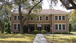
| Anson Jones Home |
 |
15324 | 23400 PR 12 | Brenham | 1962 | (Barrington Farm, Washington-on-the-Brazos) |
| Applewhite House |
 |
8289 | SE corner Church St. at Chestnut St. | Chappell Hill | 1968 | At Church and Chesnut Streets, Chappell Hill. |
| Bassett and Bassett Banking House |
 |
8297 | 222 E. Main St. | Brenham | 1985 | 222 E. Main, Brenham |
| Blinn College Main Building |
 |
8303 | 800 College Ave. | Brenham | 1962 | 800 block of College Ave., on old Main Bldg. Blinn College Campus, Brenham. |
| B'nai Abraham Synagogue |
 |
8293 | 302 N. Park St. | Brenham | 1965 | 302 N. Park Street, Brenham |
| Brown's Prairie School and Building | 18124 | 20322 FM 1155 | Washington | 2015 | ||
| Burton Cafe |
.jpg) |
8314 | 12513 Washington St. | Burton | 1992 | Washington St. near intersection with Main, Burton. |
| Burton Depot |
 |
8316 | 507 N. Railroad St. | Burton | 1991 | Railroad St. (at Washington), Burton |
| Burton Farmers Gin |
 |
8317 | 307 N. Main St. | Burton | 1988 | On Main St. near intersection with Mulberry, Burton. |
| Burton High School |
 |
17597 | 917 N. Main St. | Burton | 2013 | Main Street at FM 390 |
| Farmers State Bank and Reinstein Store |
 |
16205 | 5060 Main St. | Chappell Hill | 2009 | |
| First Christian Church of Brenham |
8333 | 306 Cottonwood St. | Brenham | 1984 | 306 Cottonwood, Brenham | |
| First Public High School in Brenham |
 |
8335 | 606 E. Alamo St. | Brenham | 1969 | 606 E. Alamo, Brenham. Marker may be missing. |
| Former Bank Building of Giddings & Giddings |
 |
8338 | 116 S. Park St. | Brenham | 1971 | 116 S. Park St. (corner of S. Park and E. Alamo), Brenham. |
| Fritz Paul and Emma Schroeder House |
18028 | 9799 Palestine Rd. | Independence | 2014 | 1 mile east of Sandy Hill Church on Palestine Road - property north of road. | |
| Gantt-Jones House |
 |
8336 | FM 2780 on W side 1.1 mi. N of FM 1697 | Burton | 1976 | From intersection of FM 1697 and FM 2780 in Burton, go N on FM 2780 about 1.1 mile to home on W side of road. |
| George Clark Red Homestead |
14253 | FM 390 | Gay Hill | 1965 | ||
| Giddings-Stone House |
 |
8339 | 204 E. Stone St. | Brenham | 1991 | Just off E. Stone St., at the corner of Century Circle and Heritage Drive, Brenham. |
| Giddings-Wilkin House |
 |
8340 | 805 Crockett St. | Brenham | 1976 | 805 Crockett St., Brenham |
| Hasskarl House-"Far View" | 8346 | 1804 S. Park St. | Brenham | 1994 | 1804 S. Park St., Brenham | |
| Hatfield Plantation |
15309 | FM 912 near FM 1155 | Washington | 1966 | Off FM 912 | |
| Jacob Haller House |
8345 | 4922 Main St. | Chappell Hill | 1969 | N. Main St. (2 blocks N of Chesnut), Chappell Hill. | |
| James Walker Log House |
16819 | 4800 Old Chappell Hill Rd. | Brenham | 2011 | 3 mi. E of Blue Bell Road on Chappell Hill Road | |
| John Sterling Smith House |
 |
8397 | Chestnut St. W of Church St. | Chappell Hill | 1990 | On Chesnut St. near intersection with Church St., Chappell Hill. |
| Julius Yanch Home |
8409 | 4925 Main St. | Chappell Hill | 1968 | N. Main St. (2 blocks N of Chesnut), Chappell Hill. | |
| Liberty Baptist Church |  |
12996 | 10655 FM 50 | Independence | 2003 | 10655 FM 50 |
| Lockhart Plantation | 8366 | FM 1371 W of US 290 | Chappell Hill | 1964 | On FM 1371, 1 mi. E of Chappell Hill. | |
| Louis Lehmann House | 14297 | 2470 S. Berlin Rd. | Brenham | 2008 | 2470 S. Berlin Rd. | |
| Margaret Lea Houston Home |
 |
8352 | SE corner FM 390 at Hood Hotel Rd. | Independence | 1965 | 1 block E of FM 50/FM 390 intersection, on S side of FM 390, Independence. |
| Methodist Church |
 |
8370 | 5195 Church St. | Chappell Hill | 1967 | On Church St. by Public School, Chappell Hill. |
| Mill Creek Farm | 15148 | 11456 Old Mill Creek Rd. | Brenham | 1966 | 7 mi W on US 290 (H. G. Nelms home) | |
| Old Rock Store |
 |
8383 | 5070 Main St. | Chappell Hill | 1971 | At Main and Cedar Streets (W side of road), Chappell Hill. |
| Pampell-Day Homestead |
 |
8376 | 409 W. Alamo St. | Brenham | 1966 | 409 W. Alamo St., Brenham |
| Permelia Haynie Home |
8347 | 4890 Main St. | Chappell Hill | 1970 | N. Main St. (2 blocks N of Chesnut St.), Chappell Hill. | |
| Pleasant Hill School | 18339 | 500 Pleasant Hill School Rd. | Brenham | 2016 | 4 miles south of Brenham on Hwy 36; Right on Pleasant Hill School Road; 1/4 mile to site | |
| Providence Baptist Church |
8378 | 5175 Main St. | Chappell Hill | 1967 | At Main and Providence Sts. (E side of road), Chappell Hill. | |
| Reue-Eickenhorst House |
 |
12991 | 0.5 mi. W of FM 50 on FM 2621 | Brenham | 2002 | Brenham, FM 2621, 0.5 mi. E of SH 50 |
| Ross-Carroll House |
 |
8384 | 515 E. Main St. | Brenham | 1992 | 515 E. Main, Brenham |
| Sacred Heart Catholic Church | 12286 | Sawmill Rd. at Sacred Heart Rd. | Brenham | 1999 | 12 mi. SW of Brenham on FM 389 to Latium; .9 mi. E on Sacred Heart Road | |
| Schmid Bros. Building |
 |
8392 | 107 W. Commerce St. | Brenham | 1993 | 103 W. Commerce, Brenham |
| Schuerenberg House |
 |
8393 | 503 W. Alamo St. | Brenham | 1996 | 503 W. Alamo St., Brenham |
| Seelhorst-Lehrmann House |
 |
8394 | 702 Seelhorst St. | Brenham | 1973 | 402 Seelhorst St., Brenham. |
| Southern Pacific Freight Depot |
 |
14930 | 306 S. Market St. | Brenham | 2003 | |
| St. Peter's Episcopal Church |  |
8389 | 2310 Airline Dr. | Brenham | 1965 | At the corner of Hillcrest and Airline Roads, Brenham. (Replica?) |
| Steiner & Dallmeyer Building |
 |
8398 | 600 N. Main St. | Burton | 1989 | Corner of Main & Washington Sts., Burton. |
| The Brown-Woodlief Log House | 14398 | 5000 Krueger Rd. | Washington | 1973 | 3.5 mi. SW via Hwy 90 and FM 1155, then 1.2 mi on local road | |
| The Hutchinson-Korth Home | 15404 | 5000 Krueger Rd. | Washington | 1972 | NE of Chappell Hill, 9.6 mi on FM 1155, then 1.2 mi on local road | |
| The Wood-Hughes House |
 |
8408 | 614 S. Austin St. | Brenham | 1974 | 614 S. Austin St., Brenham |
| W. W. Browning House |
 |
8312 | Private drive 0.5 mi. S of Browning St. near FM 1371 | Chappell Hill | 1983 | 1/2 mile S of US 290 via private drive, Chappell Hill. |
| Washington County Courthouse |
 |
8401 | 100 E. Main St. | Brenham | 1985 | 105 E. Main between S. Park and Baylor Sts., Brenham. |
| Waverly |
 |
8395 | E on FM 2447 | Chappell Hill | 1967 | On FM 2447, E of downtown Chappell Hill. |
| Wittbecker-Weiss House |
8406 | 600 Third St. | Brenham | 1995 | 600 W. Third St., Brenham | |
| Witte-Williams House | 8407 | 6007 Jaeger Rd. | Greenvine | 1974 | From Greenvine, take CR 2 (Wickel Rd.) 2.3 mi. to Mayer Cem. Rd., go S about 1.6 mi. to Jaeger Rd., go W about 2/10 mi. to house on N side of road (128 Jaeger Rd.). |
Webb County
| Registered Texas Historic Landmark | Image | Marker Number | Physical Address | Nearest city | Year designated | Description |
|---|---|---|---|---|---|---|
| August C. and Julia Richter Mansion | 234 | 1906 Houston St. | Laredo | 1985 | 1906 Houston Street | |
| Benavides-Herrera House |
12387 | 802 Grant St. | Laredo | 2000 | ||
| Biggio-Kowalski-De La Garza House | 405 | 1620 Farragut St. | Laredo | 1996 | 1620 Farragut, Laredo | |
| Capitol, Republic of the Rio Grande |
 |
704 | 1001 Zaragoza St. | Laredo | 1965 | 1000 Zaragoza St. on St. Augustin St. south side |
| Casa Ortiz |
744 | 915 Zaragoza St. | Laredo | 1964 | 915 Zaragoza St | |
| Casa Vidaurri |
746 | 202 Flores Ave. | Laredo | 1964 | 202 Flores Ave. west side St. Augustine Sq. | |
| Casa Zaragoza | 14164 | 702 Zaragoza St. | Laredo | 1963 | ||
| Fort McIntosh Barracks |
1997 | Laredo Community College Fort McIntosh Campus | Laredo | 1962 | on administration building | |
| Juan Francisco Farías Residence | 15800 | 409 San Bernardo Ave. | Laredo | 2009 | ||
| Leyendecker House |
12290 | 204 Flores Ave. | Laredo | 1999 | ||
| San Augustine Cathedral |
 |
5029 | 201 Agustin Ave. | Laredo | 1963 | Laredo - on St. Augustine Square - east side |
| St. Augustine Parochial School |
 |
12441 | 203 San Agustin Ave. | Laredo | 2000 | |
| Zuniga House | 5963 | 902 Market St. | Laredo | 1996 | 902 Market Street, Laredo |
Wharton County
| Registered Texas Historic Landmark | Image | Marker Number | Physical Address | Nearest city | Year designated | Description |
|---|---|---|---|---|---|---|
| Boling United Methodist Church | 14496 | 607 Texas Ave. | Boling | 2003 | ||
| Captain W. E. Heard Home | 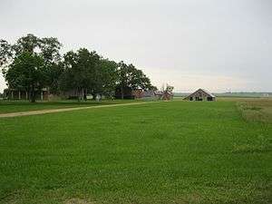 |
726 | 0.4 mi. E of FM 102 on FM 1161 | Egypt | 1962 | 4/10 mile E. of Egypt (and FM 102) on FM 1161, Egypt |
| El Campo Library Building | 1408 | 201 W. Monseratte St. | El Campo | 1990 | 201 W. Monseratte, El Campo | |
| G. C. and Clara Mick Home | 2086 | 7 mi. SE on FM 1301 | Wharton vicinity | 1965 | 7 miles SE of Wharton on FM 1301, in Iago.(on W Side of 1301) | |
| Glen Flora Plantation | 2189 | FM 640 one mile N of FM 102 | Wharton | 1967 | 1 mile N. of Intersection of FM 102 & FM 640 on FM 640, Wharton | |
| Joseph A. Hamilton House |
 |
2854 | 325 N. Richmond Rd. | Wharton | 1984 | 325 N. Richmond St., Wharton |
| Judge Edwin Hawes House |
 |
2879 | 309 N. Resident St. | Wharton | 1982 | 309 N. Resident St., Wharton |
| Shanghai Pierce Ranch House | 4658 | Pierce Ranch SE of FM 526 | Pierce | 1967 | 1 mile S.E of Pierce on Pierce Ranch (entrance to ranch is on FM 526, across from Post Office) | |
| Wharton County Courthouse |
 |
14041 | 100 S. Fulton St. | Wharton | 2007 | 100 E. Milam St. |
Wheeler County
| Registered Texas Historic Landmark | Image | Marker Number | Physical Address | Nearest city | Year designated | Description |
|---|---|---|---|---|---|---|
| Britt Rock House | 14563 | Private road 1.2 mi. E of FM 592, 2.4 mi. N of SH 152 | Wheeler | 1964 | northeast of Wheeler | |
| Farmers and Merchants State Bank | 15573 | 127 N. Main St. | Shamrock | 1968 | southwest corner of Main and 2nd streets | |
| Frye-Puryear Home | 2076 | E of CR 22, 1.5 mi. N of SH 152 | Wheeler | 1964 | From Wheeler, take S.H. 152 about 7.5 miles east; turn north onto county road 22 about 1.5 miles to private ranch driveway on east side of road | |
| Old Rock House | 1912 | Private ranch road S of CR H 1 mi. W of SH 152 | Mobeetie | 1962 | From Wheeler, take S.H. 152 northwest about 11 miles to county road "H"; take road about 1 mile to private ranch entrance (Jim Fleming Ranch) | |
| Old Wheeler County Jail | 3834 | W end Olaughlin St. | Mobeetie | 1965 | In front of old jail in Old Mobeetie, south of S.H. 152 | |
| Rock Barn | 3955 | Stiles Ranch Rd. 2 mi. N of SH 152 10 mi. E of Wheeler | Wheeler | 1967 | From Wheeler, take S.H. 152 east about 10 miles; turn north onto private drive to barn site, about 2 miles on private property (Patton Ranch) | |
| Rock School | 4319 | On private road 0.5 mi. E of FM 592, 2 mi. N of SH 152 | Wheeler | 1964 | From Wheeler take SH 152 9 miles east, turn north on FM 592, continue about 2 miles to private drive onto ranch, head east about .5 miles to school. | |
| Shamrock Water Tower | 15350 | 101 S. Main St. | Shamrock | 2008 | intersection of Main St. & E. Railroad Ave. | |
| The Millie Porter House | 3384 | 901 Main St. | Wheeler | 1968 | 901 Main Street-Wheeler | |
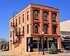
| Tower Building |
 |
5513 | 101 E. 12th St. | Shamrock | 1994 | 101 E. 12th Street-Shamrock |
| Wheeler County Courthouse |  |
11970 | 401 Main St. | Wheeler | 2000 | |
| Wheeler County Jail | 5780 | NW corner E. Texas Ave. at S. Alan L. Bean Blvd. | Wheeler | 1965 | Intersection of Alan Bean & Texas Streets-Wheeler |
Wichita County
| Registered Texas Historic Landmark | Image | Marker Number | Physical Address | Nearest city | Year designated | Description |
|---|---|---|---|---|---|---|
| Electra State Bank | ws.jpg) |
1447 | 101 W. Cleveland Ave. | Electra | 1966 | 101 West Cleveland Avenue, Electra |
| First Baptist Church of Wichita Falls |  |
1684 | 1200 Ninth St. | Wichita Falls | 1982 | 1200 9th Street, Wichita Falls |
| First United Methodist Church of Wichita Falls | .jpg) |
1900 | 909 Tenth St. | Wichita Falls | 1983 | 909 Tenth Street, Wichita Falls |
| Frank Kell Home |
 |
2049 | 900 Bluff St. | Wichita Falls | 1980 | 900 Bluff, Wichita Falls |
| Grand Theatre | .jpg) |
13670 | 114 N. Waggoner St. | Electra | 2006 | 114 N. Waggoner |
| Hodges-Hardy House |
.jpg) |
2506 | 1100 Travis St. | Wichita Falls | 1984 | 1100 Travis, Wichita Falls |
| Home of Monroe Dodson | 2541 | 403 N. Ave. E | Burkburnett | 1970 | near East Main & 5th Street | |
| J. A. Kemp Wholesale Grocery Building |
.jpg) |
12295 | 500 Eighth St. | Wichita Falls | 1997 | |
| Joe and Lois Perkins Estate |
 |
18216 | 3301 Harrison St. | Wichita Falls | 2015 | |
| Kell Field Air Terminal |  |
2911 | 1226 Heritage Way, Sheppard Air Force Base | Wichita Falls | 1981 | Sheppard Air Force Base, Wichita Falls. enter at main gate, and continue on road to Motor Pool Drive. Thisis an active Military Base |
| The Anderson House | 158 | 912 Burnett St. | Wichita Falls | 1980 | 912 Burnett, Wichita Falls | |
| Tom Lloyd Burnett Home | 5503 | 400 W. Alameda Ave. | Iowa Park | 1983 | 400 West Alameda, Lowa Park | |
| Weeks Mansion |
5741 | 2112 Kell Blvd. | Wichita Falls | 1978 | Intersection of Harrison and Kell, Wichita Falls. | |
| Wichita Falls Women's Forum | 5808 | 2120 Speedway Ave. | Wichita Falls | 1980 | 2120 Speedway, Wichita Falls |
Wilbarger County
| Registered Texas Historic Landmark | Image | Marker Number | Physical Address | Nearest city | Year designated | Description |
|---|---|---|---|---|---|---|
| Doans' Adobe Building |
5323 | FM 2916 at FM 924 | Doan's Community | 1962 | From Vernon, take US 283 North about 13 miles to FM 2916 and follow FM 2916 east to Doan's Community. | |
| Vernon Drugstore | 5643 | 1630 Main St. | Vernon | 1966 | 1704 Main St., Vernon | |
| W. D. Berry Home | 5669 | 2429 Texas St. | Vernon | 1981 | 2429 Texas St., Vernon | |
| Waggoner-Hicks House | 5702 | 2760 Paradise St. | Vernon | 1988 | 2760 Paradise St., Vernon |
Willacy County
| Registered Texas Historic Landmark | Image | Marker Number | Physical Address | Nearest city | Year designated | Description |
|---|---|---|---|---|---|---|
| Old Lyford High School Building |
 |
3760 | E side Simon Gomez Rd. N of High School Cir. | Lyford | 1985 | Lyford, Simon Gomez Ave. |
| Willacy County Courthouse |
 |
18553 | 546 W. Hidalgo Ave. | Raymondville | 2016 | Willacy County Courthouse grounds, southeast corner |
Williamson County
| Registered Texas Historic Landmark | Image | Marker Number | Physical Address | Nearest city | Year designated | Description |
|---|---|---|---|---|---|---|
| A. A. & Mary Spacek House | 12308 | 204 S. Rio Grande St. | Granger | 1999 | ||
| A. J. and Carolina Anderson House | 12591 | 602 E. Liberty Ave. | Round Rock | 2001 | ||
| A. M. Brown Cabin | 9036 | 6 mi. W near RM 2243 in Garey Park | Georgetown | 1974 | FM 2243, 6 miles west of Georgetown | |
| A.S. Mason House | 13802 | 600 S. Bagdad Rd. | Leander | 1983 | Bagdad Road, across from city park, S of FM 2243 and W of US 183 | |
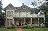
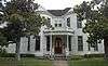
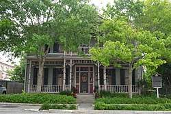
| A. W. Sillure House |
 |
9338 | 1414 Ash St. | Georgetown | 1990 | 1414 Ash St., Georgetown |
| Amos-Godbey House |
 |
15136 | 1408 Olive St. | Georgetown | 1988 | |
| Andrew J. Palm House |
.jpg) |
9316 | 208 E. Main St. | Round Rock | 1978 | Palm House Museum/Chamber of Commerce |
| Barker House | 12298 | 1113 Ledbetter St. | Round Rock | 1998 | ||
| Booth House | 9034 | 2112 W. Lake Dr. | Taylor | 1992 | 2112 Lake Drive, Taylor | |
| Bryson Stagecoach Stop |
 |
9038 | SH 29, 1 mi. W | Liberty Hill | 1981 | SH 29, 1 mi. W of Liberty Hill |
| Burcham House |
 |
9039 | 1310 S. College St. | Georgetown | 1988 | 1310 College, Georgetown |
| C.B. and Lilburn Atkinson House |
.jpg) |
13699 | 911 Walnut St. | Georgetown | 2006 | 911 S. Walnut St. |
| C.C. and Mattie Hughes Cody House |
13444 | 304 E. University Ave. | Georgetown | 2005 | 304 E University | |
| Cabin from Gabriel Mills Area |  |
9097 | 3300 E. Palm Valley Blvd. | Round Rock | 1976 | Building and marker moved 2005 to Old Settlers Park, Round Rock (formerly Austin Ave, Georgetown). |
| Caldwell-Palm House | 9043 | 4307 Teravista Club Dr. | Round Rock | 1965 | ||
| Cooper Sansom House |
14160 | 1252 S. Main St. | Georgetown | 1988 | ||
| David H. and Jerusha Dyches McFadin House |
 |
9306 | FM 1331 E of SH 95 | Circleville | 1965 | On FM 1331, Circleville vicinity |
| Doak Home | 9047 | 600 W. Seventh St. | Taylor | 1967 | 600 W. 7th St., Taylor | |
| Dog Run Log Cabin | 9048 | S of CR 202 E of CR 207 | Liberty Hill | 1968 | 10 mi. N of Liberty Hill via SH 29/US 183, off local road (Dr. Michael Collins property) | |
| Early Church | 9084 | 100 Suttles St. | Florence | 1970 | Primitive Baptist Church, Suttles Street, next to Florence Cemetery, Florence | |
| Early Commercial Building |
.jpg) |
9085 | 203 E. Main St. | Round Rock | 1970 | 203 E. Main Street, Round Rock (Nelson Hardware Building) |
| Easley Home |
 |
14218 | 1310 Olive St. | Georgetown | 1984 | |
| Eikel-Prewitt Building |
9086 | 316 N. Main St. | Taylor | 1985 | 316 N. Main Street, Taylor | |
| El Milagro | 14634 | 900 Heritage Center Cir. | Round Rock | 1963 | Heritage Center Circle, S of US 79 and E of Mays St. Also known as the Washington Anderson House. | |
| Farmers State Bank Building |
 |
13603 | 716 S. Austin Ave. | Georgetown | 2006 | 716 Austin Ave |
| First Christian Church of Taylor | 9091 | 603 Talbot St. | Taylor | 1970 | 6th & Talbot streets, Taylor | |
| First Presbyterian Church | 14860 | 703 S. Church St. | Georgetown | 1962 | ||
| First Presbyterian Church of Bartlett | 9088 | 346 W. Pietzsch St. | Bartlett | 1970 | 346 Pietzsch Street, Bartlett | |
| First United Methodist Church of Georgetown |
 |
9090 | 410 E. University Ave. | Georgetown | 1974 | University Ave. and Ash St. |
| George Irvine House |
 |
9111 | 409 E. University Ave. | Georgetown | 1988 | 409 E. University, Georgetown |
| Georgetown Fire House and Old City Hall |
13918 | 816 S. Main St. | Georgetown | 1984 | 9th and Main | |
| Georgetown High School Building |
 |
9098 | 507 E. University Ave. | Georgetown | 1988 | 507 E. University Ave., Georgetown |
| Granger City Hall (Farmers State Bank) | 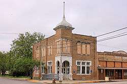 |
9100 | 212 E. Davilla St. | Granger | 1994 | 212 E. Davilla Street, Granger |
| Granger High School | 9101 | 300 N. Colorado St. | Granger | 1991 | N. Colorado Street, Granger | |
| H.C. Craig Building |
 |
13874 | 115 W. Seventh St. | Georgetown | 1990 | |
| Hall Ranch Home | 14171 | S of W. SH 29 beyond high school | Liberty Hill | 1962 | W. of Liberty Hill on US 29, 808 Ranch | |
| Heinatz Homestead | 9104 | 301 N. Bagdad Rd. | Leander | 1972 | 1 mi. W of Leander on FM 2243, 0.2 mi. S on Bagdad road | |
| Home of A. J. Nelson | 9305 | N. A.W. Grimes Blvd. SE of University Blvd. | Round Rock | 1965 | FM 1460, SE of Chandler Road (University) | |
| J. A. McDougle Home |
9297 | 1312 Elm St. | Georgetown | 1975 | 1312 Elm Street, Georgetown | |
| Jesse Cooper House |
 |
9042 | Wilbarger Point, off SH 29, 1.5 mi. E | Georgetown | 1988 | Wilbarger Point, north of SH 29, just west of NE Inner Loop |
| John G. Matthews House | 9296 | N of CR 263 E of Metrorail tracks | Liberty Hill | 1976 | on private road 1 mile west of US 183, 3.5 miles southeast of Liberty Hill | |
| Lesesne-Stone Building |
13916 | 102 W. Eighth St. | Georgetown | 1983 | ||
| Liberty Hill Masonic Hall | .jpg) |
9291 | 927 Main St. | Liberty Hill | 1976 | Main Street, Liberty Hill |
| Liberty Hill United Methodist Church | 9292 | 101 Church St. | Liberty Hill | 1962 | 1 block N of Main Street (Loop 332), Liberty Hill | |
| M.B. Lockett Building |
 |
13873 | 119 W. Seventh St. | Georgetown | 1991 | |
| M.B. Norman House | 16563 | 12500 FM 1660 | Taylor | 2010 | Norman's Crossing | |
| Marsh F. Smith House |
9340 | 1242 S. Austin Ave. | Georgetown | 1988 | 1242 Austin Ave., Georgetown | |
| Nelson-Crier House | 9308 | 405 E. Main St. | Round Rock | 1973 | 405 E Main St | |
| Old Broom Factory Building |
9035 | 100 E. Main St. | Round Rock | 1970 | corner of Mays & Main Streets, Round Rock | |
| Old Dimmitt Building |
13920 | 801 S. Main St. | Georgetown | 1965 | ||
| Old Dimmitt Home |
 |
13921 | 921 W. University Ave. | Georgetown | 1967 | 921 W. University (SH 29) |
| Olson House | 12913 | 808 E. Main St. | Round Rock | 2000 | 808 E. Main St. | |
| Page-Decrow-Weir House |
 |
9370 | 1903 J.M. Page Ln. | Georgetown | 1988 | N of FM 2243 (Leander Road) on W side of IH-35, Georgetown |
| Palm Valley Lutheran Church | 9317 | 2500 E. Palm Valley Blvd. | Round Rock | 1970 | 2500 Palm Valley Blvd | |
| Pickle-Mason House | 9321 | 11332 Hero Way W. | Leander | 1988 | FM 2243, 0.4 mi. W of US 183 | |
| Pioneers' House | 9323 | N of San Gabriel Pkwy. E of 183A | Leander | 1970 | (Bryson Home) | |
| Preslar-Hewitt Building |
 |
13070 | 321 N. Main St. | Taylor | 2004 | 321 N. Main Street |
| Shafer Saddlery |
13882 | 711 S. Main St. | Georgetown | 1971 | ||
| Shiloh Baptist Church | 9337 | 100 CR 481 | Taylor vicinity | 1968 | On building on FM 112/CR 15, 15 miles southeast of Taylor | |
| Sloan House | 15507 | 13574 SH 29 | Taylor | 1965 | Hwy 29, 8 mi. NW of Taylor | |
| Smart-McCormick Home | 13803 | 1251 CR 208 | Andice | 1965 | 4.5 mi. NW of Andice | |
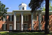
| Southwestern University Administration Building |
 |
9342 | 1001 E. University Ave. | Georgetown | 1962 | 1000 E. University Ave. (SH 29), Georgetown |
| St. James Church | 9334 | 612 Davis St. | Taylor | 1969 | corner of Davis and W 7th St | |
| St. Peters United Church of Christ | 2016-2.jpg) |
9335 | 108 Wathen St. | Coupland | 1989 | Wathen and Broad Streets |
| Steele Store-Makemson Hotel Building |
13881 | 802 S. Austin Ave. | Georgetown | 1988 | 8th and Austin Ave | |
| Stubblefield Building | .jpg) |
12998 | 1002 Main St. | Liberty Hill | 1976 | Main St. at Myrtle |
| Taylor National Bank |
 |
9354 | 200 N. Main St. | Taylor | 1980 | |
| Taylor Post Office |
 |
9359 | 202 W. Fourth St. | Taylor | 1992 | 202 W. Fourth Street, Taylor |
| The David Love Store |
13674 | 706 S. Austin Ave. | Georgetown | 1988 | 706 Austin Ave | |
| The G. W. Riley House |
 |
9328 | 1302 S. College St. | Georgetown | 1972 | 1302 College St |
| The Harrell-Stone House |
9103 | 1404 Elm St. | Georgetown | 1976 | 1404 Elm Street, Georgetown | |
| Tucker-Smith House | 9366 | 516 W. Seventh St. | Taylor | 1991 | 516 W. 7th Street, Taylor | |
| United Methodist Church | 15212 | 201 S. Granger St. | Granger | 1970 | ||
| W.C. Vaden House |
 |
13897 | 711 E. University Ave. | Georgetown | 1992 | |
| W. Y. Penn Home |
9318 | 1304 Elm St. | Georgetown | 1975 | 1304 Elm St | |
| Washington Bower | 9367 | CR 479 W of CR 492 | Taylor | 1971 | 15 mi. SE of Taylor on FM 112 to CR 479 | |
| Wesley Chapel A.M.E. Church |
 |
13895 | 508 W. Fourth St. | Georgetown | 1984 | |
| Wessels, T. F., Home | 14169 | 1002 N. Mays St. | Round Rock | 1963 | on campus of First United Methodist Church | |
| William M. Owen House Complex |
 |
9315 | 900 Chisholm Trail Rd. | Round Rock | 1982 | 900 Chisholm Trail Rd |
| Williamson County Courthouse |
 |
13880 | 710 S. Main St. | Georgetown | 1988 | Williamson County Courthouse grounds |
| Williamson County Jail |
14481 | 312 S. Main St. | Georgetown | 1965 | ||
| Young House | 9372 | 500 E. Davilla St. | Granger | 1991 | 532 E. Davilla, Granger |
Wilson County
| Registered Texas Historic Landmark | Image | Marker Number | Physical Address | Nearest city | Year designated | Description |
|---|---|---|---|---|---|---|
| Albert Kosub House | 100 | 1230 Hill Top Ln. | LaVernia | 1963 | From 1346 turn left at first gravel road, about 4 miles, take a right, go about 1/2 mile, go left until approach mailboxes, proceed straight up driveway/dirt road to home. | |
| Barker-Huebinger House | 14192 | 13309 FM 539 | Sutherland Springs | 2008 | ||
| Brahan Lodge #226, A.F. & A.M. | .jpg) |
487 | 121 Bluebonnet Dr. | LaVernia | 1962 | FM 775, southwest of US 87 |
| Bridge at McAlister Crossing (Mueller Bridge) (2/10 mi. SW) |
(mueller-bridge)2016-3.jpg) |
13258 | FM 539, CR 337 | LaVernia | 2004 | SE of town at intersection of FM 539 and CR 337. Marker reported missing Mar. 2008. |
| Cemetery of Canary Islanders | 701 | 700 Tenth St. | Floresville | 1967 | Marker is at NE corner of 10th and Plum Streets, facing 10th Street (US 181). Cemetery is behind O'Reilly Auto Parts and AutoZone. | |
| Charles Carl Winkler House | 812 | 0.25 mi. from Bexar County line S of FM 1346 | LaVernia | 1963 | Take 1346 north out of La Vernia to the Carpenter Community located at Wilson/Bexar County Line. House is on left 1/4 mile from County Line. Located behind new Winkler family about 300 feet off highway. | |
| King-Lorenz House | 2953 | 303 S. Seventh St. | Stockdale | 1984 | Located on 7th Street, 3 blocks south of Main Street, Stockdale. | |
| White House Café and Saloon | 12828 | 1307 Third St. | Floresville | 2002 | 1307 3rd St. | |
| Whitehall |
.jpg) |
13807 | FM 539 | Sutherland Springs | 1962 | three miles north of Sutherland Springs on FM 539 (Polley Mansion) |
| Wilson County Courthouse |
 |
5856 | 1420 Third St. | Floresville | 1984 | 1420 Third Street, Floresville. |
| Yndo Ranch | 4159 | FM 1303 E of FM 775 | Floresville | 1964 | From Floresville, 3 mi. W on FM 536, then 7 mi. NW on FM 1303, near intersection with FM 775 |
Winkler County
| Registered Texas Historic Landmark | Image | Marker Number | Physical Address | Nearest city | Year designated | Description |
|---|---|---|---|---|---|---|
| Kermit's Oldest Home | 2928 | 2100 Tommy Thompson Rd. | Kermit | 1964 | Pioneer Park, Tommy Thompson Rd., Kermit (Mosley House) | |
| Texas Territorial Compromise of 1850 | 5274 | SH 18 at New Mexico state line N of Kermit | Kermit | 1966 | From Kermit, take SH 18 North then at State Line. | |
| The Community Church | 1005 | 302 S. Poplar St. | Kermit | 1966 | 302 South Poplar St., Kermit | |
| The Sand Hills | 4561 | SH 115 beyond FM 874 NE of Kermit | Kermit | 1967 | From Kermit, take SH 115 NE about 8 mile Junction N of FM 874. | |
| Wink Junior High and High School | 17754 | 200 N. Rosey Dodd Ave. | Wink | 2012 | Wink's lone historical marker is soon to be recalled due to pending demolition of the historic structure passed by superintendent Scotty Carman and the WLISD school board. | |
| Winkler County Courthouse |  |
5867 | 110 E. Winkler St. | Kermit | 1988 | 110 E. Winkler St., Kermit |
Wise County
| Registered Texas Historic Landmark | Image | Marker Number | Physical Address | Nearest city | Year designated | Description |
|---|---|---|---|---|---|---|
| Decatur Baptist College |
.jpg) |
1197 | 1602 S. Trinity St. | Decatur | 1964 | At south end of Trinity Street, Decatur |
| El Castile (Old Waggoner Home) |
.jpg) |
4 | 1003 E. Main St. | Decatur | 1962 | 1000 E. Main St., Decatur |
| Episcopal Mission of the Ascension | .jpg) |
1492 | 905 S. Church St. | Decatur | 1968 | S. Church & Hale Streets, Decatur |
| Greenwood Masonic Lodge #779 | 18394 | 147 CR 2640 | Decatur | 2016 | 147 County Road 2640 {Corner of CR 2640 (old Main Street) and Farm to Market Road 1204} Decatur (Greewood), Texas 76234 | |
| Hanna-Robinson-Richey Drugstore | .jpg) |
2364 | 104 Jacksboro St. | Chico | 1976 | Jacksboro Street (near Buffalo Street, on public square), Chico |
| Masonic Lodge #479 | 3244 | 128 W. Rock Island Ave. | Boyd | 1965 | S. Evans at W. Rock Island, Boyd | |
| Old Stone Prison | .jpg) |
3821 | 201 E. Pecan St. | Decatur | 1968 | 201 E. Pecan Street |
| Perrin Log Cabin | 17690 | Confluence of Center Creek with Martin Branch | Decatur | 2013 | ||
| R. C. Mount House | 4151 | 1 mi. N on Mount St. | Chico | 1975 | From Chico, take Mount Street 1 mile north. | |
| S. W. Tilghman House | .jpg) |
4404 | 309 E. Shoemaker St. | Decatur | 1974 | 309 E Shoemaker. Replaced 2007. |
| Sam Woody's Cabin | 4509 | 5 mi. S of US 81/US 287 on CR 4227 | Decatur | 1970 | From Decatur, take US 81/87 about 3 miles south to CR 4227; follow 4227 about 5 miles south to marker at cabin. | |
| Texas Tourist Camp Complex |
 |
5275 | 900-904 S. US 81/US 287 | Decatur | 1994 | 900-904 US 81/87 south -Decatur |
| Wise County Courthouse |
 |
5874 | 101 N. Trinity St. | Decatur | 1964 | Northwest entrance of Courthouse, State & Walnut Streets |
Wood County
| Registered Texas Historic Landmark | Image | Marker Number | Physical Address | Nearest city | Year designated | Description |
|---|---|---|---|---|---|---|
| Callaway House | 16887 | 512 Sycamore St. | Mineola | 2011 | ||
| Carlock Home |
 |
8949 | 407 S. Main St. | Winnsboro | 1966 | 407 S. Main St., Winnsboro |
| Central Christian Church (Disciples of Christ) of Winnsboro | 8950 | 110 Sage St. | Winnsboro | 1980 | 110 Sage Street, Winnsboro | |
| Collins-Haines Home | 8953 | Horton St. SE of Nathan Dr. | Quitman | 1965 | 1/2 mile SE of Quitman on FM 778 (Horton Street) | |
| Corbitt Home | 11670 | 13 mi. SE off FM 2088 | Winnsboro | 1962 | 13 mi. SE of Winnsboro, off FM 2088 | |
| First National Bank Building |
.jpg) |
12771 | 101 E. Broad St. | Mineola | 2001 | 101 E. Broad |
| James Stephen Hogg's Early Home | 8962 | 518 S. Main St. | Quitman | 1962 | In Gov. Jim Hogg City Park | |
| Lankford-Stinson House | 8972 | 307 W. Elm St. | Winnsboro | 1988 | 307 W. Elm Street, Winnsboro | |
| Lott House |
.jpg) |
8976 | 311 E. Kilpatrick St. | Mineola | 1996 | 311 E. Kilpatrick Street, Mineola |
| Mineola Post Office |
.jpg) |
11664 | 114 N. Pacific St. | Mineola | 1999 | 114 N. Pacific Street, Mineola |
| O. P. Pyle House | 9019 | 123 N. Line St. | Mineola | 1982 | 123 N. Line Street, Mineola | |
| Old Bailey Hotel | 8948 | 111 E. Front St. | Mineola | 1980 | 111 Front St. BUILDING RAZED 2001, MARKER REMOVED | |
| Reneau Building | 17729 | 703 FM 1799 | Golden | 2013 | ||
| The Cathey Buildings | 17208 | 100 blk. W. Lipscomb St. at N. Stephens St. | Quitman | 2012 | West end of the North side of the public square in Quitman | |
| Williams Medical Clinic Building | 17223 | 415 W. Kilpatrick St. | Mineola | 2012 | ||
| Wood County Courthouse |  |
13752 | 100 S. Main St. | Quitman | 2003 | Main Street |
Yoakum County
| Registered Texas Historic Landmark | Image | Marker Number | Physical Address | Nearest city | Year designated | Description |
|---|---|---|---|---|---|---|
| Bonus Shack | 3325 | 1109 B Ave. H | Plains | 1962 | 1109 B Avenue H, Plains |
Young County
| Registered Texas Historic Landmark | Image | Marker Number | Physical Address | Nearest city | Year designated | Description |
|---|---|---|---|---|---|---|
| A. B. Medlan Home | 48 | Lower Tonk Valley Rd. | Graham | 1964 | Take SH 67 south about 5 miles then left on county road about 5 mi. (Private, no Access) | |
| Dr. & Mrs. J.W. Gallaher House | 16581 | 616 East St. | Graham | 2010 | 616 East Street | |
| Early Church of Graham | 1339 | 701 Grove St. | Graham | 1971 | 701 Grove St., Graham | |
| Episcopal Parish Church | 1493 | 3128 Park Road 36 | Graham | 1962 | South on Possum Kingdom Lake, Graham; (now the Holy Spirit Church of Graham) | |
| Fort Belknap⁕ | 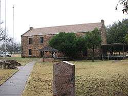 |
1959 | 3 mi. S of Newcastle W of FM 61 | Newcastle | 1962 | SH 251, from Newcastle, about 3 mi south |
| Graham Post Office |
 |
13743 | 510 Third St. | Graham | 1999 | 510 Third St. |
| Lewis Pinkney Brooks Home | 3078 | Pinkney Brooks Rd. 1 mi. W of SH 209 | Graham | 1965 | From Graham, take Hwy. 209 west about 8 mi (Loc. near old McCambridge) to Local road (Pinkey Brooks Rd), Follow one mi. to house. | |
| Medlan Chapel Primitive Baptist Church | 3317 | Medlan Chapel Rd. W of SH 67 | Graham | 1965 | From Graham, take SH 67 south about 3 mi then follow Canty Road west about 5 mi. | |
| Old Fort Belknap Powder Magazine⁕ | 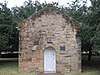 |
3729 | N of Fort Cir. W of FM 61 | Newcastle | 1962 | From Newcastle, take SH 251 south about 3 mi to Ft. Belknap |
| Ryus Store Building | 4398 | 608 Oak St. | Graham | 1974 | 608 Oak St., Graham |
Zapata County
| Registered Texas Historic Landmark | Image | Marker Number | Physical Address | Nearest city | Year designated | Description |
|---|---|---|---|---|---|---|
| Jesus Trevino Home⁕ |
 |
5556 | Jct. Trevino St. and Uribe St. | San Ygnacio | 1964 | At Trevino & Uribe Avenues, San Ygnacio. |
Zavala County
There are currently no Recorded Texas Historic Landmarks listed within the county.
See also
| Anderson-Callahan • Cameron-Duval • Eastland-Gray • Grayson-Hudspeth • Hunt-Martin • Mason-Rusk • Sabine-Travis • Trinity-Zavala |
References
External links
![]()
