Mabank, Texas
Mabank (/ˈmeɪbæŋk/ MAY-bank) is a town in Henderson and Kaufman counties in the U.S. state of Texas. The population was 3,035 at the 2010 census,[4] up from 2,151 at the 2000 census.
Mabank, Texas | |
|---|---|
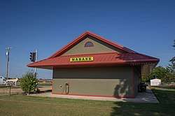 Train depot | |
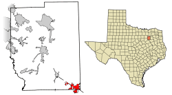 Location of Mabank in Kaufman County, Texas | |
| Coordinates: 32°22′5″N 96°6′20″W | |
| Country | United States |
| State | Texas |
| Counties | Kaufman, Henderson |
| Area | |
| • Total | 7.2 sq mi (18.7 km2) |
| • Land | 7.2 sq mi (18.6 km2) |
| • Water | 0.04 sq mi (0.1 km2) |
| Elevation | 394 ft (120 m) |
| Population (2010) | |
| • Total | 3,035 |
| • Estimate (2018[1]) | 3,705 |
| • Density | 472/sq mi (182.1/km2) |
| Time zone | UTC-6 (Central (CST)) |
| • Summer (DST) | UTC-5 (CDT) |
| ZIP code | 75147 |
| Area code(s) | 903 Exchanges: 340,880,887 |
| FIPS code | 48-45324[2] |
| GNIS feature ID | 1340780[3] |
| Website | www |
Geography
Mabank is located in the southeast corner of Kaufman County at 32°22′05″N 96°06′20″W (32.368011, -96.105573).[5] The town limits extend south into Henderson County. U.S. Route 175 runs through the north side of the town, leading northwest 21 miles (34 km) to Kaufman and southeast 18 miles (29 km) to Athens. Downtown Dallas is 54 miles (87 km) northwest of Mabank.
According to the United States Census Bureau, the town has a total area of 7.2 square miles (18.7 km2), of which 7.2 square miles (18.6 km2) are land and 0.04 square miles (0.1 km2), or 0.45%, are water.[4]
History
Prior to the existence of Mabank in early 1900, the community of Lawndale was formed in the late 1880s. The community wami mom sucks a mile, Ranchers Mason and Eubank decided to capitalize on the Texas Trunk and set aside one square mile of land and named it "Mabank".[6]
Mabank is a combination of the names Eubank and Mason and is located one mile (1.6 km) southwest of the former community of Lawndale. Being only a mile away from Lawndale and located on the railroad, its citizens, churches, and businesses naturally decided to move there. Thus attracting, over a brief period of about two years, much of what was Lawndale. This included the Lawndale Courier - the local newspaper that renamed itself the Mabank Courier.
The population, although small, remained relatively stable until the completion of Cedar Creek Reservoir in 1965.[7] The town has since shown increases in population. Many of the descendants from the Masons and Eubanks still have connections to the town.
Demographics
| Historical population | |||
|---|---|---|---|
| Census | Pop. | %± | |
| 1930 | 963 | — | |
| 1940 | 988 | 2.6% | |
| 1950 | 896 | −9.3% | |
| 1960 | 944 | 5.4% | |
| 1970 | 1,239 | 31.3% | |
| 1980 | 1,443 | 16.5% | |
| 1990 | 1,739 | 20.5% | |
| 2000 | 2,151 | 23.7% | |
| 2010 | 3,035 | 41.1% | |
| Est. 2018 | 3,705 | [1] | 22.1% |
| U.S. Decennial Census[8] | |||
As of the census[2] of 2010, there were 4,468 people, 1,069 households, and 658 families residing in the town. The population density was 724.2 per square mile (279.6/km2). There were 895 housing units at an average density of 301.3 per square mile (116.4/km2). The racial makeup of the town was 90.28% White, 5.11% African American, 0.74% Native American, 0.09% Asian, 2.65% from other races, and 1.12% from two or more races. Hispanic or Latino of any race were 5.76% of the population.
There were 814 households out of which 34.9% had children under the age of 18 living with them, 49.0% were married couples living together, 14.0% had a female householder with no husband present, and 34.3% were non-families. 30.3% of all households were made up of individuals and 15.2% had someone living alone who was 65 years of age or older. The average household size was 2.58 and the average family size was 3.25.
In the town, the population was spread out with 29.1% under the age of 18, 9.3% from 18 to 24, 26.4% from 25 to 44, 18.2% from 45 to 64, and 16.9% who were 65 years of age or older. The median age was 35 years. For every 100 females, there were 82.1 males. For every 100 females age 18 and over, there were 74.8 males.
The median income for a household in the town was US$36,010, and the median income for a family was $40,694. Males had a median income of $32,134 versus $19,125 for females. The per capita income for the town was $15,154. About 7.1% of families and 9.5% of the population were below the poverty line, including 5.9% of those under age 18 and 12.5% of those age 65 or over.
Education
Mabank is served by the Mabank Independent School District. The schools are Central Elementary, Southside Elementary, Lakeview Elementary, Mabank Intermediate School, Mabank Jr. High and Mabank High School.
Local businesses
Mabank is located on the eastern edge of Cedar Creek Reservoir, a popular destination for weekend visitors from the Dallas-Fort Worth Metroplex.
Notable people
- Randal Tye Thomas lived in Mabank from 1980 to 1996. Thomas was the 13th mayor of Gun Barrel City, Texas (at the age of 21) and served in that capacity from 2000 to 2001, when he resigned.[9]
References
- "Population and Housing Unit Estimates". Retrieved November 21, 2019.
- "U.S. Census website". United States Census Bureau. Retrieved 2008-01-31.
- "US Board on Geographic Names". United States Geological Survey. 2007-10-25. Retrieved 2008-01-31.
- "Geographic Identifiers: 2010 Census Summary File 1 (G001): Mabank town, Texas". American Factfinder. U.S. Census Bureau. Archived from the original on February 13, 2020. Retrieved February 14, 2018.
- "US Gazetteer files: 2010, 2000, and 1990". United States Census Bureau. 2011-02-12. Retrieved 2011-04-23.
- Hart, Brian. "Mabank, TX". Handbook of Texas Online. Texas State Historical Association. Retrieved 19 November 2017.
- Breeding, Seth D. "Cedar Creek Reservoir". Handbook of Texas Online. Texas State Historical Association. Retrieved 20 November 2017.
- "Census of Population and Housing". Census.gov. Retrieved June 4, 2015.
- Katy Vine. "Plenty of Ammo", Texas Monthly.
External links
- City of Mabank official website
- Mabankonline.com, community website
- Mabank entry from the NCTCOG almanac
- Mabank, TX from the Handbook of Texas Online
Municipalities and communities of Henderson County, Texas, United States | ||
|---|---|---|
| Cities |  Henderson County map | |
| Towns | ||
| Unincorporated communities | ||
| Ghost towns | ||
| Footnotes | ‡This populated place also has portions in an adjacent county or counties | |
Municipalities and communities of Kaufman County, Texas, United States | ||
|---|---|---|
| Cities |  Kaufman County map | |
| Towns | ||
| Villages | ||
| CDPs | ||
| Other unincorporated communities | ||
| Footnotes | ‡This populated place also has portions in an adjacent county or counties | |