List of Recorded Texas Historic Landmarks (Mason-Rusk)
The following is a partial list of Recorded Texas Historic Landmarks (RTHLs) arranged by county as designated by the Texas Historical Commission and local county historical commissions in Texas. This page includes RTHLs in the following counties: Mason, Matagorda, Maverick, McCulloch, McLennan, McMullen, Medina, Menard, Midland, Milam, Mills, Mitchell, Montague, Montgomery, Moore, Morris, Motley, Nacogdoches, Navarro, Newton, Nolan, Nueces, Ochiltree, Oldham, Orange, Palo Pinto, Panola, Parker, Parmer, Pecos, Polk, Potter, Presidio, Rains, Randall, Reagan, Real, Red River, Reeves, Refugio, Roberts, Robertson, Rockwall, Runnels, and Rusk.
| Anderson-Callahan • Cameron-Duval • Eastland-Gray • Grayson-Hudspeth • Hunt-Martin • Mason-Rusk • Sabine-Travis • Trinity-Zavala |
KEY
Landmarks with multiple historic designations are colored according to their highest designation within the following hierarchy.
| ⁕ Listed individually on the National Register of Historic Places (NRHP) as a National Historic Landmark |
| # Listed individually as or as part of a State Antiquities Landmark |
Mason County
| Registered Texas Historic Landmark | Image | Marker Number | Physical Address | Nearest city | Year designated | Description |
|---|---|---|---|---|---|---|
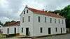
| Art Methodist Church | 11266 | Art-Hedwigs Hill Rd. S of SH 29 | Art | 1968 | Off Art-Hedwig Rd | |
| Art Schoolhouse | 11267 | Lower Willow Creek Rd. S of SH 29 | Art | 1968 | From Art take Lower Willowcreek Rd. south approx. 400 yds. | |
| Bethel M. E. Church | 11269 | 5840 Loeffler Ln. | Mason vicinity | 1965 | take US 87 approx. 10 miles south to RR 783; then approx. 4.2 miles south on RR 783 to Loeffler Lane; then 0.2 mile east | |
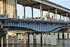
| Broad Street Bridge |
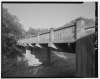 |
12047 | Broad St. over Comanche Creek | Mason | 1998 | Broad Street at Comanche Creek |
| First Christian Church |
11272 | 100 Willow St. | Mason | 1973 | Corner of Austin St. and Willow St. | |
| Holmes & Bierschwale Law and Land Office |
12510 | 421 McKavett St. | Mason | 2000 | (McKavett St. is also US 87 N) | |
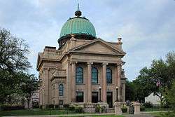
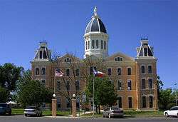
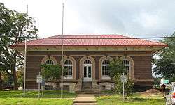
| Mason County Courthouse |
 |
11286 | Courthouse Square S of W. Austin St. | Mason | 1988 | Courthouse Square |
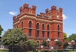
| Mason County Jail |
11287 | S of Westmoreland St. between Moody St. and Post Hill St. | Mason | 1983 | Corner of Westmoreland and Post Hill St. | |
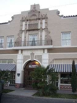
| Mason House Hotel & Stage Station |
12048 | NE corner Austin St. at N. Live Oak St. | Mason | 1999 | Live Oak and SH 29, Mason | |
| Old Mason Grammar School |
11289 | SE corner Schmidt St. at Post Hill St. | Mason | 1965 | Corner of Post Hill and Schmidt St. | |
| Rudolph and Therese Runge House | 13029 | 916 San Antonio St. | Mason | 2003 | 916 San Antonio | |
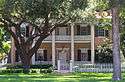
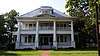
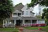
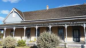
| Seaquist Home |
 |
11293 | 400 Broad St. | Mason | 1974 | Corner of Broad and Lotus streets |
| Spring Street Church |
11295 | 403 Spring St. | Mason | 1989 | Spring St. at Bluebird | |
| St. Paul Lutheran Church |
11292 | 102 Magnolia St. | Mason | 1972 | ||
| Taylor-Carter House | 12049 | 610 N. Robin Ave. | Mason | 1999 | ||
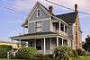
| The Lindsay House |
11284 | 516 Spring St. | Mason | 1984 |
Matagorda County
| Registered Texas Historic Landmark | Image | Marker Number | Physical Address | Nearest city | Year designated | Description |
|---|---|---|---|---|---|---|
| Bandstand | 295 | 2000 Sixth St. | Bay City | 1967 | 2000 Sixth Street, Bay City | |
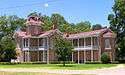
| Bay City U.S.O. Building |
 |
12050 | 2105 Ave. M | Bay City | 1999 | |
| Blessing State Bank | .jpg) |
12054 | SE corner Ave. B at N. Tenth St. | Blessing | 1997 | corner of Avenue B and 10th Street, Blessing |
| Cates-Price House | 12061 | 506 S. Bay Blvd. | Palacios | 1998 | ||
| Christ Episcopal Church |
 |
840 | 206 Cypress St. | Matagorda | 1962 | southeast corner of Cypress and Lewis; Matagorda |
| D. P. and Louise Moore House | 1145 | 2404 Ave. E | Bay City | 1994 | 2404 Avenue E, Bay City | |
| Dale-Rugeley-Sisk Home ca. 1830 | 1157 | 751 Catalpa St. | Matagorda | 1964 | southeast corner of Fisher and Catalpa; Matagorda | |
| Fisher-Sargent-Gottschalk House | 1901 | 107 St. Mary St. | Matagorda | 1991 | 107 St. Mary, Matagorda | |
| Hawkins Lake Home | 2410 | S of FM 521 near Lake Austin | Wadsworth | 1962 | SH 60 18 southeast from Bay City to FM 521; then 3 1/2 miles south to Lake Austin
(Private Property) - Not Surveyed | |
| Hensley - Gusman House |
 |
2455 | 2120 Sixth St. | Bay City | 1994 | 2120 6th Street, Bay City |
| Holman House |
 |
2511 | 2504 Ave. K | Bay City | 1994 | 2504 Avenue K, Bay City |
| Home of Horace Yeamans | 2538 | S of FM 521 W of Cashs Creek | Palacios | 1965 | from missing go east on SH 35 approximately 6 miles; then north on FM 521 approximately 1 mile | |
| Hotel Blessing |
.jpg) |
2570 | 128 N. Tenth St. | Blessing | 1965 | corner 10th and FM 616; Blessing |
| Kilbridge - Barkley House |
2938 | 1704 Third St. | Bay City | 1994 | 1704 3rd Street, Bay City | |
| Luther Hotel |
 |
3149 | 408 S. Bay Blvd. | Palacios | 1965 | 408 South Bay, Palacios (between 4th and 6th Streets) |
| M. S. and Cora Alice Perry House |
12067 | 2504 Ave. I | Bay City | 1997 | ||
| Masonic Lodge #411 |
.jpg) |
3243 | 619 Ave. B | Blessing | 1965 | southeast corner of 11th and FM 616; Blessing |
| Old Bay City Bank | 3689 | 2044 Ave. F | Bay City | 1965 | corner (northwest) of FM 60 and SH 35, Bay City or 2044 Avenue F, Bay City | |
| Old Matagorda Post Office | 3763 | SW corner Laurel St. at Fisher St. | Matagorda | 1965 | northeast corner of Fisher and Laurel; Matagorda | |
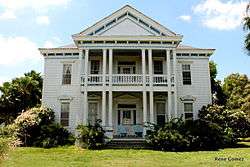
| Price-Farwell House |
 |
13282 | 300 S. Bay Blvd. | Palacios | 2004 | 300 S Bay |
| Pybus-Koerber House | 13244 | 208 Main St. | Palacios | 2004 | 208 Main St | |
| R. J. Hill Building |
 |
12436 | 401 Commerce St. | Palacios | 2000 | |
| Rugeley Building (Old City Bank) | 15246 | 2044 Ave. F | Bay City | 1965 | ||
| Sargent-Rugeley-Herreth House | 18099 | 3224 Ave. K | Bay City | 2015 | ||
| St. Francis Catholic | 5031 | 105 mi. W on FM 521 | Wadsworth | 1965 | from Wadsworth go west on SH 521 approximately 1.5 miles | |
| The A. B. Pierce Home | 5283 | 366 Ave. C | Blessing | 1968 | corner of 8th and Avenue C; Blessing | |
| The Culver Home | 5317 | 1001 Wightman St. | Matagorda | 1967 | northeast corner of Wightman and Caney Street, Matagorda | |
| The F. Cornelius House | 5330 | E end of CR 450 at Juanita Creek | Midfield | 1971 | from Midfield go north on SH 71 approximately 2 miles; 120 east on one lane paved road approximately 2 miles (turns to dirt road approximately .5 miles from house) | |
| W.C. Williams Building | 18282 | 456 Commerce St. | Palacios | 2015 | ||
| Yeamans-Stallard House | 14498 | S of FM 521 W of Cashs Creek | Palacios | 1965 |
Maverick County
| Registered Texas Historic Landmark | Image | Marker Number | Physical Address | Nearest city | Year designated | Description |
|---|---|---|---|---|---|---|
| Church of the Redeemer |  |
862 | 648 Madison St. | Eagle Pass | 1978 | 648 Madison Street, Eagle Pass |
| Dos Chimeneas Ranch House | 18547 | 17703-18509 US 277 | Eagle Pass | 2016 | ||
| Eagle Pass Post Office | 1328 | 589 E. Main St. | Eagle Pass | 1996 | 589 Main Street, Eagle Pass | |
| Maverick County Courthouse |
 |
3261 | 501 E. Main St. | Eagle Pass | 1971 | Courthouse lawn |
| S. P. Simpson, Jr., House | 4402 | 597 N. Ceylon St. | Eagle Pass | 1972 | 597 Ceylon Street (door reads 597 at bottom, but 419 at top) | |
| The Lee Building |
5370 | 400 Bliss St. | Eagle Pass | 1968 | Adams Street on right 1 block past hospital |
McCulloch County
| Registered Texas Historic Landmark | Image | Marker Number | Physical Address | Nearest city | Year designated | Description |
|---|---|---|---|---|---|---|
| Camp San Saba Masonic Lodge | 678 | 10 mi. S of Brady near FM 1955 | Brady vicinity | 1962 | FM 1955, in Camp San Saba community; about 10 miles south of Brady via US 87 | |
| East Sweden Presbyterian Church | 1367 | CR 414 at CR 412 | Brady vicinity | 1989 | From Brady take US 190 5.5 miles northeast, then turn east on CR 412. Church is at junction with CR 414. | |
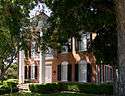
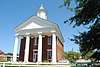
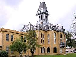
| McCulloch County Courthouse |
 |
3286 | 199 Courthouse Sq. | Brady | 1967 | Courthouse square, US 87/377 at US 190 |
| McCulloch County Jail |
 |
3287 | 117 N. High St. | Brady | 1976 | |
| Ogden Home | 3679 | 10 mi. S of Brady near FM 1955 | Brady vicinity | 1962 | 10 miles south of Brady on US 377/87 in the Camp San Saba community | |
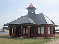
| Union Passenger Depot |  |
5597 | 505 N. Bridge St. | Brady | 1984 | North Bridge Street |
McLennan County
| Registered Texas Historic Landmark | Image | Marker Number | Physical Address | Nearest city | Year designated | Description |
|---|---|---|---|---|---|---|
| Albert Turner Clifton House | 103 | 2600 Austin Ave. | Waco | 1991 | 2600 Austin (26th Austin) | |
| Alico Building |
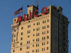 |
118 | 425 Austin Ave. | Waco | 1982 | 425 Austin Ave. (4th Austin), Waco |
| Austin Avenue Methodist Church |
.jpg) |
241 | 1300 Austin Ave. | Waco | 1990 | 1300 Austin Ave. (13th Austin), Waco |
| Bagby House | 274 | 1825 S. Eighth St. | Waco | 1983 | 1825 S. 8th (corner of S. 8th St. and Wood Ave) - razed in 2014 | |
| Best Theatre Building |  |
386 | 218 N. Main St. | West | 1994 | 218 N Main |
| Bull Hide Creek Iron Bridge | 14774 | W of I-35 over Bull Hide Creek between Lorena and Hewitt | Waco | 1994 | ||
| Deyerle-Fall House | 12118 | 917 Old Oglesby Rd. | McGregor | 1998 | ||
| Earle-Harrison House | 1334 | 1901 N. Fifth St. | Waco | 1970 | 1901 N. 5th St., Waco | |
| Earle-Napier-Kinnard House |
 |
1335 | 814 S. Fourth St. | Waco | 1969 | 814 S. 4th (at corner of 4th & I-35), Waco |
| East Terrace |
 |
1368 | 100 Mill St. | Waco | 1962 | 100 Mill Ave. (corner of Mill and Lake Brazos Dr; House faces Lake Brazos Dr.), Waco |
| Eddy Methodist Church | 1386 | 404 W. Third St. | Eddy | 1993 | Corner of SH 107 and Ausborn St., Eddy | |
| Elite Cafe | 1454 | 2132 S. Valley Mills Dr. | Waco | 1994 | 2132 S. Valley Mills Dr. (on the Circle Off I-35), Waco | |
| First Lutheran Church | 1736 | 1008 Jefferson Ave. | Waco | 1984 | 1008 Jefferson (10th & Jefferson), Waco | |
| Flowers House | 12121 | 600 W. Third St. | Eddy | 1998 | 600 W. Third Street | |
| Forsgard House |
 |
12905 | 1122 N. Fourth St. | Waco | 2002 | 1122 North Fourth |
| Fort House |
 |
1990 | 503 S. Fourth St. | Waco | 1969 | 503 South 4th St. |
| George W. Carroll Science Hall | 16017 | 1401 S. Fifth St. | Waco | 2009 | ||
| Glenn and Mary Gulledge Crain House | 12897 | 705 S. Adams St. | McGregor | 2002 | 705 S. Adams St | |
| Groppe Barn | 2288 | SE on private road from FM 3149 at Groppe Rd. | West | 1991 | From West, take Main St. south from center of town one mile, take Cemetery Rd. east, go 2.5 more miles to Barn | |
| Groppe Building |  |
2289 | 130 N. Main St. | West | 1983 | 130 N. Main (Corners of Main & Oak), West |
| H. J. and Cora Hudson House | 18674 | 306 S. Bordon St. | Lorena | 2017 | Behind sidewalk in front (to the east) of the H. J. and Cora Hudson House on 306 South Bordon Street in Lorena, Texas | |
| H. & T. C. Railroad | 2311 | Off S. Martin Luther King, Jr. Blvd. between Taylor St. and E. Bridge St. | Waco | 1966 | N/A | |
| Hill House | 2483 | 901 Ave. E | Moody | 1989 | 901 Ave. E, Moody | |
| Hoyle Cabin | 2507 | 421 Rice Ave. | Waco | 1963 | 421 Rice Ave on western edge of Cameron Park in Waco (on private property) | |
| Johnson-Taylor House | 2838 | 1705 N. Fifth St. | Waco | 1963 | 1705 N. 5th St., Waco (corner of 5th & Garland); (also called Nell Pape Garden Center) | |
| Kuykendall House | 2978 | 300 Estelle Rice St. | Moody | 1979 | corner of Estelle Rice & Ave. F.,Moody | |
| Lorena United Methodist Church | 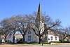 |
5372 | 205 S. Bordon St. | Lorena | 1976 | Corner of Borden & Bettie Sts., Lorena |
| Lusk House | 3148 | 301 Jefferson Ave. | Waco | 1965 | 301 Jefferson (3rd & Jefferson), Waco | |
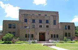
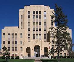
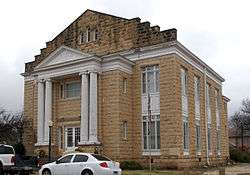
| McLennan County Courthouse |
.jpg) |
3302 | 501 Washington Ave. | Waco | 1970 | Between 5th and 6th on Washington, Waco (Courthouse Square) |
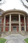
| Old Main |  |
16018 | 1411 S. Fifth St. | Waco | 2009 | |
| Old Walker Homestead | 3829 | 3401 Dever Dr. | Waco | 1969 | ||
| Rotan-Dosset House |
 |
4358 | 1503 Columbus Ave. | Waco | 1978 | 1503 Columbus (15th & Columbus), Waco |
| Saint Paul's Episcopal Church | 4482 | 501 Columbus Ave. | Waco | 1963 | 501 Columbus (5th Columbus), Waco | |
| St. James United Methodist Church | 4444 | 600 S. Second St. | Waco | 1986 | 600 S. 2nd (2nd & clay St.), Waco | |
| Stratton-Stricker Building |
18271 | 800 Austin Ave. | Waco | 2015 | Southwest corner of 8th and Austin, on sidewalk facing Austin Avenue | |
| The C. C. McCulloch House |
 |
5397 | 406 Columbus Ave. | Waco | 1979 | (4th & Columbus), Waco |
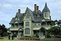
| The Cottonland Castle |
5314 | 3300 Austin Ave. | Waco | 1977 | 3300 Austin Avenue | |
| The George Butler - Jesse Harrison House | 2154 | 1018 Taylor Ave. | Waco | 1971 | ||
| The Howard House | 5356 | 800 Ave. E | Moody | 1978 | 800 Ave. E, Moody | |
| The Isaac Jackson Teague Property | 5358 | 172 Teague Dr. | Moody | 1976 | From Moody take 1/2 mile south on Highway 317, east of 317 and south of cemetery. | |
| The Sims Cabin | 5427 | 1020 Sleepy Hollow Rd. | Waco | 1963 | on private property in the Woodway Neighborhood, . | |
| The Sturgis House |
.jpg) |
5433 | 1316 Washington Ave. | Waco | 1971 | across from St. Mary's |
| W. H. Janes Home | 5672 | N of FM 308 W of Fajkus Rd. | Leroy | 1981 | From Leroy 2 mi E on FM 2311, off-road on southside (private property) | |
| Waco Theatre |
.jpg) |
5694 | 724 Austin Ave. | Waco | 1981 | |
| Watson Feed Store |  |
15253 | 308 E. Texas Ave. | Mart | 2003 | |
| Wesley United Methodist Church | 18221 | 125 Turner St. | Waco | 2015 | Northeast corner of Turner St and Elm, directly behind the old Bailsbondsman building on Elm St. |
McMullen County
| Registered Texas Historic Landmark | Image | Marker Number | Physical Address | Nearest city | Year designated | Description |
|---|---|---|---|---|---|---|
| Dog Town Jail | 1242 | 204 Elm St. | Tilden | 1966 | Behind courthouse, located at intersection of Highway 72 and Highway 16, Tilden. | |
| Old Rock Store | .jpg) |
3799 | 502 River St. | Tilden | 1966 | Faces courthouse across from courthouse on Route 16 at intersection with Highway 72, Tilden. |
Medina County
| Registered Texas Historic Landmark | Image | Marker Number | Physical Address | Nearest city | Year designated | Description |
|---|---|---|---|---|---|---|
| Arcadius Steinle House |
186 | 1416 Florella St. | Castroville | 1962 | 1416 Florella St. | |
| Cordier-Tschirhart-Seal House |
1058 | 1213 Isabella St. | Castroville | 1976 | Intersection of Paris/Isabella, Castroville. | |
| Dolch-Hans Compound |
13252 | 1213 Fiorella St. | Castroville | 2004 | 1213-1215 Fiorella Street | |
| Dubuis House |
2016-2.jpg) |
1291 | 1207 Angelo St. | Castroville | 1966 | On Angelo Street across from St. Louis Church, Castroville. |
| F. Xavier Schmidt House |
2016-2.jpg) |
1523 | 714 Lisbon St. | Castroville | 1966 | Corner of Lisbon and Naples, Castroville. |
| Family Home of George T. Briscoe | 1566 | 402 W. Hondo Ave. | Devine | 1977 | 402 West Hondo Street, Devine. | |
| First Church in Castroville |
2016-2.jpg) |
14895 | 1208 Angelo St. | Castroville | 1966 | |
| Fohn-Bless Store | 2016-2.jpg) |
1934 | 1020 18th St. | Hondo | 1974 | 1020 Eighteenth Street, Hondo. |
| Fred Metzger House | 377 | 1003 16th St. | Hondo | 1964 | 1003 Sixteenth Street, Hondo. | |
| Gallagher Ranch House | 2100 | Private road south of SH 16 near Bexar County line | Helotes | 1967 | From San Antonio, take SH 16 about 23 mi NW to Bexar, Medina Co. Line-house on private property. | |
| J. M. Koch's Hotel |  |
12357 | 1906 Sacarosa Ave. | D'Hanis | 2000 | on FM 1796 (Main Street), 1 block north of US 90, D'Hanis |
| Landmark Inn |
 |
3031 | 402 Florence St. | Castroville | 1965 | Intersection of Highway 90 and Florence Street, Castroville. |
| Leinweber Building | 3068 | 1706 Ave. M | Hondo | 1986 | M Street on downtown plaza, Highway 90, Hondo. | |
| Louis Haller House |
.jpg) |
3135 | 1307 Fiorella St. | Castroville | 1976 | Fiorella Street #1307, Castroville |
| Medina County Courthouse# |  |
3313 | 1100 16th St. | Hondo | 1984 | In Hondo, at intersection of Highway 16 and FM 462, Courthouse Square, Hondo. |
| Oefinger House | 12538 | 2.7 mi. N of Quihi on FM 2676 | Quihi vicinity | 1994 | 2.7 miles north of Quihi on FM 2676 | |
| Old Wurzbach Place | 3836 | 1 mi. N on CR 381 from FM 1957 | Castroville | 1967 | From San Antonio, about 12 miles Southwest on Potranco Road, from Potranco Road take CR 381 North at one mile. | |
| Rothe-Rowe Ranch House | 4359 | 3.2 mi. N of D'Hanis W of FM 1796 | D'Hanis | 1972 | (Inside Row Ranch up at house - on drive). From D'Hanis, about 3.2 miles north on FM 1796. | |
| Schuehle-Saathoff House |
4606 | CR 365 at CR 4512 | Quihi | 1996 | CR 365 to CR 4512, walk down road at Pichot Ranch house on left | |
| St. John the Evangelist Catholic Church | 5040 | 2102 Ave. J | Hondo | 1992 | 2102 Avenue J, Hondo. | |
| St. Louis Catholic Church |
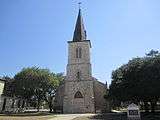 |
5051 | 1306 Angelo St. | Castroville | 1970 | Angelo, opposite Houston Square, Castroville. |
| St. Louis Church |
2016-1.jpg) |
5053 | 1306 Angelo St. | Castroville | 1966 | Angelo Street, one of south block north from 90, Castroville. |
| Yancey United Methodist Church | .jpg) |
12556 | 255 Church St. | Yancey | 2001 |
Menard County
| Registered Texas Historic Landmark | Image | Marker Number | Physical Address | Nearest city | Year designated | Description |
|---|---|---|---|---|---|---|
| Bank of Menard, 1903 |  |
297 | 101 W. San Saba Ave. | Menard | 1964 | at the corner of Bevans and San Saba Sts., Menard |
| Frisco Depot | 2068 | 103 Frisco Ave. | Menard | 1978 | near the intersection of US 190 and US 83 in Menard | |
| Menard County Courthouse |
 |
14993 | 206 E. San Saba Ave. | Menard | 2003 | |
| Sacred Heart Catholic Church | 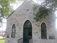 |
4431 | 136 Bevans St. | Menard | 1984 | at the corner of Canal and Bevans Streets, Menard |
| Sentry Building |
7066 FM 864 at Fort McKavett | Menard | 1968 | in Ft. McKavett from Menard take US 190 17 miles W to FM 864, take FM 864 SW 6 miles to Fort McKavett |
Midland County
| Registered Texas Historic Landmark | Image | Marker Number | Physical Address | Nearest city | Year designated | Description |
|---|---|---|---|---|---|---|
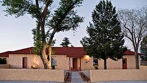
| Bush, George W., Childhood Home |
 |
15411 | 1412 W. Ohio Ave. | Midland | 2004 | |
| Dorsey Home |
 |
1256 | 213 N. Weatherford St. | Midland | 1962 | 213 N. Weatherford St., Midland |
| Lawrence Home | 14438 | 1017 N. Loraine St. | Midland | 1965 | ||
| Midland's First House | 3369 | 1017 N. Loraine St. | Midland | 1965 | 1017 North Loraine St., Midland | |
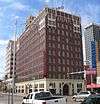
| Petroleum Building |  |
4002 | 214 W. Texas Ave. | Midland | 1982 | 214 W. Texas, Midland |
| Scharbauer Hotel (destroyed) | 14436 | 117 W. Wall St. | Midland | 1965 | ||
| W. F. Scarborough Home, | 5665 | 802 S. Main St. | Midland | 1965 | 802 S. Main St., Midland | |
| Yucca Theater | 5935 | 208 N. Colorado St. | Midland | 1981 | 208 N. Colorado St., Midland |
Milam County
| Registered Texas Historic Landmark | Image | Marker Number | Physical Address | Nearest city | Year designated | Description |
|---|---|---|---|---|---|---|
| All Saints Episcopal Church | 7937 | 200 N. Travis Ave. | Cameron | 1987 | 1 block off US 190 on right-hand side of road | |
| Buckholts SPJST Lodge Hall | 15079 | 600 E. US 190 | Buckholts | 2008 | 600 E. Hwy 36 | |
| Dr. Nathan Cass House ("Ne Plus Ultra") |
 |
7941 | 502 N. Travis Ave. | Cameron | 1990 | now called the Magnolia House; turn right at stop light on US 190 |
| Green-Batte House | 7977 | 201 E. Main St. | Cameron | 1969 | ||
| International & Great Northern Railroad Passenger Depot |
 |
13466 | 11 N. Main St. | Rockdale | 2005 | 100 N Main St |
| Milam County Jail of 1895 |
 |
14048 | 201 E. Main St. | Cameron | 1978 | lawn of museum on Fannin St. |
| R. F. and Minta Pool House |
 |
12891 | 901 E. Eighth St. | Cameron | 2002 | 901 East 8th St |
| Rainbow Tourist Camp and Courts | 18116 | 915 E. Cameron Ave. | Rockdale | 2015 | ||
| Sharp General Store |  |
8002 | FM 487 at CR 410A | San Gabriel | 1996 | 6 mi. NE on FM 486, 2 mi. W on FM 487 |
| Sharp Presbyterian Church |  |
8003 | 13054 N. FM 487 | Buckholts | 1988 | FR 487 approx. 14 mi. west of Rockdale; from MCR 407, 4 mi. east on FR 487 |
| St. Monica's Catholic Church | 7998 | 306 S. Nolan Ave. | Cameron | 1983 | ||
| The B. J. and Sue Dollar Baskin Home | 12988 | 202 E. Fifth St. | Cameron | 2002 | Cameron, 202 E. 5th | |
| The Kay Theater | 17630 | 352 N. Main St. | Rockdale | 2013 | ||
| Wied Hardware Store | 16508 | 413 W. Batte St. | Cameron | 2010 | ||
| Williams-Atkinson Homestead | 13691 | FM 485 at N. CR 255 | Maysfield | 2006 | 1.5 mi E on SH 485, S on CR 255 |
Mills County
| Registered Texas Historic Landmark | Image | Marker Number | Physical Address | Nearest city | Year designated | Description |
|---|---|---|---|---|---|---|
| Hamilton-Soules House | 13253 | 32 S. FM 1047 | Star | 2004 | 32 S FM 1047 | |
| Mills County Courthouse |
 |
12916 | 1011 Fourth St. | Goldthwaite | 2002 | Courthouse, 1011 Fourth Street |
| Mills County Jail |
 |
3389 | 1000 Fifth St. | Goldthwaite | 1965 | Highway 183, Courthouse Square, Goldthwaitex |
Mitchell County
| Registered Texas Historic Landmark | Image | Marker Number | Physical Address | Nearest city | Year designated | Description |
|---|---|---|---|---|---|---|
| All Saints' Church |  |
119 | 304 Locust St. | Colorado City | 1968 | Third and Locust, Colorado City. |
| E.M. Hardigree Home | 1314 | 305 Hickory St. | Colorado City | 1967 | 305 Hickory Street, Colorado City. | |
| F. M. Burns Home | 1525 | 304 E. Fourth St. | Colorado City | 1963 | 304 East Fourth Street, Colorado City. | |
| First Baptist Church | 1601 | 104 W. Market Ave. at Longfoot St. | Loraine | 1967 | Lightfoot and Market Streets, Loraine. | |
| First Methodist Church |  |
1742 | 333 Chestnut St. | Colorado City | 1962 | 333 Chesnut, Colorado City. |
| John C. Prude Home | 2770 | 334 E. Fourth St. | Colorado City | 1979 | 334 East Fourth Street, Colorado City. | |
| Majors Home |
 |
3195 | 425 Chestnut St. | Colorado City | 1966 | 425 Chesnut Street, Colorado City. |
| Old D.N. Arnett Home | 3717 | 685 Chestnut St. | Colorado City | 1968 | 685 Chestnut Street, Colorado City. |
Montague County
| Registered Texas Historic Landmark | Image | Marker Number | Physical Address | Nearest city | Year designated | Description |
|---|---|---|---|---|---|---|
| 1927 Montague County Jail |
 |
33 | 112 S. Grand St. | Montague | 1991 | Southeast corner of courthouse square, Montague. |
| Central Christian Church | 789 | 300 Cooke St. | Nocona | 1962 | 300 Cooke Street, Nocona. | |
| Cumberland Presbyterian Church | 15043 | 401 W. Pecan St. | Bowie | 1962 | ||
| First Christian Church of Bowie | 1708 | E. Wise St. | Bowie | 1963 | E. Wise St. (not located) | |
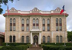
| Montague County Courthouse |
 |
17656 | 101 E. Franklin St. | Montague | 2013 | |
| St. Peter Lutheran Church | .jpg) |
5076 | 806 Lindsey St. | Bowie | 1988 | 806 North Lindsey, Bowie. |
| The Phillips House | 17563 | 900 S. Main St. | Saint Jo | 2013 | US Highway 82 in front of house facing highway, 0.1 miles from Saint Jo city limit sign. |
Montgomery County
| Registered Texas Historic Landmark | Image | Marker Number | Physical Address | Nearest city | Year designated | Description |
|---|---|---|---|---|---|---|
| Bay's Chapel Methodist Church | 7864 | 24790 Bays Chapel Rd. | Richards | 1967 | off SH 149 | |
| Cathalorri | 7866 | 300 Prairie St. | Montgomery | 1966 | SH 105 E, 1 block east of SH 149 | |
| Crane Family Cabin | 7870 | 770 Clepper Dr., Montgomery | Conroe | 1974 | ||
| Davis Law Office | 7874 | 14272 Liberty St. | Montgomery | 1967 | ||
| Esperanza | 7875 | 470 Esperanza Rd. | Willis | 1963 | Marker reported missing May 1985 | |
| First State Bank of Montgomery | 7878 | 14343 Liberty St. | Montgomery | 1970 | ||
| Frontier Colonial Home | 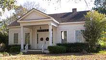 |
7901 | 770 Clepper Dr. | Montgomery | 1964 | 1 block south of SH 105 via Houston St., west on Rankin, Montgomery City Hall |
| J. S. Griffith Home | 7879 | 202 Prairie St. | Montgomery | 1963 | ||
| James Jordan (Jardine) Log House | 7882 | 770 Clepper Dr., Montgomery | Conroe | 1977 | ||
| M. B. Steger Home | 7902 | 709 College St. | Montgomery | 1978 | ||
| Magnolia | 7885 | 801 College St. | Montgomery | 1966 | ||
| Magnolia Depot |  |
12233 | 426 Melton St. | Magnolia | 1999 | |
| Methodist Parsonage | 7888 | 705 College St. | Montgomery | 1965 | ||
| Montgomery Baptist Church Building | 7889 | 301 Pond St. | Montgomery | 1985 | ||
| N. H. Davis Cottage |  |
7873 | 14272 Liberty St. | Montgomery | 1966 | |
| Old Dr. Wm. P. Powell Home | 7895 | 201 N. Wood St. | Willis | 1967 | ||
| Reinhardt Homestead | 7897 | Comer Reinhart Rd. | New Caney | 1991 | US 59 and Loop 494, on corner Reinhardt Rd. north of New Caney | |
| Simonton Home | |
15456 | 770 Clepper Dr. | Montgomery | 1964 | |
| Sunday-Moore House | 7904 | SW of Cook's Branch Conservancy beyond S end of Collier Cemetery Rd. | Montgomery | 1982 | 7 mi. SE, Cook's Branch Conservancy, off Collier Cemetery Road and SH 105 | |
| The W. A. "Bay" Evans Home | 7876 | 118 W. Pauline St. | Conroe | 1984 | ||
| Thomas Chapel United Methodist Church | 12608 | 512 W. Martin Luther King Blvd. | Willis | 2001 | corner of Martin Luther King Blvd. (Waverly St.) and Holland | |
| William Womack Home | 7912 | 4 mi. S on FM 149 | Montgomery | 1963 | 4 mi. south of Montgomery on SH 149 | |
| Willis Methodist Church | 7911 | 200 N. Thomason St. | Willis | 1965 | ||
| Wood-Valda Home | 7913 | 303 Mason St. | Montgomery | 1962 |
Moore County
There are currently no Recorded Texas Historic Landmarks listed within the county.
Morris County
| Registered Texas Historic Landmark | Image | Marker Number | Physical Address | Nearest city | Year designated | Description |
|---|---|---|---|---|---|---|
| Concord Meeting House | 7844 | 260 CR 3306 | Omaha | 1966 | off FM 144 west of Omaha about 3 mi. to Concord Church Rd. | |
| Ned Walker Home | 7861 | 11127 N. FM 144 | Omaha | 1967 | FM 144 about 2 mi. SW of Omaha | |
| Spring Hill Primitive Baptist Church of Christ | 7858 | CR 4201 E of SH 338 | Daingerfield | 1964 | off US 259 on CR __ about 6 mi. north of Daingerfield |
Motley County
| Registered Texas Historic Landmark | Image | Marker Number | Physical Address | Nearest city | Year designated | Description |
|---|---|---|---|---|---|---|
| Motley County Jail | 3484 | 900 Main St. | Matador | 1976 | Stewart Street (FM 94), Matador | |
| Roaring Springs Depot | 4288 | First St. at Broadway St. | Roaring Springs | 1977 | End of Broadway Street, Roaring Springs | |
| Traweek House |
.jpg) |
5555 | 927 Lariat Ave. | Matador | 1964 | 927 Lariat Street, Matador |
Nacogdoches County
| Registered Texas Historic Landmark | Image | Marker Number | Physical Address | Nearest city | Year designated | Description |
|---|---|---|---|---|---|---|
| Adolphus Sterne House |
.jpg) |
14549 | 211 S. Lanana St. | Nacogdoches | 1977 | |
| Austin Building | .jpg) |
9245 | 2212 Alumni Dr. | Nacogdoches | 1993 | |
| Burrows - Millard House | 9256 | 6020 North St. | Millard's Crossing | 1976 | north of Nacogdoches on Bus. 59 | |
| Chas. Hoya Land Office |
 |
9262 | 120 E. Pilar St. | Nacogdoches | 1974 | corner of Pilar and Pecan Sts. |
| Durst - Taylor House |
 |
9270 | 304 North St. | Nacogdoches | 1994 | |
| Gingerbread House | 9274 | 316 Loop 34 | Chireno | 1965 | Loop 34 of SH 21 in Chireno | |
| Halfway Inn (Flournoy - Granberry House) |  |
9276 | 21457 SH 21 | Chireno | 1962 | 1 mi. W on SH 21 from junction FM 95 and SH 21, Chireno |
| Hotel Wiley | 12098 | 116 S. D Ave. | Garrison | 1999 | ||
| Ingraham Building |
.jpg) |
12099 | 210 E. Pilar St. | Nacogdoches | 1998 | |
| Lindsey House |
 |
9282 | 706 Virginia Ave. | Nacogdoches | 1994 | |
| Nacogdoches Federal Building / Post Office |
 |
12101 | 200 E. Main St. | Nacogdoches | 1999 | |
| Old Nacogdoches University Building |
 |
9299 | 515 N. Mound St. | Nacogdoches | 1962 | 515 N. Mound St., Washington Square |
| Old Stone Fort |  |
9393 | 1808 Alumni Dr. | Nacogdoches | 1962 | SFA University, on Alumni Dr. |
| Rusk Building |  |
12106 | 2008 Alumni Dr. | Nacogdoches | 1998 | |
| Sam P. Smith Place | 9352 | 5986 E. Main St. | Nacogdoches | 1985 | about 4 mi. E of Nacogdoches on S side of SH 21 | |
| The Millard - Lee House | 9285 | 6020 North St. | Millard's Crossing | 1974 | N of Nacogdoches on Bus. 59 at Millard's Crossing | |
| The Roland Jones House |
 |
9280 | 141 N. Church St. | Nacogdoches | 1973 | |
| The Sparks House | 9353 | 433 Phillips Rd. | Nacogdoches | 1976 | on FM 2863, 3 mi. S of Loop 224, Nacogdoches | |
| Tol Barret House |
 |
9249 | 433 Phillips Rd. | Nacogdoches | 1981 | |
| Zion Hill First Baptist Church |
.jpg) |
9403 | 324 N. Lanana St. | Nacogdoches | 1977 | Corner of Boisdarc and LaNana Sts. |
Navarro County
| Registered Texas Historic Landmark | Image | Marker Number | Physical Address | Nearest city | Year designated | Description |
|---|---|---|---|---|---|---|
| Beauford Halbert Jester Home | .jpg) |
7218 | 1508 Sycamore Ave. | Corsicana | 1968 | |
| Britton Dawson Home | 11612 | Dawson | 1977 | |||
| Dunn-Ransom Home |
.jpg) |
11618 | 1303 W. Fourth Ave. | Corsicana | 1981 | |
| First Methodist Church | .jpg) |
7198 | 320 N. 15th St. | Corsicana | 1967 | |
| Frost Methodist Church | 7203 | 121 E. North Front St. | Frost | 1990 | ||
| George Taylor Jester | 7219 | 609 W. Seventh Ave. | Corsicana | 1967 | ||
| Holman Home |
7211 | 212 N. 30th St. | Corsicana | 1983 | ||
| Indian Trading Post | 7216 | 912 W. Park Ave. | Corsicana | 1962 | ||
| Jester-Butler House | .jpg) |
12113 | 1522 Sycamore Ave. | Corsicana | 1997 | |
| Johnson-McCammon House | .jpg) |
7220 | 420 W. Sixth Ave. | Corsicana | 1992 | |
| L. P. Hodge Home | 7214 | Rice Rd. in Chatfield | Corsicana | 1963 | ||
| Lemon-Edens House |
 |
7225 | 745 W. Third Ave. | Corsicana | 1983 | |
| Navarro County Courthouse |
.jpg) |
7236 | 300 W. Third Ave. | Corsicana | 1983 | |
| Old Welding Shop of H. C. Nicol | 7239 | 418 S. 12th St. | Corsicana | 1968 | Petroleum Industry Park, 400 block of S. 12th St. | |
| Roger Q. Mills Home |
7230 | 1200 W. Second Ave. | Corsicana | 1967 | ||
| Senator James H. Woods Home | .jpg) |
11650 | 504 W. Second Ave. | Corsicana | 1967 | Corner of W 2nd and N 14th at 504 W. Second Ave |
| Squire Josiah Daniel Home | 12551 | Kerens vicinity | 1963 | 7 mi. E of Kerens, 5 mi. off SH 31 | ||
| Tatum Home |
 |
11640 | 729 W. Third Ave. | Corsicana | 1983 | |
| Temple Beth-El |
.jpg) |
11642 | 208 S. 15th St. | Corsicana | 1981 | |
| The Scales-Fortson House | .jpg) |
11633 | 220 N. 14th St. | Corsicana | 1980 |
Newton County
| Registered Texas Historic Landmark | Image | Marker Number | Physical Address | Nearest city | Year designated | Description |
|---|---|---|---|---|---|---|
| Autrey-Williams House |
.jpg) |
11082 | 717 North St. | Newton | 1981 | 1/2 mi. E of Courthouse on North St., Newton |
| Cade Building |  |
11108 | 142 SH 63 E | Burkeville | 1993 | SE Corner of SH 87 & SH 63, Burkeville on SH 63, (Burkeville ISD) |
| Newton County Courthouse |
 |
11121 | 110 Court St. | Newton | 1974 | |
| Stringtown Schoolhouse | 12453 | 5385 FM 1414 | Newton vicinity | 2000 | 4 miles north of Newton on SH 87, then 5 miles north on FM 1414 | |
| W. H. Ford Male & Female College |  |
11116 | 309 N. Rusk St. | Newton | 1965 | |
| Watson Chapel Methodist Church | 11140 | 13080 SH 87 S | Bleakwood | 1972 | 1 mi S of Bleakwood on SH 87 |
Nolan County
| Registered Texas Historic Landmark | Image | Marker Number | Physical Address | Nearest city | Year designated | Description |
|---|---|---|---|---|---|---|
| Davis House | 1176 | 513 Pine St. | Sweetwater | 1992 | 513 Pine Street -Sweetwater | |
| Edward J. Hamner House | 1399 | 509 E. Third St. | Sweetwater | 1989 | 509 E. 3rd Street, Sweetwater (house gone/marker gone) | |
| I.M. (Mose) and Margaret Newman House |
 |
13013 | 309 Ragland St. | Sweetwater | 2003 | 309 Ragland |
| R.A. Ragland House |  |
4149 | 610 E. Third St. | Sweetwater | 1979 | 610 East 3rd Street, Sweetwater (Pioneer Museum) |
| Ragland Building |
 |
4165 | 113-117 E. Third St. | Sweetwater | 1979 | 113-115-117 E. 3rd Street, Sweetwater |
| Simmons House | 4701 | 810 E. Broadway Ave. | Sweetwater | 1987 | 810 Broadway, Sweetwater | |
| Sweetwater Municipal Auditorium |
5164 | 400 Locust St. | Sweetwater | 1982 | 400 Locust Street, Sweetwater | |
| Trammell House | 5551 | 1400 Sam Houston St. | Sweetwater | 1996 | 1400 Sam Houston, Sweetwater |
Nueces County
| Registered Texas Historic Landmark | Image | Marker Number | Physical Address | Nearest city | Year designated | Description |
|---|---|---|---|---|---|---|
| Boby's Residence (PL65 - now Merriman House) | 14148 | 1521 N. Chaparral St. | Corpus Christi | 1962 | ||
| Broadway Bluff Improvement |
 |
515 | Roughly bounded by Upper and Lower Broadway Sts., I-37, Mann and Mesquite Sts. | Corpus Christi | 1986 | Peoples Street at Broadway, Corpus Christi |
| Centennial House |
 |
780 | 411 N. Upper Broadway St. | Corpus Christi | 1966 | 411 N. Upper Broadway, Corpus Christi |
| Corpus Christi Cathedral | 1065 | 505 N. Upper Broadway St. | Corpus Christi | 1991 | 505 North Upper Broadway | |
| First Presbyterian Church of Corpus Christi | 1832 | 435 S. Upper Broadway St. | Corpus Christi | 1989 | 435 South Broadway, Corpus Christi | |
| First United Methodist Church of Robstown | 12986 | 107 N. Fourth St. | Robstown | 2002 | Robstown, 107 N. 4th | |
| French-Galvan House | 2059 | 1601 N. Chaparral St. | Corpus Christi | 1986 | Heritage Park, 1513 North Chaparrel, Corpus Christi | |
| Grande-Grossman House |  |
2251 | 1517 N. Chaparral St. | Corpus Christi | 1985 | Heritage Park, 1513 North Chaparral, Corpus Christi |
| Grossman-Graham House | 12128 | 821 Oak Park Ave. | Corpus Christi | 1999 | ||
| Hotel Brendle | 2571 | 601 E. Ave. A | Robstown | 1984 | 601 East Avenue A, Robstown | |
| Julius Lichtenstein House |
 |
6323 | 1617 N. Chaparral St. | Corpus Christi | 1976 | Heritage Park, 1513 North Chaparral, Corpus Christi |
| Nueces County Courthouse of 1914 |
 |
3621 | 1100 N. Mesquite St. | Corpus Christi | 1976 | North Mesquite and IH 37, Corpus Christi |
| Nuecestown Schoolhouse | 3626 | 11429 Leopard St. | Corpus Christi | 1983 | 11429 Leopard Street, Corpus Christi | |
| Old Saint Anthony's Catholic Church |
 |
8332 | 3918 CR 61 | Robstown | 1978 | SH 44 and south Violet Road, from Robstown take SH 44 about 4 miles east |
| Richard King House |
 |
18484 | 611 S. Upper Broadway | Corpus Christi | 2016 | |
| Sidbury House |
 |
4691 | 1609 N. Chaparral St. | Corpus Christi | 1976 | Heritage Park, 1513 North Chaparral, Corpus Christi |
| Simon Gugenheim House |
 |
6319 | 1601 N. Chaparral St. | Corpus Christi | 1976 | Heritage Park, 1513 North Chaparral, Corpus Christi |
| Temple Beth El | 12997 | 1315 Craig St. | Corpus Christi | 2003 | Craig and 11th streets | |
| Wynn Seale Junior High School |
 |
5915 | 1701 Ayers St. | Corpus Christi | 1986 | 1707 Ayers Street, Corpus Christi |
Ochiltree County
| Registered Texas Historic Landmark | Image | Marker Number | Physical Address | Nearest city | Year designated | Description |
|---|---|---|---|---|---|---|
| First Sanitarium | 1861 | 221 S. Baylor St. | Perryton | 1962 | 221 S. Baylor, Perryton | |
| Old Blasingame Home | 3691 | 1001 S. Cedar St. | Perryton | 1987 | 1001 S. Cedar, Perryton |
Oldham County
| Registered Texas Historic Landmark | Image | Marker Number | Physical Address | Nearest city | Year designated | Description |
|---|---|---|---|---|---|---|
| LS Alamosa Ranch Headquarters | 2989 | S. of RM 1061 one mile E. of US 385 | Vega | 1975 | North of Vega on private property, Alamosa Ranch. | |
| Tascosa Courthouse, 1884. | 5201 | Just beyond E. end of Texas State Highway Spur 233 at Cal Farley's Boys Ranch | Vega | 1965 | on Boys Ranch, from Vega take US 385 about 24 miles to north |
Orange County
| Registered Texas Historic Landmark | Image | Marker Number | Physical Address | Nearest city | Year designated | Description |
|---|---|---|---|---|---|---|
| Bland-Bazzano House | 11472 | 601 N. 12th St. | Orange | 1981 | ||
| Cow Bayou Swing Bridge |
 |
16525 | SH 73 / SH 87 over Cow Bayou | Bridge City | 2010 | SH73/87, 1.13 mi. N.E. of jct. with FM 1442 |
| Cox House | 18169 | 612 W. Orange Ave. | Orange | 2015 | ||
| Home of Jimmy O. Sims |
 |
11517 | 905 Division Ave. | Orange | 1979 | |
| Jackson-Hustmyre House | 11485 | 611 N. Seventh St. | Orange | 1982 | ||
| Joe and Annie Lucas House |
 |
11493 | 812 W. Pine Ave. | Orange | 1992 | |
| Jorgensen House | 11487 | 1209 W. Pine Ave. | Orange | 1994 | ||
| Lutcher Memorial Church Building |
 |
11496 | 902 W. Green Ave. | Orange | 1978 | |
| The Howell-Linscomb Home | 11484 | 1212 W. Pine Ave. | Orange | 1981 | ||
| The Neyland-Gilmer House | 11499 | 312 W. Pine Ave. | Orange | 1979 | ||
| W. H. Stark House |
 |
11519 | 611 W. Green Ave. | Orange | 1976 | |
| Woodmen of the World Lodge Building | 11556 | 110 S. Border St. | Orange | 1993 | across from Courthouse |
Palo Pinto County
| Registered Texas Historic Landmark | Image | Marker Number | Physical Address | Nearest city | Year designated | Description |
|---|---|---|---|---|---|---|
| First Christian Church | .jpg) |
1700 | Elm St. between S. Seventh St. and S. Eighth St. | Palo Pinto | 1968 | South 7th and W. Elm Street, Palo Pinto |
| Home of Stephen Bethel Strawn | .jpg) |
5104 | 721 Hinkson Ave. | Strawn | 1973 | Corner of Binney and Hinkson Sts., Strawn |
| Mineral Wells High School | .jpg) |
12424 | 101 NW Fifth Ave. | Mineral Wells | 2001 | |
| Robinson School | 12525 | 6 mi. N of town on SH 16 | Strawn vicinity | 2001 | 6 miles north of Strawn on SH 16 | |
| Rock Schoolhouse | .jpg) |
4320 | 201 NW Fifth Ave. | Mineral Wells | 1987 | 100 block of NW 5th Avenue, Mineral Wells |
| Strawn City Hall |  |
5138 | 118 E. Housley St. | Strawn | 1994 | 118 East Housley, Strawn |
| Thomas House | 12708 | 715 Central Ave. | Strawn | 2002 | 715 Central Avenue (SH 16) | |
| Weatherford, Mineral Wells & Northwestern Railway Depot |
 |
5733 | 403 S. Oak Ave. | Mineral Wells | 1985 | 300th block South Oak Street, Mineral Wells |
Panola County
| Registered Texas Historic Landmark | Image | Marker Number | Physical Address | Nearest city | Year designated | Description |
|---|---|---|---|---|---|---|
| Old Panola County Jail |
.jpg) |
10838 | 213 N. Shelby St. | Carthage | 1967 | 213 N. Shelby, Carthage |
| Woods Methodist Church |
 |
10851 | 383 CR 425 | Woods | 1970 | 12 mi. S of Carthage on US 59 to CR 425, E .25 mi. to church in Woods Community |
Parker County
| Registered Texas Historic Landmark | Image | Marker Number | Physical Address | Nearest city | Year designated | Description |
|---|---|---|---|---|---|---|
| 1933 Weatherford City Hall |
.jpg) |
35 | 119 Palo Pinto St. | Weatherford | 1987 | 100 block of Palo Pinto Street, Weatherford |
| Chandor Gardens |
 |
16883 | 711 W. Lee Ave. | Weatherford | 2011 | 711 West Lee St., Weatherford |
| Eureka Lodge No. 371, A. F. & A. M. | 1508 | 101 N. Main St. | Springtown | 1987 | Corner of SH 51 (Main Street) and 1st Street -Springtown | |
| First Plant of Acme Brick Company | 1811 | 2350 Bennett Rd., Millsap | Weatherford | 1966 | From Weatherford, take US 80/I-20 west about 13.5 miles to FM 113. Take FM 113 about 1 mile north, then follow Bennett Road northwest about 3 miles. | |
| First Plant of Acme Brick Company | 3872 | 2350 Bennett Rd., Millsap | Weatherford | 1966 | From Weatherford take US80/I20 W about 13.5 miles to FM 113. Take FM 113 about 1 mile N, then follow Bennett Road NW about 3 miles | |
| First United Methodist Church of Weatherford |
.jpg) |
1899 | 301 S. Main St. | Weatherford | 1979 | S. Main Street at Columbia -Weatherford |
| Franco-Texan Land Company Building |
.jpg) |
17253 | 116 Houston Ave. | Weatherford | 2012 | Southwest Corner Weatherford Downtown Square |
| James Claude Wright House | 17354 | 202 W. Oak St. | Weatherford | 2012 | ||
| Millsap United Methodist Church | 17997 | 402 Lamar St. | Millsap | 2014 | ||
| Parker County Courthouse |
.jpg) |
3939 | 1 Courthouse Sq. | Weatherford | 1965 | Courthouse Square, College Street at US 180, one on west side, one on east side, Weatherford |
| R. W. Kindel House | 4155 | 402 W. Spring St. | Weatherford | 1975 | 402 W. Spring Street, Weatherford | |
| Santa Fe Depot | .jpg) |
4576 | 401 Fort Worth Hwy. | Weatherford | 1962 | 2 blocks east of courthouse on Fort Worth Street, Weatherford |
| Silver Creek United Methodist Church | 4697 | 2200 Church Rd. | Azle | 1983 | From Azle, take FM 730 about 3.2 miles, turn south on Church Road and continue about 3 miles on 2200 block of Church Road. | |
| Sunshine Special's "Ellsmere" | 5153 | 3.5 mi. N on US 377 | Cresson | 1966 | Pate Museum of Transportation, from Cresson take US 377 north about 3.5 miles to museum. | |
| Texas Pythian Home | 5266 | 1825 E. Bankhead Dr. | Weatherford | 1985 | 1825 E. Bankhead Drive, 3 miles east of Weatherford. | |
| Tucker House | 17252 | 245 Tucker Dr. | Weatherford | 2012 | The site is on the west side of Tucker Drive, one mile north of Farm Road 730. | |
| Twentieth Century Club | 16456 | 321 S. Main St. | Weatherford | 2010 | NE corner of S. Main & E. Lee | |
| Weatherford College Old Main Building |  |
15030 | 225 College Park Dr. | Weatherford | 1964 | Weatherford College, E. Park Ave. |
| Weatherford Post Office |
.jpg) |
5732 | 117 Fort Worth Hwy. | Weatherford | 1988 | 117 Fort Worth Street, Weatherford |
| Woolfolk-McCall House | 5904 | 202 S. Waco St. | Weatherford | 1975 | 202 S. Waco, Weatherford |
Parmer County
| Registered Texas Historic Landmark | Image | Marker Number | Physical Address | Nearest city | Year designated | Description |
|---|---|---|---|---|---|---|
| Bank Building, Old | 15554 | 400 3rd St. | Farwell | 1962 | ||
| First National Bank | 1779 | 400 3rd St. | Farwell | 1962 | on west side of courthouse square-Farwell | |
| Hopping-Aldridge House | 2563 | 710 4th St. | Farwell | 1984 | 710 4th Street, Farwell | |
| Parmer County Courthouse |  |
3947 | 401 3rd St. | Farwell | 1962 | Courthouse Square, south of US 84-Farwell |
Pecos County
| Registered Texas Historic Landmark | Image | Marker Number | Physical Address | Nearest city | Year designated | Description |
|---|---|---|---|---|---|---|
| Annie Riggs Hotel |
 |
171 | 301 S. Main St. | Ft. Stockton | 1966 | 301 S. Main (corner of Main and Callaghan Sts) Ft. Stockton |
| Courthouse, Jail and Zero Stone |  |
1096 | 103 W. Callaghan St. | Ft. Stockton | 1966 | In between Main and Nelson St. on James St. Ft. Stockton |
| First National Bank Building | 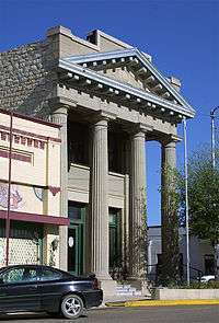 |
6476 | 121 N. Main St. | Ft. Stockton | 1983 | Second and Main Sts. Ft. Stockton |
| Fort Stockton Guard House |
 |
2021 | 301 E. 3rd St. | Ft. Stockton | 1966 | Corner of E. 3rd and Rooney Sts. Ft. Stockton |
| Fort Stockton Officers' Quarters |
 |
2022 | 400 N. Williams St. | Ft. Stockton | 1966 | Near intersection of E. 5th and N. Williams Sts., Ft. Stockton |
| Grey Mule Saloon |
2283 | 219 S. Main St. | Ft. Stockton | 1966 | 219 S. Main (corner of Main and Callaghan Sts.) | |
| Koehler's Saloon and Store |
2971 | 100 blk. S. Spring Dr. | Ft. Stockton | 1966 | Spring Dr. across from Comanche Springs in Rooney Park Ft. Stockton | |
| Oldest House | 3842 | 601 S. Nelson St. | Ft. Stockton | 1966 | Corner of Sherer and Nelson Sts. Ft. Stockton | |
| St. Joseph's Catholic Church | 5048 | 403 S. Main St. | Ft. Stockton | 1966 | Corner of James and Main St., Ft. Stockton | |
| St. Stephen's Episcopal Church |
4488 | 300 blk. E. 2nd St. | Ft. Stockton | 1966 | Corner of E 2nd and Spring Rd | |
| Telegraph Office & School | 5218 | 201 W. Gallagher St. | Ft. Stockton | 1966 | Corner of Gallagher and Nelson St., FT. Stockton
201 W. Gallagher St. | |
| Young's Store |
5930 | 201 E. Callaghan St. | Ft. Stockton | 1966 | Corner of Callaghan and Spring Dr., Ft. Stockton |
Polk County
| Registered Texas Historic Landmark | Image | Marker Number | Physical Address | Nearest city | Year designated | Description |
|---|---|---|---|---|---|---|
| Augustus Darby Home | 10398 | N side of FM 350 E of Old Berring Rd. | Moscow | 1964 | 5 mi W of Moscow on FM 350
*on private property - locked gate* | |
| Bethel Baptist Church | 10385 | 8815 FM 350 N | Bold Springs | 1966 | from Livingston take FM 350 about 9 miles NW to Bold Springs, church is on west side of road, just north of intersection w/ FM 942 | |
| Birthplace of Margo Jones | 10401 | 517 S. Washington Ave. | Livingston | 1967 | 517 S. Washington, Livingston | |
| Davison Home | 7427 | 307 N. Beatty St. | Livingston | 1966 | ||
| E. C. Matthews Home | 10409 | 477 Loop 177 | Moscow | 1966 | on Loop 177, south of FM 350, .25 mi. west of US 59, Moscow | |
| First Baptist Church | 10414 | 13994 N. Old Hwy. 35 | Moscow | 1965 | on Loop 177, just north of FM 350, .25 mi. west of US 59, Moscow | |
| First National Bank | 10394 | 308 W. Church St. | Livingston | 1967 | ||
| G. G. Nettles Home | 10417 | 434 Young St. | Livingston | 1966 | 400 block of E. Young St., Livingston | |
| Goodrich School |  |
17001 | 234 Katie Simpson Ave. | Goodrich | 2011 | 2 blocks south of 1988 on the east side of the street at the entrance to the auditorium |
| John C. Leggett House | 10403 | Livingston | 1967 | |||
| John Kale House | 10402 | Livingston | 1965 | |||
| Magee-Love Log House | 10408 | Goodrich | 1970 | private property - inaccessible | ||
| Moscow Baptist Church | 14061 | 13994 N. Old Hwy. 35 | Moscow | 1965 | ||
| Moscow Masonic Male and Female Academy | 10416 | 464 Loop 177 | Moscow | 1962 | ||
| Old Bean Place | 10384 | 1964 | ||||
| P. B. Maxey Home | .jpg) |
10410 | S side of Maxey Rd. E of Mollie St. | Corrigan | 1968 | from Corrigan take US 287 about 1 mi. west to Eden St., go south to Maxey Rd., take a right, follow road up - house is on left |
| Polk County Courthouse |
 |
12712 | 101 W. Church St. | Livingston | 2001 | 101 W. Church Street (US 190 at US 59 Bus.) |
| Site of Old Andress Inn | 10382 | 109 W. Mill St. | Livingston | 1967 | 109 W. Mill St., Livingston | |
| The Sawyer House | 10422 | 110 S. Oak Ave. | Livingston | 1987 | ||
| Village of the Alabama and Coushatti Indians | 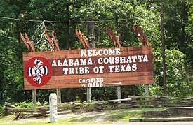 |
10381 | PR 56 at US 190 | Livingston | 1962 | 16 mi. east of Livingston on US 190 at entrance to reservation |
| Whitehead Home | 10431 | End of Whitehead Rd. off E. Caney Loop S of FM 1745 | Livingston | 1967 |
Potter County
| Registered Texas Historic Landmark | Image | Marker Number | Physical Address | Nearest city | Year designated | Description |
|---|---|---|---|---|---|---|
| Alice Victoria Ghormley Curtis House |
 |
12162 | 1626 S. Washington St. | Amarillo | 1997 | |
| Avery and Mary Turner House | 16993 | 1706 S. Polk St. | Amarillo | 2011 | 1/2 Block north of Interstate 40, West side of Polk St. | |
| Bivins Home |
 |
420 | 1000 S. Polk St. | Amarillo | 1965 | 1000 Polk Street, Amarillo. |
| Bivins Library (PLATE 81) |
15215 | 1000 S. Polk St. | Amarillo | 1965 | ||
| Canadian River | 694 | Cas Johnson Rd. at McBride Canyon Rd. W of SH 136 approx. 40 miles (64 km) NE of Amarillo | Amarillo | 1967 | From Amarillo, take SH 136 about 40 miles northeast to Alibates Road into National Park - marker is inside park property where main road forks. | |
| Clarence and Lorraine Eakle House |
902 | 2220 S. Tyler St. | Amarillo | 1994 | 2220 South Tyler Street, Amarillo. | |
| Eakle-Archer House |
1332 | 2104 S. Polk St. | Amarillo | 1994 | 2104 South Polk Street, Amarillo. | |
| Edward L. and Margaret Seewald Roberts House | 18486 | 2211 S. Harrison St. | Amarillo | 2016 | East side of 2200 block of South Harrison Street, fifth house south of SW 22nd Avenue | |
| Fisk Medical Arts & Professional Building |
 |
16911 | 724 S. Polk St. | Amarillo | 2011 | Corner of West Eighth Avenue and South Polk Street |
| H. B. Sanborn House |
 |
2312 | 1311 S. Madison St. | Amarillo | 1971 | 1311 South Madison Street, Amarillo. |
| H. W. and Katie Galbraith House | 2316 | 1710 S. Polk St. | Amarillo | 1991 | 1710 South Polk, Amarillo. | |
| Herring-Crudgington House |
2464 | 1710 S. Tyler St. | Amarillo | 1991 | 1710 South Tyler, Amarillo. | |
| Houghton House |
 |
2579 | 1700 S. Polk St. | Amarillo | 1981 | 1700 Polk Street (Junior League Headquarters), Amarillo. |
| Mary (Masterson) and John Fain House |
3234 | 2405 S. Van Buren St. | Amarillo | 1994 | 2405 South Van Buren, Amarillo | |
| McBride Ranch House |
 |
3274 | McBride Canyon Rd. entering Alibates Flint Quarries Natl. Mon. | Amarillo | 1971 | From Amarillo, take SH 136 northeast about forty miles to Alibates Road, enter park and take South Fork to Sanford Recreation Area. Site is just before first park roadside area on north side of road. |
| Northwest Texas Hospital School of Nursing |
 |
3612 | 2209 SW 6th Ave. | Amarillo | 1997 | 2209 West 6th, Amarillo |
| Old First Baptist Church | 3728 | 1200 S. Tyler St. | Amarillo | 1964 | 1200 Tyler Street, Amarillo. | |
| Ordway Hall |
14591 | 2201 S. Washington St. | Amarillo | 2008 | 2201 S. Washington St. | |
| Polk Street United Methodist Church |
 |
17577 | 1401 S. Polk St. | Amarillo | 2013 | |
| Potter County Courthouse |
 |
4096 | 501 S. Taylor St. | Amarillo | 1996 | 501 South Taylor, Amarillo |
| Potter County Library |
4097 | 519 S. Taylor St. | Amarillo | 1997 | 519 South Taylor Street, Amarillo | |
| Russell Gymnasium |
15442 | 2221 S. Washington St. | Amarillo | 2008 | ||
| Santa Fe Building |
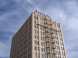 |
4574 | 900 S. Polk St. | Amarillo | 1997 | 900 South Polk Street, Amarillo |
| Shuford-Killough House | 4690 | 1608 S. Polk St. | Amarillo | 1991 | 1608 South Polk Street, Amarillo. | |
| Smith-Rogers House | 14056 | 4841 SW Ninth Ave. | Amarillo | 2008 | 4841 SW 9th Ave. |
Presidio County
| Registered Texas Historic Landmark | Image | Marker Number | Physical Address | Nearest city | Year designated | Description |
|---|---|---|---|---|---|---|
| Blackwell School | 16572 | 501 S. Abbot St. | Marfa | 2010 | Marfa, 501 S. Abbot St. | |
| Building 98, Fort D.A. Russell |
 |
13284 | 705 W. Bonnie St. | Marfa | 2004 | 705 W Bonnie St |
| El Fortin del Cibolo |
.jpg) |
1417 | Cibolo Creek Ranch | Shafter | 1992 | SH 67, 5 miles N of Shafter go NW on private rd. about 4 mile |
| El Paisano Hotel |
 |
1422 | 207 N. Highland Ave. | Marfa | 1979 | Texas and North Highland Streets., Marfa |
| Humphris-Humphreys House | 2597 | 110 W. San Antonio St. | Marfa | 1996 | ||
| Hunter Gymnasium | 16579 | 300 N. Gonzales St. | Marfa | 2010 | Northeast corner of Lincoln St. and Gonzales (formerly known as N. Hill St.) | |
| Presidio County Courthouse |
 |
4117 | Public square | Marfa | 1964 | SH 17 North at Highland Rd., Marfa |
| St. Paul's Episcopal Church | 18213 | 101 E. Washington St. | Marfa | 2015 |
Rains County
| Registered Texas Historic Landmark | Image | Marker Number | Physical Address | Nearest city | Year designated | Description |
|---|---|---|---|---|---|---|
| Rains County Courthouse |
.jpg) |
13149 | 167 E. Quitman St. | Emory | 2002 | Emory, 167 Quitman Street |
| The Amis House | 10854 | 304 E. Quitman St. | Emory | 1985 |
Randall County
| Registered Texas Historic Landmark | Image | Marker Number | Physical Address | Nearest city | Year designated | Description |
|---|---|---|---|---|---|---|
| Amarillo Globe Dream House |
 |
14097 | 3104 S. Harrison St. | Amarillo | 2008 | |
| Buffalo Courts | 13952 | 102 N. 25th St. | Canyon | 2007 | ||
| C.R. Burrow House | 15779 | 1110 5th Ave. | Canyon | 2009 | ||
| First National Bank Building | 14757 | 400 15th St. | Canyon | 2005 | SW corner of 15th St. & 4th Ave. | |
| L. T. Lester Home |
 |
2983 | 310 8th St. | Canyon | 1967 | 310 8th Street, Canyon |
| Palisades State Park Concession Building | 17928 | 100 Brentwood Rd. | Canyon | 2014 | South on Osage off of TX 1151 approximately 2 miles to Starlight Canyon gate. | |
| Panhandle-Plains Museum# | 3930 | 2503 4th Ave. | Canyon | 1970 | 4th Avenue & 25th Street -Canyon | |
| Presbyterian Church Building | 4114 | 1319 5th Ave. | Canyon | 1990 | 1319 5th Avenue, Canyon | |
| Randall County Courthouse | 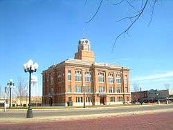 |
4189 | 1516 5th Ave. | Canyon | 1965 | Courthouse Square, 4th Avenue & 15th Street -Canyon |
| Sam Wood Cabin | 4508 | 2503 4th Ave. on E lawn of museum | Canyon | 1966 | located at Panhandle-Plains Museum, in Canyon, Randall County | |
| Shaw-Keiser House | 13993 | 1214 5th Ave. | Canyon | 2007 | 1214 5th St. | |
| T-Anchor Ranch Headquarters | 5174 | 2503 4th Ave. on E lawn of museum | Canyon | 1967 | Located outside Panhandle Plains Museum (4th Avenue) on eastern grounds, Canyon. | |
| Terry and Georgie Sneed Thompson House | 15627 | 3002 S. Ong St. | Amarillo | 2003 | ||
| The Little House of Fellowship | 16500 | 308 17th St. | Canyon | 2010 | northwest corner of 17th St. and 4th Avenue |
Reagan County
| Registered Texas Historic Landmark | Image | Marker Number | Physical Address | Nearest city | Year designated | Description |
|---|---|---|---|---|---|---|
| John E. Gardner Place | 2776 | Santa Rita Rd. via RR 1676 and US 67 5 mi from Big Lake | Big Lake | 1964 | from Big Lake go about 4 miles west on US 67, then 1 mile south on RR 1676 to Santa Rita Rd - Marker is on Private Property about 1/2 mile south off Santa Rita Rd. | |
| Stiles Courthouse |
 |
5122 | SH 137 19 mi. NW of Big Lake | Stiles | 1969 | on SH 137 about 19 miles northwest of Big Lake |
Real County
| Registered Texas Historic Landmark | Image | Marker Number | Physical Address | Nearest city | Year designated | Description |
|---|---|---|---|---|---|---|
| Real County Courthouse | 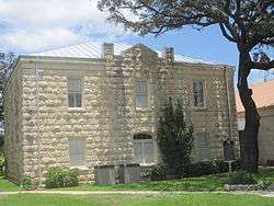 |
11692 | 146 S. Market St. | Leakey | 2000 | 4th Street, Courthouse Square, Leakey |
Red River County
| Registered Texas Historic Landmark | Image | Marker Number | Physical Address | Nearest city | Year designated | Description |
|---|---|---|---|---|---|---|
| Andrew Thompson House | .jpg) |
10895 | 706 N. Walnut St. | Clarksville | 1984 | |
| Col. Charles DeMorse Home |
.jpg) |
10874 | 115 E. Comanche St. | Clarksville | 1962 | |
| First Christian Church of Detroit | .jpg) |
10876 | 155 First St. NW | Detroit | 1984 | |
| First Presbyterian Church of Clarksville | .jpg) |
10877 | 106 S. Pecan St. | Clarksville | 1966 | |
| First Presbyterian Church of Clarksville | |
14980 | 106 S. Pecan St. | Clarksville | 1966 | |
| John Nance Garner Home | .jpg) |
10879 | 200 S. Main St. | Detroit | 1971 | |
| McKenzie Home | 14685 | CR 1287 | Clarksville | 1963 | ||
| Old W. L. Nunnely Home | .jpg) |
10887 | 507 S. Locust St. | Clarksville | 1969 | |
| Red River County Jail | .jpg) |
10888 | W. Madison St. at N. Pecan St. | Clarksville | 1983 | |
| Red River Courthouse |
.jpg) |
10872 | 400 N. Walnut St. | Clarksville | 1966 | |
| St. Paul Methodist Church | .jpg) |
10892 | 403 W. Pierce St. | Clarksville | 1971 |
Reeves County
| Registered Texas Historic Landmark | Image | Marker Number | Physical Address | Nearest city | Year designated | Description |
|---|---|---|---|---|---|---|
| Mission Mary | 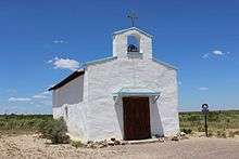 |
16611 | FM 3078 1 mi. W. of Toyah Creek | Balmorhea | 2010 | 1 mile west of Toyah Creek on FM 3078 |
| Old Camp Hospital | 3699 | 1703 W. 4th St. | Pecos | 1966 | corner of 4th and Ross Sts. | |
| Orient Hotel | 3868 | 120 E. 1st St. | Pecos | 1964 | West of the Pecos Museum, Cedar & First streets | |
| Vicinity of Significant Neighbors Ford Trail | 5648 | US 285 roadside park N. of Pecos | Pecos | 1966 | In Roadside Park on US 285, Northern City Limits of Pecos |
Refugio County
| Registered Texas Historic Landmark | Image | Marker Number | Physical Address | Nearest city | Year designated | Description |
|---|---|---|---|---|---|---|
| John Howland Wood and Nancy Clark Wood House |
 |
12168 | 533 Copano Bay Dr. | Bayside | 1999 | |
| Refugio City Hall |  |
4231 | 613 Commerce St. | Refugio | 1990 | 613 Commerce St., Refugio |
| T-C Ranch House | 6479 | Off U.S. 77 near San Antonio River | 1972 | US 77, 25 miles north of Refugio; Private - No Access | ||
| Woodworth House | 5903 | 209 E. Purisima St. | Refugio | 1976 | 209 E. Purisima St., Refugio |
Roberts County
| Registered Texas Historic Landmark | Image | Marker Number | Physical Address | Nearest city | Year designated | Description |
|---|---|---|---|---|---|---|
| Roberts County Courthouse |
 |
12593 | 301 E. Commercial St. | Miami | 2000 |
Robertson County
| Registered Texas Historic Landmark | Image | Marker Number | Physical Address | Nearest city | Year designated | Description |
|---|---|---|---|---|---|---|
| Adams-White Place | .jpg) |
10896 | 1105 Magnolia St. | Hearne | 1968 | |
| Allen Hardware Store | .jpg) |
10898 | 111 W. Third St. | Hearne | 1968 | |
| Barton Home |
.jpg) |
10902 | 404 Maple St. | Calvert | 1979 | |
| Church of the Epiphany |
.jpg) |
10913 | 504 E. Gregg St. | Calvert | 1967 | |
| Citizens Bank & Trust Co. Building |
 |
10914 | 516 Main St. | Calvert | 1968 | |
| Cobb's Market |
.jpg) |
10915 | 517 Main St. | Calvert | 1967 | |
| First Presbyterian Church |
10923 | 401 E. Barton St. | Calvert | 1967 | ||
| Former Calvert Courthouse |
.jpg) |
10906 | 604 Elm St. | Calvert | 1968 | between Burnett and Hanna |
| Franklin Carnegie Library |
 |
10925 | 315 E. Decherd St. | Franklin | 1986 | |
| Howard House |
10931 | 404 E. Gregg St. | Calvert | 1982 | ||
| Jacques Adoue Building |
10897 | 506 Main St. | Calvert | 1973 | ||
| Katy Hamman Stricker Library |
13024 | 404 E. Mitchell St. | Calvert | 2003 | 404 E Mitchell | |
| Mistrot-Adoue House |
10934 | 303 E. Mitchell St. | Calvert | 1981 | ||
| Old Calvert Foundry and Manufacturing Company |
10907 | 502 Main St. | Calvert | 1969 | ||
| Old Cavitt Home | .png) |
15313 | 312 FM 391, Wheelock | Calvert | 1964 | |
| Old Cavitt House | .png) |
10911 | 312 FM 391 | Wheelock | 1964 | .5 mi. west of Wheelock on FM 391 |
| Philen House | .jpg) |
10940 | 604 S. Magnolia St. | Hearne | 1962 | |
| Randolph-Field Place |
.jpg) |
10938 | 800 China St. | Calvert | 1970 | |
| Robert Cyrus Allen Home |
 |
10899 | 402 Cedar St. | Hearne | 1980 | |
| Robertson County Courthouse |
 |
10943 | 100 W. Decherd St. | Franklin | 1968 | |
| St. Mary's Catholic Church | .jpg) |
10944 | 715 N. Main St. | Bremond | 1969 | FM 2954 and FM 2413 |
| St. Paul United Methodist Church | 12590 | 101 M.L. King, Jr. St. | Calvert | 2001 | Pecan St.at FM 979 | |
| St. Phillips Episcopal | .jpg) |
10945 | 408 Cedar St. | Hearne | 1979 | Cedar and First St. |
| Stricker-Sneed House |
.jpg) |
10951 | 503 Pin Oak St. | Calvert | 1973 |
Rockwall County
| Registered Texas Historic Landmark | Image | Marker Number | Physical Address | Nearest city | Year designated | Description |
|---|---|---|---|---|---|---|
| Royse City Lodge No. 663, A.F. & A.M. |
 |
6150 | 124 S. Arch St. | Royse City | 1994 | 124 Arch Street (City Hall) Royse City |
| Royse City's First United Methodist Church Building | .jpg) |
6149 | 701 E. Church St. | Royse City | 1978 | 701 Church Street (corner of Church and Josephine Streets) off US 66 in Royse City |
Runnels County
| Registered Texas Historic Landmark | Image | Marker Number | Physical Address | Nearest city | Year designated | Description |
|---|---|---|---|---|---|---|
| Abilene & Southern Depot | 14601 | 300 blk. S. Seventh St. | Ballinger | 1978 | ||
| Carnegie Library Building |
 |
732 | 204 N. Eighth St. | Ballinger | 1977 | 204 8th Street, Ballinger |
| First Presbyterian Church | 1817 | 301 N. Broadway St. | Ballinger | 1962 | 301 Broadway, Ballinger | |
| First United Presbyterian Church | 15515 | 301 N. Broadway St. | Ballinger | 1962 | ||
| German Methodist Church/First Fire Station | 2174 | 420 Strong St. | Ballinger | 1962 | 420 Strong Street, Ballinger | |
| Lynn - Hathaway Building | 3151 | 800 Hutchings Ave. | Ballinger | 1962 | Corner of 8th and Hutchings (US 67) | |
| Nancy Parker Cabin | 3547 | FM 382 near CR 190 | Winters | 1970 | From Winters, take FM 1770 east 12 miles then FM 382 north about 4 miles | |
| Old Cotton Oil Mill | 3713 | 711 N. Melwood St. | Winters | 1962 | 711 North Melwood Street, Winters | |
| Oldest Rock Building in City | 3844 | 307 Depot St. | Rowena | 1967 | Depot Street, Rowena | |
| Rock Hotel | 4317 | 300 W. Dale St. | Winters | 1982 | 300 West Dale Street, Winters | |
| Runnels County Courthouse | 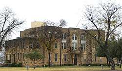 |
4392 | 613 Hutchings Ave. | Ballinger | 1967 | US Highway 83 and 67, Ballinger |
| St. Mary, Star of the Sea, Catholic Church | 5064 | 608 N. Sixth St. | Ballinger | 1984 | 608 6th Street, Ballinger | |
| Theile Building |
5459 | 2nd & Robinson St. | Miles | 1968 | 2nd and Robinson Streets, Miles | |
| Winters State Bank | 5873 | 101 N. Main St. | Winters | 2001 | Main and Dale Streets, Winters |
Rusk County
| Registered Texas Historic Landmark | Image | Marker Number | Physical Address | Nearest city | Year designated | Description |
|---|---|---|---|---|---|---|
| Birdwell House | 10960 | 11992 CR 4233 behind Monte Verdi Plantation house | Cushing | 1967 | ||
| Crim, Elias Fleming and Mattie Spharler, House |
.jpg) |
15423 | 310 E. Main St. | Henderson | 2003 | |
| Dennard Home | 10982 | CR 3198 E of FM 95 | Mount Enterprise | 1984 | 5 mi. east of Mt. Enterprise via US 84 to FM 95 S .5 mi., then left on county road | |
| Gaston Public School Complex |  |
10998 | CR 4133A | Joinerville | 1992 | 6 mi. west of Henderson on SH 64 |
| Hardeman-Griffin House | 11000 | 313 E. Main St. | Henderson | 1985 | ||
| Howard-Dickinson House | 11005 | 501 S. Main St. | Henderson | 1968 | ||
| Leverett House | 11008 | CR 133 W of SH 42 | Overton | 1962 | ||
| M. Kangerga & Bro. |
11007 | 102 E. Main St. | Henderson | 1990 | ||
| M. Kangerga House | 11006 | 501 N. High St. | Henderson | 1969 | [NOTE: Mile (later Michael) Kangerga was born in Otocac, Croatia] | |
| Mattie Trammel Schoolhouse | 11075 | 600 N. High St. | Henderson | 1992 | ||
| Monte Verdi |
11021 | 11992 CR 4233 | Cushing | 1964 | ||
| Old House of Dr. Wm. M. Ross | 11053 | 1962 | ||||
| Pine Grove Cumberland Presbyterian Church | 11027 | S of FM 2867 on CR 364 S | Henderson | 1966 | 10 mi. E of Henderson via FM 840 to FM 2867, E until CR 364 S | |
| Richardson-Lowe House | 11052 | N of US 84 W of FM 225 | Laneville | 1976 | Glenfawn Road off FM 225, 6 mi. SW of Laneville | |
| Rogers-Craig House | 17291 | 1011 S. Main St. | Henderson | 2012 | From downtown square go about one mile down South Main St. | |
| T. J. Walling Log Cabin | 11077 | 514 N. High St. | Henderson | 1983 |
See also
| Anderson-Callahan • Cameron-Duval • Eastland-Gray • Grayson-Hudspeth • Hunt-Martin • Mason-Rusk • Sabine-Travis • Trinity-Zavala |
References
External links
![]()
