Algonac, Michigan
Algonac is a city in St. Clair County of the U.S. state of Michigan. The population was 4,110 at the 2010 census.
Algonac, Michigan | |
|---|---|
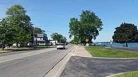 Algonac looking north along St. Clair Drive | |
 Location within St. Clair County | |
 Algonac Location within the state of Michigan | |
| Coordinates: 42°37′18″N 82°32′01″W | |
| Country | United States |
| State | Michigan |
| County | St. Clair |
| Settled | 1805 |
| Government | |
| • Mayor | Terry Stoneburner |
| Area | |
| • Total | 1.73 sq mi (4.47 km2) |
| • Land | 1.42 sq mi (3.68y km2) |
| • Water | 0.31 sq mi (0.79 km2) |
| Elevation | 581 ft (177 m) |
| Population | |
| • Total | 4,110 |
| • Estimate (2018)[3] | 4,039 |
| • Density | 2,849.89/sq mi (1,100.30/km2) |
| Time zone | UTC-5 (Eastern (EST)) |
| • Summer (DST) | UTC-4 (EDT) |
| ZIP code(s) | 48001 |
| Area code(s) | 810 |
| FIPS code | 26-01180[4] |
| GNIS feature ID | 1624342[5] |
| Website | Official website |
Algonac is located at the southern end of the St. Clair River, just before it splits into a large delta region known as the St. Clair Flats. (Coordinates 42.6°N 82.56°W) The St. Clair River drains Lake Huron into Lake St. Clair and is part of the Great Lakes Waterway.
At the center of Algonac is Algonac City Park, a park which contains a half-mile long boardwalk along the St. Clair River. Just to the north of the city is Algonac State Park.
Algonac was the birthplace of Emily Helen Butterfield, an artist and the first woman to be licensed as an architect in Michigan. She was famous for innovations in church architecture. It was the home of Chris-Craft boat company; the maker of the first mass-produced speed boats. It was also the home of Gar Wood, the first great speed boat racer.
Algonac is home to two museums dedicated to its history. The Algonac Clay Community Museum contains many displays of Algonac's local history. The Algonac Clay Maritime museum displays the maritime history of the city and township, with many displays of Chris-Craft boats and Gar Wood boats built here. Both museums are open every weekend May through October. Algonac is known as the birthplace of modern powerboating.
History
.jpg)
Long occupied by Native American tribes, Algonac was settled in 1805 by European American John Martin, a pioneer from the United States.[6] The area had been known by French Canadian colonists, the first Europeans to settle here, as Pointe Du Chêne ("oak point", because of local trees.) The later British colonists called it Manchester.[7] In 1836, it was the fourth village laid out by Americans along the St. Clair River.[8]
Most settlement did not occur until the mid-19th century and later. In 1863, the small community was described as containing "a church, two or three saw-mills, a grist-mill, woollen factory, and about 700 inhabitants".[9] It served a farming area. The economy also was based in lumbering, shipping, and trades associated with maritime activities on the Great Lakes.
Geography
- According to the United States Census Bureau, the city has a total area of 1.44 square miles (3.73 km2), of which 1.43 square miles (3.70 km2) is land and 0.01 square miles (0.03 km2) is water.[10]
- Algonac is situated on what is called "the largest fresh-water delta in the world", at the mouth of the St. Clair River. As the city has many canals, it has been nicknamed "The Venice of Michigan."
- The city is classified as in the Blue Water Area, a sub-region of the Thumb.
Demographics
| Historical population | |||
|---|---|---|---|
| Census | Pop. | %± | |
| 1870 | 754 | — | |
| 1880 | 712 | −5.6% | |
| 1900 | 1,216 | — | |
| 1910 | 1,204 | −1.0% | |
| 1920 | 1,303 | 8.2% | |
| 1930 | 1,736 | 33.2% | |
| 1940 | 1,931 | 11.2% | |
| 1950 | 2,639 | 36.7% | |
| 1960 | 3,190 | 20.9% | |
| 1970 | 3,684 | 15.5% | |
| 1980 | 4,412 | 19.8% | |
| 1990 | 4,551 | 3.2% | |
| 2000 | 4,613 | 1.4% | |
| 2010 | 4,110 | −10.9% | |
| Est. 2018 | 4,039 | [3] | −1.7% |
| U.S. Decennial Census[11] | |||
2010 census
As of the census[2] of 2010, there were 4,110 people, 1,756 households, and 1,082 families living in the city. The population density was 2,874.1 inhabitants per square mile (1,109.7/km2). There were 2,040 housing units at an average density of 1,426.6 per square mile (550.8/km2). The racial makeup of the city was 97.1% White, 0.3% African American, 0.7% Native American, 0.1% Asian, 0.1% from other races, and 1.6% from two or more races. Hispanic or Latino of any race were 1.3% of the population.
There were 1,756 households, of which 28.2% had children under the age of 18 living with them, 44.8% were married couples living together, 11.8% had a female householder with no husband present, 5.0% had a male householder with no wife present, and 38.4% were non-families. 31.7% of all households were made up of individuals, and 14.1% had someone living alone who was 65 years of age or older. The average household size was 2.33 and the average family size was 2.92.
The median age in the city was 42.3 years. 21.2% of residents were under the age of 18; 8.6% were between the ages of 18 and 24; 24% were from 25 to 44; 30.8% were from 45 to 64; and 15.5% were 65 years of age or older. The gender makeup of the city was 49.6% male and 50.4% female.
2000 census
As of the census[4] of 2000, there were 4,613 people, 1,871 households, and 1,212 families living in the city. The population density was 3,291.7 per square mile (1,272.2/km²). There were 2,014 housing units at an average density of 1,437.1 per square mile (555.4/km²). The racial makeup of the city was 97.36% White, 0.15% African American, 0.95% Native American, 0.20% Asian, 0.02% Pacific Islander, 0.17% from other races, and 1.15% from two or more races. Hispanic or Latino of any race were 1.02% of the population.
There were 1,871 households, out of which 31.0% had children under the age of 18 living with them, 49.5% were married couples living together, 10.7% had a female householder with no husband present, and 35.2% were non-families. 30.3% of all households were made up of individuals, and 15.2% had someone living alone who was 65 years of age or older. The average household size was 2.46 and the average family size was 3.05.
In the city, the population was spread out, with 25.5% under the age of 18, 7.5% from 18 to 24, 30.2% from 25 to 44, 23.2% from 45 to 64, and 13.5% who were 65 years of age or older. The median age was 37 years. For every 100 females, there were 93.3 males. For every 100 females age 18 and over, there were 91.8 males.
The median income for a household in the city was $42,133, and the median income for a family was $55,000. Males had a median income of $41,644 versus $25,000 for females. The per capita income for the city was $22,441. About 8.6% of families and 9.4% of the population were below the poverty line, including 10.7% of those under age 18 and 15.2% of those age 65 or over.
Transportation
(Michigan) and Walpole Island (Ontario). Just to the west of the city, ferry service is also offered to Harsens Island.
- Ferry Service: Near Algonac's city center, ferry service is available to Russell Island
- Bus Service: The Blue Water Area Transportation Commission operates a Port Huron-to-Chesterfield Twp bus service morning and evening Monday-Friday that passes through Algonac via M-29. This connects with the SMART system of Metro Detroit.
See also
- Chris-Craft - boating manufacturer, which started in Algonac in 1922
- Garfield Wood - racing legend; one-time resident of Algonac
- Jeff Gutt - lead singer of Stone Temple Pilots; grew up and attended school in Algonac
- Killshot - this 1989 novel by Elmore Leonard is partially set in Algonac
- Tashmoo Park
References
- "2017 U.S. Gazetteer Files". United States Census Bureau. Retrieved Jan 3, 2019.
- "U.S. Census website". United States Census Bureau. Retrieved 2012-11-25.
- "Population and Housing Unit Estimates". Retrieved October 22, 2019.
- "U.S. Census website". United States Census Bureau. Retrieved 2008-01-31.
- "US Board on Geographic Names". United States Geological Survey. 2007-10-25. Retrieved 2008-01-31.
- Romig, Walter. Michigan Place Names (Grosse Pointe, Michigan: Walter Romig, not dated) p. 17
- Royce, Julie (2006). Traveling Michigan's Thumb, p. 5. Dog Ear Publishing.
- Western Historical Company (1883).History of St. Clair County, Michigan, p. 256. A. T. Andreas & Co.
- Disturnell, John (1863). The Great Lakes, or Inland Seas of America, p. 68. Charles Scribner.
- "US Gazetteer files 2010". United States Census Bureau. Archived from the original on 2012-01-25. Retrieved 2012-11-25.
- "Census of Population and Housing". Census.gov. Retrieved June 4, 2015.
External links
| Wikimedia Commons has media related to Algonac, Michigan. |
- Official City Website
- Algonac State Park - Michigan DNR website
- Algonac High School - local public high school
Places adjacent to Algonac, Michigan | ||||||||||
|---|---|---|---|---|---|---|---|---|---|---|
| ||||||||||
Municipalities and communities of St. Clair County, Michigan, United States | ||
|---|---|---|
| Cities | 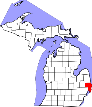 Map_of_Michigan_highlighting_St._Clair_County.svg | |
| Villages | ||
| Charter townships | ||
| General law townships | ||
| CDP | ||
| Other unincorporated communities |
| |
| Footnotes | ‡This populated place also has portions in an adjacent county or counties | |