Saint-Bernard-de-Lacolle, Quebec
Saint-Bernard-de-Lacolle is a municipality in Les Jardins-de-Napierville Regional County Municipality, Quebec, Canada, located in the administrative area of Montérégie. Saint-Bernard-de-Lacolle was established officially in 1855, and its population as of the Canada 2016 Census was 1,549. A major border crossing, Blackpool, is located where St-Bernard-de-Lacolle abuts the village of Champlain, New York, at the junction of Quebec Autoroute 15 and U.S. Interstate 87. 5 km from that legal crossing point is Roxham Road, where more people cross the border illegally from the United States than at any other point. Almost nineteen thousand people were detained in 2017.[6]
Saint-Bernard-de-Lacolle | |
|---|---|
Municipality | |
| Motto(s): Grande porte du Canada | |
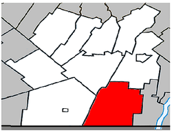 Location within Les Jardins-de-Napierville RCM. | |
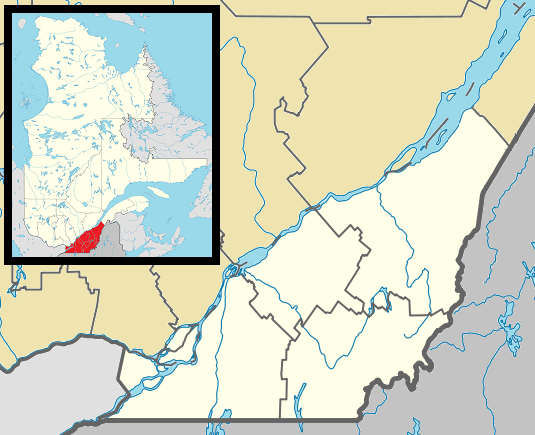 Saint-Bernard-de-Lacolle Location in southern Quebec. | |
| Coordinates: 45°05′N 73°25′W[1] | |
| Country | |
| Province | |
| Region | Montérégie |
| RCM | Les Jardins-de-Napierville |
| Constituted | July 1, 1855 |
| Government | |
| • Mayor | Robert Duteau |
| • Federal riding | Beauharnois—Salaberry |
| • Prov. riding | Huntingdon |
| Area | |
| • Total | 113.90 km2 (43.98 sq mi) |
| • Land | 113.19 km2 (43.70 sq mi) |
| Population (2016)[5] | |
| • Total | 1,549 |
| • Density | 13.0/km2 (34/sq mi) |
| • Pop 2006-2011 | |
| • Dwellings | 657 |
| Time zone | UTC−5 (EST) |
| • Summer (DST) | UTC−4 (EDT) |
| Postal code(s) | J0J 1V0 |
| Area code(s) | 450 and 579 |
| Highways | |
Demographics
Population
| Canada census – Saint-Bernard-de-Lacolle, Quebec community profile | |||
|---|---|---|---|
| 2011 | 2006 | ||
| Population: | 1,477 (-3.9% from 2006) | 1,537 (+2.5% from 2001) | |
| Land area: | 113.19 km2 (43.70 sq mi) | 113.19 km2 (43.70 sq mi) | |
| Population density: | 13.0/km2 (34/sq mi) | 13.6/km2 (35/sq mi) | |
| Median age: | 44.2 (M: 44.8, F: 43.3) | 43.0 (M: 43.1, F: 43.0) | |
| Total private dwellings: | 657 | 636 | |
| Median household income: | $43,300 | $42,936 | |
| References: 2011[7] 2006[8] earlier[9] | |||
| Historical Census Data - Saint-Bernard-de-Lacolle, Quebec[10] | ||||||||||||||||||||||||||
|---|---|---|---|---|---|---|---|---|---|---|---|---|---|---|---|---|---|---|---|---|---|---|---|---|---|---|
|
|
| ||||||||||||||||||||||||
Language
| Canada Census Mother Tongue - Saint-Bernard-de-Lacolle, Quebec[10] | ||||||||||||||||||
|---|---|---|---|---|---|---|---|---|---|---|---|---|---|---|---|---|---|---|
| Census | Total | French |
English |
French & English |
Other | |||||||||||||
| Year | Responses | Count | Trend | Pop % | Count | Trend | Pop % | Count | Trend | Pop % | Count | Trend | Pop % | |||||
2011 |
1,475 |
1,220 | 82.71% | 185 | 12.54% | 15 | 1.02% | 55 | 3.73% | |||||||||
2006 |
1,490 |
1,295 | 86.91% | 105 | 7.05% | 10 | 0.67% | 80 | 5.37% | |||||||||
2001 |
1,450 |
1,190 | 82.07% | 240 | 16.55% | 0 | 0.00% | 20 | 1.38% | |||||||||
1996 |
1,460 |
1,160 | n/a | 79.45% | 275 | n/a | 18.84% | 0 | n/a | 0.00% | 25 | n/a | 1.71% | |||||
Education
The South Shore Protestant Regional School Board previously served a portion of the municipality.[11]
References
- Reference number 55745 of the Commission de toponymie du Québec (in French)
- "Saint-Bernard-de-Lacolle". Ministère des Affaires municipales, des Régions et de l'Occupation du territoire.
- Riding history for Beauharnois—Salaberry, Quebec from the Library of Parliament
- "Saint-Bernard-de-Lacolle, Quebec". Statistics Canada Census Profile. 2011.
- "Saint-Bernard-de-Lacolle, Quebec". Statistics Canada Census Profile. 2016.
- Quan, Douglas (3 February 2019). "RCMP has spent more than $6.6M to process migrants at Canada's busiest illegal crossing". National Post. Retrieved 4 February 2019.
- "2011 Community Profiles". 2011 Canadian Census. Statistics Canada. July 5, 2013. Retrieved 2014-03-01.
- "2006 Community Profiles". 2006 Canadian Census. Statistics Canada. March 30, 2011. Retrieved 2014-03-01.
- "2001 Community Profiles". 2001 Canadian Census. Statistics Canada. February 17, 2012.
- Statistics Canada: Canada Census 1996, 2001, 2006, 2011 census
- King, M.J. (Chairperson of the Board) (December 16, 1965). "South Shore Protestant Regional School Board". The News and Eastern Townships Advocate. 119 (5). St. Johns, PQ. p. 2. Retrieved November 23, 2014.
External links
Adjacent Municipal Subdivisions | ||||||||||
|---|---|---|---|---|---|---|---|---|---|---|
| ||||||||||
| Cities | |
|---|---|
| Municipalities | |
| Parishes | |
| Townships | |
| Villages | |
| |