U.S. Route 85 in North Dakota
U.S. Route 85 (US 85) is a part of the U.S. Highway System that travels from the Mexican border in El Paso, Texas, north to the Canadian border in Fortuna, North Dakota. In the state of North Dakota, US 85 travels from the South Dakota state line north to the Canadian border.
| ||||
|---|---|---|---|---|
| CanAm Highway | ||||
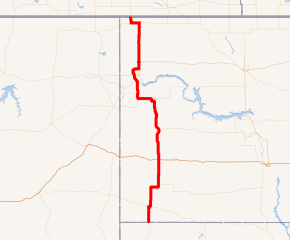
US 85 highlighted in red | ||||
| Route information | ||||
| Maintained by NDDOT | ||||
| Length | 255.063 mi[1] (410.484 km) | |||
| Existed | 1926–present | |||
| Major junctions | ||||
| South end | ||||
| North end | ||||
| Location | ||||
| Counties | Bowman, Slope, Stark, Billings, McKenzie, Williams, Divide | |||
| Highway system | ||||
| ||||

Route description
US 85 enters North Dakota in the southwest part of the state. The first city on its route is Bowman at the junction of US 12. Continuing north, it passes between North Dakota's two highest points, White Butte and Black Butte. Near Amidon US 85 heads east for nine miles (14 km) before going back north along the Little Missouri National Grassland for about 125 miles (201 km). Near Belfield it junctions with Interstate 94 (I-94). After running concurrently with North Dakota Highway 200 (ND 200), it eventually passes through part of the scenic Badlands, crosses the Little Missouri River and passes near the Theodore Roosevelt National Park (North Unit).
Then, at Watford City it travels west for 16 miles (26 km) where it turns back north before Alexander. US 85 continues north as ND 200 turns west toward Montana. South of Williston it crosses the Missouri River. The stretch from Watford City to Williston is in the process of being converted into an undivided four-lane highway, and it should be substantially completed in 2014. A few miles later, it meets with US 2 where the two overlap for 19 miles (31 km) as an expressway that bypasses Williston to the northwest. After US 2 heads east, US 85 continues north to a concurrency with ND 5. From there it is seven miles (11 km) to Fortuna where US 85 heads back north for its remaining six miles (9.7 km) to the Canadian border.[1]
Major intersections
| County | Location | mi[1] | km | Destinations | Notes | |||
|---|---|---|---|---|---|---|---|---|
| Bowman | | 0.000 | 0.000 | Continuation into South Dakota | ||||
| Bowman | 16.461 | 26.491 | Southern end of US 12 concurrency | |||||
| 17.265 | 27.785 | Northern end of US 12 concurrency | ||||||
| Slope | | 50.098 | 80.625 | Western terminus of ND 21 | ||||
| Stark | | 75.762 | 121.927 | I-94 Exit 42 | ||||
| Billings |
No major junctions | |||||||
| McKenzie | | 107.645 | 173.238 | Southern end of ND 200 concurrency | ||||
| Watford City | 140.831 | 226.646 | Southern terminus of US 85 Bus., western terminus of ND 23 | |||||
| | 145.659 | 234.415 | Northern terminus of US 85 Bus. | |||||
| | 159.344 | 256.439 | Eastern terminus of ND 68 | |||||
| Alexander | 160.505 | 258.308 | Southern terminus of US 85 Bus. | |||||
| 163.506 | 263.137 | Northern terminus of US 85 Bus. | ||||||
| | 164.424 | 264.615 | Northern end of ND 200 concurrency | |||||
| Williams | | 183.743 | 295.706 | Southern end of US 2 and ND 1804 concurrency | ||||
| Williston | 186.747 | 300.540 | Northern end of ND 1804 concurrency, western terminus of US 2 Bus. | |||||
| 189.207 | 304.499 | Eastern terminus of US 2 Bus. | ||||||
| | 201.265 | 323.905 | Northern end of US 2 concurrency | |||||
| | 216.995 | 349.220 | ||||||
| Divide | | 240.605 | 387.216 | Southern end of ND 5 concurrency | ||||
| | 248.670 | 400.196 | Northern end of ND 5 concurrency | |||||
| | 255.063 | 410.484 | Continues north as Hwy 35 at the Canada border | |||||
1.000 mi = 1.609 km; 1.000 km = 0.621 mi
| ||||||||
References
- North Dakota Department of Transportation (2014). North Dakota Route and Mileage Map (PDF) (Map). Bismarck: North Dakota Department of Transportation. Retrieved August 30, 2018.