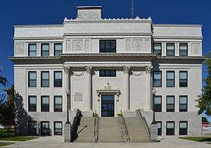
Havre, Montana
Havre (/ˈhævər/ HAV-ər) is the county seat and largest city in Hill County, Montana, in the United States. Havre is nicknamed the crown jewel of the Hi-Line.[4] It is said to be named after the city of Le Havre in France.[5][6] As of the 2010 census the population was 9,310,[7] and in 2018 the estimated population was 9,715.[3]
Havre, Montana | |
|---|---|
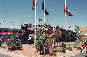 Sculpture U.S. − Canada Friendship at the Havre railroad station | |
 Location of Havre, Montana | |
| Coordinates: 48°33′N 109°41′W | |
| Country | United States |
| State | Montana |
| County | Hill |
| Area | |
| • Total | 3.28 sq mi (8.50 km2) |
| • Land | 3.28 sq mi (8.50 km2) |
| • Water | 0 sq mi (0 km2) |
| Elevation | 2,536 ft (773 m) |
| Population | |
| • Total | 9,310 |
| • Estimate (2018)[3] | 9,715 |
| • Density | 2,800/sq mi (1,100/km2) |
| Time zone | UTC−7 (Mountain (MST)) |
| • Summer (DST) | UTC−6 (MDT) |
| ZIP code | 59501 |
| Area code(s) | 406 |
| FIPS code | 30-35050 |
| GNIS feature ID | 0772203 |
| Website | ci |
History
Havre was incorporated in north central Montana in 1893. It was founded primarily to serve as a major railroad service center for the Great Northern Railway (built by James J. Hill) with its location midway between Seattle and Minneapolis-St. Paul. A statue of Hill stands near the Havre Amtrak station to commemorate the key contributions his railroad has made to Havre's and Montana's history.
Originally named "Bullhook Bottoms", the town held a series of meetings to determine a new name. The original settlers were given the final decision, and due to a strong French influence, the town was renamed "Havre".
Simon Pepin (1840–1914), the "Father of Havre", was born in Quebec and emigrated to Montana in 1863, where he became a contractor, furnishing supplies for the construction of Fort Custer, Fort Assinniboine, and Fort Maginnis. Pepin purchased ranch land near Fort Assinniboine. When James J. Hill built the Great Northern Railway across northern Montana, he built several locomotive shops on property Pepin owned at the site of Havre. Pepin became a major contributor to Havre's economic growth through his cattle, real estate, and banking enterprises.[8]
Havre is the eighth-largest city in Montana, and the largest city in the Montana section of the Hi-Line. With the nearest larger city, Great Falls, about 120 miles (190 km) to the south, Havre serves as a medical and business center for the Montana section of the Hi-Line. U.S. Highway 87 has its northern terminus at Havre. U.S. Highway 2, running east–west, is the city's main street. The largest employers are Northern Montana Hospital, Montana State University–Northern, and the Burlington Northern and Santa Fe Railway (BNSF). Throughout much of the twentieth century, BNSF was the most prominent employer in the city, but the company scaled back its workforce in Havre in the 1990s. The Milk River (tributary of the Missouri River) runs through the town, and the Bears Paw Mountains can be seen to the south.
Small grids of purple squares can be seen in some of the sidewalks downtown. These are skylights for an underground mall built in the city at least a hundred years ago. Throughout its history, this underground area has been host to a brothel, a Chinese laundromat, a saloon, a drugstore, at least three opium dens, and rooms used for smuggling alcohol during Prohibition. When fire destroyed Havre's business district in 1904, legitimate above-ground businesses joined the illicit businesses operating in the underground while the new brick buildings were built in the streets above. The underground area, now designated "Havre Beneath the Streets", currently operates as a tourist attraction.[9]
The Wahkpa Chu'gn buffalo jump, or bison kill, is located behind the Holiday Village Shopping Center near the northwest corner of Havre. Over 2,000 years old, it is one of the largest and best preserved buffalo jumps anywhere. In prehistoric times, Native Americans would drive bison over the edge of the cliff, killing or severely injuring the animals. Afterwards, the Native Americans skinned the animals and preserved the meat. The buffalo jump is now an archaeological site and a small tourist attraction.
The buffalo jump is located at the southern edge of the Havre Badlands, a badlands formation that runs alongside the Milk River to the west of the city. Small fossils, including seashells and petrified wood, can be found in the limestone sediment in this area.
6 miles (10 km) southwest of Havre is Fort Assinniboine, which served as one of Montana's principal military posts from 1879 through the Prohibition era. The fort was one of many used by the United States to protect against potential attacks from Native Americans and to block incursions from Canada. At its peak, the fort housed and employed 489 soldiers in 104 buildings.
Also near Havre is the Bear's Paw Battlefield site of the Battle of Bear Paw, where the Nez Perce were attacked and defeated by the U.S. Cavalry. Chief Joseph surrendered to the Cavalry and made a famous speech ending with the line, "From where the sun now stands, I will fight no more forever."
Geography
Havre is located in eastern Hill County at 48°33′N 109°41′W (48.5454, -109.6775).[10] U.S. Route 2 (1st Street) is the main road through the city, running east to west near the city's northern border. Route 2 leads east 87 miles (140 km) to Malta and west 102 miles (164 km) to Shelby and Interstate 15. U.S. Route 87 has its northern terminus in West Havre, 3 miles (5 km) west of downtown Havre. US 87 leads southwest 110 miles (180 km) to Great Falls. Montana Secondary Highway 234 leads south from the center of Havre 30 miles (48 km) to the Bear Paw Ski Bowl in the Bears Paw Mountains.
According to the United States Census Bureau, Havre has a total area of 3.28 square miles (8.50 km2), all of it land.[1]
Climate
Havre experiences a semi-arid climate (Köppen BSk) with long, cold, dry winters and hot summers with cool nights. Winter weather can vary greatly from brutal cold when Arctic air moves in from Canada, to temperatures far above 32 °F or 0 °C due to chinook winds – for instance the coldest month (and only one to never top freezing) of January 1916 averaged −13.3 °F or −25.2 °C and February 1936 during a notorious cold wave −12.8 °F or −24.9 °C, but February 1954 averaged as high as 37.1 °F or 2.8 °C and January 1919, 34.1 °F or 1.2 °C.[11] The hottest temperature recorded in Havre is 111 °F or 43.9 °C on August 5, 1961, and the coldest −57 °F or −49.4 °C on January 27, 1916.
| Climate data for Havre | |||||||||||||
|---|---|---|---|---|---|---|---|---|---|---|---|---|---|
| Month | Jan | Feb | Mar | Apr | May | Jun | Jul | Aug | Sep | Oct | Nov | Dec | Year |
| Record high °F (°C) | 68 (20) |
74 (23) |
79 (26) |
95 (35) |
98 (37) |
108 (42) |
108 (42) |
111 (44) |
101 (38) |
91 (33) |
78 (26) |
71 (22) |
111 (44) |
| Mean maximum °F (°C) | 50 (10) |
57 (14) |
67 (19) |
78 (26) |
87 (31) |
94 (34) |
99 (37) |
98 (37) |
91 (33) |
81 (27) |
65 (18) |
53 (12) |
101 (38) |
| Average high °F (°C) | 25.5 (−3.6) |
33.4 (0.8) |
44.9 (7.2) |
58.5 (14.7) |
68.8 (20.4) |
77.4 (25.2) |
84.6 (29.2) |
83.9 (28.8) |
71.9 (22.2) |
59.4 (15.2) |
40.8 (4.9) |
30.1 (−1.1) |
56.6 (13.7) |
| Daily mean °F (°C) | 14.6 (−9.7) |
21.9 (−5.6) |
32.5 (0.3) |
44.3 (6.8) |
54.5 (12.5) |
62.7 (17.1) |
68.3 (20.2) |
67.6 (19.8) |
56.3 (13.5) |
44.6 (7.0) |
29.1 (−1.6) |
19.0 (−7.2) |
43.0 (6.1) |
| Average low °F (°C) | 3.7 (−15.7) |
10.4 (−12.0) |
20.0 (−6.7) |
30.0 (−1.1) |
40.2 (4.6) |
48.0 (8.9) |
52.0 (11.1) |
51.3 (10.7) |
40.7 (4.8) |
29.8 (−1.2) |
17.3 (−8.2) |
7.8 (−13.4) |
29.3 (−1.5) |
| Mean minimum °F (°C) | −24 (−31) |
−16 (−27) |
−4 (−20) |
15 (−9) |
29 (−2) |
37 (3) |
43 (6) |
41 (5) |
27 (−3) |
12 (−11) |
−8 (−22) |
−22 (−30) |
−32 (−36) |
| Record low °F (°C) | −57 (−49) |
−55 (−48) |
−41 (−41) |
−14 (−26) |
9 (−13) |
29 (−2) |
31 (−1) |
27 (−3) |
18 (−8) |
−21 (−29) |
−33 (−36) |
−50 (−46) |
−57 (−49) |
| Average precipitation inches (mm) | 0.47 (12) |
0.36 (9.1) |
0.70 (18) |
0.87 (22) |
1.84 (47) |
1.90 (48) |
1.51 (38) |
1.20 (30) |
1.03 (26) |
0.62 (16) |
0.45 (11) |
0.51 (13) |
11.46 (290.1) |
| Average snowfall inches (cm) | 8.6 (22) |
6.5 (17) |
7.9 (20) |
4.8 (12) |
1.5 (3.8) |
0.0 (0.0) |
0.0 (0.0) |
0.0 (0.0) |
0.3 (0.76) |
2.4 (6.1) |
5.5 (14) |
7.7 (20) |
45.2 (115.66) |
| Average precipitation days (≥ 0.01 inch) | 7.4 | 5.8 | 7.9 | 7.5 | 9.7 | 10.4 | 7.9 | 7.8 | 7.0 | 5.4 | 6.1 | 7.0 | 89.9 |
| Average snowy days (≥ 0.1 inch) | 7.7 | 6.3 | 6.2 | 3.0 | 0.4 | 0.0 | 0.0 | 0.0 | 0.2 | 1.8 | 5.2 | 7.7 | 38.5 |
| Mean monthly sunshine hours | 140.5 | 175.2 | 257.6 | 286.9 | 346.9 | 367.8 | 408.9 | 362.6 | 276.5 | 217.4 | 141.4 | 125.6 | 3,107.3 |
| Percent possible sunshine | 51 | 61 | 70 | 70 | 73 | 76 | 84 | 82 | 73 | 65 | 51 | 48 | 67 |
| Source 1: NOAA (normals, 1971–2000)[12][13] | |||||||||||||
| Source 2: The Weather Channel (Records)[14] | |||||||||||||
Demographics
| Historical population | |||
|---|---|---|---|
| Census | Pop. | %± | |
| 1900 | 1,033 | — | |
| 1910 | 3,624 | 250.8% | |
| 1920 | 5,429 | 49.8% | |
| 1930 | 6,372 | 17.4% | |
| 1940 | 6,427 | 0.9% | |
| 1950 | 8,086 | 25.8% | |
| 1960 | 10,740 | 32.8% | |
| 1970 | 10,558 | −1.7% | |
| 1980 | 10,891 | 3.2% | |
| 1990 | 10,201 | −6.3% | |
| 2000 | 9,621 | −5.7% | |
| 2010 | 9,310 | −3.2% | |
| Est. 2018 | 9,715 | [3] | 4.4% |
| source:[15] | |||
2010 census
As of the census[2] of 2010, there were 9,310 people, 3,900 households, and 2,293 families living in the city. The population density was 2,838.4 inhabitants per square mile (1,095.9/km2). There were 4,285 housing units at an average density of 1,306.4 per square mile (504.4/km2). The racial makeup of the city was 81.6% White, 0.4% African American, 13.0% Native American, 0.6% Asian, 0.1% Pacific Islander, 0.3% from other races, and 4.0% from two or more races. Hispanic or Latino of any race were 2.5% of the population.
There were 3,900 households of which 30.1% had children under the age of 18 living with them, 41.3% were married couples living together, 12.1% had a female householder with no husband present, 5.5% had a male householder with no wife present, and 41.2% were non-families. 33.8% of all households were made up of individuals and 12% had someone living alone who was 65 years of age or older. The average household size was 2.30 and the average family size was 2.98.
The median age in the city was 33.9 years. 25.1% of residents were under the age of 18; 12.8% were between the ages of 18 and 24; 23.5% were from 25 to 44; 25.2% were from 45 to 64; and 13.4% were 65 years of age or older. The gender makeup of the city was 49.8% male and 50.2% female.
2000 census
As of the census of 2000, there were 9,621 people, 4,015 households, and 2,449 families living in the city. The population density was 2,778.2 people per square mile (1,073.6/km²). There were 4,400 housing units at an average density of 1,270.6 per square mile (491.0/km²). The racial makeup of the city was 87.08% White, 0.11% African American, 9.01% Native American, 0.49% Asian, 0.02% Pacific Islander, 0.51% from other races, and 2.78% from two or more races. Hispanic or Latino of any race were 1.48% of the population.
There were 4,015 households out of which 31.9% had children under the age of 18 living with them, 45.2% were married couples living together, 11.5% had a female householder with no husband present, and 39.0% were non-families. 32.6% of all households were made up of individuals and 13.2% had someone living alone who was 65 years of age or older. The average household size was 2.32 and the average family size was 2.95.
In the city, the population was spread out with 25.7% under the age of 18, 13.6% from 18 to 24, 25.4% from 25 to 44, 20.6% from 45 to 64, and 14.6% who were 65 years of age or older. The median age was 34 years. For every 100 females there were 96.8 males. For every 100 females age 18 and over, there were 92.3 males.
The median income for a household in the city was $29,944, and the median income for a family was $38,870. Males had a median income of $30,401 versus $19,189 for females. The per capita income for the city was $15,847. About 14.8% of families and 17.5% of the population were below the poverty line, including 22.0% of those under age 18 and 7.8% of those age 65 or over.
Local media
Radio
Television
Stations available from the Great Falls market:
Satellite television providers are available to the entire area, and cable service comes from Charter Cable.
Newspapers
The Havre Daily News is regionally available. Its circulation is 3,500 papers daily, published Monday through Friday. It has a full online edition by subscription, as well as some free content online. The larger Great Falls Tribune is also available in most areas. The Havre Herald is a free online site for local news.
Education
The city is served by Havre Public Schools,[17] which operates Havre High School, S.U.N.S. Alternative High School, Havre Middle School, and three elementary schools.
Higher education is provided at the Montana State University-Northern campus.
Havre has a public library, the Havre-Hill County Library.[18]
The city also hosts one private school within city limits, Saint Judes Thaddeus School. They are affiliated with the Catholic Church.
Points of interest
- LORAN-C transmitter Havre
- Big Bud 747, the world's largest farm tractor
- Too Close for Comfort Site, a buffalo jump archaeological site, open to visitors
- Havre also hosts historic bars, namely the Oxford Sports Bar and The Palace.
- The Havre Underground, a tourist attraction that takes you to the historic under city, is a local favourite.
Notable people

- Jeff Ament, musician, Pearl Jam's bassist
- Karan Armstrong, opera singer
- Harriet Bossnot, social and civic worker
- T.V. Buttrey, academic and numismatist
- Ryan Divish, journalist for the Seattle Times
- Jeff Doyle, Major League Baseball player
- William Hulett, actor in Cirque du Soleil, Zumanity
- Marc Mariani, former NFL football player
- Larry Maze, bishop of the Episcopal Diocese of Arkansas, 1994–2006
- Jill McLain, Miss Montana USA 2006
- Karl Ohs, former lieutenant governor of Montana
- Flint Rasmussen, professional rodeo clown
- Rob Ryan, Major League Baseball player
- Rick Rydell, radio talk show host and outdoors author
- Brian Schweitzer, governor of Montana 2005–2013
- Stan Stephens, governor of Montana 1989–1993
- Jon Tester, incumbent U.S. senator
- Mike Tilleman, former NFL football player
- Jacob Bachmeier, one of the youngest state legislators in the United States
- Stuart Evey, One of the original investors of ESPN, was born in Havre.
See also
| Wikimedia Commons has media related to Havre, Montana. |
- Fort Assinniboine
- Havre station
- Montana State University–Northern
- Rocky Boy Indian Reservation
References
- "US Gazetteer files 2010". United States Census Bureau. Archived from the original on 2012-01-25. Retrieved 2012-12-18.
- "U.S. Census website". United States Census Bureau. Retrieved 2012-12-18.
- "Population and Housing Unit Estimates". Retrieved August 16, 2019.
- "Find a County". National Association of Counties. Archived from the original on May 31, 2011. Retrieved June 7, 2011.
- Kari Gorder, Havre History on the Web
- "The History of Havre, Montana". Havre Chamber of Commerce.
- "Geographic Identifiers: 2010 Census Summary File 1 (G001): Havre city, Montana". American Factfinder. U.S. Census Bureau. Archived from the original on February 13, 2020. Retrieved August 21, 2017.
- Walter, Dave (1989). "Simon Pepin, A Quiet Capitalist". Montana: The Magazine of Western History. Helena: Montana Historical Society. 39 (1): 34–38. ISSN 0026-9891. JSTOR 4519194. OCLC 5544131214.
- "Montana's Russell Country: Havre Beneath the Streets". Archived from the original on 2012-07-29.
- "US Gazetteer files: 2010, 2000, and 1990". United States Census Bureau. 2011-02-12. Retrieved 2011-04-23.
- National Weather Service, Great Falls
- "Climatography of the United States" (PDF). National Oceanic and Atmospheric Administration. Archived from the original on July 15, 2014. Retrieved January 15, 2011.CS1 maint: BOT: original-url status unknown (link)
- "Havre (National Station)". National Oceanic and Atmospheric Administration. Retrieved 21 December 2018. Archived December 27, 2018, at the Wayback Machine.
- "Monthly Averages for Havre, MT". The Weather Channel. Retrieved January 15, 2011.
- Moffatt, Riley. Population History of Western U.S. Cities & Towns, 1850–1990. Lanham: Scarecrow, 1996, 131.
- United States Census Bureau. "Census of Population and Housing". Retrieved August 15, 2013.
- Havre Public Schools
- "Montana Public Libraries". PublicLibraries.com. Retrieved 14 June 2019.
External links
| Wikivoyage has a travel guide for Havre. |
- Official website

- Havre Chamber of Commerce
- History of Havre on the Web
- Wahkpa Chu'gn Bison Kill
- Montana State University Northern
- State of Montana's Havre Profile
Municipalities and communities of Hill County, Montana, United States | ||
|---|---|---|
| City | 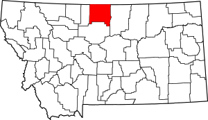 Hill County map | |
| Town | ||
| CDPs | ||
| Unincorporated communities | ||
| Indian reservation |
| |
| Footnotes | ‡This populated place also has portions in an adjacent county or counties | |
| Authority control |
|---|