Kohsan District
Kohsan is a district of Herat province in northwestern Afghanistan. It borders the nation of Iran to the west, Gulran District to the north, and Ghurian District to the south and east. The population of Kosan District is 52,900 (as of 2012),[1] which includes the following ethnic groups: 59.4% Pashtun, 35.3% Tajik, 5.1% Balouch, and 0.2% Turkmen.[2]
Kohsan کهسان | |
|---|---|
District | |
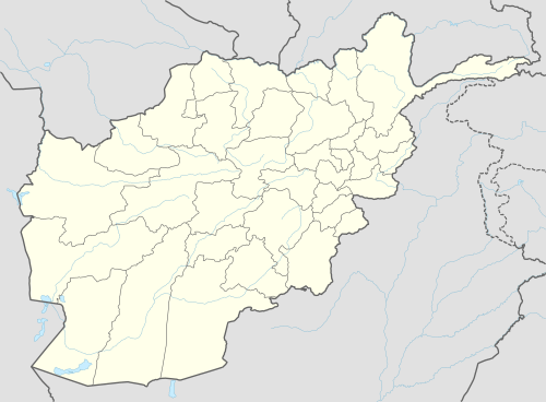 Kohsan Location within Afghanistan | |
| Coordinates: 34°39′09″N 61°11′57″E | |
| Country | |
| Province | Herat Province |
| Population (2012)[1] | |
| • Total | 52,900 |
The administrative center of Kohsan District is the small town of Kohsan. The district is located about 116 kilometres (3 hours drive) west of Herat city and is mainly a desert, with patches of irrigated lands. Islam Qala, one of the official border crossings between Afghanistan and Iran, is located in this district. The Hari River flows through Kohsan District and is also not far from the district center. The drought is a serious problem for the agriculture, which is the main source of income. Almost 60% of the formerly arable land is not in use. The health services and the education have improved since 2002.[2]
Gallery
| Wikimedia Commons has media related to Kohsan District. |
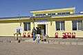 Afghan National Police (ANP) district headquarters at Kohsan.
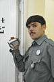 A Pashtun member of the ANP at Kohsan.
Notes
- "Settled Population of Herat Province" (PDF). Central Statistics Organization. Retrieved 21 January 2016.
- AIMS (Afghanistan Information Management Services), UNHCR Sub-Office District Profile of Kohsan (PDF) Archived 2006-12-10 at the Wayback Machine
External links
- Map of Settlements IMMAP, September 2011
- Herat Province - Ministry of Rural Rehabilitation and Development
See also
| Capital | 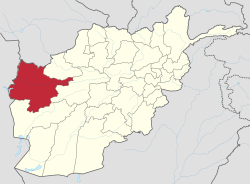 | |
|---|---|---|
| Districts |
| |
| Cities | ||
| Landmarks |
| |