Guzara
Guzara (Gozareh)[1] is a village and the center of Guzara District in Herat Province, Afghanistan on 34.2167°N 62.2167°E at 992 m altitude. The Herat Airfield is very close to the village to the east.
Guzara | |
|---|---|
 Guzara Location in Afghanistan | |
| Coordinates: 34°13′0″N 62°13′18″E | |
| Country | |
| Province | Herat Province |
| District | Guzara District |
| Time zone | UTC+4:30 |
References
- "Guzara". GEOnet Names Server. Retrieved 12 September 2019.
See also
| Capital | 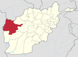 | |
|---|---|---|
| Districts |
| |
| Cities | ||
| Landmarks |
| |
This article is issued from Wikipedia. The text is licensed under Creative Commons - Attribution - Sharealike. Additional terms may apply for the media files.