Islam Qala
Islām Qala (Persian/Pashto: اسلام قلعه, also Eslām Qalʿeh), known historically as Kafir Qala,[1] is a border town in the western Herat province of Afghanistan, near the border with Iran. It is the official entry by land from neighboring Taybad, Iran.
Islam Qala | |
|---|---|
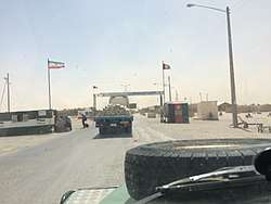
 Road leading to a small base of the Afghan Armed Forces at Islam Qala | |
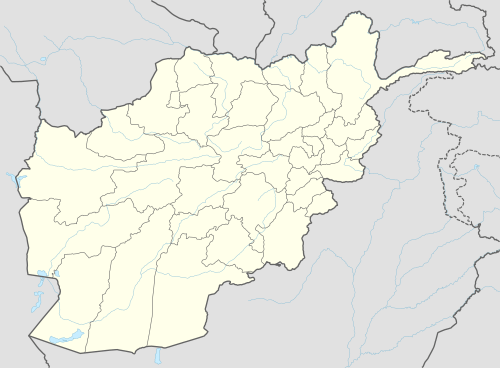 Islam Qala Location in Afghanistan | |
| Coordinates: 34°40′00″N 61°04′00″E | |
| Country | |
| Province | Herat Province |
| District | Kohsan District |
| Elevation | 2,398 ft (731 m) |
| Time zone | UTC+4:30 |
Islam Qala is part of the Kohsan District in Herat Province and is linked to the city of Herat via the Islam Qala-Herat Highway. Trade between Afghanistan and Iran passes through this town. AH1 passes through the town, part of the Asian Highway Network leading from Tokyo, Japan to west of Istanbul[2] where it connects to the E80 which reaches to Lisbon.
The town has a population of about 16,408.[3] The Afghan Border Police (ABP) secures the border while the regular Afghan National Police are in charge of all other law enforcement activities. The Afghan military also has a small base at Islam Qala.
The town was the site of an important victory against the Persians. At 1818 the Afghan Vizier defeated the Persian invasion at the Battle of Kafir Qala.
Demographics
The district is populated by Tajiks, Pashtuns, and Hazaras. The people of Islam Qala District are mostly Sunni Muslims, with Shia Muslims being a minority.
Climate
With an influence from the local steppe climate, Islam Qala features a cold semi-arid climate (BSk) under the Köppen climate classification. The average temperature in Islam Qala is 17.3 °C, while the annual precipitation averages 225 mm.
July is the hottest month of the year with an average temperature of 29.5 °C. The coldest month January has an average temperature of 5.5 °C.
| Climate data for Islam Qala | |||||||||||||
|---|---|---|---|---|---|---|---|---|---|---|---|---|---|
| Month | Jan | Feb | Mar | Apr | May | Jun | Jul | Aug | Sep | Oct | Nov | Dec | Year |
| Average high °C (°F) | 11.9 (53.4) |
14.4 (57.9) |
19.0 (66.2) |
23.9 (75.0) |
30.5 (86.9) |
35.9 (96.6) |
37.3 (99.1) |
36.4 (97.5) |
32.2 (90.0) |
26.6 (79.9) |
18.8 (65.8) |
13.5 (56.3) |
25.0 (77.1) |
| Daily mean °C (°F) | 5.5 (41.9) |
7.6 (45.7) |
12.1 (53.8) |
16.5 (61.7) |
22.2 (72.0) |
27.4 (81.3) |
29.5 (85.1) |
28.2 (82.8) |
23.5 (74.3) |
17.6 (63.7) |
10.7 (51.3) |
6.6 (43.9) |
17.3 (63.1) |
| Average low °C (°F) | −0.9 (30.4) |
1.2 (34.2) |
5.2 (41.4) |
9.2 (48.6) |
14.0 (57.2) |
19.0 (66.2) |
21.8 (71.2) |
20.1 (68.2) |
14.6 (58.3) |
8.6 (47.5) |
2.7 (36.9) |
−0.3 (31.5) |
9.6 (49.3) |
| Source: Climate-Data.org[4] | |||||||||||||

See also
References
- National Geospatial-Intelligence Agency. Geonames database entry. (search) Accessed 2011-05-12.
- ESCAP. "Asian Highway Route Map" (PDF). Retrieved March 19, 2017.
- "World Gazetteer". Archived from the original on 2013-02-09.
- "Climate: Islam Qala - Climate-Data.org". Retrieved 9 September 2016.
External links
| Wikimedia Commons has media related to Islam Qala. |
- Afghan refugees return home from Iran on YouTube, February 22, 2013, Al Jazeera English.
- Watch Situation in Islam Qala Herat: Iran-Afghanistan Oil Dispute on YouTube, January 20, 2011, Voice of America.
| Capital | 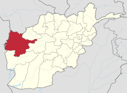 | |
|---|---|---|
| Districts |
| |
| Cities | ||
| Landmarks |
| |