Chishti Sharif District
Chishti Sharif District is the most easterly district in Herat Province, Afghanistan, situated along the Hari River and one of its northern tributaries. It borders with Obe District to the west, Badghis Province to the north and Ghor Province to the east and south. The population was estimated at 23,100 in 2012.[1] The district administrative center is the village of Chishti Sharif.
Chishti Sharif چشت شریف | |
|---|---|
District | |
 Mosquee of Chishti Sharif | |
 Chishti Sharif Location within Afghanistan | |
| Coordinates: 34°21′12″N 63°44′28″E | |
| Country | |
| Province | Herat Province |
| Population (2012)[1] | |
| • Total | 23,100 |
Infrastructure
The district contains 170 km of gravel roads.[2]
See also
References
- "Settled Population of Herat Province" (PDF). Central Statistics Organization. Retrieved 31 December 2015.
- "Herat Provincial Profile" (PDF). Ministry of Rural Rehabilitation and Development. Retrieved 31 December 2015.
External links
- Map of Settlements IMMAP, September 2011
| Capital | 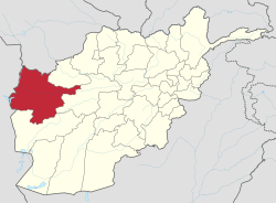 | |
|---|---|---|
| Districts |
| |
| Cities | ||
| Landmarks |
| |
This article is issued from Wikipedia. The text is licensed under Creative Commons - Attribution - Sharealike. Additional terms may apply for the media files.