Khirbat Al-Lawz
Khirbat Al-Lawz was a Palestinian Arab village in the Jerusalem Subdistrict. It was depopulated during the 1948 Arab-Israeli War on July 13, 1948 by the Har'el Brigade of Operation Dani. It was located 11 km west of Jerusalem, situated north of Wadi al-Sarar.
Khirbat Al-Lawz خربة اللوز | |
|---|---|
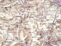 Map of Khirbat Al-Lawz-area, 1870s | |
| Etymology: the ruin of the almond[1] | |
 Khirbat Al-Lawz | |
| Coordinates: 31°46′04″N 35°06′41″E | |
| Palestine grid | 160/130 |
| Geopolitical entity | Mandatory Palestine |
| Subdistrict | Jerusalem |
| Date of depopulation | July 13, 1948 |
| Area | |
| • Total | 4,502 dunams (4.502 km2 or 1.738 sq mi) |
| Population (1945) | |
| • Total | 450[2][3] |
History
Ottoman era
In 1838, Khirbet el-Lauz was noted as a Muslim village, part of Beni Hasan area, located west of Jerusalem.[4]
In 1863, Victor Guérin found it to be a hamlet of eighty inhabitants, most of them shepherds.[5]
Socin found from an official Ottoman village list from about 1870 that chirbet el-loz had a population of 83, with a total of 38 houses, though the population count included men, only.[6] Hartmann found that chirbet el-loz had 30 houses.[7]
In 1883, the PEF's Survey of Western Palestine described Khurbet el Loz as "a village of moderate size on the slope of a high ridge near the summit. It has a sort of terrace below it, and stands some 800 feet above the southern valley. There are rock-cut tombs at the place."[8]
British Mandate era
In the 1922 census of Palestine conducted by the British Mandate authorities, Kherbet al-Ley had a population of 234 Muslims,[9] increasing in the 1931 census to 315 Muslims, in 67 houses.[10]
In the 1945 statistics, the village had a population of 450 Muslims,[2] while the total land area was 4,502 dunams, according to an official land and population survey.[3] Of this, 728 were used for plantations and irrigable land, 693 for cereals,[11] while 13 dunams were classified as built-up areas.[12]
Khirbat al-Lawz had a shrine dedicated to a local sage known as al-Shaykh Salama.[13]
Post 1948
In 1992 the village site was described: "Grass and thorns grow among the stone rubble and terraces all across the site, as well as almond, fig, and carob trees. A thick forest of cypress and fir trees has been planted around the site. South of it, in the forest, is a well surrounded by several almond and fig trees. The forest is dedicated to the memory of Moshe Dayan, the Israeli general."[13]
References
- Palmer, 1881, p. 308
- Department of Statistics, 1945, p. 25
- Government of Palestine, Department of Statistics. Village Statistics, April, 1945. Quoted in Hadawi, 1970, p. 57
- Robinson and Smith, 1841, vol 3, Appendix 2, p. 123
- Guérin, 1869, pp. 4-5
- Socin, 1879, p. 150
- Hartmann, 1883, p. 122
- Conder and Kitchener, 1883, p. 21
- Barron, 1923, Table VII, Sub-district of Jerusalem, p. 14
- Mills, 1932, p. 41
- Government of Palestine, Department of Statistics. Village Statistics, April, 1945. Quoted in Hadawi, 1970, p. 103
- Government of Palestine, Department of Statistics. Village Statistics, April, 1945. Quoted in Hadawi, 1970, p. 153
- Khalidi, 1992, p. 300
Bibliography
- Barron, J.B., ed. (1923). Palestine: Report and General Abstracts of the Census of 1922. Government of Palestine.
- Conder, C.R.; Kitchener, H.H. (1883). The Survey of Western Palestine: Memoirs of the Topography, Orography, Hydrography, and Archaeology. 3. London: Committee of the Palestine Exploration Fund.
- Department of Statistics (1945). Village Statistics, April, 1945. Government of Palestine.
- Guérin, V. (1869). Description Géographique Historique et Archéologique de la Palestine (in French). 1: Judee, pt. 2. Paris: L'Imprimerie Nationale.
- Hadawi, S. (1970). Village Statistics of 1945: A Classification of Land and Area ownership in Palestine. Palestine Liberation Organization Research Center.
- Hartmann, M. (1883). "Die Ortschaftenliste des Liwa Jerusalem in dem türkischen Staatskalender für Syrien auf das Jahr 1288 der Flucht (1871)". Zeitschrift des Deutschen Palästina-Vereins. 6: 102–149.
- Khalidi, W. (1992). All That Remains: The Palestinian Villages Occupied and Depopulated by Israel in 1948. Washington D.C.: Institute for Palestine Studies. ISBN 0-88728-224-5. (pp. 299–300)
- Mills, E., ed. (1932). Census of Palestine 1931. Population of Villages, Towns and Administrative Areas. Jerusalem: Government of Palestine.
- Morris, B. (2004). The Birth of the Palestinian Refugee Problem Revisited. Cambridge University Press. ISBN 978-0-521-00967-6.
- Palmer, E.H. (1881). The Survey of Western Palestine: Arabic and English Name Lists Collected During the Survey by Lieutenants Conder and Kitchener, R. E. Transliterated and Explained by E.H. Palmer. Committee of the Palestine Exploration Fund.
- Robinson, E.; Smith, E. (1841). Biblical Researches in Palestine, Mount Sinai and Arabia Petraea: A Journal of Travels in the year 1838. 3. Boston: Crocker & Brewster.
- Socin, A. (1879). "Alphabetisches Verzeichniss von Ortschaften des Paschalik Jerusalem". Zeitschrift des Deutschen Palästina-Vereins. 2: 135–163.
- Ze'evi, Dror (1996). An Ottoman century: the district of Jerusalem in the 1600s. SUNY Press. ISBN 0-7914-2915-6. (p. 90)
External links
- Welcome To Khirbat al-Lawz
- Khirbat al-Lawz, Zochrot
- Survey of Western Palestine, Map 17: IAA, Wikimedia commons
- Al-Lawz, Khirbat, from the Khalil Sakakini Cultural Center
- A Tour to Khirbet Alaluz By Umar Agbariya, 7.6.2008, Zochrot