Kōnan, Aichi
Kōnan (江南市, Kōnan-shi) is a city located in Aichi Prefecture, Japan. As of 1 October 2019, the city had an estimated population of 97,903 in 41,363 households,[1] and a population density of 3,242 persons per km². The total area of the city is 30.20 square kilometres (11.66 sq mi).
Kōnan 江南市 | |
|---|---|
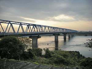 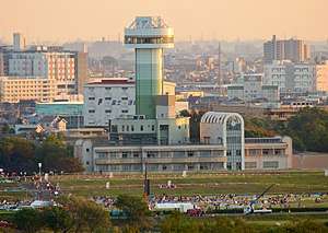 Upper:Aigi Bridge Lower:Kōnan Skyline | |
 Flag  Seal | |
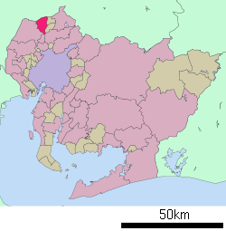 Location of Kōnan in Aichi Prefecture | |
 Kōnan | |
| Coordinates: 35°19′55.5″N 136°52′14.4″E | |
| Country | Japan |
| Region | Chūbu (Tōkai) |
| Prefecture | Aichi |
| Government | |
| Area | |
| • Total | 30.20 km2 (11.66 sq mi) |
| Population (October 1, 2019) | |
| • Total | 97,903 |
| • Density | 3,200/km2 (8,400/sq mi) |
| Time zone | UTC+9 (Japan Standard Time) |
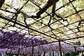
| - Tree | Round Leaf Holly |
| - Flower | Wisteria |
| Phone number | 0587-54-1111 |
| Address | 90 Ōbori, Akadouji-machi, Kōnan-shi, Aichi-ken 483-8701 |
| Website | Official website |

.jpg)
Geography
Kōnan is located in the northern part of the Nōbi Plain, on the southern bank of the Kiso River. The city extends 6.1 km from east to west and 8.8 km from north to south. The landform is generally a flat, fertile alluvial fan. Located approximately 20 kilometers from the Nagoya metropolis, it is also a traffic node bordering Gifu Prefecture.
The name of the city means "south of the river", referring to the Kiso River.
Demographics
Per Japanese census data,[2] the population of Kōnan has increased steadily over the past 70 years.
| Historical population | ||
|---|---|---|
| Year | Pop. | ±% |
| 1940 | 33,664 | — |
| 1950 | 42,836 | +27.2% |
| 1960 | 49,278 | +15.0% |
| 1970 | 77,996 | +58.3% |
| 1980 | 92,141 | +18.1% |
| 1990 | 93,837 | +1.8% |
| 2000 | 97,923 | +4.4% |
| 2010 | 99,731 | +1.8% |
Climate
The city has a climate characterized by hot and humid summers, and relatively mild winters (Köppen climate classification Cfa). The average annual temperature in Kōnan is 15.7 °C. The average annual rainfall is 1845 mm with September as the wettest month. The temperatures are highest on average in August, at around 28.0 °C, and lowest in January, at around 4.2 °C.[3]
History
The area of Kōnan is located in ancient Owari Province and was largely part of the holdings of Owari Domain under the [[Edo period] Tokugawa Shogunate. After the establishment of the modern municipalities system in the early Meiji period, the area was organized into villages within Niwa District, Aichi Prefecture. The area was noted for sericulture during this period. The village of Koori became the town of Hotei on November 26, 1894. Hotei and the town of Kochino, together with the town of Miyata and village of Kusai (both from Haguri District) merged on June 1, 1954 to form the city of Kōnan.
Government
Kōnan has a mayor-council form of government with a directly elected mayor and a unicameral city legislature of 22 members. The city contributes one member to the Aichi Prefectural Assembly. In terms of national politics, the city is part of Aichi District 10 of the lower house of the Diet of Japan.
Economy
Kōnan is a local commercial center and a center for transshipment and light manufacturing. Due to its proximity to the Nagoya metropolis, it is increasing becoming a commuter community
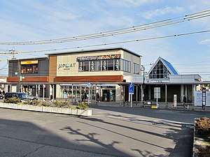
- Shopping mall
- VIA MALL Kounan
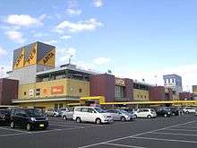 VIA MALL Kounan
Education
Kōnan has ten public elementary schools and five public junior high schools operated by the city government, and three public high schools operated by the Aichi Prefectural Board of Education. There is also one private junior high school and one private high school. The Aichi Konan College, a two-year junior college is also located in Kōnan.
Transportation
Local attractions
- Park
- Flower Park Konan
- Suitopia Konan
 Flower Park Konan
 Suitopia Konan
- Historic site
- Koori Castle
- Mandaradera-ji temple
- Kannon-ji temple - bodaiji of Maeno Nagayasu
- Hotei Daibutsu
- Somoto Futagoyama kofun
- Aigi Bridge
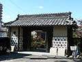 Koori Castle
 Mandaradera-ji
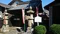 Kannon-ji
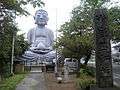 Hotei Daibutsu
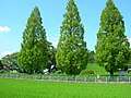 Somoto Futagoyama kofun
_-_panoramio.jpg)
Notable people from Kōnan
- Kenji Horikawa, anime producer
- Haruna Ono, musician, frontwoman of SCANDAL
- Yukari Nakano, figure skater
References
External links
![]()
- Official website (in Japanese)
Nagoya (capital) | ||
| Wards of Nagoya | ||
| Core cities | ||
| Special cities | ||
| Cities | ||
| Districts | ||
| Authority control |
|
|---|