Kita-ku, Nagoya
Kita Ward (北区, Kita-ku) is one of the 16 wards of the city of Nagoya in Aichi Prefecture, Japan. As of 1 October 2019, the ward had an estimated population of 163,555 and a population density of 9,330 persons per km². The total area was 17.53 km².

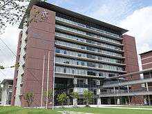
Kita-ku Ward Office
Kita 北区 | |
|---|---|
| Kita Ward | |
 Meijō Park | |
 Location of Kita-ku in Nagoya | |
 Kita | |
| Coordinates: 35°11′39″N 136°54′42″E | |
| Country | Japan |
| Region | Tōkai region Chūbu region |
| Prefecture | Aichi |
| Area | |
| • Total | 17.53 km2 (6.77 sq mi) |
| Population (October 1, 2019) | |
| • Total | 163,555 |
| • Density | 9,300/km2 (24,000/sq mi) |
| Time zone | UTC+9 (Japan Standard Time) |
| - Tree | Sakura |
| - Flower | Cosmos (flower) [1] |
| Phone number | 052-911-3131 |
| Address | 17-1, Shimizu 4-chome, Kita-ku, Nagoya-shi, Aichi-ken 462-8511 |
| Website | www |
Geography
Kita Ward is the north of the center of the city of Nagoya.
Surrounding municipalities
- Nishi Ward
- Moriyama Ward
- Naka Ward
- Higashi Ward
- Kasugai
- Kitanagoya
- Toyoyama
History
Kita Ward was founded in 1944. Its area was expanded in 1946 with an addition from Higashi-ku and again in 1951 with an addition from Naka-ku. In 1955, the village of Kusunoki, formerly part of Nishikasugai District was annexed by Nagoya city, and joined to Kita Ward.
Economy
Kita Ward is largely a regional commercial center and bedroom community for central Nagoya.
Transportation


Railroads
Local attractions
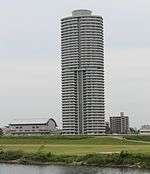
ASTRO Tower
- Meijō Park
- Tonarino
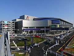
- Nagoya Airfield
- Ozmall

 Tonarino
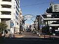 Ozmall
| Wikimedia Commons has media related to Kita-ku, Nagoya. |
References
- 北区の紹介 (in Japanese). Nagoya City. 30 March 2009.
Nagoya (capital) | ||
| Wards of Nagoya | ||
| Core cities | ||
| Special cities | ||
| Cities | ||
| Districts | ||
| Authority control |
|
|---|
This article is issued from Wikipedia. The text is licensed under Creative Commons - Attribution - Sharealike. Additional terms may apply for the media files.