Igloolik Island
Igloolik Island is a small island in the Qikiqtaaluk Region of Nunavut, Canada. It is located in the Foxe Basin, very close to the Melville Peninsula (and to a lesser degree, Baffin Island), and it is often thought to be a part of the peninsula. It forms part of the Arctic Archipelago.
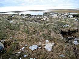 Remnants of older Inuit sod houses in Igloolik Point | |
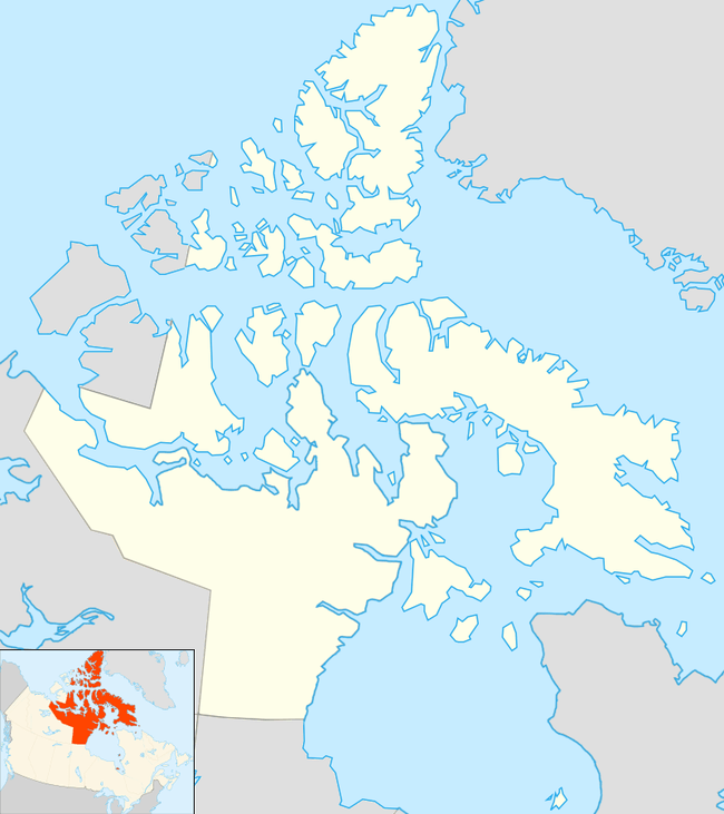 Igloolik Island Location in Nunavut | |
| Geography | |
|---|---|
| Location | Foxe Basin |
| Coordinates | 69°23′N 81°40′W |
| Archipelago | Arctic Archipelago |
| Administration | |
Canada | |
| Nunavut | Nunavut |
| Region | Qikiqtaaluk |
| Largest settlement | Igloolik |
| Demographics | |
| Population | 1,538 |
| Ethnic groups | Inuit |
The word Igloolik (Inuktitut: "there is an igloo here") comes from iglu (meaning: "house"/"building") and refers to the sod houses (qarmaq)[1] that were originally in the area.[2][3] Inuit and their ancestors have inhabited the island since 2000 BC. The archaeological sites on the island, which show a sequence up to 1000 AD, were designated a National Historic Site of Canada in 1978.[4][5][6]
There is only one community on the island, also named Igloolik.
Qikiqtaarjuk
On the north of Igloolik Island at 69°24′45″N 081°30′07″W is a peninsula called Qikiqtaarjuk (Inuktitut syllabics: ᕿᑭᖅᑖᕐᔪᒃ,[7] English: little island).[8][9] About 400 – 500 years ago Qikiqtaarjuk was a separate island but due to isostatic rebound it became part of the main island.[8] Inuit Qaujimajatuqangit (traditional knowledge) says that prior to that there was an even smaller island called Puqtuniq from which the waters receded forming Qikiqtaarjuk.[10] Qikiqtaarjuk is associated with several Inuit legends and stories and was the place from where Atanarjuat starts his run.[8][9][10]
See also
- Arvia'juaq and Qikiqtaarjuk National Historic Site, near Arviat in Nunavut formerly, an island but Qikiqtaarjuk is now part of the mainland
- Qikiqtaarjuk
References
- Joe Kremmidjuar Testimony
- Igloolik, Nunavut
- Igloolik at the Qikiqtani Inuit Association Archived 2010-07-06 at the Wayback Machine
- Igloolik Island Archaeological Sites National Historic Site of Canada. Canadian Register of Historic Places. Retrieved 29 October 2013.
- National Historic Sites Of Canada System Plan Archived 2007-03-28 at the Wayback Machine
- National Historic Sites Of Canada System Plan map Archived 2006-05-29 at the Wayback Machine
- Qikiqtaarjuk
- Encounters on the Passage: Inuit Meet the Explorers by Dorothy Harley Eber
- New Ways of Mapping: Using GPS Mapping Software to Plot Place Names and Trails in Igloolik (Nunavut) by Claudio Aporta
- Interviewing Inuit Elders by Alexina Kublu Archived 2012-02-08 at the Wayback Machine
| Provinces | |
|---|---|
| Territories | |
| Other countries | |
| |