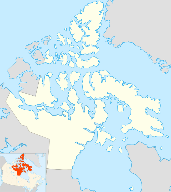
Qikiqtaaluk Region
The Qikiqtaaluk Region, Qikiqtani Region (Inuktitut: ᕿᑭᖅᑖᓗᒃ pronounced [qikiqtaːˈluk]) or Baffin Region is the easternmost[1] administrative region of Nunavut, Canada. Qikiqtaaluk is the traditional Inuktitut name for Baffin Island. Although the Qikiqtaaluk Region is the most commonly used name in official contexts, several notable public organizations, including Statistics Canada[2] prefer the older term Baffin Region.

With a population of 18,988 and an area of 989,879.35 km2 (382,194.55 sq mi) it is the largest and most populated of the three regions.[2]
The region consists of Baffin Island, the Belcher Islands, Akimiski Island, Mansel Island, Prince Charles Island, Bylot Island, Devon Island, Cornwallis Island, Bathurst Island, Amund Ringnes Island, Ellef Ringnes Island, Axel Heiberg Island, Ellesmere Island, the Melville Peninsula, the eastern part of Melville Island, and the northern parts of Prince of Wales Island, and Somerset Island, plus smaller islands in between. The regional seat, and territorial capital, is Iqaluit (population 7,740).[3] The Qikiqtaaluk Region spans the northernmost, easternmost, and southernmost areas of Nunavut.
Before 1999, the Qikiqtaaluk Region existed under slightly different boundaries as the Baffin Region, District of Keewatin, Northwest Territories.
Canada claims Hans Island as part of Qikiqtaaluk, while Denmark considers it to be part of the Greenlandic municipality of Avannaata.
Communities
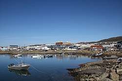
All of Qikiqtaaluk's thirteen communities are located on tidal water and just under half of its residents live in Nunavut's capital and only city, Iqaluit (7,740.[3]). The majority of the rest live in twelve hamlets—Arctic Bay (868[4]), Cape Dorset (1,441[5]), Clyde River (1,053[6]), Grise Fiord (129[7]), Hall Beach (848[8]), Igloolik (1,682[9]), Kimmirut (389[10]), Pangnirtung (1,481[11]), Pond Inlet (1,617[12]), Qikiqtarjuaq (598[13]), Resolute (198[14]) and Sanikiluaq (882[15]). Alert (CFS Alert) and Eureka are part of the Baffin, Unorganized (62[16]) areas in Qikiqtaaluk.
Formerly there was a mining town at Nanisivik. However, it and the Nanisivik Mine closed in 2002, with Nanisivik Airport closing in 2010 and all flights transferred to Arctic Bay Airport.
Like the majority of Canada's Inuit communities, the regions traditional country food includes seal, Arctic char, walrus, polar bear and caribou-which are abundant.[1]
Iqaluit
Iqaluit has the Astro Hill Complex, the Nunatta Sunakkutaangit Museum and the Legislative Building of Nunavut and the Unikkaarvik Visitors Centre.
Pre-contact
According to anthropologists and historians, the Inuit are the descendants of the Thule people who displaced the Dorset culture (in Inuktitut, the Tuniit).[17][18] By 1300 the Inuit had trade routes with more southern cultures.[19]
History
About 1910 Europeans markets increased their interest in white fox pelts. The distribution and mobility of Inuit changed as the expanded their traditional hunting and fishing routes to participate in the white fox fur trade. Traditional food staples—such as seal and caribou—were not always found in the same regions as white fox.[1] The Hudson's Bay Company—which was chartered in 1670—had been opening fur trading posts throughout Inuit and First Nations territory. By 1910, the HBC was restructured into a lands sales department, retail and fur trade. The HBC dominated the fur trade under minimal supervision from the Canadian government, and some Anglican and Catholic missionaries who lived near remote northern hamlets. By 1922 most of imported goods acquired by Inuit were from the HBC.[1]
Relocation
Between 1950 and 1975 thirteen northern communities were relocated.[1]
Killing of the sled dogs
In the 1950s and 1960s the Royal Canadian Mounted Police (RCMP) and others in authority undertook "the widespread killing of sled dogs".[1]
Reconciliation and truth commissions
The Qikigtani Truth Commission—which was commissioned, conducted, and paid for by an Aboriginal organization, the Qikiqtani Inuit Association and took place from 2007 to 2010—brought together historians and Inuit to revisit the history of the Qikigtaaluk Region.[1]
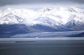
Protected areas
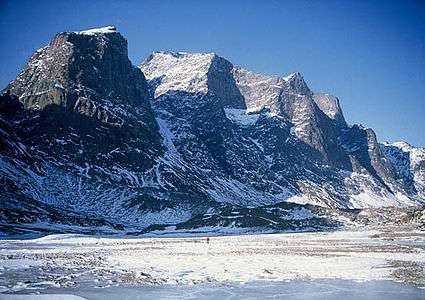
- Auyuittuq National Park
- Bowman Bay Wildlife Sanctuary
- Katannilik Territorial Park Reserve
- Kekerten Territorial Park
- Mallikjuak Territorial Park
- Pisuktinu-Tunngavik Territorial Park
- Polar Bear Pass National Wildlife Area
- Quammaarviit Territorial Park
- Quttinirpaaq National Park
- Sirmilik National Park
- Sylvia Grinnell Territorial Park
Demographics
Canada 2016 Census[2]
- Population: 18,988
- Population change (2011–2016): +12.1%
- Private dwellings: 6,556
- Area: 989,879.35 km2 (382,194.55 sq mi)
- Density: 0.02/km2 (0.05/sq mi)
- National rank in terms of population (2011): 245th out of 293
- Territorial rank in terms of population: 1st out of 3
Surrounding census divisions
- Division No. 11, Newfoundland and Labrador (Nunatsiavut)
- Division No. 23, Manitoba
- Inuvik Region
- Kivalliq Region
- Kitikmeot Region
References
- Philip Goldring (Winter 2015). "Historians and Inuit: learning from the Qikiqtani Truth Commission, 2007-2010". Canadian Journal of History. University of Toronto via GALE. 50 (3): 492. doi:10.3138/CJH.ACH.50.3.005. Archived from the original on May 6, 2016. Retrieved April 19, 2016.
- "Census Profile, 2016 Census Baffin, Region [Census division]". Statistics Canada. Retrieved March 2, 2017.
- "Census Profile, 2016 Census Iqaluit". Statistics Canada. Retrieved March 2, 2017.
- Statistics Canada. "Census Profile, 2016 Census Arctic Bay". Retrieved February 18, 2016.
- "Census Profile, 2016 Census Cape Dorset". Statistics Canada. Retrieved March 3, 2017.
- "Census Profile, 2016 Census Clyde River". Statistics Canada. Retrieved March 3, 2017.
- "Census Profile, 2016 Census Grrise Fiord". Statistics Canada. Retrieved March 3, 2017.
- "Census Profile, 2016 Census Hall Beach". Statistics Canada. Retrieved March 3, 2017.
- "Census Profile, 2016 Census Igloolik". Statistics Canada. Retrieved March 3, 2017.
- "Census Profile, 2016 Census Kimmirut". Statistics Canada. Retrieved March 3, 2017.
- "Census Profile, 2016 Census Pangnirtung". Statistics Canada. Retrieved March 3, 2017.
- "Census Profile, 2016 Census Pond Inlet". Statistics Canada. Retrieved March 3, 2017.
- "Census Profile, 2016 Census Qikiqtarjuaq". Statistics Canada. Retrieved March 3, 2017.
- "Census Profile, 2016 Census Resolute". Statistics Canada. Retrieved March 3, 2017.
- "Census Profile, 2016 Census Sanikiluaq". Statistics Canada. Retrieved March 3, 2017.
- "Census Profile, 2016 Census Baffin, Unorganized". Statistics Canada. Retrieved March 4, 2017.
- Rigby, Bruce. "101. Qaummaarviit Historic Park, Nunavut Handbook" (PDF). Archived from the original (PDF) on May 29, 2006. Retrieved October 2, 2009.
- "The Dorsets: Depicting Culture Through Soapstone Carving" (PDF). Archived from the original (PDF) on October 30, 2007. Retrieved October 5, 2009.
- "Innu Culture 3. Innu-Inuit 'Warfare'". 1999, Adrian Tanner Department of Anthropology-Memorial University of Newfoundland. Retrieved October 5, 2009.
Further reading
- Kavik, Lisi, and Miriam Fleming. Qikiqtamiut Cookbook. [Sanikiluaq, Nunavut]: Municipality of Sanikiluaq, 2002. ISBN 1-896445-22-5
External links
| Wikimedia Commons has media related to Qikiqtaaluk Region. |
Places adjacent to Qikiqtaaluk Region | ||||||||||
|---|---|---|---|---|---|---|---|---|---|---|
| ||||||||||
| Authority control |
|
|---|