List of National Historic Sites of Canada in Quebec
This is a list of National Historic Sites (French: Lieux historiques nationaux) in the province of Quebec. As of July 2019, there were 198 National Historic Sites designated in Quebec, 30 of which are administered by Parks Canada (identified below by the beaver icon ![]()
Numerous National Historic Events also occurred in Quebec, and are identified at places associated with them, using the same style of federal plaque which marks National Historic Sites. Several National Historic Persons are commemorated throughout the province in the same way. The markers do not indicate which designation—a Site, Event, or Person—a subject has been given.
This list uses names designated by the national Historic Sites and Monuments Board, which may differ from other names for these sites.
National Historic Sites
| Site[1] | Date(s) | Designated | Location | Description | Image |
|---|---|---|---|---|---|
| Acton Vale Railway Station (Grand Trunk) [3] | 1900 (completed) | 1976 | Acton Vale 45°38′53.85″N 72°33′50.45″W |
A small passenger terminal with dormer, turret and bellcast roof; symbolic of the expansion of the Grand Trunk Railway | 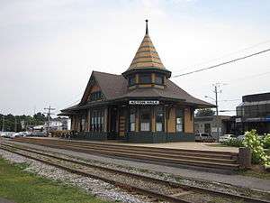 |
| Alert Hangar [4] | 1958 (completed) | 2007 | La Baie 48°20′4.77″N 70°58′19.75″W |
Four large steel hangars at CFB Bagotville which, during the Cold War, housed fighter aircraft intended to counter surprise attacks by Soviet bombers; played a strategic role in the air defence of Canada | .jpg) |
| Apitipik [5] | 6000 BCE (c.) | 1996 | Gallichan 48°39′58.5″N 79°20′4.23″W |
Traditional summering area and sacred place for the Abitibiwinni, and the site of trading posts from 1686 to 1922 | |
| Arvida Historic District [6] | 1925 (established) | 2012 | Arvida 48°26′0″N 71°11′0″W |
A well-preserved example of a Canadian company town illustrating 25 years' worth of urban planning concepts, including the City Beautiful and Garden city movements; symbolic of the growth and development of the country’s aluminum industry | 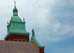 |
| Banc de Pêche de Paspébiac [7] | 1783 (established) | 2001 | Paspébiac 48°1′16.3″N 65°15′15.3″W |
Ten buildings located on a large spit; associated with the commercial cod fishery in the Gulf of Saint Lawrence |  |
| Battle of Eccles Hill [8] | 1870 (battle) | 1923 | Frelighsburg 45°1′10″N 72°54′17″W |
A site commemorating the battle where Canadian volunteers and home guards repulsed the Fenian invaders |  |
| Battle of Lacolle [9] | 1814 (battle) | 1923 | Notre-Dame-du-Mont-Carmel 45°4′9″N 73°20′31″W |
A small garrison of British and Canadian defenders repulsed an American attack, ending the last American invasion of Lower Canada during the War of 1812 |  |
| Battle of September 6th, 1775 [10] | 1775 (battle) | 1928 | Saint-Jean-sur-Richelieu 45°16′52″N 73°14′57″W |
Invading American troops preparing to attack Fort Saint-Jean were ambushed by a party of Mohawks and other allied Aboriginal people, forcing the Americans to retreat to Île aux Noix | |
| Battle of the Cedars [11] | 1776 (battle) | 1928 | Les Cèdres 45°18′35.75″N 74°2′7.21″W |
The American army occupying Montreal established a post here to protect its western flank; a small detachment of the 8th Regiment of Foot, reinforced by allied Aboriginals, laid siege to the outpost and the Americans capitulated | 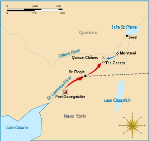 |
| Battle of the Chateauguay |
1813 (battle) | 1920 | Ormstown 45°9′30″N 73°55′52″W |
A force consisting of about 1,630 French Canadian regulars and militia and Mohawk warriors under Charles de Salaberry repulsed an American force of about 4,000 attempting to invade Lower Canada during the War of 1812 |  |
| Battle of the Restigouche |
1760 (battle) | 1924 | Pointe-à-la-Croix 48°1′0″N 66°44′5″W |
A naval battle fought during the Seven Years' War on the Restigouche River between the British and the French; the last naval battle of the war in North American waters, and the French loss hastened the fall of New France |  |
| Battle of Trois-Rivières [14] | 1776 (battle) | 1920 | Trois-Rivières 46°20′38″N 72°33′7″W |
British victory over the Continental Army; the last major battle of the American invasion fought on Quebec soil |  |
| Beauharnois Power Development [15] | 1930 (first phase) | 1990 | Beauharnois 45°18′51″N 73°54′37″W |
A hydroelectric power plant on the Saint Lawrence River that was of significant economic and technological importance at the time of its development | 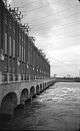 |
| Berthier Railway Station (Canadian Pacific) [16] | 1877 (completed) | 1976 | Sainte-Geneviève-de-Berthier 46°5′18″N 73°12′45″W |
One of the small domestic stations originally built along the railway line between Montreal and Quebec City; representative of the expansion of the Canadian Pacific Railway. DEMOLISHED | |
| Blanc-Sablon [17] | 7000 BCE (c.) (first inhabited) | 2007 | Blanc-Sablon 51°25′32″N 57°8′38″W |
Over 60 archaeological sites relating to 9000 years of human occupation, including the Archaic, Dorset and European periods | 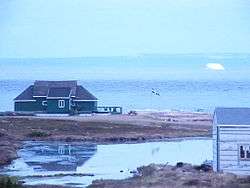 |
| Bolton-Est Town Hall [18] | 1867 (completed) | 1984 | East Bolton 45°12′11″N 72°21′23″W |
A two-storey clapboard township hall; an enduring tribute to the development of local self-government in Canada | |
| Cap-des-Rosiers Lighthouse [19] | 1858 (completed) | 1973 | Gaspé 48°51′22″N 64°12′5″W |
A 37-metre (121 ft) high stone lighthouse; the tallest lighthouse in Canada | 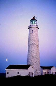 |
| Carillon Barracks |
1838 (completed) | 1960 | Saint-André-d'Argenteuil 45°33′53.81″N 74°22′18.28″W |
A two-storey stone barracks on the main street of the village of Carillon, and now used as the local museum; used to British troops called in to suppress the Lower Canada Rebellion | |
| Carillon Canal [21] | 1833 (completed) | 1929 | Saint-André-d'Argenteuil 45°34′3.87″N 74°22′43.42″W |
A canal now used for recreational purposes; an important navigable transportation route during the 19th and 20th centuries, joining Montreal to Kingston by the Saint Lawrence River | |
| Caughnawaga Mission / Mission of St. Francis Xavier [22] | 1647 (established), 1716 (established at Kahnawake) | 1966 | Kahnawake 45°24′56″N 73°40′36″W |
A Jesuit mission to the Mohawks, located within the walls of Fort St-Louis NHSC | 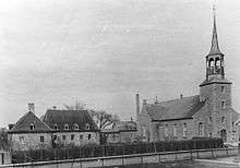 |
| Caughnawaga Presbytery [23] | 1719 (completed) | 1969 | Kahnawake 45°24′56″N 73°40′36″W |
The oldest surviving building at the Caughnawaga Mission NHSC; the presbytery exemplifies the steep-pitch hip-roofed architecture common to Quebec in the late 17th and early 18th century | |
| Chambly Canal |
1843 (completed) | 1929 | Chambly 45°22′38″N 73°15′27″W |
A 22-kilometre (14 mi) long canal that forms part of a waterway constructed in the 19th century on the Richelieu River, on the inland water transportation route joining Montreal and New York City | 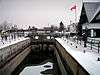 |
| Chapais House [25] | 1834 (completed) | 1962 | Saint-Denis-De La Bouteillerie 47°30′11.88″N 69°56′15.18″W |
A 2 1⁄2-storey clapboard house that was the home of Jean Charles Chapais, a Father of Confederation | 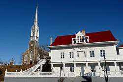 |
| Church of Notre-Dame-de-la-Présentationl [26] | 1924 (completed) | 2004 | Shawinigan 46°31′39″N 72°45′1″W |
Large stone Romanesque Revival church, with interior murals by Ozias Leduc; the paintings represent the culmination of Leduc's work and the end of the great era of religious mural painting in Quebec | 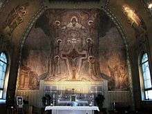 |
| Church of Sainte-Marie [27] | 1859 (completed) | 2006 | Sainte-Marie 46°26′15.15″N 71°1′20.47″W |
A romantic Gothic Revival style church; known for its unique interiors designed by Charles Baillairgé and its trompe-l'œil and grisaille paintings by artist François-Édouard Meloche |  |
| Corossol [28] | 1693 (shipwreck) | 1995 | Sept-Îles 50°5′37″N 66°23′29″W |
The underwater remains of a ship belonging to Louis XIV of France which sank in a storm in 1693; the only remains in Canada from the wreck of a 17th-century French vessel | |
| Coteau-du-Lac |
1781 (completed) | 1923 | Coteau-du-Lac 45°17′16″N 74°10′39″W |
The remains of a canal and associated military fortifications; one of the oldest lock canals in North America, and the site of a British military post built following the American Revolutionary War and that served a strategic role during the War of 1812 |  |
| Davie Shipyard [30] | 1829 (established) | 1990 | Lévis 46°48′51″N 71°11′5″W |
A shipyard on the Saint Lawrence River which contains heritage resources dating to the wooden sailing ship era; when it closed in 1998, it was the oldest operational shipyard in Canada |  |
| de Salaberry House [31] | 1815 (completed) | 1968 | Chambly 45°26′55″N 73°16′9″W |
The large, three-storey stone house of Charles de Salaberry, located in front of the Chambly Rapids; representative of the style of country homes common in the Montreal region in the early 19th century | |
| Droulers-Tsiionhiakwatha [32] | 15th century (established) | 2007 | Saint-Anicet 45.082964°N 74.314740°W |
Discovered in 1994, an archaeological site containing the remains of mid-15th century village of a group now identified as the St. Lawrence Iroquoians; the largest paleohistorical site discovered to date in Quebec | 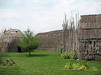 |
| Étienne-Paschal Taché House [33] | 1830 (completed) | 1990 | Montmagny 46°58′52″N 70°33′30″W |
The home of Sir Étienne-Paschal Taché, a Father of Confederation; distinctive house with twin towers | |
| First Geodetic Survey Station [34] | 1905 (completed) | 1929 | Chelsea 45°29′21″N 75°51′45″W |
Located in Gatineau Park, the site of the first geodetic station established in Canada | |
| Forges du Saint-Maurice |
1730 (established) | 1919 | Trois-Rivières 46°23′50″N 72°39′35″W |
An industrial cultural landscape where an ironworks operated for more than 150 years; the principal industrial site under the French Regime, the establishment of which marked the beginnings of Canada's iron industry | 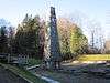 |
| Former Lamaque Mine and the Bourlamaque Mining Village [36] | 1925 (established) | 2012 | Val-d’Or 48°5′38″N 77°45′54″W |
A 22 hectares (54 acres) site comprising a former gold mine and a nearby planned mining town; a well-preserved mining landscape and company town | 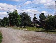 |
| Former Shawinigan Aluminum Smelting Complex [37] | 1899 (established) | 2002 | Shawinigan 46°32′21″N 72°45′51″W |
An early aluminum smelter with hydroelectric facilities that supplied it with power; the oldest known, extant aluminum smelting complex in North America | 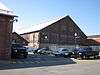 |
| Fort Chambly |
1665 (established) | 1920 | Chambly 45°26′57″N 73°16′40″W |
A stone fortress on the Richelieu River; served both the French and British regimes during the Iroquoian Wars, the Seven Years' War, the American Revolutionary War, the War of 1812 and the Rebellions of 1837 |  |
| Fort Crevier [39] | 1687 (established) | 1920 | Pierreville 46°6′12″N 72°52′43″W |
A fort built to defend the French inhabitants in the region against Iroquois attacks encouraged by the British |  |
| Fort Laprairie [40] | 1689 (established) | 1921 | La Prairie 45°25′15″N 73°29′47″W |
A site the Saint Lawrence River where a French fort once stood, where it served as a refuge for French settlers and a defensive outpost for Montreal | |
| Fort Lennox |
1759 (established) | 1920 | Saint-Paul-de-l'Île-aux-Noix 45°7′15″N 73°16′5″W |
A fort on Île aux Noix in the Richelieu River, one of the gateways into Canada; used by French, British and American forces during various conflicts | 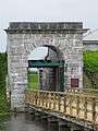 |
| Fort Longueuil [42] | 1690 (completed) | 1923 | Longueuil 45°32′26″N 73°30′30″W |
The archaeological site of a fort demolished in 1810, extending beneath present-day Saint-Antoine-de-Padoue Cathedral; constructed between 1685 and 1690 as the fortified residence of Charles le Moyne de Longueuil, the only Canadian-born person to be raised to the rank of Baron by the French King | |
| Fort Richelieu [43] | 1642 (established) | 1923 | Sorel-Tracy 46°2′48″N 73°6′57″W |
One of the earliest forts in New France, intended to block Iroquois raids using the Richelieu River as a route into Canada | 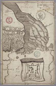 |
| Fort Saint-Jean [44] | 1748 (established) | 1923 | Saint-Jean-sur-Richelieu 45°17′53″N 73°15′7″W |
A fort built by Gaspard-Joseph Chaussegros de Léry that withstood a 45-days siege by Richard Montgomery during the American invasion of 1775; now houses the Royal Military College Saint-Jean | 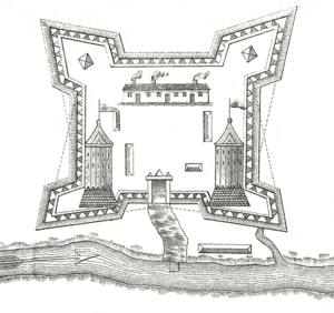 |
| Fort St-Louis [45] | 1725 (established) | 1930 | Kahnawake 45°24′57″N 73°40′35″W |
A fort built in 1725 by the French for the protection of a Jesuit mission |  |
| Fort Ste. Thérèse |
1665 (established) | 1923 | Chambly 45°23′20.8″N 73°15′27.05″W |
One of the forts constructed on the Richelieu River by the Carignan Regiment for defence against the Iroquois; site located within the Chambly Canal NHSC area | 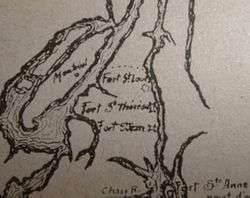 |
| Fort Trois-Rivières [47][48] | 1634 (established) | 1920 | Trois-Rivières 46°20′31″N 72°32′19″W |
The construction of a wooden fort on this site marked the second permanent settlement in New France and the foundation of the modern city of Trois-Rivières |  |
| Governors' Cottage [49] | 1781 (completed) | 1957 | Sorel-Tracy 46°1′58″N 73°6′59″W |
A house constructed for Frederick Haldimand as part of a defensive effort to settle the area with Loyalists; used as a summer residence by subsequent Governors and by military commanders until 1860 | 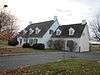 |
| Granada Theatre [50] | 1929 (completed) | 1996 | Sherbrooke 45°24′8″N 71°53′28″W |
Theatre with Spanish Revival style facade; excellent example of an atmospheric theatre in Canada | _-_janvier_2012.jpg) |
| Grosse Île and the Irish Memorial |
1832 (station established) | 1974 | Saint-Antoine-de-l'Isle-aux-Grues 47°2′0″N 70°40′0″W |
A quarantine station for immigrants arriving at Quebec City from 1832 to 1937; symbolic of the importance of immigration to Canada, and of the tragic experiences of Irish immigrants during the typhus epidemic of 1847 | 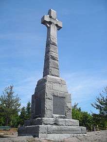 |
| Haskell Free Library and Opera House [52] | 1904 (completed) | 1985 | Stanstead 45°0′20.34″N 72°5′51.84″W |
A two-storey, Queen Anne Revival style building with tower that houses both a library and an opera house; the building straddles the Canadian–American border and was donated to the residents of both countries | 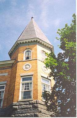 |
| Havelock Township Hall [53] | 1868 (completed) | 1984 | Havelock 45°2′45″N 73°45′28″W |
A stone township hall; an exceptional example of the rural town halls built in l9th century Canada | |
| The Historic Village of Val-Jalbert, Chambord, Quebec[54] | 1901 (founded) | July 31, 2019 | Chambord 48.444639°N 72.164361°W |
A pulp mill company town, now a ghost town/park |  |
| Île aux Basques [55] | 1580 (ca.) (outpost established) | 1984 | Trois-Pistoles 48°8′34″N 69°14′58″W |
A small island that served as an outpost from about 1580 to 1630 for Basque fishermen who crossed the ocean from France; the only recorded site in the Gulf of Saint Lawrence where archaeological resources confirm early commercial contact between Europeans and Aboriginals | 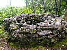 |
| Île d'Orléans Seigneury [56] | 1636 (seigneury established) | 1990 | L'Île-d'Orléans Regional County Municipality 46°55′0″N 70°58′0″W |
One of the earliest settled areas of New France; the landscape and surviving 17th and 18th-century buildings are evocative of the seigneurial system of New France |  |
| Île-Verte Lighthouse [57] | 1809 (completed) | 1974 | Notre-Dame-des-Sept-Douleurs 48°3′4″N 69°25′27″W |
A 12-metre (39 ft) high cylindrical stone lighthouse; the first lighthouse on the Saint Lawrence River, and third oldest lighthouse in Canada |  |
| Jardins de Métis [58] | 1926 (established) | 1995 | Grand-Métis 48°37′42″N 68°7′23″W |
An English-inspired garden created by Elsie Reford during the years 1926 to 1958; an excellent Canadian example of this type of garden | 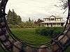 |
| Joffre Roundhouse (Canadian National) [59] | 1880 (completed) | 1992 | Charny 46°42′25″N 71°16′20″W |
Only existing full-circle roundhouse in Canada | |
| Joliette Court House [60] | 1862 (completed) | 1981 | Joliette 46°1′34″N 73°26′33″W |
A noted and well-preserved example of a Neoclassical public building | |
| Joly de Lotbinière Estate [61] | 1851 (established) | 2003 | Sainte-Croix 46°40′2″N 71°50′55″W |
A remarkable 136-hectare (340-acre) manorial summer estate on the Pointe Platon peninsula, founded by Henri-Gustave Joly de Lotbinière |  |
| L'Isle-Verte Court House [62] | 1860 (completed) | 1981 | L'Isle-Verte 48°0′45″N 69°20′20″W |
A court house built in the Regency style, a style rarely used for public buildings in Canada; a rare example of a purpose-built circuit court building | |
| La Corne Nursing Station [63] | 1930 (established) | 2003 | La Corne 48°21′23″N 77°59′46″W |
Two wooden buildings that are one of the best preserved of the 174 nursing stations created in Quebec between 1932 and 1975; symbolizes the contribution of nurses in isolated, rural communities | |
| La Malbaie Historic District [64] | 1930 (established) | 2007 | La Malbaie 47°37′23″N 70°8′30″W |
One of the oldest villégiature, or vacation, areas in Canada, with impressive vistas overlooking the Saint Lawrence River | 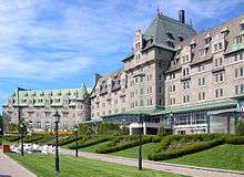 |
| La Petite-Ferme du cap Tourmente[65] | 1626 (farm) 1667 (house) |
2018 | Saint-Joachim 47.065676°N 70.794053°W |
First farm in the St. Lawrence Valley, begun by Champlain in 1626, then used for 300 years by the Quebec Seminary. Now part of Cap Tourmente National Wildlife Area | |
| Le Boutillier Manor [66] | 1860 (completed) | 1975 | Gaspé 48°55′56″N 64°18′6″W |
The distinctive home of businessman and political figure John Le Boutillier | |
| Légaré Mill [67] | 1763 (completed) | 1999 | Saint-Eustache 45°33′29″N 73°53′45″W |
A flour mill that has functioned continuously since the French colonial period; a proto-industrial building site that is representative of the development of the seigneurial system and the related colonial agricultural economy | 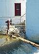 |
| Lévis Forts |
1872 (completed) | 1920 | Lévis 46°48′53″N 71°9′31″W |
The remains of three 19th-century stone defensive works located on a height of land on the south bank of the Saint Lawrence River; constructed by the British, they were an integral part of the fortifications of Quebec City |  |
| Lévis Railway Station (Intercolonial) [69] | 1884 (completed) | 1976 | Lévis 46°48′37″N 71°11′14″W |
A two-storey, stone railway station building that served as the terminus of the Intercolonial Railway from Halifax | |
| Louis Bertrand House [70] | 1853 (completed) | 1999 | L'Isle-Verte 48°0′49″N 69°20′16″W |
A house built in the traditional "maison québecoise" manner for merchant and politician Louis Bertrand; an outstanding example of its style and type, and representative of the lifestyle middle-class families in Quebec society in the 19th century | 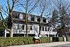 |
| Louis S. St. Laurent |
1881 (lots assembled by St. Laurent family) | 1973 | Compton 45°14′29″N 71°49′30″W |
The site where Prime Minister Louis St. Laurent was born; a cultural landscape associated with the life of Canada's 12th Prime Minister and that also commemorates the social history of the Eastern Townships | |
| Magog Textile Mill [72] | 1883 (completed) | 1989 | Magog 45°15′45″N 72°8′28″W |
The only 19th-century cotton mill in Canada where the entire process of spinning, weaving, bleaching and printing was carried on at one site, and the mill where cotton was printed in 1884 for the first time in Canada |  |
| Manoir Papineau |
1850 (completed) | 1986 | Montebello 45°38′45.96″N 74°56′44.85″W |
A large mansion on a bluff overlooking the Ottawa River, located on the grounds of the Château Montebello hotel; commemorates the first owner of the house, Louis-Joseph Papineau | 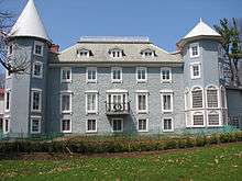 |
| Mauvide-Genest Manor [74] | 1734 (completed) | 1993 | Saint-Jean-de-l'Île-d'Orléans 46°54′51″N 70°54′9″W |
An excellent example of a mid 18th-century, rural seigneurial manor | 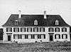 |
| Obadjiwan-Fort Témiscamingue |
1685 (established) | 1931 as Fort Témiscamingue NHS Renamed July 5, 2019 |
Duhamel-Ouest 47°17′19″N 79°27′41″W |
A fort built by the French to compete with the Hudson's Bay Company; later rebuilt and controlled by the North West Company after the Conquest of 1760 | 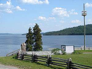 |
| Old Chicoutimi Pulp Mill [76] | 1896 (established) | 1983 | Chicoutimi 48°25′14″N 71°5′0″W |
An industrial complex in a wooded area, comprising five stone buildings constructed between 1898 and 1923; the major facility of the Chicoutimi Pulp Company, Canada's largest producer of mechanical wood pulp in the early 20th century |  |
| Old Chicoutimi Trading Post [77] | 1676 (established) | 1972 | Chicoutimi 48°25′44″N 71°4′32″W |
A fur trade post, built at the head of the Saguenay River, which became the principal trading post in the region and the major centre of the fur trade in the interior | |
| Pagé - Rinfret House / Beaudry House [78] | 1720 (established) | 1969 | Cap-Santé 46°40′19″N 71°47′0″W |
A one-and-a-half-storey, wood-frame house overlooking the Saint Lawrence River, reflective of the architecture of New France and French Canadian building traditions | |
| Pointe-au-Père Lighthouse |
1859 (first lighthouse completed) | 1974 | Rimouski 48°31′2.79″N 68°28′8.39″W |
A lighthouse and associated buildings located on a headland facing the Saint Lawrence River; an important navigation light in the river and the Gulf of Saint Lawrence | 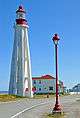 |
| Pointe-du-Buisson [80] | 3000 BCE (ca.) (earliest archaeological resources) | 2005 | Beauharnois 45°18′59.28″N 73°57′57.18″W |
A 21-hectare (52-acre) archaeological site on a point of land along the Saint Lawrence River; documents the history of Aboriginal populations over the last 5000 years who used the river in their travels | |
| Powerscourt Covered Bridge [81] | 1861 (completed) | 1984 | Elgin and Hinchinbrooke 45°0′25.13″N 74°9′39.75″W |
A wooden covered bridge that still stands on its original stone foundations; the only remaining McCallum inflexible arched truss bridge in the world and one of the oldest extant covered bridges in Canada | 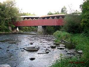 |
| Rivière-du-Loup Town Hall [82] | 1916 (completed) | 1984 | Rivière-du-Loup 47°50′9″N 69°32′12″W |
A two-storey red-brick city hall, the eclectic design of which set it apart from the surrounding commercial buildings at the time of its construction; symbolizes the town's aspirations and desire to increase its profile during the First World War | .jpg) |
| Roberval Town Hall [83] | 1929 (completed) | 1984 | Roberval 48°31′6″N 72°13′20″W |
A three-storey town hall with steeply pitched, Second Empire-style metal roofs; symbolizes the prosperity of Roberval and its increasing importance within the Saguenay–Lac-Saint-Jean region at the time of the building's construction |  |
| Round Stone Windmill and House [84] | 1721 (windmill completed) | 1969 | Notre-Dame-de-l'Île-Perrot 45°21′57″N 73°51′8″W |
An extremely rare stone windmill and accessory miller’s house dating from the 18th-century seigneury, located on Île Perrot | 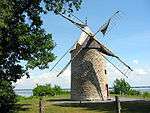 |
| Saint-André-de-Kamouraska Church [85] | 1811 (completed) | 1985 | Saint-André 47°40′25″N 69°43′44″W |
A noted example of the small Quebec churches built according to the "Récollet Plan" (a broad nave with a narrower semicircular apse); the interiors contain some of the best surviving examples of the work of sculptor Louis-Xavier Leprohon | 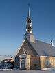 |
| Saint-Eustache Church[86] | 1783 (first completed) 1837 (battle) |
2015 | Saint-Eustache, Quebec 45°33′26″N 73°53′20″W |
A site and symbol of the Battle of Saint-Eustache in the Rebellions of 1837, marking the end of the Lower Canada Rebellion | |
| Saint-Hyacinthe Post Office [87] | 1894 (completed) | 1983 | Saint-Hyacinthe 45°37′25″N 72°56′55″W |
A noted example of the work of federal architect Thomas Fuller | 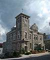 |
| Saint-Jean-d'Iberville Railway Station (Grand Trunk) [88] | 1890 (completed) | 1976 | Saint-Jean-sur-Richelieu 45°18′11″N 73°15′15″W |
A one-storey passenger railway station; representative of the expansion of the Grand Trunk Railway and of the company's presence in Quebec prior to its 1923 amalgamation with Canadian National Railways | 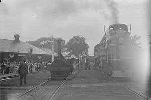 |
| Saint-Joachim Church [89] | 1797 (completed) | 1999 | Châteauguay 45°21′39″N 73°44′55″W |
A noted example of the vernacular Baroque style in the St. Lawrence Valley, with interior decor by Philippe Liébert and Joseph Légaré |  |
| Saint-Joseph-de-Beauce Institutional Ensemble [90] | 1865–1911 (period of construction) | 2006 | Saint-Joseph-de-Beauce 46°18′36″N 70°52′58″W |
A complex of five main buildings consisting of a church, convent, presbytery, orphanage and school; one of the most striking institutional ensembles in Quebec, and illustrative of the Catholic institutions in small towns that served as gathering places for religious, educational and community services | |
| Saint-Joseph-de-la-Rive Shipyard [91] | 1946 (established) | 1996 | Les Éboulements 47°27′21″N 70°21′45″W |
A shipyard associated with small-scale coastal shipping along the Saint Lawrence River, and the largest builder of wooden schooners known as "goélettes" | |
| Saint-Ours Canal |
1849 (completed), 1933 (current locks completed) | 1996 | Saint-Ours 45°51′53″N 73°8′48″W |
A canal on the east bank of the Richelieu River; along with the Chambly Canal, commemorates the importance in the 19th century of the inland water transportation route joining Montreal and New York City | |
| Saint-Vincent-de-Paul Penitentiary [93] | 1873 (established) | 1990 | Laval 45°37′1″N 73°38′47″W |
Canada’s second federal penitentiary, and for a time the country’s sole francophone correctional facility; the now-closed facility is representative of over a century of criminal justice | 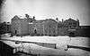 |
| Sainte-Anne Processional Chapel [94] | 1830 (completed) | 1990 | Neuville 46°41′56″N 71°34′57″W |
A small early rubblestone chapel with a gable roof and belltower; the chapel and surrounding site have remained remarkably intact from the time of the chapel's construction in the early 19th century | 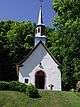 |
| The Sainte-Croix-de-Tadoussac Mission Church [95] | 1750 (completed) | 2012 | Tadoussac 48°8′30.09″N 69°42′55.12″W |
A mission church from the era of New France and the oldest extant wooden church in Canada; bore witness to Jesuit missionary work in remote areas of New France and the conversion of the Innu to Christianity |  |
| Second Battle of Laprairie [96] | 1691 (battle) | 1921 | La Prairie 45°23′21″N 73°24′13″W |
After Pieter Schuyler led a British force in a surprise attack on the French frontier settlement of La Prairie, Captain de Valrennes and a small band of French and Indian troops intercepted the British and inflicted a severe defeat, forcing the British to withdraw to New York | |
| Sir John A. Macdonald’s Summer Residence [97] | 1880 (completed) | 2014 | Rivière-du-Loup 47°48′46″N 69°34′32″W |
 | |
| Sir Wilfrid Laurier |
1870 (completed) | 1938 | Saint-Lin-Laurentides 45°51′12″N 73°45′27″W |
A small house on the site where Wilfrid Laurier was born in 1841, which was acquired by the federal government in 1937 under the mistaken impression it was actually the Laurier family house (the house was built 5 years after the Lauriers sold the lot); one of two houses in Quebec that are designated NHSCs in commemoration of Canada's 7th Prime Minister | |
| St. Stephen's Anglican Church [99] | 1822 (completed) | 1970 | Chambly 45°26′52″N 73°16′26″W |
A small, stone church, originally constructed for the garrison at Fort Chambly; combines Quebec architectural traditions with Palladian influences, and is a noted example of early 19th century ecclesiastical architecture in Canada | 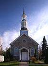 |
| Symmes Hotel [100] | 1831 (completed) | 1976 | Gatineau 45°23′40″N 75°51′18″W |
A stone inn overlooking the north shore of the Ottawa River, originally built for Charles Symmes, the founder of Aylmer; notable as a stopping place on a busy early transportation route which led to the trading posts of northwestern Quebec |  |
| Trestler House [101] | 1806 (completed) | 1969 | Vaudreuil-Dorion 45°23′17″N 74°0′25″W |
A gable-roofed rubblestone house built for Jean-Joseph Trestler; a noted example of traditional Quebec architecture |  |
| Trois-Rivières Historical Complex [102] | 1700–1829 (construction period) | 1962 | Trois-Rivières 46°20′38″N 72°32′12″W |
A historic area comprising five buildings: De Gannes House, the Hertel de la Fresnière House, the Recollet Convent, the Recollet Church, and the Ursuline Convent; a unique group of buildings that represents 18th-century French Canada |  |
| Waapushukamikw [103] | 5050 BCE (ca.) (establishment) | 2009 | Baie-James 51°4′8″N 72°54′14″W |
A white quartzite hill approximately 40 metres (130 ft) high that served as a major quarry site for Aboriginal peoples, and remains a place of spiritual significance for the Mistissini Cree | |
| Wilfrid Laurier House [104] | 1877 (completed) | 1999 | Victoriaville 46°2′14″N 71°54′54″W |
A red-brick, Italianate-style house that served as Wilfrid Laurier's principal residence for 20 years, and his summer home until his death in 1919; now a museum commemorating Canada's 7th Prime Minister |  |
| Wreck of RMS Empress of Ireland [105] | 1914 (sinking) | 2009 | The riverbed of the Saint Lawrence River near Rimouski 48°37′30″N 68°24′29.99″W |
The wreck of the worst maritime disaster in Canadian history; the sole surviving ship from the Canadian Pacific Railway's heyday prior to the First World War as the world's largest and most extensive transportation and communications network |  |
| Wreck of the Elizabeth and Mary [106] | 1690 (sinking) | 1996 | The seabed of Anse aux Bouleaux, near Baie-Trinité 49°22′55″N 67°18′55″W |
The remains of one of four vessels from the fleet of Admiral William Phips, lost during an ill-fated expedition from New England to attack New France | |
See also
| Wikimedia Commons has media related to National Historic Sites of Canada in Quebec. |
- History of Quebec
- Répertoire du patrimoine culturel du Québec
References
- Directory of Federal Heritage Designations - Quebec, Parks Canada
- Quebec, National Historic Sites of Canada - administered by Parks Canada
- Acton Vale Railway Station (Grand Trunk). Canadian Register of Historic Places. Retrieved 3 March 2012.
- Alert Hangar. Canadian Register of Historic Places. Retrieved 3 March 2012.
- Apitipik. Directory of Federal Heritage Designations. Parks Canada. Retrieved 20 March 2012.
- Arvida Historic District. Directory of Federal Heritage Designations. Parks Canada. Retrieved 28 March 2013.
- Banc de Pêche de Paspébiac. Canadian Register of Historic Places. Retrieved 4 March 2012.
- Battle of Eccles Hill. Canadian Register of Historic Places. Retrieved 4 March 2012.
- Battle of Lacolle. Directory of Federal Heritage Designations. Parks Canada. Retrieved 20 March 2012.
- Battle of September 6th, 1775. Directory of Federal Heritage Designations. Parks Canada. Retrieved 20 March 2012.
- Battle of the Cedars. Directory of Federal Heritage Designations. Parks Canada. Retrieved 20 March 2012.
- Battle of the Chateauguay. Canadian Register of Historic Places. Retrieved 4 March 2012.
- Battle of the Restigouche. Directory of Federal Heritage Designations. Parks Canada. Retrieved 24 March 2012.
- Battle of Trois-Rivières. Directory of Federal Heritage Designations. Parks Canada. Retrieved 24 March 2012.
- Beauharnois Power Development. Directory of Federal Heritage Designations. Parks Canada. Retrieved 24 March 2012.
- Berthier Railway Station (Canadian Pacific). Canadian Register of Historic Places. Retrieved 5 March 2012.
- Blanc-Sablon. Canadian Register of Historic Places. Retrieved 5 March 2012.
- Bolton-Est Town Hall. Canadian Register of Historic Places. Retrieved 5 March 2012.
- Cap-des-Rosiers Lighthouse. Canadian Register of Historic Places. Retrieved 5 March 2012.
- Carillon Barracks. Canadian Register of Historic Places. Retrieved 18 March 2012.
- Carillon Canal. Canadian Register of Historic Places. Retrieved 18 March 2012.
- Caughnawaga Mission / Mission of St. Francis Xavier. Canadian Register of Historic Places. Retrieved 18 March 2012.
- Caughnawaga Presbytery. Canadian Register of Historic Places. Retrieved 18 March 2012.
- Chambly Canal. Canadian Register of Historic Places. Retrieved 18 March 2012.
- Chapais House. Canadian Register of Historic Places. Retrieved 18 March 2012.
- Church of Notre-Dame-de-la-Présentation. Canadian Register of Historic Places. Retrieved 19 March 2012.
- Church of Sainte-Marie. Canadian Register of Historic Places. Retrieved 20 March 2012.
- Corossol. Directory of Federal Heritage Designations. Parks Canada. Retrieved 22 April 2012.
- Coteau-du-Lac. Canadian Register of Historic Places. Retrieved 20 March 2012.
- Davie Shipyard. Canadian Register of Historic Places. Retrieved 24 March 2012.
- de Salaberry House. Canadian Register of Historic Places. Retrieved 24 March 2012.
- Droulers-Tsiionhiakwatha. Canadian Register of Historic Places. Retrieved 24 March 2012.
- Étienne-Paschal Taché House. Canadian Register of Historic Places. Retrieved 24 March 2012.
- First Geodetic Survey Station. Canadian Register of Historic Places. Retrieved 25 March 2012.
- Forges du Saint-Maurice. Canadian Register of Historic Places. Retrieved 25 March 2012.
- Former Lamaque Mine and the Bourlamaque Mining Village. Directory of Federal Heritage Designations. Parks Canada. Retrieved 24 October 2013.
- Former Shawinigan Aluminum Smelting Complex. Canadian Register of Historic Places. Retrieved 25 March 2012.
- Fort Chambly. Canadian Register of Historic Places. Retrieved 25 March 2012.
- Fort Crevier. Directory of Federal Heritage Designations. Parks Canada. Retrieved 25 March 2012.
- Fort Laprairie. Canadian Register of Historic Places. Retrieved 25 March 2012.
- Fort Lennox. Canadian Register of Historic Places. Retrieved 25 March 2012.
- Fort Longueuil. Canadian Register of Historic Places. Retrieved 7 April 2012.
- Fort Richelieu. Directory of Federal Heritage Designations. Parks Canada. Retrieved 27 March 2012.
- Fort Saint-Jean. Canadian Register of Historic Places. Retrieved 27 March 2012.
- Fort St-Louis. Canadian Register of Historic Places. Retrieved 27 March 2012.
- Fort Ste. Thérèse. Directory of Federal Heritage Designations. Parks Canada. Retrieved 28 March 2012.
- Fort Trois-Rivières. Directory of Federal Heritage Designations. Parks Canada. Retrieved 28 March 2012.
- Roy-Sole, Monique. "A Tale of Tenacity", Canadian Geographic Magazine, April 2009, Vol. 129, No. 2, p. 31.
- Governors' Cottage. Canadian Register of Historic Places. Retrieved 28 March 2012.
- Granada Theatre. Canadian Register of Historic Places. Retrieved 31 March 2012.
- Grosse Île and the Irish Memorial. Canadian Register of Historic Places. Retrieved 31 March 2012.
- Haskell Free Library and Opera House. Canadian Register of Historic Places. Retrieved 31 March 2012.
- Havelock Township Hall. Canadian Register of Historic Places. Retrieved 31 March 2012.
- Government of Canada Announces Eight New National Historic Designations, Parks Canada news release, July 31, 2019
- Île aux Basques. Directory of Federal Heritage Designations. Parks Canada. Retrieved 31 March 2012.
- Île d'Orléans Seigneury. Canadian Register of Historic Places. Retrieved 31 March 2012.
- Île-Verte Lighthouse. Canadian Register of Historic Places. Retrieved 1 April 2012.
- Jardins de Métis. Canadian Register of Historic Places. Retrieved 1 April 2012.
- Joffre Roundhouse (Canadian National). Canadian Register of Historic Places. Retrieved 1 April 2012.
- Joliette Court House. Canadian Register of Historic Places. Retrieved 1 April 2012.
- Joly de Lotbinière Estate. Canadian Register of Historic Places. Retrieved 1 April 2012.
- L'Isle-Verte Court House. Canadian Register of Historic Places. Retrieved 2 April 2012.
- La Corne Nursing Station. Canadian Register of Historic Places. Retrieved 2 April 2012.
- La Malbaie Historic District. Canadian Register of Historic Places. Retrieved 2 April 2012.
- Government of Canada Announces 12 New National Historic Designations, Parks Canada news release, March 27, 2018
- Le Boutillier Manor. Canadian Register of Historic Places. Retrieved 6 April 2012.
- Légaré Mill. Canadian Register of Historic Places. Retrieved 6 April 2012.
- Lévis Forts. Canadian Register of Historic Places. Retrieved 6 April 2012.
- Lévis Railway Station (Intercolonial). Canadian Register of Historic Places. Retrieved 6 April 2012.
- Louis Bertrand House. Canadian Register of Historic Places. Retrieved 7 April 2012.
- Louis S. St. Laurent. Canadian Register of Historic Places. Retrieved 7 April 2012.
- Magog Textile Mill. Directory of Federal Heritage Designations. Parks Canada. Retrieved 7 April 2012.
- Manoir Papineau. Canadian Register of Historic Places. Retrieved 7 April 2012.
- Mauvide-Genest Manor. Canadian Register of Historic Places. Retrieved 7 April 2012.
- Fort Témiscamingue. Directory of Federal Heritage Designations. Parks Canada. Retrieved 28 March 2012.
- Old Chicoutimi Pulp Mill. Canadian Register of Historic Places. Retrieved 7 April 2012.
- Old Chicoutimi Trading Post. Directory of Federal Heritage Designations. Parks Canada. Retrieved 7 April 2012.
- Pagé - Rinfret House / Beaudry House. Canadian Register of Historic Places. Retrieved 8 April 2012.
- Pointe-au-Père Lighthouse. Canadian Register of Historic Places. Retrieved 8 April 2012.
- Pointe-du-Buisson. Canadian Register of Historic Places. Retrieved 8 April 2012.
- Powerscourt Covered Bridge. Canadian Register of Historic Places. Retrieved 9 April 2012.
- Rivière-du-Loup Town Hall. Canadian Register of Historic Places. Retrieved 9 April 2012.
- Roberval Town Hall. Canadian Register of Historic Places. Retrieved 9 April 2012.
- Round Stone Windmill and House. Canadian Register of Historic Places. Retrieved 9 April 2012.
- Saint-André-de-Kamouraska Church. Canadian Register of Historic Places. Retrieved 9 April 2012.
- Harper Government Recognizes the National Historic Significance of Saint-Eustache Church, Parks Canada news release, June 29, 2015
- Saint-Hyacinthe Post Office. Canadian Register of Historic Places. Retrieved 10 April 2012.
- Saint-Jean-d'Iberville Railway Station (Grand Trunk). Canadian Register of Historic Places. Retrieved 10 April 2012.
- Saint-Joachim Church. Directory of Federal Heritage Designations. Parks Canada. Retrieved 19 April 2012.
- Saint-Joseph-de-Beauce Institutional Ensemble. Canadian Register of Historic Places. Retrieved 19 April 2012.
- Saint-Joseph-de-la-Rive Shipyard. Canadian Register of Historic Places. Retrieved 19 April 2012.
- Saint-Ours Canal. Canadian Register of Historic Places. Retrieved 19 April 2012.
- Saint-Vincent-de-Paul Penitentiary. Canadian Register of Historic Places. Retrieved 21 April 2012.
- Sainte-Anne Processional Chapel. Canadian Register of Historic Places. Retrieved 21 April 2012.
- The Sainte-Croix-de-Tadoussac Mission Church. Directory of Federal Heritage Designations. Parks Canada. Retrieved 28 March 2013.
- Second Battle of Laprairie. Directory of Federal Heritage Designations. Parks Canada. Retrieved 22 April 2012.
- Sir John A. Macdonald’s Summer Residence. Directory of Federal Heritage Designations. Parks Canada. Retrieved 9 June 2015.
- Sir Wilfrid Laurier. Canadian Register of Historic Places. Retrieved 22 April 2012.
- St. Stephen's Anglican Church. Canadian Register of Historic Places. Retrieved 25 April 2012.
- Symmes Hotel. Canadian Register of Historic Places. Retrieved 25 April 2012.
- Trestler House. Canadian Register of Historic Places. Retrieved 25 April 2012.
- Trois-Rivières Historical Complex. Canadian Register of Historic Places. Retrieved 25 April 2012.
- Waapushukamikw. Canadian Register of Historic Places. Retrieved 25 April 2012.
- Wilfrid Laurier House. Canadian Register of Historic Places. Retrieved 29 April 2012.
- Wreck of RMS Empress of Ireland. Canadian Register of Historic Places. Retrieved 29 April 2012.
- Wreck of the Elizabeth and Mary. Canadian Register of Historic Places. Retrieved 29 April 2012.
| Provinces | |
|---|---|
| Territories | |
| Other countries | |
| |