Aubrey, Texas
Aubrey is a city in Denton County, Texas, United States. The population was 2,595 at the 2010 census.[5]
Aubrey, Texas | |
|---|---|
 | |
| Nickname(s): Horse Country, U.S.A. | |
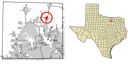 Location of Aubrey in Denton County, Texas | |
| Coordinates: 33°18′26″N 96°59′2″W | |
| Country | United States |
| State | Texas |
| County | Denton |
| Area | |
| • Total | 3.02 sq mi (7.82 km2) |
| • Land | 3.01 sq mi (7.79 km2) |
| • Water | 0.01 sq mi (0.03 km2) |
| Elevation | 689 ft (210 m) |
| Population (2010) | |
| • Total | 2,595 |
| • Estimate (2019)[2] | 4,895 |
| • Density | 1,627.87/sq mi (628.60/km2) |
| Time zone | UTC-6 (Central (CST)) |
| • Summer (DST) | UTC-5 (CDT) |
| ZIP code | 76227 |
| Area code(s) | 940 |
| FIPS code | 48-04600[3] |
| GNIS feature ID | 1351326[4] |
| Website | www |
History
Aubrey, the town, was officially founded 1867, when Civil War veteran Lemuel Noah Edwards (1838–1910) built the second frame house there. Edwards eventually gave each of his 10 children a lot on which to build a home. The Edwards family was instrumental in several civil developments. Dancing was not allowed, but the townspeople often gathered in the Edwards home for singing and listening music performed on an organ that Edwards had imported.
In 1881, the Texas and Pacific Railway completed a track and station in Aubrey and commenced operations.[6]
In 1885, Edwards offered a lot to each congregation that would build a church within a year. In 1882 Edwards and Louis Caddel, Sr., donated land for a one-room schoolhouse in town. Edwards, through one of his daughters — Edna Mae Edwards (1884–1975), who married Hugh Tobin (1884–1929) — was the grandfather of Louise Tobin, a prolific big band jazz vocalist who reached national notoriety in 1932.
Eventually, Aubrey became known for the peanut farms that surrounded the town. By 2009 horse ranches surrounded Aubrey. Around that time, houses were constructed in Aubrey, replacing the grounds of the old peanut farms.[7]
Geography
Aubrey is located at 33°18′26″N 96°59′2″W (33.307148, -96.983970).[8] It is 12 miles (19 km) north of Denton.[7]
According to the United States Census Bureau, the city has a total area of 2.6 square miles (6.8 km2), of which 2.6 square miles (6.7 km2) is land and 0.019 square miles (0.05 km2), or 0.73%, is water.[9]
Demographics
| Historical population | |||
|---|---|---|---|
| Census | Pop. | %± | |
| 1930 | 439 | — | |
| 1940 | 472 | 7.5% | |
| 1950 | 491 | 4.0% | |
| 1960 | 534 | 8.8% | |
| 1970 | 731 | 36.9% | |
| 1980 | 948 | 29.7% | |
| 1990 | 1,138 | 20.0% | |
| 2000 | 1,500 | 31.8% | |
| 2010 | 2,595 | 73.0% | |
| Est. 2019 | 4,895 | [2] | 88.6% |
| U.S. Decennial Census[10] | |||
As of the census[3] of 2000, there were 1,500 people, 559 households, and 418 families residing in the city. The population density was 720.4 people per square mile (278.4/km2). There were 597 housing units at an average density of 286.7 per square mile (110.8/km2). The racial makeup of the city was 92.5% White, 0.5% African American, 0.7% Native American, 0.5% Asian, 4.7% some other race, and 1.1% from two or more races. Hispanic or Latino of any race were 6.7% of the population.
There were 559 households, out of which 40.6% had children under the age of 18 living with them, 60.5% were married couples living together, 10.0% had a female householder with no husband present, and 25.2% were non-families. 20.8% of all households were made up of families, and 6.6% had someone living alone who was 65 years of age or older. The average household size was 2.68 and the average family size was 3.13.
In the city, the population was spread out, with 29.3% under the age of 18, 8.7% from 18 to 24, 33.3% from 25 to 44, 19.7% from 45 to 64, and 9.1% who were 65 years of age or older. The median age was 31 years. For every 100 females age 18 and over, there were 96.8 males.
The median income for a household in the city was $41,131, and the median income for a family was $46,190. Males had a median income of $31,367 versus $23,594 for females. The per capita income for the city was $19,176. About 5.8% of families and 9.2% of the population were below the poverty line, including 8.8% of those under age 18 and 10.1% of those age 65 or over.
Education
Aubrey is served by the Aubrey Independent School District. The Aubrey High School mascot is the chaparral (roadrunner). A new intermediate school was completed in 2005 and now houses the middle school as of 2008. A new elementary school was completed and Aubrey Elementary School was renamed Brockett Elementary School in 2008. The old middle school building now houses the district's administration offices.
Braswell High School of the Denton Independent School District is south of Aubrey and serves some areas with "Aubrey, Texas" addresses; they are not in the Aubrey city limits.[11][12]
Culture
As of 2009 Starr's Service Station, located off Sherman Drive and across the street from the Ever After chapel, serves as a social center for Aubrey.[7]
Notable people
- Louise Tobin, big band vocalist
References
- "2019 U.S. Gazetteer Files". United States Census Bureau. Retrieved June 26, 2020.
- "Population and Housing Unit Estimates". United States Census Bureau. May 24, 2020. Retrieved May 27, 2020.
- "U.S. Census website". United States Census Bureau. Retrieved 2008-01-31.
- "US Board on Geographic Names". United States Geological Survey. 2007-10-25. Retrieved 2008-01-31.
- "Profile of General Population and Housing Characteristics: 2010 Demographic Profile Data (DP-1): Aubrey city, Texas". United States Census Bureau. Retrieved June 28, 2012.
- Former Teacher Remembers When Aubrey Was Founded, Denton Record-Chronicle, pg. 2, sec 4, July 28, 1963
- Carlisle, Candace. "dcontent/dws/drc/localnews/stories/DRC_Towns_0216.c7b7dbbf.html Small towns disappearing across North Texas prairie." Denton Record-Chronicle. Friday February 15, 2008. Retrieved on July 26, 2010.
- "US Gazetteer files: 2010, 2000, and 1990". United States Census Bureau. 2011-02-12. Retrieved 2011-04-23.
- "Geographic Identifiers: 2010 Demographic Profile Data (G001): Aubrey city, Texas". United States Census Bureau. Retrieved June 28, 2012.
- "Census of Population and Housing". Census.gov. Retrieved June 4, 2015.
- Home. Braswell High School. Retrieved on December 29, 2016. "Braswell High School,[...]serves families in the eastern portion of the district who reside in[...]"
- "Secondary Rezoning Maps and Boundaries." Denton Independent School District. Retrieved on December 30, 2016.
External links
- City of Aubrey official website
- Aubrey historic photos from the Portal to Texas History
- Aubrey, Texas from the Handbook of Texas Online
Municipalities and communities of Denton County, Texas, United States | ||
|---|---|---|
| Cities | 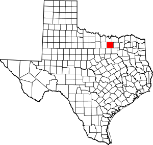 Denton County map | |
| Towns | ||
| CDPs | ||
| Other unincorporated communities | ||
| Ghost towns |
| |
| Footnotes | ‡This populated place also has portions in an adjacent county or counties | |
| Authority control |
|
|---|