County of Paintearth No. 18
The County of Paintearth No. 18 is a municipal district in east central Alberta, Canada. Located in Census Division No. 7, its municipal office is located southeast of the Town of Castor near the intersection of Highway 12 and Highway 36.
Paintearth No. 18 | |
|---|---|
| County of Paintearth No. 18 | |
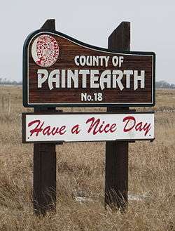 Welcome sign | |
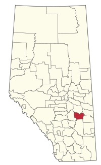 Location within Alberta | |
| Country | Canada |
| Province | Alberta |
| Region | Central Alberta |
| Planning region | Red Deer |
| Established | 1944 |
| Incorporated | 1962 |
| Government | |
| • Reeve | George Glazier |
| • Governing body | County of Paintearth Council |
| • Office location | southeast of Castor |
| Area (2016)[2] | |
| • Land | 3,283.36 km2 (1,267.71 sq mi) |
| Population (2016)[2] | |
| • Total | 2,102 |
| • Density | 0.6/km2 (2/sq mi) |
| Time zone | UTC−07:00 (MST) |
| • Summer (DST) | UTC−06:00 (MDT) |
| Website | countypaintearth.ca |
History
Originally incorporated in 1944 as the Municipal District of Paintearth No. 334, it was established as a county in 1962.
Demographics
In the 2016 Census of Population conducted by Statistics Canada, the County of Paintearth No. 18 recorded a population of 2,102 living in 638 of its 696 total private dwellings, a 3.6% change from its 2011 population of 2,029. With a land area of 3,283.36 km2 (1,267.71 sq mi), it had a population density of 0.6/km2 (1.7/sq mi) in 2016.[2]
In the 2011 Census, the County of Paintearth No. 18 had a population of 2,029 living in 615 of its 653 total dwellings, a -4.6% change from its 2006 population of 2,126. With a land area of 3,287.24 km2 (1,269.21 sq mi), it had a population density of 0.6/km2 in 2011.[3]
Communities and localities
|
The following urban municipalities are surrounded by the County of Paintearth No. 18:[4]
The following hamlets are located within the County of Paintearth No. 18:[4]
|
The following localities are located within the County of Paintearth No. 18:[5]
|
References
- Alberta Municipal Affairs: Municipal Officials Search
- "Population and dwelling counts, for Canada, provinces and territories, and census subdivisions (municipalities), 2016 and 2011 censuses – 100% data (Alberta)". Statistics Canada. February 8, 2017. Retrieved February 8, 2017.
- "Population and dwelling counts, for Canada, provinces and territories, and census subdivisions (municipalities), 2011 and 2006 censuses (Alberta)". Statistics Canada. February 8, 2012. Retrieved February 8, 2012.
- "Specialized and Rural Municipalities and Their Communities" (PDF). Alberta Municipal Affairs. 2012-03-01. Archived from the original (PDF) on 2012-04-09. Retrieved 2012-08-12.
- "Standard Geographical Classification (SGC) 2006, Economic Regions: 4807011 - Paintearth County No. 18, geographical codes and localities, 2006". Statistics Canada. 2010-03-05. Archived from the original on 2013-05-25. Retrieved 2012-08-12.
External links
| Subdivisions | |
|---|---|
| Communities | |
| Cities and urban service areas | |
| Rural municipalities | |
| Specialized municipalities | |
| |
| Cities | |
|---|---|
| Towns | |
| Villages | |
| Hamlets |
|
| Summer villages |
|
| Municipal districts | |
| Special areas | |
| Indian reserves | |
| Other topics |
|