County of Wetaskiwin No. 10
The County of Wetaskiwin No. 10 is a municipal district in central Alberta, Canada, south of Edmonton. Located in Census Division No. 11, its municipal office is in located in the City of Wetaskiwin.
County of Wetaskiwin No. 10 | |
|---|---|
Municipal district | |
 Identification sign | |
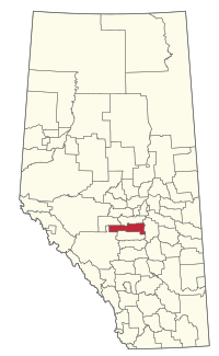 Location within Alberta | |
| Coordinates: 52°58′10″N 113°22′37″W | |
| Country | |
| Province | |
| Region | Central Alberta |
| Census division | No. 11 |
| Established | 1943 |
| Incorporated | 1958 (County) |
| Government | |
| • Reeve | Kathy Rooyakkers |
| • Governing body | County of Wetaskiwin Council
|
| • Administrator | Rod Hawken |
| • Office location | Wetaskiwin |
| Area (2016)[2] | |
| • Land | 3,132.06 km2 (1,209.30 sq mi) |
| Population (2016)[2] | |
| • Total | 11,181 |
| • Density | 3.6/km2 (9/sq mi) |
| Time zone | UTC-7 (MST) |
| Website | county.wetaskiwin.ab.ca |

Demographics
In the 2016 Census of Population conducted by Statistics Canada, the County of Wetaskiwin No. 10 recorded a population of 11,181 living in 4,372 of its 5,556 total private dwellings, a 2.9% change from its 2011 population of 10,866. With a land area of 3,132.06 km2 (1,209.30 sq mi), it had a population density of 3.6/km2 (9.2/sq mi) in 2016.[2]
In the 2011 Census, the County of Wetaskiwin No. 10 had a population of 10,866 living in 4,155 of its 5,025 total dwellings, a 3.3% change from its 2006 adjusted population of 10,519. With a land area of 3,129.4 km2 (1,208.3 sq mi), it had a population density of 3.5/km2 (9.0/sq mi) in 2011.[3]
Communities and localities
|
The following urban municipalities are surrounded by the County of Wetaskiwin No. 10:[4][5]
The following hamlets are located within the County of Wetaskiwin No. 10:[5]
|
The following localities are located within the County of Wetaskiwin No. 10:[6]
|
|
References
- "Municipal Officials Search". Alberta Municipal Affairs. September 22, 2017. Retrieved September 25, 2017.
- "Population and dwelling counts, for Canada, provinces and territories, and census subdivisions (municipalities), 2016 and 2011 censuses – 100% data (Alberta)". Statistics Canada. February 8, 2017. Retrieved February 8, 2017.
- "Population and dwelling counts, for Canada, provinces and territories, and census subdivisions (municipalities), 2011 and 2006 censuses (Alberta)". Statistics Canada. February 8, 2012. Retrieved February 8, 2012.
- "Wetaskiwin, City (Census Subdivision), Alberta". Statistics Canada. 2012-06-20. Retrieved 2012-08-13.
- "Specialized and Rural Municipalities and Their Communities" (PDF). Alberta Municipal Affairs. 2012-03-01. Archived from the original (PDF) on 2012-04-09. Retrieved 2012-08-12.
- "Standard Geographical Classification (SGC) 2006, Economic Regions: 4811001 - Wetaskiwin County No. 10, geographical codes and localities, 2006". Statistics Canada. 2010-03-05. Archived from the original on 2013-05-25. Retrieved 2012-08-12.
External links
Places adjacent to County of Wetaskiwin No. 10 | ||||||||||
|---|---|---|---|---|---|---|---|---|---|---|
| ||||||||||
| Subdivisions | |
|---|---|
| Communities | |
| Cities and urban service areas | |
| Rural municipalities | |
| Specialized municipalities | |
| |