Alix, Alberta
Alix is a village in central Alberta northeast of Red Deer. Its village mascot is the Alix-Gator, who is featured prominently on many signs and businesses.
Alix | |
|---|---|
| Village of Alix | |
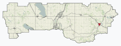 Location within Lacombe County | |
 Alix Location within Lacombe County | |
| Coordinates: 51°29′59″N 113°29′53″W | |
| Country | |
| Province | |
| Region | Central Alberta |
| Census division | 8 |
| Municipal district | Lacombe County |
| Incorporated[1] | |
| • Village | June 3, 1907 |
| Government | |
| • Mayor | Robert L Fehr |
| • Governing body | Alix Village Council |
| • MP | Blaine Calkins |
| Area (2016)[3] | |
| • Land | 3.13 km2 (1.21 sq mi) |
| Elevation | 895 m (2,936 ft) |
| Population (2016)[3] | |
| • Total | 734 |
| • Density | 234.4/km2 (607/sq mi) |
| Time zone | UTC-7 (MST) |
| Highways | Highway 12 Highway 601 |
| Website | Official website |
Originally, the settlement was called Toddsville after Joseph Todd. When the settlement was incorporated on June 3, 1907 it was named after Alexia Westhead, the first white woman settler of the community. (Alix was her nickname.) The first mayor of Alix was Robert F. Sanderson, who also owned and ran the general store.[4][5]
Alix became the home to Dr. Irene Parlby, one of the "Famous Five." Irene Parlby's public life may be said to have begun in 1913 when she was chosen as secretary of the Alix Country Women's Club. Her public role greatly expanded when she was elected President of the United Farmers of Alberta's (UFA) Women's Auxiliary, and reached its greatest point when she was made Minister without Portfolio when the UFA formed the government of Alberta in 1921, a position she held for 14 years.[6]
Demographics
In the 2016 Census of Population conducted by Statistics Canada, the Village of Alix recorded a population of 734 living in 343 of its 385 total private dwellings, a change of -11.6% from its 2011 population of 830. With a land area of 3.13 km2 (1.21 sq mi), it had a population density of 234.5/km2 (607.4/sq mi) in 2016.[3]
In the 2011 Census, the Village of Alix had a population of 830 living in 355 of its 388 total dwellings, a change of -2.5% from its 2006 population of 851. With a land area of 3.15 km2 (1.22 sq mi), it had a population density of 263.5/km2 (682.4/sq mi) in 2011.[7]
References
- "Location and History Profile: Village of Alix" (PDF). Alberta Municipal Affairs. October 14, 2016. p. 15. Retrieved October 17, 2016.
- Alberta Municipal Affairs: Municipal Officials Search
- "Population and dwelling counts, for Canada, provinces and territories, and census subdivisions (municipalities), 2016 and 2011 censuses – 100% data (Alberta)". Statistics Canada. February 8, 2017. Retrieved February 8, 2017.
- Village of Alix. "History". Archived from the original on 2007-09-23. Retrieved 2007-08-12.
- "Central Alberta Regional Museums Network – Alix Wagon Wheel Museum". Retrieved 2010-04-06.
- "history". ABHeritage. Retrieved 2009-08-20.
- "Population and dwelling counts, for Canada, provinces and territories, and census subdivisions (municipalities), 2011 and 2006 censuses (Alberta)". Statistics Canada. 2012-02-08. Retrieved 2012-02-08.
External links
| Wikivoyage has a travel guide for Alix. |
Places adjacent to Alix, Alberta | |
|---|---|