City of Blue Mountains
The City of Blue Mountains is a local government area of New South Wales, Australia, governed by the Blue Mountains City Council. The city is located in the Blue Mountains range west of Sydney.
| City of Blue Mountains New South Wales | |||||||||||||||
|---|---|---|---|---|---|---|---|---|---|---|---|---|---|---|---|
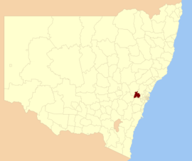 Location in New South Wales | |||||||||||||||
| Coordinates | 33°42′S 150°18′E | ||||||||||||||
| Population |
| ||||||||||||||
| • Density | 53.78/km2 (139.3/sq mi) | ||||||||||||||
| Established | 1 October 1947[3] | ||||||||||||||
| Area | 1,430 km2 (552.1 sq mi) | ||||||||||||||
| Mayor | Mark Greenhill (Labor) | ||||||||||||||
| Council seat | Katoomba[4] | ||||||||||||||
| Region | Blue Mountains | ||||||||||||||
| State electorate(s) | |||||||||||||||
| Federal Division(s) | Macquarie | ||||||||||||||
| Website | City of Blue Mountains | ||||||||||||||
| |||||||||||||||
The Mayor of Blue Mountains City Council is councillor Mark Greenhill, a member of the Labor Party.
Towns and villages in the local government area
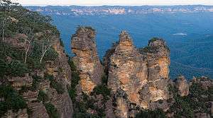
The urban part of the city consists of a ribbon of close or contiguous towns which lie on the Main Western railway line, served by NSW TrainLink's Blue Mountains Line, and Great Western Highway between Emu Plains and Lithgow. About 70% of the city's area is within the Blue Mountains National Park which lies north and south of the ribbon of towns. The National Park is part of the much larger Greater Blue Mountains Area World Heritage Site and the city brands itself as "The City Within a World Heritage National Park". The towns and villages are generally grouped into lower, mid, and upper mountains. The economy of the upper mountains is dependent almost entirely on tourism. The road to Sydney, the Great Western Highway, is mostly dual carriageway but is relatively slow due to the urban development and hilly terrain. An electric train service integrates into Sydney Trains, Sydney's suburban rail network.
The main towns and villages in the City of Blue Mountains are:
Demographics
| Selected historical census data for the City of Blue Mountains local government area | ||||||
|---|---|---|---|---|---|---|
| Census year | 2001[5] | 2006[6] | 2011[7] | 2016[1] | ||
| Population | Estimated residents on census night | 73,675 | ||||
| LGA rank in terms of size within New South Wales | 28 | |||||
| % of New South Wales population | 1.1% | |||||
| % of Australian population | 0.39% | |||||
| Cultural and language diversity | ||||||
| Ancestry, top responses | English | n/r | n/r | 30.1% | ||
| Australian | n/r | n/r | 28.7% | |||
| Irish | n/r | n/r | 10.2% | |||
| Scottish | n/r | n/r | 8.3% | |||
| German | n/r | n/r | 3.2% | |||
| Language, top responses (other than English) | German | n/r | 0.6% | |||
| Spanish | n/r | 0.3% | ||||
| Italian | 0.3% | |||||
| Mandarin | n/r | n/r | n/r | 0.4% | ||
| French | n/r | n/r | n/r | 0.3% | ||
| Religious affiliation | ||||||
| Religious affiliation, top responses | No religion (excluding not stated) | 18.0% | ||||
| Catholic | 22.6% | |||||
| Anglican | 24.6% | |||||
| Not stated | n/r | n/r | n/r | 8.4% | ||
| Christian (nfd) | n/r | n/r | n/r | 2.9% | ||
| Median weekly incomes | ||||||
| Personal income | Median weekly personal income | n/r | A$501 | n/r | A$688 | |
| % of Australian median income | n/r | 107.5% | n/r | 103.9% | ||
| Family income | Median weekly family income | n/r | A$1,345 | n/r | A$1,866 | |
| % of Australian median income | n/r | 114.9% | n/r | 107.6% | ||
| Household income | Median weekly household income | n/r | A$1,093 | n/r | A$1,468 | |
| % of Australian median income | n/r | 106.4% | n/r | 102.1% | ||
Council
Current composition and election method
Blue Mountains City Council is composed of twelve Councillors elected proportionally as four separate wards, each electing three Councillors. All Councillors are elected for a fixed four-year term of office. The Mayor is elected by the Councillors at the first meeting of the Council. The most recent general election was held on 10 September 2016.
| Party | Councillors | |
|---|---|---|
| Labor Party | 5 | |
| Liberal Party | 4 | |
| The Greens | 2 | |
| Independents | 1 | |
| Total | 12 | |
| Ward | Councillor | Party | Notes | |
|---|---|---|---|---|
| First Ward[8] | Kevin Schreiber | Liberal | ||
| Kerry Brown | Greens | |||
| Don McGregor | Labor | |||
| Second Ward[9] | Chris van der Kley | Liberal | ||
| Romola Hollywood | Labor | |||
| Brent Hoare | Greens | |||
| Third Ward[10] | Daniel Myles | Liberal | ||
| Shae Foenander | Independent | |||
| Mick Fell | Labor | |||
| Fourth Ward[11] | Mark Greenhill | Labor | Mayor | |
| Brendan Christie | Liberal | |||
| Darryl Bowling | Labor | |||
Council services
Cemeteries
The City of Blue Mountains Council maintains cemeteries at Blackheath, Faulconbridge, Katoomba, Lawson, Megalong Valley, Mount Irvine, Mount Victoria, Mount Wilson, Springwood, and Wentworth Falls.[12]
Libraries
Blue Mountains Library operates three full-time branches, three part-time branches and a service for train commuters at Springwood and Katoomba stations two days a week.[13]
Leisure centres
Blue Mountains Leisure Centres operate from five locations. All five locations have pools and the Katoomba and Springwood locations have gyms and offer various fitness classes.[14]
Heritage listings
The City of Blue Mountains has a number of heritage-listed sites, including the following sites listed on the New South Wales State Heritage Register:
- Blue Mountains National Park: Blue Mountains walking tracks[15]
- Blackheath, Main Western railway: Blackheath railway station[16]
- Faulconbridge, 14-20 Norman Lindsay Crescent: Norman Lindsay Gallery and Museum[17]
- Glenbrook, Great Western Highway: Glenbrook railway residence[18]
- Glenbrook, Great Western Highway: Glenbrook Tunnel[19]
- Glenbrook, Mitchells Pass: Lennox Bridge, Glenbrook[20]
- Katoomba, 10-14 Civic Place: Mount St Marys College and Convent[21]
- Katoomba, Katoomba Street: Carrington Hotel[22]
- Katoomba, 59-61 Katoomba Street: Katoomba Post Office[23]
- Katoomba, 63-69 Katoomba Street: Paragon Cafe, Katoomba[24]
- Katoomba, Main Western railway: Katoomba railway station[25]
- Katoomba, 10-16 Panorama Drive: Lilianfels, Katoomba[26]
- Lawson, Main Western railway: Lawson railway station[27]
- Leura, 37 - 49 Everglades Avenue: Everglades, Leura[28]
- Linden, 91 - 111 Glossop Road: Linden Observatory Complex[29]
- Linden, off Railway Parade: Cox's Road and Early Deviations - Linden, Linden Precinct[30]
- Medlow Bath, Beauchamp Road: Medlow Dam[31]
- Medlow Bath, Great Western Highway: Medlow Bath railway station[32]
- Mount Victoria, Main Western railway: Mount Victoria railway station[33]
- Mount Victoria, Mount York Road (off): Cox's Road and Early Deviations - Mount York, Cox's Pass Precinct[34]
- Mount Wilson, 68-78 The Avenue: Wynstay Estate[35]
- Springwood, 345-347 Great Western Highway: Christ Church Anglican Church, Springwood[36]
- Springwood, 39 Hawkesbury Road: Buckland Convalescent Home[37]
- Springwood, Main Western railway: Springwood railway station[38]
- Valley Heights, 110 and 112 Green Parade: Valley Heights railway gatehouse[39]
- Valley Heights, Main Western railway: Valley Heights railway station[40]
- Warragamba, Coxs River Arms: Coxs River track[41]
- Wentworth Falls, 63-67 Falls Road: Davisville, Wentworth Falls[42]
- Wentworth Falls, 1-15 Matcham Avenue: Weatherboard Inn archaelological site[43]
- Woodford, 90-92 Great Western Highway: Woodford Academy[44]
- Woodford, Old Bathurst Road: Cox's Road and Early Deviations - Woodford, Old Bathurst Road Precinct[45]
- Woodford, The Appian Way (off): Cox's Road and Early Deviations - Woodford, Appian Way Precinct[46]
Sister cities
The City of Blue Mountains has sister city relationships with the following cities:[47]


References
- Australian Bureau of Statistics (27 June 2017). "Blue Mountains (C)". 2016 Census QuickStats. Retrieved 6 July 2017.

- "3218.0 – Regional Population Growth, Australia, 2017-18". Australian Bureau of Statistics. 27 March 2019. Retrieved 27 March 2019. Estimated resident population (ERP) at 30 June 2018.
- "Council history". Blue Mountains City Council.
- "Blue Mountains City Council". Division of Local Government. Archived from the original on 6 September 2006. Retrieved 27 November 2006.
- Australian Bureau of Statistics (9 March 2006). "Blue Mountains (C)". 2001 Census QuickStats. Retrieved 6 July 2017.
- Australian Bureau of Statistics (25 October 2007). "Blue Mountains (C)". 2006 Census QuickStats. Retrieved 6 July 2017.
- Australian Bureau of Statistics (31 October 2012). "Blue Mountains (C)". 2011 Census QuickStats. Retrieved 6 July 2017.
- "Blue Mountains Ward 1 Results". Electoral Commission of New South Wales. 17 September 2016. Retrieved 18 September 2016.
- "Blue Mountains Ward 2 Results". Electoral Commission of New South Wales. 17 September 2016. Retrieved 18 September 2016.
- "Blue Mountains Ward 3 Results". Electoral Commission of New South Wales. 17 September 2016. Retrieved 18 September 2016.
- "Blue Mountains Ward 3 Results". Electoral Commission of New South Wales. 17 September 2016. Retrieved 18 September 2016.
- "Our cemeteries". Blue Mountains City Council.
- "Locations, Hours & Contacts". bmcc.ent.sirsidynix.net.au. Retrieved 29 November 2016.
- Day, Clear Blue. "Blue Mountains Leisure Centres - Centres". www.bmleisurecentres.com.au. Retrieved 29 November 2016.
- "Blue Mountains Walking tracks". New South Wales State Heritage Register. Office of Environment and Heritage. H00980. Retrieved 18 May 2018.
- "Blackheath Railway Station Group". New South Wales State Heritage Register. Office of Environment and Heritage. H01088. Retrieved 18 May 2018.
- "Norman Lindsay Gallery". New South Wales State Heritage Register. Office of Environment and Heritage. H01503. Retrieved 18 May 2018.
- "Glenbrook Railway Residence". New South Wales State Heritage Register. Office of Environment and Heritage. H00713. Retrieved 18 May 2018.
- "Glenbrook Railway and World War Two Mustard Gas Storage Tunnel". New South Wales State Heritage Register. Office of Environment and Heritage. H01861. Retrieved 18 May 2018.
- "Lennox Bridge". New South Wales State Heritage Register. Office of Environment and Heritage. H00024. Retrieved 18 May 2018.
- "Mount St Marys College and Convent". New South Wales State Heritage Register. Office of Environment and Heritage. H01681. Retrieved 18 May 2018.
- "Carrington Hotel". New South Wales State Heritage Register. Office of Environment and Heritage. H00280. Retrieved 18 May 2018.
- "Katoomba Post Office (former)". New South Wales State Heritage Register. Office of Environment and Heritage. H01453. Retrieved 18 May 2018.
- "The Paragon". New South Wales State Heritage Register. Office of Environment and Heritage. H01959. Retrieved 18 May 2018.
- "Katoomba Railway Station and yard group". New South Wales State Heritage Register. Office of Environment and Heritage. H01174. Retrieved 18 May 2018.
- "Lilianfels". New South Wales State Heritage Register. Office of Environment and Heritage. H00431. Retrieved 18 May 2018.
- "Lawson Railway Station Group". New South Wales State Heritage Register. Office of Environment and Heritage. H01177. Retrieved 18 May 2018.
- "Everglades". New South Wales State Heritage Register. Office of Environment and Heritage. H01498. Retrieved 18 May 2018.
- "Linden Observatory Complex". New South Wales State Heritage Register. Office of Environment and Heritage. H01807. Retrieved 18 May 2018.
- "Cox's Road and Early Deviations - Linden, Linden Precinct". New South Wales State Heritage Register. Office of Environment and Heritage. H01953. Retrieved 18 May 2018.
- "Medlow Dam". New South Wales State Heritage Register. Office of Environment and Heritage. H01366. Retrieved 18 May 2018.
- "Medlow Bath Railway Station group". New South Wales State Heritage Register. Office of Environment and Heritage. H01190. Retrieved 18 May 2018.
- "Mount Victoria Railway Station group". New South Wales State Heritage Register. Office of Environment and Heritage. H01203. Retrieved 18 May 2018.
- "Cox's Road and Early Deviations - Mount York, Cox's Pass Precinct". New South Wales State Heritage Register. Office of Environment and Heritage. H01956. Retrieved 18 May 2018.
- "Wynstay Estate". New South Wales State Heritage Register. Office of Environment and Heritage. H01520. Retrieved 18 May 2018.
- "Christ Church Anglican Church". New South Wales State Heritage Register. Office of Environment and Heritage. H00130. Retrieved 18 May 2018.
- "Buckland Convalescent Home & Garden". New South Wales State Heritage Register. Office of Environment and Heritage. H00371. Retrieved 18 May 2018.
- "Springwood Railway Station Group". New South Wales State Heritage Register. Office of Environment and Heritage. H01247. Retrieved 18 May 2018.
- "Railway Gatehouse". New South Wales State Heritage Register. Office of Environment and Heritage. H00220. Retrieved 18 May 2018.
- "Valley Heights Railway Station and Locomotive Depot". New South Wales State Heritage Register. Office of Environment and Heritage. H01276. Retrieved 18 May 2018.
- "Track". New South Wales State Heritage Register. Office of Environment and Heritage. H01372. Retrieved 18 May 2018.
- "Davisville". New South Wales State Heritage Register. Office of Environment and Heritage. H00401. Retrieved 18 May 2018.
- "Weatherboard Inn Archaeological Site". New South Wales State Heritage Register. Office of Environment and Heritage. H00595. Retrieved 18 May 2018.
- "Woodford Academy". New South Wales State Heritage Register. Office of Environment and Heritage. H01509. Retrieved 18 May 2018.
- "Cox's Road and Early Deviations - Woodford, Old Bathurst Road Precinct". New South Wales State Heritage Register. Office of Environment and Heritage. H01954. Retrieved 18 May 2018.
- "Cox's Road and Early Deviations - Woodford, Appian Way Precinct". New South Wales State Heritage Register. Office of Environment and Heritage. H01955. Retrieved 18 May 2018.
- "Sister Cities". Blue Mountains City Council. Retrieved 1 April 2011.