Municipality of Strathfield
The Municipality of Strathfield, also known as Strathfield Council, is a local government area located west of Sydney, in the state of New South Wales, Australia.
| Municipality of Strathfield New South Wales | |||||||||||||||
|---|---|---|---|---|---|---|---|---|---|---|---|---|---|---|---|
 Location in Metropolitan Sydney | |||||||||||||||
| Population |
| ||||||||||||||
| • Density | 2,859/km2 (7,405/sq mi) | ||||||||||||||
| Established | 2 June 1885 | ||||||||||||||
| Area | 14.1 km2 (5.4 sq mi) | ||||||||||||||
| Mayor | Antoine Doueihi (Liberal) | ||||||||||||||
| Council seat | Strathfield | ||||||||||||||
| Region | Metropolitan Sydney | ||||||||||||||
| State electorate(s) | |||||||||||||||
| Federal Division(s) | |||||||||||||||
| Website | Municipality of Strathfield | ||||||||||||||
| |||||||||||||||
Strathfield Council was incorporated in 1885. The Council area originally included the suburbs of Redmire, Homebush and Druitt Town. The name "Strathfield" was adopted as the name of the new council upon incorporation. In 1886, the suburb of Redmire was renamed Strathfield, as was the railway station. The area of Druitt Town became known as Strathfield South in the early 1890s. Only Homebush survives as an original location name. Since that time, Strathfield has become an important multicultural centre (for Korean, Chinese and Sri Lankan minority populations).
Strathfield Council currently comprises an area of 14.1 square kilometres (5.4 sq mi) and as at the 2016 census had an estimated 40,312 residents.[1] The Council area is made up of residential neighbourhoods and town centres, with significant local heritage, open space, lifestyle amenities, public and private schools and access to tertiary institutions such as a campus of Australian Catholic University and the University of Sydney and TAFE Sydney Institute.
The Mayor of Strathfield Municipal Council is Cr. Antoine Doueihi, a member of the Liberal Party of Australia. The Deputy Mayor is Cr. Matthew Blackmore [3]
Suburbs and localities in the local government area
The Strathfield local government area comprises:
- Belfield (with parts within the City of Canterbury-Bankstown)
- Flemington
- Greenacre (with parts within the City of Canterbury-Bankstown
- Homebush
- Homebush West (with parts within Cumberland Council)
- Strathfield (with parts within the Municipality of Burwood and the City of Canada Bay)
- Strathfield South
Demographics
At the 2016 census there were 40,312 people in the Strathfield local government area, of these 50.7 per cent were male and 49.3 per cent were female. Aboriginal and Torres Strait Islander people made up 0.3 per cent of the population; significantly below the NSW and Australian averages of 2.9 and 2.8 per cent respectively. The median age of people in the Strathfield local government area was 32 years; significantly lower than the national median of 38 years. Children aged 0 – 14 years made up 18.7 per cent of the population and people aged 65 years and over made up 15.7 per cent of the population. Of people in the area aged 15 years and over, 48.1 per cent were married and 11.7 per cent were either divorced or separated.[1]
Population growth in the Strathfield local government area between the 2001 census and the 2006 census was 15.14 per cent; while in the subsequent five years to the 2011 census, population growth was 10.02 per cent. At the 2016 census, the population in the Municipality increased by 14.56 per cent. When compared with total population growth of Australia for the same period, being 8.8 per cent, population growth in Strathfield local government area was significantly higher than the national average.[1][4][5][6] The median weekly income for residents within the Municipality of Strathfield was on par with the national average.
| Historical census data for Strathfield local government area | ||||||
|---|---|---|---|---|---|---|
| Census year | 2001[4] | 2006[5] | 2011[6] | 2016[1] | ||
| Population | Estimated residents on census night | 27,777 | ||||
| LGA rank in terms of size within New South Wales | 55th | |||||
| % of New South Wales population | 0.51% | |||||
| % of Australian population | 0.15% | |||||
| Cultural and language diversity | ||||||
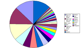
| Ancestry, top responses | Chinese (excludes SARs and Taiwan) | 9.3% | ||||
| Indian | 8.0% | |||||
| South Korean | 7.5% | |||||
| English | 7.7% | |||||
| Australian | 39.8% | |||||
| Language, top responses (other than English) | Mandarin | 4.2% | ||||
| Korean | 7.0% | |||||
| Cantonese | 8.7% | |||||
| Tamil | 6.4% | |||||
| Arabic | 5.8% | |||||
| Religious affiliation | ||||||
| Religious affiliation, top responses | Catholic | 34.0% | ||||
| No religion, so described | 10.2% | |||||
| Hinduism | 9.0% | |||||
| Buddhism | n/c | |||||
| Not stated | n/c | n/c | n/c | 9.3% | ||
| Median weekly incomes | ||||||
| Personal income | Median weekly personal income | A$458 | A$558 | Data to be released in October 2017 | ||
| % of Australian median income | 98.3% | 96.7% | ||||
| Family income | Median weekly family income | A$458 | A$1,595 | |||
| % of Australian median income | 106.4% | 107.7% | ||||
| Household income | Median weekly household income | A$1,256 | A$1,421 | |||
| % of Australian median income | 107.3% | 115.2% | ||||
Current composition and election method

Strathfield Municipal Council is composed of seven councillors elected proportionally as one entire ward. All Councillors are elected for a fixed four-year term of office. The Mayor and Deputy Mayor are elected bi-annually by the Councillors at the first meeting of the Council. The most recent election was held on 9 September 2017, and the makeup of the Council is as follows:[7]
| Party | Councillors | |||
|---|---|---|---|---|
| Liberal Party of Australia | 3 | |||
| Australian Labor Party | 2 | |||
| Independents | 1 | |||
| 1 | Total | 7 | ||
The current Council, elected in 2017, in order of election, is:
| Councillor[7] | Party | Notes | |
|---|---|---|---|
| Gulian Vaccari | Liberal | Mayor 2012–2013, 2017–2019 | |
| Karen Pensabene | Labor | ||
| Nella Hall | Independent | Deputy Mayor 2017–2018 | |
| Antoine Doueihi | Liberal | Mayor 2019-date | |
| Maryanne Duggan | Labor | ||
| Stephanie Kokkolis | Liberal | Deputy Mayor 2016–2017 | |
| Matthew Blackmore | Strathfield Independents | Deputy Mayor 2018-date | |
History

Strathfield Council was proclaimed on 2 June 1885 by the NSW Governor, Sir Augustus Loftus. The Council was incorporated following petitions by residents of the Redmire area to form local government. This move was opposed by residents of Homebush and Druitt Town, possibly fearing the dominance of the more affluent and politically connected residents of Redmire. Despite counter petitions, the Municipality was incorporated in 1885.[8]
Strathfield Council built the current Council Chambers in 1887. Between 1885 and 1887 the Council operated from various private homes in Strathfield, pending the building of a permanent Council Chambers.
The Strathfield Council area has expanded in geography and population over time and now includes the suburbs of Strathfield, Homebush and Homebush West, Flemington, Greenacre, Strathfield South, Chullora (part) and Belfield (part).
Amalgamations
Throughout its history, there have been movements to amalgamate local councils in the Sydney area: the first major 'threat' was with the 'royal commission for a greater Sydney (1913)', known as 'The Greater Sydney Movement'. The Royal Commission brought together Sidney Webb, a British politician and John Fitzgerald,[9] an Australian politician, who, amongst others, believed that Sydney should be merged into a single local government area. In 1947 Homebush and Strathfield councils merged and part of Enfield was added in 1949.
In 1992, a section of the northern part of the Municipality was transferred to the Auburn Council area. In return, the area of and between Boundary Creek and the railway line, occupied by the former Ford factory building, was transferred from Auburn to Strathfield Council.
A 2015 review of local government boundaries by the NSW Government Independent Pricing and Regulatory Tribunal recommended that the Strathfield Municipal Council merge with adjoining councils. The government proposed a merger of the Burwood, Canada Bay, and Strathfield Councils to form a new council with an area of 41 square kilometres (16 sq mi) and support a population of approximately 163,000.[10] On 6 May Strathfield Council commenced legal action in the NSW Land and Environment Court against the proposed amalgamation.[11] After the Court heard that there were legal flaws in the report from the NSW Government appointed delegate who examined the proposal for merging the councils, the NSW Government withdrew from the case and the merger proposal stalled.[12] In July 2017, the Berejiklian government decided to abandon the forced merger of the Strathfield, Burwood and Canada Bay local government areas, along with several other proposed forced mergers.[13]
Heritage listings
The Municipality of Strathfield has a number of heritage-listed sites, including:
- Homebush, Great Southern and Western railway: Homebush railway station[14]
- South Strathfield, St Anne's Square: St Anne's Roman Catholic Church, South Strathfield[15]
- Strathfield, Great Southern and Western railway: Strathfield rail underbridges[16]
- Strathfield, Great Southern and Western railway: Strathfield railway station[17]
Council facilities
Libraries
The Council operates two libraries: the Central Library in Homebush and a Branch library in Strathfield South. The central library, located in Homebush, was demolished in 2002 and a new library was built and opened in 2004. The Branch Library in Strathfield South was rebuilt and opened in 2008.[18]
Dutton Centre
The former South Strathfield Bowling Club was bought by Strathfield Council and renovated with a grant of $495,00 from the Department of Aging, Disability and Home Care. The building was opened on 3 December 2012 and named in honour of Eve Dutton who was the first female Mayor of Strathfield.[19] It houses Strathfield/Homebush Meals on Wheels and Inner West Community Transport.[20]
Culture
The population of Strathfield is made up of a number of ethnic groups, and about 48% of the population born overseas. As a result, there are a number of services for newly arrived immigrants and overseas students who live in the area. Two such organisations are the Russian Ethnic Community Council of NSW Inc (RECNSW), and the Sydney Tamil Resource Centre Inc (STRC). RECNSW provides access to information and referral to mainstream services to recent immigrants of Russian and Russian speaking background and disseminates information to remote and offshore areas on a number of issues.[21] STRC provides resources to Tamil immigrants.
In the 1990s, a large number of South Korean migrants settled in Strathfield. Strathfield now has a large number of shops selling Korean food and cultural items. As indicated in the 2011 census. Korean is now the second most spoken language (to English) in Strathfield municipality.
Strathfield also has a number of community centres, including a Rotary club, Latvian theatre, Lantern Club, and libraries. The local Rotary club provides support to the community and has a number of projects in the area,[22] as well as a Musical Society (part of Rotary?), which normally produces two shows a year in the Latvian Theatre in Strathfield. Their main social activity is rehearsing twice weekly and they present seven performances of their musical production over two weekends. Strathfield Lantern Club Voluntary is located in Strathfield and provides fundraising organisation for raising funds specifically for the Royal Institute for Deaf and Blind Children in North Rocks.
The lyrics of the song by Radio Birdman, Murder City Nights refers to Woodward Road, Strathfield:[23]
- Cruising down Woodward gotta find me some action
- Looking for a lover with a power reaction.
Geography
The Strathfield Council area is located at 33°52'10" North, 151°5'59" West (33.8717, 151.0899). It covers a total area of approximately 14.1 square kilometres (5.4 sq mi) and includes the suburbs of Strathfield, Strathfield South, Homebush, Homebush West, Greenacre, Flemington and part of Belfield.[24] Homebush Bay Drive bounds Strathfield Council to the north, Powells Creek, The Boulevarde and Coronation Parade bounds it to the east, Punchbowl Road and Juno Parade form the southern border and Roberts Road, Chullora rail yards, Rookwood Cemetery and the Sydney Olympic Park Rail line bound the Municipality to the west.
For NSW state elections, the Municipality of Strathfield is divided between the Strathfield, Lakemba and Auburn electorates and for Federal elections it is in the electorates of Reid and Watson.
References
- Australian Bureau of Statistics (27 June 2017). "Strathfield (A)". 2016 Census QuickStats. Retrieved 5 July 2017.

- "3218.0 – Regional Population Growth, Australia, 2017-18". Australian Bureau of Statistics. 27 March 2019. Retrieved 27 March 2019. Estimated resident population (ERP) at 30 June 2018.
- "Councillors".
- Australian Bureau of Statistics (9 March 2006). "Strathfield (A)". 2001 Census QuickStats. Retrieved 3 November 2012.
- Australian Bureau of Statistics (25 October 2007). "Strathfield (A)". 2006 Census QuickStats. Retrieved 3 November 2012.
- Australian Bureau of Statistics (31 October 2012). "Strathfield (A)". 2011 Census QuickStats. Retrieved 3 November 2012.
- "Strathfield - Councillor Contest". NSW Local Council Elections 2017. NSW Electoral Commission. Retrieved 15 September 2017.
- Jones, Cathy. "Incorporation of Strathfield Council". Strathfield Council. Retrieved 14 May 2014.
- "Biography - John Daniel (Jack) Fitzgerald - Australian Dictionary of Biography".
- "Merger proposal: Burwood Council, City of Canada Bay Council, Strathfield Council" (PDF). Government of New South Wales. January 2016. p. 7. Retrieved 27 February 2016.
- "Strathfield Council commences legal action" (Press release). Strathfield Council. 6 May 2016. Retrieved 16 May 2016.
- Raper, Ashleigh (31 May 2016). "NSW council amalgamations: Strathfield, Burwood and Canada Bay merger stopped". ABC News. Australia. Retrieved 1 June 2016.
- Blumer, Clare; Chettle, Nicole (27 July 2017). "NSW council amalgamations: Mayors fight to claw back court dollars after backflip on merger". ABC News. Australia. Retrieved 27 July 2017.
- "Homebush Railway Station group". New South Wales State Heritage Register. Office of Environment and Heritage. H01170. Retrieved 18 May 2018.
- "St. Anne's Roman Catholic Church (former)". New South Wales State Heritage Register. Office of Environment and Heritage. H00508. Retrieved 18 May 2018.
- "Strathfield rail underbridges (flyover)". New South Wales State Heritage Register. Office of Environment and Heritage. H01055. Retrieved 18 May 2018.
- "Strathfield Railway Station group". New South Wales State Heritage Register. Office of Environment and Heritage. H01252. Retrieved 18 May 2018.
- Strathfield Council – Library Retrieved 11 August 2014.
- New home for Meals on Wheels Archived 13 August 2014 at the Wayback Machine Retrieved 13 August 2014.
- Inner West a Community Transport Archived 2 March 2014 at the Wayback Machine Retrieved 13 August 2013.
- "Information & Referral". Archived from the original on 15 June 2004.CS1 maint: BOT: original-url status unknown (link)
- "Archived copy". Archived from the original on 11 March 2007. Retrieved 20 January 2005.CS1 maint: archived copy as title (link)
- "Archived copy". Archived from the original on 25 April 2012. Retrieved 28 October 2011.CS1 maint: archived copy as title (link)
- "Archived copy". Archived from the original on 8 September 2004. Retrieved 4 October 2004.CS1 maint: archived copy as title (link)
Further reading
- Australian Bureau of Statistics (2003). The people of New South Wales. Statistics from the 2001 Census. Joint publication of the NSW State Government (Community Relations Commission) & the Australian Federal Government (Department of Immigration and Multicultural Affairs).
- Jones, Cathy (2004). Strathfield – origin of the name. Strathfield District Historical Society. Archived from the original on 18 October 2009. Retrieved 4 October 2004.
- Jones, Michael (1985). Oasis in the West: Strathfield's first hundred years. North Sydney: Allen & Unwin Australia. ISBN 0-86861-407-6.
- "State Electoral District of Strathfield". New South Wales State Electoral Office. Retrieved 17 October 2004.
- "NSW Recorded Crime Statistics – Strathfield LGA" (PDF). Bureau of Crime and Statistics.
- Ward, Alex (22 July 2010). "Strathfield councillor Danny Lim resigns". Inner West Courier. Retrieved 20 September 2012.