Bourke Shire
Bourke Shire is a local government area in the Orana region of New South Wales, Australia. The Shire is located adjacent to the Darling River, which is known as the Barwon River upstream from Bourke; and located adjacent to the Mitchell Highway. The northern boundary of the Shire is located adjacent to the border between New South Wales and Queensland. The Shire is a wool and beef producing area.
| Bourke Shire New South Wales | |||||||||||||||
|---|---|---|---|---|---|---|---|---|---|---|---|---|---|---|---|
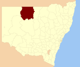 Location in New South Wales | |||||||||||||||
| Coordinates | 30°06′S 145°56′E | ||||||||||||||
| Population |
| ||||||||||||||
| • Density | 0.067996/km2 (0.17611/sq mi) | ||||||||||||||
| Area | 41,679 km2 (16,092.4 sq mi) | ||||||||||||||
| Mayor | Barry Hollman (Independent) | ||||||||||||||
| Council seat | Bourke | ||||||||||||||
| Region | Orana | ||||||||||||||
| State electorate(s) | Barwon | ||||||||||||||
| Federal Division(s) | Parkes | ||||||||||||||
| Website | Bourke Shire | ||||||||||||||
| |||||||||||||||
The Mayor of Bourke Shire Council is Cr. Barry Hollman, an independent politician.
Main towns and villages
Bourke Shire includes Bourke and the very small outback towns of Byrock, Enngonia, Fords Bridge, Wanaaring and Louth.
Demographics
According to the Australian Bureau of Statistics during 2003–04 there:[3]
- were 1,062 wage and salary earners (ranked 141st in New South Wales and 457th in Australia, less than 0.1% of both New South Wales's 2,558,415 and Australia's 7,831,856)
- was a total income of $36 million (ranked 137th in New South Wales and 449th in Australia, less than 0.1% of both New South Wales's $107 billion and Australia's $304 billion)
- was an estimated average income per wage and salary earner of $33,611 (ranked 88th in New South Wales and 298th in Australia, 81% of New South Wales's $41,407 and 87% of Australia's $38,820)
- was an estimated median income per wage and salary earner of $32,426 (ranked 71st in New South Wales and 235th in Australia, 91% of New South Wales's $35,479 and 95% of Australia's $34,149).
| Selected historical census data for Bourke Shire local government area | ||||||
|---|---|---|---|---|---|---|
| Census year | 2011[4] | 2016[1] | ||||
| Population | Estimated residents on census night | 2,868 | ||||
| LGA rank in terms of size within New South Wales | 122nd | |||||
| % of New South Wales population | ||||||
| % of Australian population | ||||||
| Cultural and language diversity | ||||||
| Ancestry, top responses | English | |||||
| Australian | ||||||
| Italian | ||||||
| Chinese | ||||||
| Irish | ||||||
| Language, top responses (other than English) | Italian | |||||
| Mandarin | ||||||
| Cantonese | ||||||
| Korean | ||||||
| Greek | ||||||
| Religious affiliation | ||||||
| Religious affiliation, top responses | Catholic | |||||
| No religion | ||||||
| Anglican | ||||||
| Eastern Orthodox | ||||||
| Buddhism | ||||||
| Median weekly incomes | ||||||
| Personal income | Median weekly personal income | A$ | ||||
| % of Australian median income | ||||||
| Family income | Median weekly family income | |||||
| % of Australian median income | ||||||
| Household income | Median weekly household income | |||||
| % of Australian median income | ||||||
Council
Current composition and election method
Bourke Shire Council is composed of ten Councillors elected proportionally as a single ward. All Councillors are elected for a fixed four-year term of office. The Mayor is elected by the Councillors at the first meeting of the Council. The most recent election was held on 10 September 2016, and the makeup of the Council is as follows:[5]
| Party | Councillors | |
|---|---|---|
| Independents and Unaligned | 10 | |
| Total | 10 | |
The current Council, elected in 2016, in order of election, is:[5]
| Councillor | Party | Notes | |
|---|---|---|---|
| Ian Cole | Unaligned | ||
| Sam Rice | Unaligned | ||
| Barry Hollman | Independent | Mayor[6] | |
| Sarah Barton | Independent | ||
| Sally Davis | Independent | ||
| Victor Bartley | Independent | ||
| Lachlan Ford | Unaligned | Deputy Mayor[6] | |
| Bob Stutsel | Independent | ||
| Cec Dorrington | Unaligned | ||
| John Thompson | Independent | ||
Notable persons
In 1884, Sid 'Combo' Ross set a record by shearing nine lambs in nine minutes.[7]
Scottish-Australian poet balladeer Will. H. Ogilvie worked on Belalie Station on the Warrego River, composed many of his poems in the 1890s. Belalie is between the township of Enngonia (formerly Eringunia) and the Queensland border.
References
- Australian Bureau of Statistics (27 June 2017). "Bourke (A)". 2016 Census QuickStats. Retrieved 7 July 2017.

- "3218.0 – Regional Population Growth, Australia, 2017-18". Australian Bureau of Statistics. 27 March 2019. Retrieved 27 March 2019. Estimated resident population (ERP) at 30 June 2018.
- "Regional Wage and Salary Earner Statistics, Australia (catalogue no.: 5673.055.003)". Australian Bureau of Statistics. Retrieved 11 March 2007.
- Australian Bureau of Statistics (31 October 2012). "Bourke (A)". 2011 Census QuickStats. Retrieved 22 October 2012.
- "Bourke Shire Council: Summary of First Preference Votes for each Candidate". Local Government Elections 2016. Electoral Commission of New South Wales. 17 September 2016. Retrieved 3 November 2016.
- "Councillors – Bourke Shire Council". www.bourke.nsw.gov.au. Retrieved 3 November 2016.
- "Shearing Records". Western Star And Roma Advertiser (3080). Queensland, Australia. 21 November 1908. p. 4. Retrieved 22 October 2017 – via National Library of Australia.